1952 ROBERT F. KENNEDY HANDWRITTEN LETTERJohn McInnis Auctioneers,LLC4.5(505)See Sold PriceFeb 25, 2024
CASED PRESENTATION HALF HULL MODEL OF THE BARQUE "HAWTHORNBANK" Last Quarter of the 19th CenturyEldred's4.7(419)See Sold PriceFeb 27, 2024
Lot Of 14 Jack Daniels And Country Club Glass Spirit BottlesRbfinearts4.5(578)See Sold PriceFeb 24, 2024
PR OF 17TH C. SPANISH BRASS CANDLESTICKSThomaston Place Auction Galleries4.4(393)See Sold PriceFeb 24, 2024
Lake Shore and Michigan Southern RR Special Excursions Timetable-July 7-13, 1892JM Hobby Supply and Railroad Artifact Auctions4.4(127)See Sold PriceFeb 24, 2024
Tiffany & Co. Sterling Silver Corkscrew Bottle OpenerSJ Auctioneers4.5(167)See Sold PriceMar 03, 2024
Sold1790 Map Of Mohawk River1790 map of Mohawk river to Schenectady and headwaters of Delaware and Susquehanna rivers. From original drawn around 1790 by Simeon D Will, Esq.. Richard Pease, Albany N.Y.. Scotch tape repair upperSee Sold Price
Sold19th c. Map19th c. map "MAP OF THE HEAD WATERS of the RIVERS/SUSQUEHANNA & DELAWARE/Embracing the EARLY Patents on the South Side of the MOHAWK RIVER/From the Original, drawn about the Year 1790 by Simeon De WitSee Sold Price
Map of the Head Waters of Rivers Susquehanna & DelawareAntique map entitled "Map of the Head Waters of the Rivers Susquehanna and Delaware, embracing the Early Patents on the south side of the Mohawk River." Map of the region between Mohawk and Delaware rSee Sold Price
SoldCarved New York Map Powder Horn.Carved New York Map Powder Horn. America, c. 1760. The cream-colored horn with finely carved map of the Hudson and Mohawk Rivers extending from New York to Lakes George and Champlain and Lake OntarioSee Sold Price
SoldImportant Carved French and Indian War Map PowdeImportant Carved French and Indian War Map Powder Horn Named to David Clayton, 1761. ThisSee Sold Price
SoldRare Hand-Colored Topographical Map Country Albany NYRare Hand-colored Topographical Map of the Country Between the Mohawk River and Wood Creek, From an Actual Survey taken in November 1738, Printed by Richard H. Pease (1813-1869), Albany, N.Y., 1848 |See Sold Price
1758 but 1850 Pease Map Near Rome, New York -- Topographical map of the Country between the MohawkTitle: 1758 but 1850 Pease Map Near Rome, New York -- Topographical map of the Country between the Mohawk River and Wood Creek from an actual survey taken in November 1758 Cartographer: R Pease Year /See Sold Price
SoldLOT OF MAPS INCLUDING NEW YORK, LAKE GEORGE, MOHAWLOT OF MAPS INCLUDING NEW YORK, LAKE GEORGE, MOHAWK RIVER VALLEY, BUFFALO, NIAGARA RIVER, OSWEGO, AND OTHERS; AND MEMBERS OF THE HOUSE OF ASSEMBLY OF NEW YORK IN 1798 AND SENATORE OF NEW YORK IN 1798See Sold Price
SoldFramed c.1849 Antique LITHOGRAPHED MAP BY PEASE AFTERDetails: Framed antique lithographed map by Pease after Simeon Dewitt c.1849. This antique map lithograph illustrates the headwaters of the Susquehanna and Delaware Rivers from a 1790 original map soSee Sold Price
Sold1790 Map Lake Superior & Slave LakeA map showing the communication of the lakes and the rivers between Lake Superior and Slave Lakes in North America London, 1790 Dimensions 8" X 9" The map shows a river connection between Slave Lake aSee Sold Price
SoldNew York Map HornUnited States,C. 1759-60 Cow horn carved with the royal coat of arms, a compass rose, panoply of arms, drum, Native American holding a scalp, New York City, the Hudson and Mohawk River Valleys, Lake OSee Sold Price
Sold5Pcs Antique and Vintage FRAMED MAPS Late 19th EarlyDetails: 5Pcs This lot consists of framed antique and vintage maps.-"Harkemeis house at German Flats 1756" with Mohawk River. Mounted on black matte in a grey decorative frame 11" x 13".-"A Map of paSee Sold Price
SoldHand Colored TOPOGRAPHICAL MAP LITHOGRAPH FROM ORIGINALDetails: Framed hand-colored lithograph map by Pease after original manuscript. This colored lithograph topographical map shows landforms and geography of the country between Mohawk River and Wood CrSee Sold Price
… The Lakes & Rivers between Lake Superior & Slave Lake… GENTS MAG 1790 mapTitle: … The Lakes & Rivers between Lake Superior & Slave Lake… GENTS MAG 1790 map Description: A Map shewing the communication of the Lakes and the Rivers between Lake Superior and SlaveSee Sold Price
SoldPlans & Profile Harkemeis House 1756Plans & Profile of Retrenched Work Round Harkemeis House at Ye German Flats1756 Mohawks River Print Type: Engraving Dimensions: 4 3/4 x 9" CondSee Sold Price
Soldc.1790 Map of Lake Superiorc. 1790 Map, “A MAP shewing the communication of the Lakes and the Rivers between Lake Superior and Slave Lake in NORTH AMERICA", Choice Very Fine. 8" x 10.25, nicely hand-colored and still brigSee Sold Price
19th Century Map of NY RiversMap of the Head Waters of the Rivers. Susquehanna & Delaware. Created from the original drawing aout the year 1790. Aproximately 32x26. Original.See Sold Price
SoldUS MapA 1790 John Harrison (London) Map of the Eastern United States. Hand colored engraving entitled "A Particular Map of the American Lakes, Rivers & c.". Wear and even discoloration, center fold line witSee Sold Price
SoldMap of Canadian Northwest 1790Title: A Map Shewing the Communication of the Lakes and the Rivers between Lake Superior and Slave Lake in North America Author: Gentleman's Magazine Description: Copper-engraved map. 20x23 cm. (8x9")See Sold Price
SoldMap of Canadian Northwest 1790Title: A Map Shewing the Communication of the Lakes and the Rivers between Lake Superior and Slave Lake in North America Author: Gentleman's Magazine Description: Copper-engraved map. 20x23 cm. (8x9")See Sold Price
SoldMap of Canadian Northwest 1790Title: A Map Shewing the Communication of the Lakes and the Rivers between Lake Superior and Slave Lake in North America Author: Gentleman's Magazine Description: Copper-engraved map. 20x23 cm. (8x9")See Sold Price
Peter Pond map of northern Canada 1790Heading: Author: Pond, Peter Title: A Map shewing the communication of the Lakes and the Rivers between Lake Superior and Slave Lake in North America Place Published: London Publisher:Gentleman's MagSee Sold Price
SoldMap of Canadian Northwest 1790Title: A Map Shewing the Communication of the Lakes and the Rivers between Lake Superior and Slave Lake in North America Author: Gentleman's Magazine Description: Copper-engraved map, hand-colored (laSee Sold Price
SoldPeter Pond: Map of Route from Lake Superior, 1790Map: A Map showing the communication of the Lakes and the Rivers between Lake Superior and Slave Lake in North America Maker/Publisher: Pond, Peter. Gentleman's Magazine Date: 1790 Type: Copperplate eSee Sold Price
Northern & Southern Africa. Maghreb. Orange River Sovereignty. HALL 1854 mapJasper524.5(9.9k)See Sold PriceFeb 28, 2024
La Basse-Guinée… Loango, Congo, AngoIa & Benguela Southern Africa BONNE 1790 mapJasper524.5(9.9k)See Sold PriceFeb 28, 2024
États du Roi de Maroc… d’Alger, Tunis & Tripoli. North Africa. BONNE 1790 mapJasper524.5(9.9k)See Sold PriceFeb 28, 2024
Northern & Southern Africa. Maghreb. Orange River Sovereignty. HALL 1856 mapJasper524.5(9.9k)See Sold PriceFeb 28, 2024
Le Canal de Mosambique, l'Isle de Madagascar… Mozambique. Africa. BONNE 1790 mapJasper524.5(9.9k)See Sold PriceFeb 28, 2024
Le Royaume d’Adel… Ajan & Zanguebar. Adal Ajuran. Kenya Tanzania. BONNE 1790 mapJasper524.5(9.9k)See Sold PriceFeb 28, 2024
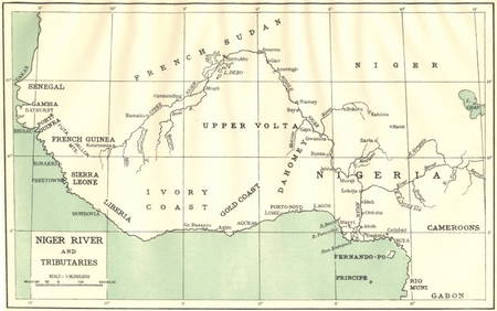
AFRICA. Niger River and Tributaries 1936 old vintage map plan chartJasper524.5(9.9k)See Sold PriceFeb 28, 2024
Rivières de Sanaga & Gambra'. Senegal Gambia rivers. Guinea. BELLIN 1746 mapJasper524.5(9.9k)See Sold PriceFeb 28, 2024
Barthelemy, Jean 1790 Map. Greece - Essa sur la Bataille de PlateeAlbion Auctions4.7(341)See Sold PriceMar 01, 2024
Barthelemy, Jean 1790 Map. Greece - Plan de L'AcademieAlbion Auctions4.7(341)See Sold PriceMar 01, 2024
Barthelemy, Jean 1790 Map. Greece - Essai sur les Environs de DelphesAlbion Auctions4.7(341)See Sold PriceMar 01, 2024
A LARGE ERRATA BOOK INDIAN MAPS AND STUDIES including the provinces of Bengal, Cossimbuzar Island, THannam's Auctioneers Ltd4.3(396)See Sold PriceFeb 27, 2024
John Senex Map of Louisiana & Mississippi RiverWillow Auction House4.5(289)See Sold PriceMar 14, 2024
Hudson River Map & North American Postcards, 45Auctions at Showplace4.6(740)See Sold PriceFeb 13, 2025