Sold1786 Hand-Colored Engraved Map, North AmericaHistoric Maps "A New Map of North America with West India Islands. Divided according to the Preliminary Articles of Peace, signed at Versailles, 20. Jan. 1783..." 1786 - Robert Sayer August 15, 1786-DSee Sold Price
Sold1825 H/C Map of North America by Andre Hubert BruéAntique Early 19th Century Hand-colored Engraved Map of North America by Andre Hubert Brué (French, 1786-1832) Entitled CARTE DE L'AMERIQUE SEPTENTRIONALE, Rédigée par A.H. Brué Geographe A Paris,See Sold Price
Sold1821 H/C Engraved Map of N. America /Andre Hubert BruéAntique Early 19th Century Hand-colored Engraved Map of North America by Andre Hubert Brué (French, 1786-1832) Entitled MAPPE-MONDE EN DEUX HÉMISPHÈRES, Par A.H. Brué Geographe de J.A.R Monsieur ASee Sold Price
SoldSAMUEL DUNN FOR ROBERT SAYER, A MAP OF NORTH AMERSAMUEL DUNN FOR ROBERT SAYER, A MAP OF NORTH AMERICA WITH THE WEST INDIES, LONDON, 1786, engraved map with hand colored outlining illustrating the United States as well as the territorial possessionsSee Sold Price
SoldHANDCOLORED ENGRAVED MAP, NORTH AMERICAHANDCOLORED ENGRAVED MAP, NORTH AMERICA, FROM VIRGINIA TO DISTRICT OF MAINE, JOHN CAREY, 1806. PLATE 20 1/2 X 23"See Sold Price
Sold2 pieces. Hand-Colored Engraved Maps - North Amer2 pieces. Hand-Colored Engraved Maps - North America: Kitchin, T. North America, Drawn from the Latest and Best Authorities." London, 1787. 14 x 15 1/2 inches; 355 x 393 mm. Orig. color. Clean. * [MelSee Sold Price
Sold5 pieces. Hand-Colored Engraved Maps - North Amer5 pieces. Hand-Colored Engraved Maps - North America: Moll, Herman. New England, New York, New Jersey and Pennsylvania & C." [London], [ca. 1740]. 7 x 10 1/2 inches; 200 x 270 mm. Old color. Framed. *See Sold Price
Sold1799 Map of North America by John RussellHistoric Maps 1799 Map North America Drawn from the Best Authorities April 7, 1799-Dated Federal Period, Partially Hand-Colored Engraved Map of North America entitled, “North America, Drawn from theSee Sold Price
Soldmap, North America, M. BonneFramed hand-colored engraved map of North America, ''Amerique Septentrionale,'' by M. Bonne (French, 18th century), sight: 9''h x 13''w, overall: 14.75''h x 18.75''wSee Sold Price
SoldSENEX, John (fl.1700-1740).* SENEX, John (fl.1700-1740). North America According to the Latest Observations. N.p.: n.p., [ca 1719]. Hand-colored engraved map of North America, image 153 x 175 mm (158 x 215 mm sheet). Showing CaSee Sold Price
SoldMOLL, HERMAN. A Map of New France Containing Canada,MOLL, HERMAN. A Map of New France Containing Canada, Louisiana &c. in Nth America. Hand-colored engraved map of colonial North America. 7¾x10¾ inches sheet size, ample margins; mounted to foSee Sold Price
SoldHandcolored Map of North America and CanadaHistoric Maps Lovely Handcolored Map of North America and Canada c. 1755 (1755-Dated) French and Indian War Era, Hand-colored, Copper-engraved, Map of North America and Canada, entitled, “Partie OriSee Sold Price
Soldc 1770 Hand-Colored Map of Colonial North AmericaHistoric Maps Hand-Colored Engraved Map of Colonial North America c. 1770 Hand-Colored Engraved Map of Colonial North America, Framed, English, Very Fine. This engraved 15.5" square, matted and framedSee Sold Price
SoldHandcolored Map of North America and CanadaHistoric Maps Lovely Handcolored Map of North America and Canada c. 1755 (1755-Dated) French and Indian War Era, Hand-colored, Copper-engraved, Map of North America and Canada, entitled, “Partie OriSee Sold Price
Sold1 piece. Hand-Colored Engraved Map. Senex, John.1 piece. Hand-Colored Engraved Map. Senex, John. North America Corrected from the Observations Communicated to The Royal Society at London and The Royal Academy at Paris." (London), 1710. 38 1/2 x 26See Sold Price
SoldHandcolored Map of North America and CanadaHistoric Maps Lovely Handcolored Map of North America and Canada c. 1755 (1755-Dated) French and Indian War Era, Hand-colored, Copper-engraved, Map of North America and Canada, entitled, “Partie OriSee Sold Price
Sold1786 Hand-Colored Map, NEW MAP OF NORTH AMERICAHistoric Maps “A New Map of North America with West India Islands. Divided according to the Preliminary Articles of Peace, signed at Versailles, 20. Jan. 1783...” 1786 - Robert Sayer August 15, 17See Sold Price
Sold1786 Hand-Colored Map, NEW MAP OF NORTH AMERICAHistoric Maps “A New Map of North America with West India Islands. Divided according to the Preliminary Articles of Peace, signed at Versailles, 20. Jan. 1783...” 1786 - Robert Sayer August 15, 17See Sold Price
SoldKITCHIN, THOMAS. A New Map of the British Empire inKITCHIN, THOMAS. A New Map of the British Empire in Nth. America. Hand-colored engraved folding map of colonial North America from George Millar's New and Universal System of Geography. 13½x15See Sold Price
SoldCLÜVER, PHILIPP. America.CLÜVER, PHILIPP. America. Small-scale hand-colored engraved map of North and South America, the Pacific Ocean and parts of Japan and New Zealand. 9¾x13¼ inches sheet size, wide margins;See Sold Price
SoldAntonia Zatta (Italian, 1757-1797),Antonia Zatta (Italian, 1757-1797), hand-colored engraved map of North and South America, dated 1776, presented in a striped French mat within a carved wooden frame and glazed, h. 15", w. 19".See Sold Price
SoldHANDCOLORED MAP. Small engraved map of "North AmerHANDCOLORED MAP. Small engraved map of "North America. Published by C. Brightly in Suffolk in 1806. Good colors. Modern frame. 9 1/8"h. 10 1/2"w.See Sold Price
SoldPAIR HANDCOLORED STEEL ENGRAVED MAPSPAIR HANDCOLORED STEEL ENGRAVED MAPS NORTH AND SOUTH AMERICA, JOHN SENEX, 1710 38 X 27" FRAMED **DUE TO THE SIZE AND/OR FRAGILITY OF THIS LOT, STANDARD IN HOUSE SHIPPING IS NOT AVAILABLE. THE BUYER ISSee Sold Price
SoldMAP OF THE WESTERN HEMISPHERE BY A.L. SMITH 1894Hand colored and engraved map of north and south America. Matted, 14.75 x 10.75 inches. Not examined outside wrapping, appears excellent.See Sold Price
Map: An 18thC engraved and hand coloured map of North America and South America, titled DeClaydon Auctioneers Ltd4.3(125)See Sold PriceFeb 26, 2024
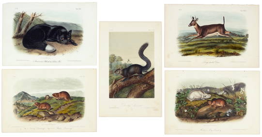
First 50 plates from Audubon's Quad Quarto (all in Vol. I)PBA Galleries4.7(383)See Sold PriceMar 07, 2024
Nearly complete set of plates from Vol. III Quad QuartoPBA Galleries4.7(383)See Sold PriceMar 07, 2024
Italian edition of Sanson's map of North America, 1677PBA Galleries4.7(383)See Sold PriceMar 07, 2024
Herman Moll A New Map of Ye North Parts of AmericaWillow Auction House4.5(284)See Sold PriceMar 14, 2024