Sold1720 Hand Colored French MapTabula Delphinatus vulgo Gouvernment General du Dauphine map made by John Baptista Hommann Nuremberg / 1720, of the Dauphine region of France. 25 x 21.5"See Sold Price
Sold(2) FRENCH HAND COLORED MAPS, NICOLAS DE FER(lot of 2) Framed hand colored maps, by Nicolas De Fer (French 1646-1720), each from the publication "Treatise on the Police", first published 1705, comprising: (1) "Lutece conquise par les Francois sSee Sold Price
SoldMap, Henri Abraham ChatelainHenri Abraham Chatelain (French, 1684–1743), "Mappemonde ou Description Generale du Globe Terrestre," circa 1720, hand-colored engraving, image (sight): 13.25"h x 17.5"w, overall (with mat/unfrSee Sold Price
Sold1720 HENRI CHATELAINE FRENCH NAVAL MAP MILITARY FORTIFICATIONHand colored some faded. frame 20" by 23 1/4". this is an original from either 1719 or 1720. Land and sea fortifications FrenchSee Sold Price
Sold1705 Original Engraved Map of Amsterdam by N. de FerAn original copper engraved hand-colored map of Amsterdam by French cartographer Nicolas de Fer (1646-1720). This map was published in Paris in 1705. It was engraved and printed by Dutch-American illuSee Sold Price
SoldCovens & Mortier, after del'Isle. Occidental MapAfter Guillaume del'Isle (French, 1675-1726). "Hemisphere Occidental," 1720, with corrections by J. Covens and C. Mortier, hand colored engraving, plate size: 19 1/2 x 19 1/2 in., framed; From the EstSee Sold Price
SoldNicolas de Fer (French, 1646-1720)Nicolas de Fer (French, 1646-1720), "Planispheres Celeste, par Mr. de la Hire", hand-colored engraved map, published 1702, sight 9" x 13". Glazed, handsomely matted and framed.See Sold Price
SoldNicolas De Fer (1646-1720, French), "Carte De LaNicolas De Fer (1646-1720, French), "Carte De La Louisiane et De La Floride", hand colored engraved map, c. 1760, showing the Indian tribes, framed, H.- 13 1/2 in., W.- 8 7/8 insight 13" x 9".See Sold Price
SoldCirca 1700 Hand Colored French MapCirca 1700 French map, by G. Del'Isle, hand colored, 18" h x 24" w (view), 26" h x 31" w (frame). Provenance: From a FL estate.See Sold Price
SoldHAND COLORED FRENCH MAPHand colored world map after 1649 Jodocus Hondisu Nicolas Berey. Nova Totius Terrarum Orbis Geographica AC Hydpographica Tabula. Marked Marcel Molinier lower right. Unframed. Plate measures 22 1/8" xSee Sold Price
SoldHand Colored French Map, "Carte de Lasie"French map, "Carte de Lasie," hand colored, by Robert de Vangondy, 19" h x 21" w (view), 25" h x 27" w (frame). Provenance: From a FL estate.See Sold Price
Soldlate 18thC hand colored French map of the Gulf oflate 18thC hand colored French map of the Gulf of Mexico - 17"x22"See Sold Price
SoldHand-colored French map, c.1670, "Carte De La NouvHand-colored French map, c.1670, "Carte De La Nouvelle France". 20.5"x23.75See Sold Price
SoldHand-colored French map "America" with "Nieuw AmstHand-colored French map "America" with "Nieuw Amsterdam", circa 1670. 20.5"x24See Sold Price
Sold1720 Hand Colored Map of Asia William Lord Cooper,1720 Hand Colored Map of Asia William Lord Cooper, Lord High Chancellor of Great Britain, by Geographer Herman Moll Measures 47 1/2 x 32 1/2 framed William Lord Cooper, Lord High Chancellor of Great BSee Sold Price
EARLY HANDCOLORED FRENCH MAP OF THE AMEEARLY HANDCOLORED FRENCH MAP OF THE AMERICAS. Dated "1722" and titled "Carte d' Amerique, Par Guillaume Delisle, Paris". Engraving with green and red coloring along the coastline and rivers. Minor staSee Sold Price
SoldJohann Baptiste Homann MapJohann Baptiste Homann "Amplissimae regionis Mississipi seu Provinciae Ludovicianae...", Nuremberg, 1720, hand-colored map, 19 1/2 in. x 22 5/8 in., framed, together with antique hand-colored map of LSee Sold Price
Sold1720 New World Map, California As An IslandHistoric MapsMap of The New World With California as an Island (1720), Hand-Colored Map of North And South America, With California as an Island, by Johannes Baptista Homann, Published in Nuremberg, CSee Sold Price
Sold1720 Map: New World With California As An IslandHistoric Maps1720 Map of The New World With California As An Island (1720), Hand-Colored Map of North And South America, With California as an Island, by Johannes Baptista Homann, Published in NurembeSee Sold Price
Sold1720 New World Map, California As An IslandHistoric Maps1720 New World Map Showing "California as an Island" c. 1720, Hand-Colored Map of North And South America, With California as an Island, by Johannes Baptista Homann, Published inSee Sold Price
Sold1720 New World Map, California As An IslandHistoric MapsMap of The New World With California as an Island (1720), Hand-Colored Map of North And South America, With California as an Island, by Johannes Baptista Homann, Published in Nuremberg, CSee Sold Price
SoldFrench World Map, Hand ColoredHand colored French world map dated 1792, titled Mappe Monde ou Description Du Globe Terrestre & Aquatique Suivant les Dernieres & Meilleures, A. Amsterdam, Ches I.B Elwe, MDCCXCII. Matted and framedSee Sold Price
LARGE LATE 17TH C. DUTCH CHART OF CANADA, GREAT LAKES, NEW FRANCE, LABRADOR, HUDSON BAY, BY PIERREThomaston Place Auction Galleries4.4(389)See Sold PriceFeb 24, 2024
LATE 17TH C. FRENCH MAP OF THE NEW WORLD BY ALEXIS-HUBERT JAILLOT (1632-1712)Thomaston Place Auction Galleries4.4(389)See Sold PriceFeb 24, 2024
18TH C. ANTIQUE MAP: FRENCH & INDIAN WAR, FRAMEDThomaston Place Auction Galleries4.4(389)See Sold PriceFeb 24, 2024
PIETER SCHENK / VALK / JANSSEN Hand Colored Map of Rhodes Greece ca1702 vgcLuis Porretta Fine Arts4.3(10)See Sold PriceMar 02, 2024
Engraving on glass Johannes Kip La Ville de Londres Prospectus Londinensis City of LondonAuction Wallstreet4.5(49)See Sold PriceMar 02, 2024
Hand Colored Map of the city of Amsterdam 1720Global Auctions Company4.3(36)See Sold PriceMar 03, 2024
[MAP]. [ALBRIZZI, Giambatista, 1698-1777]. Carta Geografica...Potter & Potter Auctions4.6(544)See Sold PriceMar 07, 2024
Johann Homann Hand-Colored Map Engraving, c. 1730Auctions at Showplace4.6(731)See Sold PriceMar 17, 2024
Willem Blaeu, Etc. 17th C. Antiquarian Maps, 2Auctions at Showplace4.6(731)See Sold PriceMar 17, 2024
Catesby, Folio - Tumble-Turds (Dung Beetle) with Canada Lily. Sup-11Trillium Antique Prints & Rare Books4.5(30)See Sold PriceFeb 24, 2024
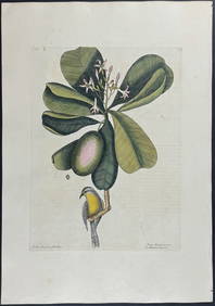
Catesby, Folio - American Goldfinch with Acacia. 1-43Trillium Antique Prints & Rare Books4.5(30)See Sold PriceFeb 24, 2024
Catesby, Folio - Bahama Titmouse with Seven Years Apple. 1-59Trillium Antique Prints & Rare Books4.5(30)See Sold PriceFeb 24, 2024
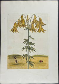
Catesby, Folio - American Partridge with Attamusco Lily. Sup-12Trillium Antique Prints & Rare Books4.5(30)See Sold PriceFeb 24, 2024
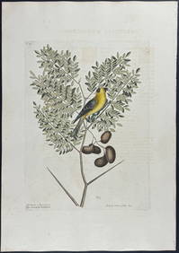
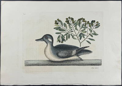
Catesby, Folio - Little Brown Duck with Soap-Wood. 1-98Trillium Antique Prints & Rare Books4.5(30)See Sold PriceFeb 24, 2024
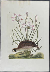
Catesby, Folio - Red Bellied Woodpecker & Hairy Woodpecker with Black Oak. 1-19Trillium Antique Prints & Rare Books4.5(30)See Sold PriceFeb 24, 2024
Galliae Regionis Nova Descriptio Hand Colored Map of France on Laid Paper, Ca. 16th Century, H 10" WDuMouchelles4.6(829)See Sold PriceMar 15, 2024


![[MAP]. [ALBRIZZI, Giambatista, 1698-1777]. Carta Geografica... (1 of 1)](https://p1.liveauctioneers.com/928/318880/171361280_1_x.jpg?height=282&quality=70&version=1707501302)