ATLAS of ANTIENT GEOGRAPHY by SAMUEL BUTLER 1843John McInnis Auctioneers,LLC4.5(505)See Sold PriceFeb 24, 2024
18TH C. ANTIQUE MAP: FRENCH & INDIAN WAR, FRAMEDThomaston Place Auction Galleries4.4(393)See Sold PriceFeb 24, 2024
Rand McNally Railroad Map Cabinet w/ 21 Railroad MapsRail & Road Auctions4.6(165)See Sold PriceMar 08, 2024
Keith Haring - Ink on New York Map, Best Buddies, Inscribed, Signed, and DatedSapphire Auction Gallery4(67)See Sold PriceMar 02, 2024
LATE 17TH C. FRENCH MAP OF THE NEW WORLD BY ALEXIS-HUBERT JAILLOT (1632-1712)Thomaston Place Auction Galleries4.4(393)See Sold PriceFeb 24, 2024
Central Railroad of New Jersey Map of Sandy Hook Route-ca. 1903JM Hobby Supply and Railroad Artifact Auctions4.4(127)See Sold PriceFeb 24, 2024
Lot of Six Mixed Atlas Box Cars-HO Scale-New in BoxJM Hobby Supply and Railroad Artifact Auctions4.4(127)See Sold PriceFeb 25, 2024
Rand McNally/Santa Fe Railroad Map of Iowa-1912JM Hobby Supply and Railroad Artifact Auctions4.4(127)See Sold PriceFeb 24, 2024
NICOLAES VISSCHER (NETHERLANDS, 1618-1709) MAP OF THE NEW WORLDThomaston Place Auction Galleries4.4(393)See Sold PriceFeb 24, 2024
17TH C. WORLD MAP BY NICOLAES VISSCHER (NETHERLANDS, 1618-1709)Thomaston Place Auction Galleries4.4(393)See Sold PriceFeb 24, 2024
Lot of Six Mixed Atlas Cabooses-HO Scale-New in BoxJM Hobby Supply and Railroad Artifact Auctions4.4(127)See Sold PriceFeb 25, 2024
Sold11 maps of English counties and shires.[England] 11 maps. Cary, John. (1) “A New Map of Dorsetshire.” 1806. (2) “Northumberland.” (3) “Leicestershire.” 1801. (4) “Shropshire.” 1805. (5) â€See Sold Price
1753 Rocque Map of English Counties -- A ParlimentaryTitle: 1753 Rocque Map of English Counties -- A Parlimentary Map of England Cartographer: J Rocque Year / Place: 1753, London Map Dimension (in.): 9.1 X 11.4 in. This is fascinating item, showing theSee Sold Price
1753 Rocque Map of English Counties -- A ParlimentaryTitle/ Content of Map: 1753 Rocque Map of English Counties -- A Parlimentary Map of England Cartographer: J Rocque Year/Place: 1753, London Dimensions: 9.1 X 11.4 in. Description: This is fascinatingSee Sold Price
1753 Rocque Map of English Counties -- A Parlimentary Map of EnglandTitle: 1753 Rocque Map of English Counties -- A Parlimentary Map of England Cartographer: J Rocque Year / Place: 1753, London Map Dimension (in.): 9.1 X 11.4 in. This is fascinating item, showing theSee Sold Price
1753 Rocque Map of English Counties -- A ParlimentaryTitle/Content of Map: 1753 Rocque Map of English Counties -- A Parlimentary Map of England Cartographer: J Rocque Year/Place: 1753, London Size: 9.1 X 11.4 in. This is fascinating item, showing the coSee Sold Price
1753 Rocque Map of English Counties -- A ParlimentaryTitle/Content of Map: 1753 Rocque Map of English Counties -- A Parlimentary Map of England Date: 1753, London Cartographer: J Rocque Size: 9.1 X 11.4 in. This is fascinating item, showing the countiesSee Sold Price
1753 Rocque Map of English Counties -- A parlimentaryTitle: 1753 Rocque Map of English Counties -- A parlimentary Map of England Date: 1753, London Cartographer: J Rocque Size: 9.1 X 11.4 in. Additional Information: This is fascinating item, showing theSee Sold Price
Sold15 maps of English counties, towns, etc.Title: Collection of 15 maps of English counties, towns, etc. Author: ** Description: Includes: Universal Magazine. Derby Shire. 1748. * Universal Magazine. Cheshire. 1748. * Seale. The West Riding ofSee Sold Price
1753 Rocque Map of English Counties -- A ParlimentaryTitle: 1753 Rocque Map of English Counties -- A Parlimentary Map of England Year/Place: 1753, London Cartographer: J Rocque Size: 9.1 X 11.4 in. Additional Information: This is fascinating item, showiSee Sold Price
TWO ANTIQUE FRAMED MAPS OF ENGLISH COUNTYBlaeu, Janssonius MONUMETHENSIS COMITATUS VERNACULE MONMOUTH SHIRE [Amsterdam, 1640] H. 38.5cm W. 50cm Engraved map, hand-coloured in outline. [Sold with]: Speede, John GLAMORGAN SHYRE WITH THE SITUATSee Sold Price
1801 Three English County MapsThree engraved county maps , two 1801 London published by Wilkes Buckinghanshire and Essex and one 1811 by Adlard of Middlesex. Fine, each approx 9 x 11". Reserve: $30.00 Shipping: Domestic: Flat-rateSee Sold Price
1801 Three English County MapsThree engraved county maps , two 1801 London published by Wilkes Buckinghanshire and Essex and one 1811 by Adlard of Middlesex. Fine, each approx 9 x 11". Reserve: $20.00 Shipping: Domestic: Flat-rateSee Sold Price
1801 Three English County MapsThree engraved county maps , two 1801 London published by Wilkes Buckinghanshire and Essex and one 1811 by Adlard of Middlesex. Fine, each approx 9 x 11". Reserve: $30.00 Shipping: Domestic: Flat-rateSee Sold Price
SoldCole & Roper - A Group of English County Mapsincluding Wiltshire, Oxforshire, Northumberland and other , 11 engraved hand-coloured maps, including 4 duplicates, sheet edges frayed from binding, contemporary ink numbering on top right corner, c.2See Sold Price
Sold(2) EARLY FRAMED ENGLISH MAPS: HEREFORDSHIRE BY MORDENIn matching gold stick frames, matted and glazed, including: "Herford Shire" (County Herefordshire) by Robert Morden, copperplate engraving with hand coloring, published by Abel Swale and John ChurchiSee Sold Price
(2) EARLY FRAMED ENGLISH MAPS: HEREFORDSHIRE BY MORDENIn matching gold stick frames, matted and glazed, including: "Herford Shire" (County Herefordshire) by Robert Morden, copperplate engraving with hand coloring, published by Abel Swale and John ChurchiSee Sold Price
Sold[ENGLISH COUNTIES] 3 framed mapsBlaeu, Janssonius MONUMETHENSIS COMITATUS VERNACULE MONMOUTH SHIRE [Amsterdam, 1640]H. 38.5cm W. 50cm Engraved map, hand-coloured in outline. [Sold with]: Speede, John GLAMORGAN SHYRE WITH THE SITUATISee Sold Price
1610 English Map of the County of NottinghamPrint. Includes six family coats of arms, "The Countie of Nottingham described", and a detailed map of the town of Nottingham. Length 11 Inches Width 14.5 InchesSee Sold Price
Speed (John) York ShireSpeed (John) York Shire,county map of Yorkshire, with compass rose, and title and scale cartouches, and a ship, engraved map with hand-colouring, 390 x 510mm., English text on verso, central vSee Sold Price
SoldSpeed (John) York ShireSpeed (John) York Shire,county map of Yorkshire, with compass rose, and title and scale cartouches, and a ship, engraved map with hand-colouring, 390 x 510mm., English text on verso, central vSee Sold Price
Sold2 maps of English shiresHeading: (Maps) Author: Title: Two maps of English Shires Place Published: No place Publisher: Date Published: No date Description: 2 maps. Each measuring approx. 10x8".See Sold Price
SoldWales.- Speed (John) Montgomery Shire, county map,NO RESERVE Wales.- Speed (John) Montgomery Shire, county map of Montgomery, engraving on laid paper with armorial watermark, with hand-colouring, sheet 387 x 510 mm. (15 1/4 x 20 1/8 in), English textSee Sold Price
SoldSpeed (John) Worcester Shire DescribedSpeed (John) Worcester Shire Described,county map with inset plan of Worcester, arms and battle scene, engraved map with hand-colouring, 390 x 515mm, English text verso with woodcut initial bySee Sold Price
Brookes: Antique Map of England & Wales, 1795Map: 1795 Brookes Map of England and Wales -- A Map of England and Wales Divided into Counties from the Best Authorities Cartographer: Brookes Gazetter Year / Place: 1795 c. London Dimensions: 7.5 x 1See Sold Price
DUNLEVIE c1856 Map Counties Of Gaspe & Bonaventure Quebec Canada SCARCE! #2Luis Porretta Fine Arts4.3(10)See Sold PriceMar 02, 2024
DUNLEVIE c1856 Map Counties Of Gaspe & Bonaventure Quebec Canada SCARCE! #1Luis Porretta Fine Arts4.3(10)See Sold PriceMar 02, 2024
THOMAS MOULE 1837 Colored Map of Warwickshire Framed vgcLuis Porretta Fine Arts4.3(10)See Sold PriceMar 02, 2024
Archaeological Books - Bowman - Remains of Antiquity Relating to the County of YorkTimeLine Auctions Ltd.4.6(183)See Sold PriceMar 06, 2024
Portfolio of 15 County Maps by Robert Morden (English 1650-1703)Nadeau's Auction Gallery4.7(409)See Sold PriceFeb 24, 2024
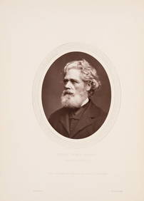
Nottingham.- Brown (Cornelius) Lives of Nottinghamshire Worthies, 1882; and another similar (3).Forum Auctions4.3(53)See Sold PriceFeb 29, 2024
3 Vintage The World Lithographs, By JanssonThe Benefit Shop Foundation Inc.4.3(2.9k)See Sold PriceMar 13, 2024
THE WHOLE CHRONICLE OF POLYBIUS ANCIENT IN ENGLISH, 1756NY Elizabeth 4.2(86)See Sold PriceMar 03, 2024


![[ENGLISH COUNTIES] 3 framed maps (1 of 7)](https://p1.liveauctioneers.com/1124/187577/94368862_1_x.jpg?height=282&quality=70&version=1607095126)