10 Hydrographic Maps of Coasts from Around the Wor1) Jabal At Tair to Perim Island 1951 Published at the Admiralty. London. 2) Plans of the North West Coast of Africa 1954 Published at the Admiralty. London. 3) San Marcos or Maranham Bay Brazil 1895See Sold Price
Soldmaps, Germany, Africa, Robert de Vaugondy(lot of 2) Framed hand-colored engraved maps: African Coast around the Gulf of Guinea, by Lattre and R. Bonne; Germany, by Robert de VaugondySee Sold Price
11 Hydrographic Maps of African Coasts - 1950sAll maps referenced from early 20th Century European Government Charts. Includes corrections up to the year 1956. 1) Table Bay 2) Walvis Bay 3) Baja Dos Tigres to Conception Bay 4) Cap Vert to Cap DeSee Sold Price
SoldPair of Antique Maps, East Coast and New York HarborLot 10 Pair of Antique Maps, East Coast and New York Harbor engraving with aquatint illegible (faded) watermarks New York Harbor: 17 1/2 x 20 1/2 inches New Netherlands: 24 x 18 1/4 inches ProvenanceSee Sold Price
SoldFricx (Eugene Henry) Partie de L'Angleterre[Fricx (Eugene Henry)] publisher. Partie de L'Angleterre,Kent including most of the Isle of Sheppey to the west, numerous ships and fishing boats around the coast, engraved map by Harrewyn, 41See Sold Price
SoldFricx Partie de L'Angleterre, KentFricx (Eugene Henry) publisher. Partie de L'Angleterre,Kent including most of the Isle of Sheppey to the west, numerous ships and fishing boats around the coast, engraved map by Harrewyn, 410See Sold Price
SoldFricx (Eugene Henry) publisher. - Partie deKent including most of the Isle of Sheppey to the west, numerous ships and fishing boats around the coast, engraved map by Harrewyn, with hand-colouring, 410 x 560mm., central vertical fold, Brussels,See Sold Price
SoldJohnson's New Illustrated Family Atlas of the WorAuthor: Johnson, A.J. Description: With hand-colored lithographed maps. 18¼x14¼, cloth. Well worn, known to be incomplete and lacking about 10 maps, about half of them European; among the maps preseSee Sold Price
SoldHills Map of Philadelphia 10 Miles AroundHILLS, John [Surveyor], KNEASS, William (1780-1840) [Engraver], VARNUM, Joseph Bradley (1751-1821 ) [Publisher]. Plan of the city of Philadelphia and environs. Engraved map with original hand color, lSee Sold Price
1757 Bellin Map Coast of BrazilA map of Jacques Bellin printed circa 1757 entitled "Suite du Bresil Depuis la Baye de Tour Saints Jusqu a St. Paul..". Printed at Paris. Very Good, Some mild wear. Measures 7 x 10.5". Reserve: $20.00See Sold Price
Sold1847 MAP, CIRCUIT OF 10 MILES AROUND THE CITY OF1847 MAP, CIRCUIT OF 10 MILES AROUND THE CITY OF PHILADELPHIA; A.C. SEDNEY, C.E. ROBERT P. SMITH, PUBLISHER; 22 5/8 IN SQUARE; SOME WEAR, DAMAGE & CREASES- WAS FOLDED IN FOUR AT ONE TIMESee Sold Price
Sold1757 Bellin Map Coast of BrazilA map of Jacques Bellin printed circa 1757 entitled "Suite du Bresil Depuis la Baye de Tour Saints Jusqu a St. Paul..". Printed at Paris. Very Good, Some mild wear. Measures 7 x 10.5". Reserve: $20.00See Sold Price
1757 Bellin Map Coast of BrazilA map of Jacques Bellin printed circa 1757 entitled "Suite du Bresil Depuis la Baye de Tour Saints Jusqu a St. Paul..". Printed at Paris. Very Good, Some mild wear. Measures 7 x 10.5". Reserve: $20.00See Sold Price
SoldCharles TREPIED [1845-1907] French astronomer[FRANCE] Charles TREPIED [1845-1907] Fr. astronomer. ALS, 1891, 2-1/2 pages, to the noted astronomer Ernest Mouchez, who was one of the greats of his time, did hydrographic map of South America; and wSee Sold Price
Charles TREPIED [1845-1907] French astronomerFRANCE] Charles TREPIED [1845-1907] Fr. astronomer. ALS, 1891, 2-1/2 pages, to the noted astronomer Ernest Mouchez, who was one of the greats of his time, did hydrographic map of South America; and waSee Sold Price
SoldCharles TREPIED [1845-1907] French astronomer[FRANCE] Charles TREPIED [1845-1907] French astronomer. ALS, 1891, 4 pages, to the noted astronomer Ernest Mouchez, who was one of the greats of his time, did hydrographic map of South America; and waSee Sold Price
Charles TREPIED [1845-1907] French astronomerFRANCE] Charles TREPIED [1845-1907] Fr. astronomer. ALS, 1891, 2-1/2 pages, to the noted astronomer Ernest Mouchez, who was one of the greats of his time, did hydrographic map of South America; and waSee Sold Price
Charles TREPIED [1845-1907] French astronomer[FRANCE] Charles TREPIED [1845-1907] Fr. astronomer. ALS, 1891, 2-1/2 pages, to the noted astronomer Ernest Mouchez, who was one of the greats of his time, did hydrographic map of South America; and wSee Sold Price
Charles TREPIED [1845-1907] French astronomerFRANCE] Charles TREPIED [1845-1907] Fr. astronomer. ALS, 1891, 2-1/2 pages, to the noted astronomer Ernest Mouchez, who was one of the greats of his time, did hydrographic map of South America; and waSee Sold Price
SoldUS MAP EAST COAST CAPITAL SCENES by J. RapkinUS MAP EAST COAST CAPITAL SCENES by J. Rapkin illustrations by f Rogers, 13 x 10 inches, overall framed size 18 x 21-1/4 inchesSee Sold Price
Sold1760 Folding Map Area Around BerlinC1760 Folding map of Eastern Europe near Berlin. Very Good, measure 8 x 10". Reserve: $20.00 Shipping: Domestic: Flat-rate of $10.00 to anywhere within the contiguous U.S. International: Foreign shippSee Sold Price
1840 Two Maps Barbary Coast AlgersTwo Maps of the Barbary coast with one of Alger, circa 1840 by Monin and Fremin, Paris. Fine condition, handcolored outlines, each approximately 12 x 10”. Please note that this lot has a confidentiaSee Sold Price
1840 Two Engraved Maps Barbary Coast AlgerTwo Maps of the Barbary coast with one of Alger, circa 1840 by Monin and Fremin, Paris. Fine condition, handcolored outlines, each approximately 12 x 10". Please note that this lot has a confidentialSee Sold Price
PLANTERS PEANUTS c1930 Collectible Around The World With Mr Peanut Coloring BookLuis Porretta Fine Arts4.3(10)See Sold PriceMar 02, 2024
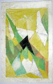
JAQUES VILLON (1875-1963) Hand Colored Cubist Lithograph ca1950Luis Porretta Fine Arts4.3(10)See Sold PriceMar 02, 2024
West coast of Africa from Cape Blanco… Arguin bay, Mauritania. LABAT 1745 mapJasper524.5(9.9k)See Sold PriceFeb 28, 2024
Carte du Golfe de Guinée'. Gulf of Guinea. Nigeria & Cameroon. BELLIN 1747 mapJasper524.5(9.9k)See Sold PriceFeb 28, 2024
Coste Orientale d’Afrique…' South Africa. Mozambique channel. BELLIN 1746 mapJasper524.5(9.9k)See Sold PriceFeb 28, 2024
Bougainville's 1766 circumnavigation. France-Africa-Réunion. GENTS MAG 1774 mapJasper524.5(9.9k)See Sold PriceFeb 28, 2024
WEST AFRICA. Guinea. Nigeria Ghana Benin Togo Sierra Leone. MALLET 1683 mapJasper524.5(9.9k)See Sold PriceFeb 28, 2024
WEST CENTRAL AFRICA. Congo Angola Gabon Cameroon Sao Tome. MALLET 1683 old mapJasper524.5(9.9k)See Sold PriceFeb 28, 2024
Coste Occidentale d’Afrique…' West Africa. Gulf of Guinea. BELLIN 1746 mapJasper524.5(9.9k)See Sold PriceFeb 28, 2024
Bougainville's 1766 circumnavigation. France-Africa-Réunion. GENTS MAG 1774 mapJasper524.5(9.9k)See Sold PriceFeb 28, 2024
East coast of Africa from the Cape… South Africa Mozambique. CHILD 1745 mapJasper524.5(9.9k)See Sold PriceFeb 28, 2024
Le Royaume d’Adel… Ajan & Zanguebar. Adal Ajuran. Kenya Tanzania. BONNE 1788 mapJasper524.5(9.9k)See Sold PriceFeb 28, 2024
Coste d’Afrique…' Guinea-Bissau & Bissagos archipelago. BELLIN 1746 old mapJasper524.5(9.9k)See Sold PriceFeb 28, 2024
Coste Orientale d’Afrique'. South Africa Mozambique BELLIN/SCHLEY 1747 mapJasper524.5(9.9k)See Sold PriceFeb 28, 2024
Suite de la Coste de Guinée'. Ghana Togo Benin coast. BELLIN/SCHLEY 1748 mapJasper524.5(9.9k)See Sold PriceFeb 28, 2024
Le Royaume d’Adel… Ajan & Zanguebar. Adal Ajuran. Kenya Tanzania. BONNE 1790 mapJasper524.5(9.9k)See Sold PriceFeb 28, 2024
Carte du Golfe de Guinée. Gulf of Guinea Nigeria Cameroon BELLIN/SCHLEY 1748 mapJasper524.5(9.9k)See Sold PriceFeb 28, 2024
Western coast of Africa… to the River Sanaga. Southern Mauritania LABAT 1745 mapJasper524.5(9.9k)See Sold PriceFeb 28, 2024
Coste d’Afrique…' Guinea-Bissau & Bissagos archipelago. BELLIN/SCHLEY 1747 mapJasper524.5(9.9k)See Sold PriceFeb 28, 2024
Coste Occidentale d’Afrique…' Namibia South Africa Angola coast BELLIN 1746 mapJasper524.5(9.9k)See Sold PriceFeb 28, 2024
Framed Vintage Map Of Le Port Au Prince In The Island Of Santo DomingoRapid Estate Liquidators and Auction Gallery4.5(1.1k)See Sold PriceMar 01, 2024


![Charles TREPIED [1845-1907] French astronomer (1 of 2)](https://p1.liveauctioneers.com/3060/65268/33006820_1_x.jpg?height=282&quality=70&version=1419113374)
![Charles TREPIED [1845-1907] French astronomer (1 of 2)](https://p1.liveauctioneers.com/3060/63285/31944226_1_x.jpg?height=282&quality=70&version=1416533471)
![Charles TREPIED [1845-1907] French astronomer (1 of 2)](https://p1.liveauctioneers.com/3060/65596/35949991_1_x.jpg?height=282&quality=70&version=1428247569)
![Charles TREPIED [1845-1907] French astronomer (1 of 2)](https://p1.liveauctioneers.com/3060/55078/27012630_1_x.jpg?height=282&quality=70&version=1401737475)
![Charles TREPIED [1845-1907] French astronomer (1 of 2)](https://p1.liveauctioneers.com/3060/58005/28976860_1_x.jpg?height=282&quality=70&version=1406669424)
![Charles TREPIED [1845-1907] French astronomer (1 of 2)](https://p1.liveauctioneers.com/3060/60584/30689195_1_x.jpg?height=282&quality=70&version=1412515249)


![Vintage Airplane Desk Model [Air France] (1 of 7)](https://p1.liveauctioneers.com/5755/320282/172113951_1_x.jpg?height=282&quality=70&version=1708463029)

