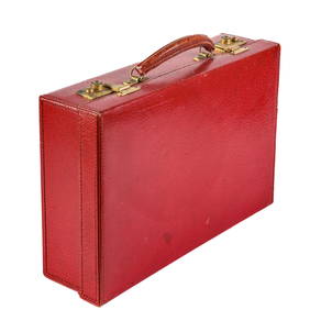
''Philips' Tape Indicator Map of London,'' near f[Britain: London]. Philips' Tape Indicator Map Of London. Lon: George Philip & Son, c.1950. 23 3/4 x 36 1/21 in. Backed with linen, folded, bound in publisher's green cloth, with attached tape measureSee Sold Price
1930s Philip Transportation Map of London -- Philips' Tape Indicator Map of London Divided intoTitle: 1930s Philip Transportation Map of London -- Philips' Tape Indicator Map of London Divided into Quarter Mile Squares for Reference and Measuring Distances Cartographer: G Philip & Son Year / PlSee Sold Price
SoldLondon.- Philip (George, & Son) Philip's Tape IndicatorLondon.- Philip (George, & Son) Philip's Tape Indicator Map of London Divided into Quarter-Mile Squares for Reference and for Measuring Distances, showing from Kentish Town down to Clapham Common andSee Sold Price
SoldLARBY Tape Indicator Map of London Cartes GuidesLARBY, E. J. - Tape Indicator Map of London. London, C. Smith & Son's, 1913. Pochette d'édition pleine percaline verte. Grand plan de Londres entoilé, avec l'indicateur des rues et le mètre ruban.See Sold Price
SoldTape Indicator Map of LondonPhilip & Son Ltd. (George, publisher) Tape Indicator Map of London,folding colour-printed map folding to 620 x 890mm., with tape-measure printed booklet together in original cloth, a very goodSee Sold Price
SoldPhilip & Son Ltd-Tape Indicator Map of LondonPhilip & Son Ltd. (George, publisher) Tape Indicator Map of London,folding colour-printed map folding to 620 x 890mm., with tape-measure printed booklet together in original cloth, a very goodSee Sold Price
SoldLondon82. London.Indicator Map of London. 20-1/2 x 30 inch linen-backed colored map, text booklet titled "An Alphabetical List of 7,000 Streets. Together housed in 8vo, gilt-lettered cloth holder, tape measSee Sold Price
1885 Map of London by Smith" The American Exchange Indicator Map of London by Smith & Son. Canvas backed paper detailed map of London. 2 original tape measures are attached.See Sold Price
SoldSmith (Charles) Smith's New Map of London and StreSmith (Charles) Smith's New Map of London and Street Indicator,from Islington to Kennington Oval, and from Commercial and Surrey Docks to Hyde Park, with indicator tape on original brass mountSee Sold Price
Sold1805 Book On Travel West of Alleganys, MapMaps1805 Book, "Travels to the Westward of the Allegany Mountains in the States of the Ohio, Kentucky, and Tennessee, in the Year 1802" by F.A. Michaux, Choice near Mint. Published in London. 96 pagesSee Sold Price
Hinton. Plan of the Town and Mole of Agde. c.1760.[France] Hinton, John. "Plan of the Town and Mole of Agde with the Fort de Brescou." London, F.A. Aveline, c.1760. Engraved map. 10 3/4" x 7 3/4". Framed: 18" x 15". Map of Cape Agde near the towns ofSee Sold Price
Map of the Holy Land and the Near East. William Hole.Map of the Holy Land and the Near East. Copperplate engraving. Colored. By William Hole. From: The History of the World, Raleigh, Walter. London, 1614. In the upper right corner: "f:51". Route of AbraSee Sold Price
Sold1900 HUGE Folding Color Street Map of London 70001900 HUGE Folding Color Street Map of London 7000 Streets Visitors Travel Guide A large, color indicator map of London from the early 20th-century. This map is bound in a hardcover binding and pairedSee Sold Price
SoldLondon.- Smith & Sons (Charles) Smith's Indicator MapNO RESERVE London.- Smith & Sons (C.) Smith's Indicator Map of London, showing from Hyde Park to Mile End, including Regents Park and part of Victoria Park with the City of London highlighted in red,See Sold Price
SoldLondon.- Philip (George, & Son) Philip's New Map ofLondon.- Philip (George, & Son) Philip's New Map of London and It's Environs, from the New Ordnance Survey including the area under the jurisdiction of the Metropolitan Board of Works, showing from ChSee Sold Price
SoldPhilips New Library Map of London and its Environs,Philips New Library Map of London and its Environs, folding map, George Philip & Son, London, The London Geographical Institute, 152cm x 117cm - Stock Ref:6678-1See Sold Price
SoldAll Over the World BOAC Takes Care of You. WorldAll Over the World BOAC Takes Care of You. World Airways Map. London: George Philips, 1965. Color map travel poster of the world detailing the airline’s routes, time zone references to lower image aSee Sold Price
SoldBOAC. World Leader in Air Travel. World Airways Map.BOAC. World Leader in Air Travel. World Airways Map. London: George Philips, 1960. Color map of the world detailing the airline's routes, time zone references to lower image area. Linen backed. 31 x 5See Sold Price
SoldAtlas Map of CheshireAtlas Map of Cheshire(London: C. F. Cruchley, n.d., circa 1890), outline color; presented behind mat in wooden frame with gilt liner. DOA 15.75 x 17.5 in. Private Collection, Greensboro, North CarolinSee Sold Price
Europe in 1871.Publication Date: c1877 Title: Europe in 1871. Cartographer: WELLER, EDW. Publisher: G.P. PUTNAM'S SONS Height: 5.8 Width: 8.6 "by Edwd. Weller, F.R.G.S." London printed map from the New York editionSee Sold Price
SoldTallis. 2 Maps of Asia and Tibet. c.1850.[Asia] Tallis, John. (1) Map of Asia. Hand colored engraved map. 5 handcolored vignettes.London, J & F. Tallis, c.1850. (2) Map of Thibet, Mongolia, and Mandchouria. Hand colored engraved map. 6 handSee Sold Price
PhilipsTitle/Content of Map: Philips' Regional Wall Map of the Near East and Middle East (Land of the Five Seas) Cartographer: FULLARD, HAROLD Date: c1956 Publisher: GEORGE PHILIP & SON, LTD. Size: 45HeightSee Sold Price
SoldAdmiralty Sea Chart of the World 1874Carrington, R. C. Track Chart of the World...Published at the Admiralty ... Under The Superintendence of Rear Admiral G.H. Richards, C.B. F.R.S. Hydrographer. Lithographed map. London: Royal Navy HydrSee Sold Price
Sold1853 NY Plank Road Stock CertificateMyrtle Avenue & Jamaica Plank Road (NY) 1853. Brooklyn. #1. 20 shs. Red seal on blue paper. Ornate design, left. Tape repair on reverse near seal. F-VF.See Sold Price
DAVID ROBERTS - Holy Land / Syria / Egypt etc. 3 x Folio Volumes 1849 Very RareLuis Porretta Fine Arts4.3(10)See Sold PriceMar 02, 2024
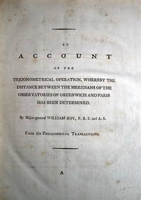
WILLIAM ROY Rare Navigation Book c1797 Trigonometry Between Paris & GreenwichLuis Porretta Fine Arts4.3(10)See Sold PriceMar 02, 2024
Prospects of London Before and After the Great Fire. Wenceslaus Hollar. 1666. Etching on two joinedTremont Auctions4.6(294)See Sold PriceFeb 25, 2024
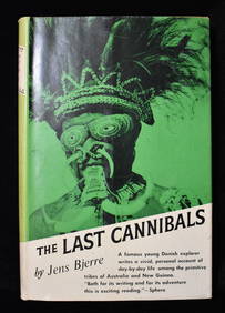
THE LAST CANNIBALS by JENS BJERRE 1957 Fine or Near FineNorth American Artifact Auctions4.6(184)See Sold PriceApr 20, 2024
[ARCTIC]. BOWEN, Emanuel. A New & Accurate Map of the North...Potter & Potter Auctions4.6(544)See Sold PriceMar 07, 2024
Collection of 50 Harvard Classsics Books, Crimson in Color with Embossed Crest on FrontNorthgate Gallery, Inc.4.5(36)See Sold PriceMar 02, 2024
Catherwood - General View of Uxmal, Taken from the Archway of Las Monjas, Looking SouthTrillium Antique Prints & Rare Books4.5(30)See Sold PriceFeb 24, 2024
Donovan's The Natural History of British Shells - 5 Volumes in 3 Books with 180 EngravingsTrillium Antique Prints & Rare Books4.5(30)See Sold PriceFeb 24, 2024
1704 DESCRIPTION OF ALL THE SEATS OF THE PRESENT WARS OF EUROPE antique w/ MAPSJasper524.5(9.8k)See Sold PriceFeb 27, 2024
First World War.- Petre (F.Loraine), Wilfrid Ewart & Major General Lowther. The Scots Guards in theForum Auctions4.3(53)See Sold PriceFeb 29, 2024
Clarke & Neele 1815 Map. Europe - Recent Political ChangesAlbion Auctions4.6(341)See Sold PriceMar 01, 2024


![[ARCTIC]. BOWEN, Emanuel. A New & Accurate Map of the North... (1 of 1)](https://p1.liveauctioneers.com/928/318880/171360917_1_x.jpg?height=282&quality=70&version=1707501302)