ATLAS of ANTIENT GEOGRAPHY by SAMUEL BUTLER 1843John McInnis Auctioneers,LLC4.6(502)See Sold PriceFeb 24, 2024
18TH C. ANTIQUE MAP: FRENCH & INDIAN WAR, FRAMEDThomaston Place Auction Galleries4.4(386)See Sold PriceFeb 24, 2024
Rand McNally Railroad Map Cabinet w/ 21 Railroad MapsRail & Road Auctions4.6(165)See Sold PriceMar 08, 2024
Keith Haring - Ink on New York Map, Best Buddies, Inscribed, Signed, and DatedSapphire Auction Gallery4(67)See Sold PriceMar 02, 2024
LATE 17TH C. FRENCH MAP OF THE NEW WORLD BY ALEXIS-HUBERT JAILLOT (1632-1712)Thomaston Place Auction Galleries4.4(386)See Sold PriceFeb 24, 2024
Central Railroad of New Jersey Map of Sandy Hook Route-ca. 1903JM Hobby Supply and Railroad Artifact Auctions4.4(126)See Sold PriceFeb 24, 2024
Lot of Six Mixed Atlas Box Cars-HO Scale-New in BoxJM Hobby Supply and Railroad Artifact Auctions4.4(126)See Sold PriceFeb 25, 2024
Rand McNally/Santa Fe Railroad Map of Iowa-1912JM Hobby Supply and Railroad Artifact Auctions4.4(126)See Sold PriceFeb 24, 2024
NICOLAES VISSCHER (NETHERLANDS, 1618-1709) MAP OF THE NEW WORLDThomaston Place Auction Galleries4.4(386)See Sold PriceFeb 24, 2024
17TH C. WORLD MAP BY NICOLAES VISSCHER (NETHERLANDS, 1618-1709)Thomaston Place Auction Galleries4.4(386)See Sold PriceFeb 24, 2024
Lot of Six Mixed Atlas Cabooses-HO Scale-New in BoxJM Hobby Supply and Railroad Artifact Auctions4.4(126)See Sold PriceFeb 25, 2024
Les Royaumes d'Espagne et de Portugal. Iberia SpainTITLE/CONTENT OF MAP: 'Les Royaumes d'Espagne et de Portugal' A map of Iberia including Spain & Portugal The top image on the right hand side shows the entire map. This map is folding hence the centreSee Sold Price
"Les Royaumes d'Espagne et de Portugal". Iberia SpainTITLE/CONTENT OF MAP: 'Les Royaumes d'Espagne et de Portugal' A map of Iberia including Spain & Portugal DATE PRINTED: 1780 IMAGE SIZE: Approx 23.0 x 34.5cm, 9 x 13.5 inches (Large); Please note thatSee Sold Price
"Les Royaumes d'Espagne et de Portugal". Iberia SpainTITLE/CONTENT OF MAP: 'Les Royaumes d'Espagne et de Portugal' A map of Iberia including Spain & Portugal Date: 1780 IMAGE SIZE: Approx 23.0 x 34.5cm, 9 x 13.5 inches (Large); Please note that this isSee Sold Price
Bonne: Antique Map of Spain Portugal, 1780TITLE/CONTENT OF MAP: 'Les Royaumes d'Espagne et de Portugal' A map of Iberia including Spain & Portugal DATE PRINTED: 1780 IMAGE SIZE: Approx 23.0 x 34.5cm, 9 x 13.5 inches (Large); Please note thatSee Sold Price
SoldJanvier (Jean) Spain and PortugalJanvier (Jean) Les Royaumes d'Espagne et de Portugal, engraved map with original hand-colouring in outline, 475 x 635mm., central vertical fold and an adjacent crease, otherwise in good conditSee Sold Price
Sold1792 Elwe Map of Spain and Portugal -- Les RoyaumesTitle/Content of Map: 1792 Elwe Map of Spain and Portugal -- Les Royaumes d'Espagne et de Portugal Date: 1792, Amsterdam Cartographer: J Elwe Size: 20 X 22.8 in. This is a very nice double-page map ofSee Sold Price
1792 Elwe Map of Spain and Portugal -- Les RoyaumesTitle/Content of Map: 1792 Elwe Map of Spain and Portugal -- Les Royaumes d'Espagne et de Portugal Date: 1792, Amsterdam Cartographer: J Elwe Size: 20 X 22.8 in. This is a very nice double-page map ofSee Sold Price
1792 Elwe Map of Spain and Portugal -- Les RoyaumesTitle/Content of Map: 1792 Elwe Map of Spain and Portugal -- Les Royaumes d'Espagne et de Portugal Date: 1792, Amsterdam Cartographer: J Elwe Size: 20 X 22.8 in. This is a very nice double-page map ofSee Sold Price
Royaumes d'Espagne et de Portugal.' by Rigobert Bonne.TITLE OF THE MAP: 'Royaumes d'Espagne et de Portugal' Kingdoms of Spain and Portugal - Iberia Date: 1780 IMAGE SIZE: Approx 24.5 x 36.0cm, 9.75 x 14 inches (Large); Please note that this is a foldingSee Sold Price
Royaumes d'Espagne et de Portugal… routes des postes Iberia VAUGONDY 1757 mapTITLE OF MAP (NOT PRINTED ON THE PAGE):'Carte des Royaumes d'Espagne et de Portugal dans laquelle sont tracees les routes des postes. Par le Sr. Robert Geographe ordin. du Roi. Avec Privilege' DATE PRSee Sold Price
SoldGeorge Hoefnagle, (Flemish, 1542-1601), Granada, tGeorge Hoefnagle (Flemish, 1542-1601) Granada, together with another engraved map"Les Royaumes D'Espagne et de Portugal" hand-colored engraved view (removed from an atlas) 14 x 20 inches, 9 x 13 1/4 iSee Sold Price
SoldJanvier (Jean) Espagne et PortugalJanvier (Jean) Les Royaumes d'Espagne et de Portugal,engraved map with original hand-colouring in outline, 475 x 635mm., central vertical fold and an adjacent crease, otherwise in good conditiSee Sold Price
SoldSpanien und Portugal "LES ROYAUMES D'ESPAGNE ET DESpanien und Portugal "LES ROYAUMES D'ESPAGNE ET DE PORTUGAL". Kolor. Kupferstichkarte, hg. von J. B. Elwe, Amsterdam, 1792. 50,3x58,4 cm. Beigelegt 2 Bll.: 1. Spanien und Portugal. "REGNORUM HISPANIAESee Sold Price
SoldJanvier (Jean) Map of Spain and PortugalJanvier (Jean) Les Royaumes D'Espage Et De Portugal, divises Par Grandes Provinces, Spain and Portugal, with decorative title cartouche, engraved map with outline hand-colouring, 475 x 640mm.,See Sold Price
SoldChatelain Royaumes d'Espagne et de PortugalChatelain (Henri Abraham) Carte Historique et Geographique des Royaumes d'Espagne et de Portugal,map of the kingdoms of Spain and Portugal divided according to their kingdoms and provinces, enSee Sold Price
Carte Des Royaumes D'espagne Et De PortugalTitle: Carte Des Royaumes D'espagne Et De Portugal Cartographer: ROBERT DE VAUGONDY, GILLES (1686-1766) Publisher: LES AUTEURS ET BOUDET Brief Description: dans laquelle sont tracees les routes des poSee Sold Price
Carte Des Royaumes D'espagne Et De PortugalTitle: Carte Des Royaumes D'espagne Et De Portugal Publication Date: 1757 Cartographer: ROBERT DE VAUGONDY, GILLES (1686-1766) Publisher: LES AUTEURS ET BOUDET Height: 18.75 Width: 22.3 dans laquelleSee Sold Price
Carte Des Royaumes D'espagne Et De PortugalTitle: Carte Des Royaumes D'espagne Et De Portugal Cartographer: ROBERT DE VAUGONDY, GILLES (1686-1766) Publication Date: 1757 Publisher: LES AUTEURS ET BOUDET Size: 18.75 X 22.3 dans laquelle sont trSee Sold Price
Chatelain: Map of Kingdom of Spain, 1719Map: Carte Historique et Geographique des Royaumes Despagne et de Portugal Divises Selon Leurs Royaumes et Provinces By: Henri Abraham Chatelain Date: 1719 (Published) Amsterdam Dimensions: 17.5 x 22.See Sold Price
SoldHenri Chatelain Map of Spain and Portugal 1719 AtHenri Abraham Chatelain (1684-1743). "Carte Historique et Geographique des Royaumes d'Espagne et de Portugal Divises Selon Leurs Royaume et Provinces," Amsterdam, 1719. From Chatelain's "Atlas HistoriSee Sold Price
Delamarche: Antique Map of Spain and Portugal, 1780TITLE/CONTENT OF MAP: 'Carte des Royaumes d'Espagne et de Portugal divisés par Provinces' A map of the kingdoms of Spain and Portugal in provinces. Curiously, Galicia includes part of northern PortugSee Sold Price
M. Barthelemy. Map of Spain and Portugal. 1809.Print from copper engraving titled „Royaumes D‘ Espagne et de Portugal“.Author/compiler – M. Barthelemy.Engraved unknown.Notes: After restauration.From „Methode abregee et facile pour apprenSee Sold Price
Map of Spain and Portugal kingdoms. 1809.Print from steel engraving titled „Royaumes D‘ Espagne et de Portugal“.Author/compiler – M. Barthelemy.Engraved unknown.Notes: After restauration.From „Methode abregee et facile pour apprenrSee Sold Price
SoldMap,''Carte Generale des Royaumes''Antiquarian map, ''Carte General des Royaumes D'Espagne et de Portugal'' printed by Pierre Husson, The Hague, depicts Spain and Portugal, sight 19''h x 22.5''wSee Sold Price
Louis Icart - Untitled XVIII from "Les Amours de Psyche de Cupidon"Dane Fine Art Auctions4.4(494)See Sold PriceMar 07, 2024
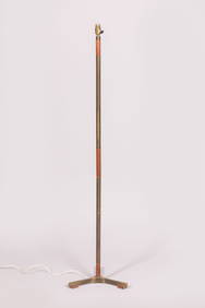
Jo HAMMERBORG (attribué à) : Lampadaire tripode en laiton et métal doré, les pieds et le fûtValoir Pousse-Cornet4.3(4)See Sold PriceFeb 24, 2024
1890 LES ORIGINES DE LA RESTAURATION DES BOURBONS EN ESPAGNE antiqueJasper524.5(9.8k)See Sold PriceFeb 27, 2024
La Basse-Guinée… Loango, Congo, AngoIa & Benguela Southern Africa BONNE 1790 mapJasper524.5(9.8k)See Sold PriceFeb 28, 2024
Carte de la Guinée, contenant…'. Guinea & Cape Verde islands. BONNE 1771 mapJasper524.5(9.8k)See Sold PriceFeb 28, 2024
États du Roi de Maroc… d’Alger, Tunis & Tripoli. North Africa. BONNE 1790 mapJasper524.5(9.8k)See Sold PriceFeb 28, 2024
Le Canal de Mosambique, l'Isle de Madagascar… Mozambique. Africa. BONNE 1788 mapJasper524.5(9.8k)See Sold PriceFeb 28, 2024
Carte de la partie septentrionale d'Afrique, ou de la Barbarie… BONNE 1780 mapJasper524.5(9.8k)See Sold PriceFeb 28, 2024
Le Canal de Mosambique, l'Isle de Madagascar… Mozambique. Africa. BONNE 1790 mapJasper524.5(9.8k)See Sold PriceFeb 28, 2024
États du Roi de Maroc… d’Alger, Tunis & Tripoli. North Africa. BONNE 1788 mapJasper524.5(9.8k)See Sold PriceFeb 28, 2024
La Basse-Guinée… Loango, Congo, AngoIa & Benguela Southern Africa BONNE 1788 mapJasper524.5(9.8k)See Sold PriceFeb 28, 2024
Suite de la Coste de Guinée'. Ghana Togo Benin coast. Whidah. BELLIN 1747 mapJasper524.5(9.8k)See Sold PriceFeb 28, 2024