ATLAS of ANTIENT GEOGRAPHY by SAMUEL BUTLER 1843John McInnis Auctioneers,LLC4.6(502)See Sold PriceFeb 24, 2024
18TH C. ANTIQUE MAP: FRENCH & INDIAN WAR, FRAMEDThomaston Place Auction Galleries4.4(386)See Sold PriceFeb 24, 2024
Rand McNally Railroad Map Cabinet w/ 21 Railroad MapsRail & Road Auctions4.6(165)See Sold PriceMar 08, 2024
Keith Haring - Ink on New York Map, Best Buddies, Inscribed, Signed, and DatedSapphire Auction Gallery4(67)See Sold PriceMar 02, 2024
LATE 17TH C. FRENCH MAP OF THE NEW WORLD BY ALEXIS-HUBERT JAILLOT (1632-1712)Thomaston Place Auction Galleries4.4(386)See Sold PriceFeb 24, 2024
Central Railroad of New Jersey Map of Sandy Hook Route-ca. 1903JM Hobby Supply and Railroad Artifact Auctions4.4(126)See Sold PriceFeb 24, 2024
Lot of Six Mixed Atlas Box Cars-HO Scale-New in BoxJM Hobby Supply and Railroad Artifact Auctions4.4(126)See Sold PriceFeb 25, 2024
Rand McNally/Santa Fe Railroad Map of Iowa-1912JM Hobby Supply and Railroad Artifact Auctions4.4(126)See Sold PriceFeb 24, 2024
NICOLAES VISSCHER (NETHERLANDS, 1618-1709) MAP OF THE NEW WORLDThomaston Place Auction Galleries4.4(386)See Sold PriceFeb 24, 2024
17TH C. WORLD MAP BY NICOLAES VISSCHER (NETHERLANDS, 1618-1709)Thomaston Place Auction Galleries4.4(386)See Sold PriceFeb 24, 2024
Lot of Six Mixed Atlas Cabooses-HO Scale-New in BoxJM Hobby Supply and Railroad Artifact Auctions4.4(126)See Sold PriceFeb 25, 2024
Sold"Carte De France" Framed MapSite image H:14" W:18 1/2"; frame size measures approximately 24" x 29"; frame is in good condition with age appropriate wear.See Sold Price
Map of France, De la Carte Generale de FranceFramed antique map of France, Suite De L'analyse, De la Carte generale de France. Late 18th century. Measures 15" x 21.25". Framed measurement 20.25" x 26.5".See Sold Price
SoldFramed Map Print Carte Du Canada Ou De La NouvelleFramed Map Print Carte Du Canada Ou De La Nouvelle France Dimensions: H: 15 inches: W: 17.5 inches Condition: Excellent condition US Shipping charge: $50See Sold Price
SoldCarte De La Nouvelle France (Map of New France)Carte De La Nouvelle France (Map of New France / Canada). Framed Size: 24 1/2" x 22". Fine full color example of Henri Chatelain's map of the inhabited parts of North America, based upon Nicholas De FSee Sold Price
SoldENGRAVED MAP 'NOUVELLE FRANCE' MAP OF CANADAENGRAVED MAP, 'NOUVELLE FRANCE', 20 1/2" X 27", FRAMED, MAP OF CANADA:Entitled "Carte de la Partie Orientale de la Nouvelle France ou du Canada", under glass, framed. From the Estate of Marylan BensonSee Sold Price
SoldENGRAVED MAP 'NOUVELLE FRANCE', 20 1/2" X 27"ENGRAVED MAP, 'NOUVELLE FRANCE', 20 1/2" X 27", FRAMED, MAP OF CANADA:Entitled "Carte de la Partie Orientale de la Nouvelle France ou du Canada", under glass, framed. From the Estate of Marylan BensonSee Sold Price
A Seminal map of Canada, which first appeared in 1703Carte du Canada ou de la Nouvelle France... Guillaume Del'Isle. Engraved map. Paris: Chez L'Auteur, 1703. 20 1/4 x 26 1/4 inches visible, 30 1/2 x 36 3/4 inches framed. One of the seminal maps of CanaSee Sold Price
THREE PCS OF FRAMED ARTWORKVintage lithograph map - Carte Des Vins de LoIre - France's Loire Valley wine map - Crus Terroir Connus Producteur - 21" w x 15.5" h, seascape oil on board unsigned 18" w x 8 5/8" h & framed lithograpSee Sold Price
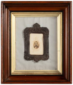
Sold[France]. Carte Générale De La Gaule.[France]. Carte G‚n‚rale De La Gaule. Double-page engraved map [c1840] in later color. 14 x 18 in archival matte, framed. Very Good. From Levasseur's **Atlas Universel de Geographique** with insetSee Sold Price
SoldDe L'Isle Engraved Map of CanadaCarte du Canada ou de la Nouvelle France. Guillaume De L’isle (1675-1726). Engraved Map. Paris, Quai de LÂ’Horloge, 1703. 20 x 26 3/4 inches sheet, 31 1/2 x 38 1/2 inches framed. "Del'Isle's mapSee Sold Price
SoldJACQUES NICOLAS BELLIN (FRANCE 1702-1873), MAP OFJACQUES NICOLAS BELLIN (FRANCE 1702-1873), MAP OF CHESAPEAKE BAY, 1ST EDITION, "CARTE DE LA BAYE DE CHESAPEACK ET PAYS VOISINS...", C.1757. SIGHT 8 1/4 X 12"; FRAMED AND GLAZED 12 X 15 3/4"See Sold Price
Sold(MAP) TASSIN, NICOLAS 10 x 14 inches.(MAP) TASSIN, NICOLAS Carte de Normandie. s.l., n.d. Framed and matted. No text to verso. Uncolored. From his illustrated topographical survey of seventeenth century France. 10 x 14 inches.See Sold Price
SoldBonne. Carte du Gouvernement de Guienne...1777.[France] Bonne, Rigobert. “Carte du Gouvernement de Guienne et Gascogne avec celui de Bearn et Basse Navarre.” Venice. P. Santini, 1777. Engraved map. 27” x 22 3/4”. Framed: 27See Sold Price
Bonne. Carte du Gouvernement de Guienne...1777.[France] Bonne, Rigobert. “Carte du Gouvernement de Guienne et Gascogne avec celui de Bearn et Basse Navarre.” Venice. P. Santini, 1777. Engraved map. 27” x 22 3/4”. Framed: 27See Sold Price
SoldMap "Carte du Pais de Rete: Lois"Hand colored. France, 17th Century. J. Jasonium, Amsterdam. Approx. 15" H x 19" W unframed, 23" H x 27" W framed. Crease in the middle. Slight staining.See Sold Price
SoldVINTAGE CARTE DE LA FRANCE MAP BY E CLOIN DESPOSEAU BEAUREAU DES ESTAMPS - 26" x 27"See Sold Price
SoldNicholas de Fer, Engraved Map"Carte de la Nouvelle France", map by Nicholas de Fer, 1646-1720, paraphrased, including St. Lawrence and Mississippi Rivers, peoples of Florida, Louisiana, and Virginia, for the establishment of "ComSee Sold Price
SoldAntique Folding Carte Map de France for Bikes & AutosAntique Folding Carte Map de France for Bikes & Autos Shipping in continental US $4.00 Please ask any questions before bidding Good Luck!See Sold Price
SoldNicholas Sanson Antique Map of Brittany, FranceNicholas Sanson antique map "Le Canal de France ou La Manche". Framed map "La Bretagne Generalite de Nantes". Dimensions: Art: 21" H x 31" W; Frame: See Sold Price
SoldDesnos, Louis Charles 1765 Map of France"Carte Generale de France" Copper Engraved Map Published 1765, Paris for "Coup d'oeil general sur la France" by Louis Charles Desnos & Louis Brion de la Tour. Paper Size: 14 x 11 inch (36 x 28cm) VerySee Sold Price
SoldH.A. CHATELAIN: Antique Map of New FranceChatelain, Henri Abraham "Carte de la Nouvelle France" ( "A Map of New France")1719 Copperplate engraving. Lower Loisiana is colored yellow, the pink area represents Canadian territory, the green BritSee Sold Price
Carte Itineraire et Générale de France. Key map.TITLE/CONTENT OF MAP: 'Carte Itineraire et Générale des 18 Feuilles de l'indicateur de France où sont distingueés les Routes Meridionales, Orientales, Septentrionales et Occidentales par raport àSee Sold Price
SoldMap LotLot (3) framed maps including "Carte De La Baye De Hudson" (sight 9 1/4" x 12 1/4"), "The River St. Laurence" (sight 10" x 14 1/2"), "A Plan of the City and Harbour of Louisburg" (sight 11" x 14 1/2")See Sold Price
SoldPoirson, J. B. 1816 Folding Map of France in Slipcase"Carte Routiere de La France" Copper Engraved Map with outline hand colour. Published Paris, 1816. Drawn by J. B. Poirson. Disected and linen backed. Uncommon. Contained in Contemporary Green SlipcaseSee Sold Price
17TH C. ANTIQUE MAP SIEGE OF LA ROCHELLE, FRANCE, FRAMEDThomaston Place Auction Galleries4.4(386)See Sold PriceFeb 24, 2024
RIGOBERT BONNE c1787 Original Colored Map Germany & Region 15" x 12"Luis Porretta Fine Arts4.3(10)See Sold PriceMar 02, 2024
[MAPS]. DUFOUR, Auguste-Henri (1795-1865). Bound Volume of ...Potter & Potter Auctions4.6(539)See Sold PriceMar 07, 2024
Map of St. Kitts and Nevis Depot de la Marine, Paris, 1758Global Auctions Company4.3(36)See Sold PriceMar 03, 2024
Duval - Pair: Map of Georgia & Map of Moscow, RussiaTrillium Antique Prints & Rare Books4.5(30)See Sold PriceFeb 24, 2024
Duval - Pair: Map of India & Map of MaldivesTrillium Antique Prints & Rare Books4.5(30)See Sold PriceFeb 24, 2024
1749 MAP CARTE DE LA TARTARIE ORIENTALE RUSSIA & CHINA antique EASTERN TARTARYJasper524.5(9.8k)See Sold PriceFeb 27, 2024
1760 MAP CARTE PARTICULIERE DE L'ISLE DE JUAN FERNANDES antique Robinson CrusoeJasper524.5(9.8k)See Sold PriceFeb 27, 2024
1764 Bellin Map of Antigua -- Carte de l'Isle d'Antigue Situee par la Latitude 17 Degres et par laJasper524.5(9.8k)See Sold PriceFeb 27, 2024
1845 Delisle/Bauche Map of Martinique -- Carte de l'Isle de la Martinique Colonie Francoise de l'uneJasper524.5(9.8k)See Sold PriceFeb 27, 2024
La Barbarie de la Nigritie et de la Guinée'. West Africa. DE L’ISLE 1745 mapJasper524.5(9.8k)See Sold PriceFeb 28, 2024
Carte de la Guinée, contenant…'. Guinea & Cape Verde islands. BONNE 1771 mapJasper524.5(9.8k)See Sold PriceFeb 28, 2024
Carte de la partie septentrionale d'Afrique, ou de la Barbarie… BONNE 1780 mapJasper524.5(9.8k)See Sold PriceFeb 28, 2024
Carte de L'Algérie et de la Régence de Tunis' ANDRIVEAU-GOUJON Algeria 1850 mapJasper524.5(9.8k)See Sold PriceFeb 28, 2024
Carte de la Haute et de la Basse Guinée. Gulf of Guinea Africa. BONNE 1780 mapJasper524.5(9.8k)See Sold PriceFeb 28, 2024
L'Afrique Françoise ou du Senegal'. French West Africa. DE L’ISLE 1727 mapJasper524.5(9.8k)See Sold PriceFeb 28, 2024
Gracielo Rodo Boulanger Tour de France LithographChurchill Galleries3.7(213)See Sold PriceFeb 26, 2024


![[France]. Carte Générale De La Gaule. (1 of 1)](https://p1.liveauctioneers.com/179/1435/617495_1_x.jpg?height=282&quality=70)


![[MAPS]. DUFOUR, Auguste-Henri (1795-1865). Bound Volume of ... (1 of 2)](https://p1.liveauctioneers.com/928/318880/171361279_1_x.jpg?height=282&quality=70&version=1707501302)