SoldA MAP OF INTERESTING CAPE COD Circa 1940 Published byA MAP OF INTERESTING CAPE COD Circa 1940 Published by F.J. Miller. Depicts Cape Cod and southeastern Massachusetts. 21" x 32" sight. Framed 24" x 35".See Sold Price
SoldPAUL PAIGE (DATES UNKNOWN) MAP OF CAPE COD. Circa 1940.PAUL PAIGE (DATES UNKNOWN) MAP OF CAPE COD. Circa 1940. 26¾x35¾ inches, 68x91 cm. Condition A: minor creases and abrasions at bottom margin. A promotional map of Cape Cod, surrounded by vigSee Sold Price
PAUL PAIGE (DATES UNKNOWN). A MAP OF CAPE COD. CircaPAUL PAIGE (DATES UNKNOWN) A MAP OF CAPE COD. Circa 1940.26¾x36 inches, 68x91½ cm. East Brewster, Mass.Condition A-: minor expert overpainting in margins.A promotional map of Cape Cod, sSee Sold Price
SoldMAP, Cape Cod, Massachusetts, PaigeCape Cod, Massachusetts. Paul Paige, A Map of Cape Cod, 1940 (circa). Printed Color. This vivid pictorial map of Cape Cod is by Paul Paige of East Brewster, Massachusetts. It highlights the Cape's manSee Sold Price
SoldRARE DECORATIVE MAP OF CAPE COD Circa 1937 "Cape CodRARE DECORATIVE MAP OF CAPE COD Circa 1937 "Cape Cod Barnstable County Mass. Inc. 1639." Drawn by C.W. Holliday. Published by Town Crier Shop, Provincetown, Massachusetts, copyright 1937. 24.75" x 34.See Sold Price
SoldCOLORFUL MAP OF CAPE COD AND THE ISLANDS Circa 1956COLORFUL MAP OF CAPE COD AND THE ISLANDS Circa 1956 Designed by Clara Chase. Published by Atlantic Card Company. 24.75" x 18.5" sight. Framed 26.5" x 20.5".See Sold Price
SoldBirds' Eye View of Cape CodBirds Eye View of Cape Cod Publisher John F. Murphy Dated: Circa 1920 - 1940 Type: Nicely Colored Demensions: 4x8 foldedSee Sold Price
SoldVery Interesting & Large Antique Wall MapGulf and Rivers St Lawrence Breton Island to Cape Cod along with the Island of Newfoundland. Published 1853 by James Imray, London. Some scattered wear and yellowing to paper consistent with age. HaviSee Sold Price
SoldC.1940 Cape Cod No Undressing In Cars Beach Sign,Cape Cod,Circa 1940 An early primitive sign from a Cape Cod, Massachusetts beach "No Undressing In Cars" in white stenciled letters over black paint. Also included is a parking lot "Fields Closed" siSee Sold Price
Colton Waugh 1926 CAPE COD MapHand colored "Map of Cape Cod" published by Colton Waugh, dated 1926. Features a portrait of Myles Standish and descriptions of movements taken by the Pilgrims. Sight size is 15" x 19".See Sold Price
SoldCAPE COD WWII-ERA POSTER Circa 1940 29” x 22”. Unframed.CAPE COD WWII-ERA POSTERCirca 1940“Phone Hyannis 10,000 Free of Charge If You Suspect or See Any Enemy Activity on Cape Cod” surrounding an image of warships off the coast.29” x 22&#See Sold Price
SoldCAPE COD WWII-ERA POSTER Circa 1940 29î x 22î. Unframed.CAPE COD WWII-ERA POSTERCirca 1940ì'Phone Hyannis 10,000 Free of Charge If You Suspect Or See Any Enemy Activity on Cape Codî surrounding a coastal scene with figures and battleships.29îSee Sold Price
Sold1930 Souvenir Map of Cape Cod, ProvincetownDetailed souvenir map of Cape Cod, signed "Published 1930, Town Crier Shop, Provincetown". Map matted and framed under glass, excellent condition. Measures framed: 30" H x 34" W,See Sold Price
Antique Trout Fish Cast Iron Cape Cod Bottle OpenerTitle: Antique Trout Fish Cast Iron Cape Cod Bottle Opener Date/Period: Circa 1940's. Dimension: 1 1/2" tall x 4 3/4" long. Provenance:Antique Cast Iron Trout Fish Bottle Opener. Souvenir of & markedSee Sold Price
SoldCRAWFORD PRESS MAP OF CAPE COD AND PLYMOUTH,CRAWFORD PRESS MAP OF CAPE COD AND PLYMOUTH, MASSACHUSETTS Circa 1936 15.5" x 16" sight. Framed 17.75" x 18".See Sold Price
SoldCram's Superior Map of Montana Circa 1940This is a large map of Montana circa 1940. The map was published by the George F. Cram Company Inc. This map shows the counties of Montana by color making this a visually appealing piece. The map showSee Sold Price
SoldFolk Art Painted Framed MirrorPeter Hunt Cape Cod artist, folk art painted framed mirror, circa 1940 20" x 16" overallSee Sold Price
SoldAntique Cape Cod Fish Cast Iron Bottle OpenerTitle: Antique Cape Cod Fish Cast Iron Bottle Opener Date/Period: Circa 1940's Dimension: 1 1/2" tall x 4 3/4" long Provenance:Antique Cast Iron Trout Fish Bottle Opener. Souvenir of & marked “CapeSee Sold Price
SoldPICTORIAL MAP OF CAPE COD, MASSACHUSETTS BY MELANIEPICTORIAL MAP OF CAPE COD, MASSACHUSETTS BY MELANIE ELIZABETH LEONARD Circa 1930 Depicts landmarks and points of interest and a yellow fish-filled border. Signed in plate lower left. 24" x 34" sight.See Sold Price
SoldLighthouse Weathervane Cape Cod- Circa 1940’s 28” L x 20” H x 5” D This handsome weathervane was commissioned for the garage roof of a private home in Truro, Ma. in the late 1940’s. It was removed circa 1990 and thereafteSee Sold Price
SoldGeorge Grosz (1893-1959), Female Nude, Cape Cod, Oil,Oil on canvas, relined at the edges USA, circa 1940 George Grosz (1893-1959) - German painter and printmaker of the New Objectivity Verso with the signature stamp as well as the estate stamp and the hSee Sold Price
MAP: United States- East Coat, Bay Of Fundy to Cape CodDescription: United States- East Coat, Bay Of Fundy to Cape Cod. Published at Washington D.C. US Department of Commerce, National Oceanic Service. Measurement approximate: 38 x 35 Inches. Material: PaSee Sold Price
SoldC.1940 Persian Middle Eastern Heriz Carpet Rug,Persia,Circa 1940 Central red field with allover geometric floral tendril pattern within a stylized floral border. Wool,14'11" x 9'8", From a Cape Cod, Massachusetts estate.See Sold Price
Rumors, Conspiracies and Gossip - Antisemitic BookletLevy Auction House4.3(11)See Sold PriceFeb 27, 2024
Antique Mary Gregory Enameled 2 Art Glass PORTRAIT ruffle Water PITCHER and Bowl Ca. Late 19th CeAuction Wallstreet4.5(51)See Sold PriceMar 02, 2024
Antique Mary Gregory Enameled Art Glass Vase 12" tall CIRCA: Late 19th CenturyAuction Wallstreet4.5(51)See Sold PriceMar 02, 2024
GEORGE GUSTAV ADOMEIT (1879-1967) "CAPE COD".Amelia Jeffers, Auctioneers & Appraisers4.5(120)See Sold PriceMar 07, 2024
Aircraft Bubble Sextant by Bendix Aviation Corp.Old Kinderhook Auction Company4.6(217)See Sold PriceMar 05, 2024
SOUTHERN AFRICA. Congo British/Portuguese/German East Africa Rhodesia 1912 mapJasper524.5(9.9k)See Sold PriceFeb 28, 2024
Gulf of Guinea. Ghana Togo Benin Nigeria. ADMIRALTY sea chart 1928 (1954) mapJasper524.5(9.9k)See Sold PriceFeb 28, 2024
Churchill & Nieuhof 1744 Folio Map. Cape of Good Hope, South AfricaAlbion Auctions4.6(341)See Sold PriceMar 01, 2024
James Cook - Map of the Friendly Isles - Tonga IslandsProverde Auctions4.3(3)See Sold PriceFeb 28, 2024
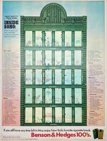
Map Inside Soho - Manhattan - New York Magazine 1974Proverde Auctions4.3(3)See Sold PriceFeb 28, 2024
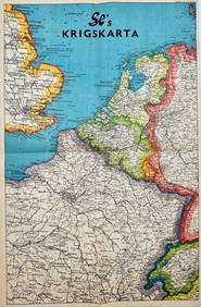
Vintage Map - Krigskarta - War Map - Second World War, published 1940Proverde Auctions4.3(3)See Sold PriceFeb 28, 2024