Poster "Les jardins de Paris", illustrated map and plan of Paris with its parcs, gardens, monuments,Proverde Auctions4.3(3)See Sold PriceFeb 28, 2024
WEST CENTRAL AFRICA. Congo Angola Gabon Cameroon Sao Tome. MALLET 1683 old mapJasper524.5(9.8k)See Sold PriceFeb 28, 2024
1859 Map of Spain and PortugalTitle: 1859 Map of Spain and Portugal Author: Chambers Medium: Ink on Paper Dimensions: 11.5"X9.5" Description: Map of Spain and Portugal dated 1859. Part of the Modern & Ancient Geography Atlas. EngrSee Sold Price
Colton: Antique Map of Spain & Portugal, 1859Title/Content of Map: Spain & Portugal by Colton Date Printed: 1859 Cartographer: H.J. Colton Material/Medium: Paper Size: 17 1/2" x 15" Hand colored,engraved. Published in New York in 'Colton's GenerSee Sold Price
Colton: Antique Map of Spain & Portugal, 1859Title/Content of Map: Spain & Portugal by Colton Date Printed: 1859 Cartographer: Colton Material/Medium: Paper Size: 14" x 17" Provenance: New York Published in New York Please note that this lot hasSee Sold Price
1859 Portugal and Spain MapAuthor: Chambers Title: 1859 Portugal and Spain Map Medium: Ink on Paper Dimensions: 11.5"X9.5" Map of Spain and Portugal dated 1859. Part of the Modern & Ancient Geography Atlas. Engraved by J.GellatSee Sold Price
Antique Map of Spain & Portugal by Colton, 1859Title/Content of Map: Spain & Portugal by Colton Date Printed: 1859 Cartographer: Material/Medium: Paper Size: 14 x 17" Provenance: New York Please note that this lot has a confidential reserve. WhenSee Sold Price
SoldSpain & Portugal. 1859 by Colton. 17x14”. Hand colored.Spain & Portugal. 1859 by Colton. 17x14”. Hand colored. New York Please note that this lot has a confidential reserve. When you leave a bid in advance of the auction, submit your maximum. The bidderSee Sold Price
Spain & Portugal. 1859 by Colton. 17x14”. Hand colored.Spain & Portugal. 1859 by Colton. 17x14”. Hand colored. New York. Please note that this lot has a confidential reserve. When you leave a bid in advance of the auction, submit your maximum. The biddeSee Sold Price
Spain and PortugalSpain and Portugal 1859 H.J. Colton 17 1/2" x 15" Hand colored and engraved. Published in New York in Colton's 'General Atlas'. Please note that this lot has a confidential reserve. When you leave a bSee Sold Price
1859 Spain and Portugal by ColtonTitle: 1859 Spain and Portugal by Colton Date/Period: 1859 Materials: Steel engraved Size: 17 1/2 x 14 1/2” Spain and Portugal. 1859. By J. H. Colton & G. W. Colton. From "General Atlas". PublishedSee Sold Price
SoldMilton, W. C1825 Hand Col Map. Spain & PortugalHand Colored Copper Engraved Map Published C1825 by J. McGowan, London. Engraved W. Milton. Paper Size: 10.5 x 8 inch (27 x 21cm) Good ConditionSee Sold Price
SoldBarclay, James 1809 Map. Spain Portugal Napoleonic Wars"The Seat of War" Outline Hand Coloured Copper Engraved Map Published 1809, Leeds for "Barclay's Complete and Universal Dictionary of the English Language..." by the Rev. James Barclay. Paper Size: 10See Sold Price
SoldGuthrie, William 1790 Antique Map. Spain & PortugalCopper Engraved Map Published 1790, London for "A New Geographical, Historical and Commercial Grammar..." by William Guthrie. The maps are by John Senex, Thomas Kitchin and others. Folds as issued. EaSee Sold Price
SoldExhibited 18th C Bowles & Carver Map - Spain & Portugal**Originally Listed At $50** Bowles and Carver - Carington II Bowles ; Henry Carington Bowles; Samuel Carver (British, active 1793-1832), "Bowles's New One-Sheet Map of the Kingdoms of Spain and PortuSee Sold Price
SoldBarclay, James 1809 Map. Spain Portugal Napoleonic Wars"The Seat of War" Outline Hand Coloured Copper Engraved Map Published 1809, Leeds for "Barclay's Complete and Universal Dictionary of the English Language..." by the Rev. James Barclay. Paper Size: 10See Sold Price
Antique European Map Spain & Portugal, 18th CAntique European Map Spain & Portugal. Matted dimensions ca 30x24 plate 27. 18th century Please note that this lot has a confidential reserve. When you leave a bid in advance of the auction, submit yoSee Sold Price
SoldFindlay, Alex C1835 Antique Map. Spain & PortugalSteel Engraved Map Published C1835 by Thomas Kelly, London for "A New and Universal English Dictionary" by the Rev. James Barclay. Maps Drawn & Engraved by Alexander Findlay. Paper Size: 10.5 x 8 inchSee Sold Price
Exhibited 18th C Bowles & Carver Map - Spain & PortugalBowles and Carver - Carington II Bowles ; Henry Carington Bowles; Samuel Carver (British, active 1793-1832), "Bowles's New One-Sheet Map of the Kingdoms of Spain and Portugal, according to De Lifle: WSee Sold Price
SoldMAP, Spain & Portugal, GastaldiSpain & Portugal. Giacomo Gastaldi, Tabula Europae II, from La Geografia di Claudio Ptolemeo Alessandrino, 1548 (circa). Black & White. This copperplate Ptolemaic map of the Iberian Peninsula prominenSee Sold Price
MAP, Spain & Portugal, BowenSpain & Portugal. Emanuel Bowen, A New & Accurate Map of Spain and Portugal. Drawn from Surveys Assisted by ye Most Approved Modern Maps and Charts..., from The Maps and Charts to the Modern Part of tSee Sold Price
MAP - Spain & Portugal. De FerSpain & Portugal. Nicholas de Fer, L'Espagne Divisee en Galice Asturies Biscaye, Navarre, Leon, Vielle et Nouvelle Castille, Arragon, Andalousie, Mursie, Valence et Catalogne..., 1705 (circa). Hand CoSee Sold Price
MAP - Spain & Portugal. BodenehrSpain & Portugal. Gabriel Bodenehr, Compendiosa Hispaniae Repraesentatio / Die Konigreich Spanien u Portugall mit Ihren Provincien, 1704 (published). Hand Color. A nice small map of the Balearic PeninSee Sold Price
Large Beautiful Antique Map Spain & PortugalEnglish rendered. Cartograpphers unknown. Fine colors. Measures 30x24 matted for framing inches.See Sold Price
MAP - Spain & Portugal. De FerSpain & Portugal. Nicholas de Fer, L'Espagne Divisee en Galice Asturies Biscaye, Navarre, Leon, Vielle et Nouvelle Castille, Arragon, Andalousie, Mursie, Valence et Catalogne..., 1705 (circa). Hand CoSee Sold Price
MAP - Spain & Portugal. BodenehrSpain & Portugal. Gabriel Bodenehr, Compendiosa Hispaniae Repraesentatio / Die Konigreich Spanien u Portugall mit Ihren Provincien, 1704 (published). Hand Color. A nice small map of the Balearic PeninSee Sold Price
Original Milo Modern Art Bull Bronze Statue Figure Abstract Mid CenturyHouse of Treasure4.4(50)See Sold PriceFeb 29, 2024
Bronze Sculpture Statue Abstract Bull Horns Figurine Stock Broker Sale Gift DecorHouse of Treasure4.4(50)See Sold PriceFeb 29, 2024
16 page stamp album Monaco, Spain, France, Portugal 1850-1980Bazaar of Persia4.3(23)See Sold PriceFeb 24, 2024
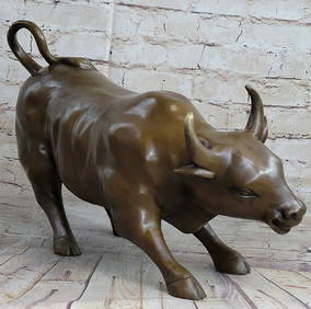
Signed Original Fierce Bull Bronze Sculpture - 5.5" x 11"Weatherham Estate Treasures3.9(157)See Sold PriceMar 14, 2024
Pair of Large Noble Heraldic Shields in Renaissance carved wood, Spain or Portugal 16th century -Templum Fine Art Auctions4.3(8)See Sold PriceFeb 28, 2024
Book: A Concise Historical, Biographical & Genealogical Atlas of the Principal Events in theClaydon Auctioneers Ltd4.3(125)See Sold PriceFeb 26, 2024
Western Africa by Edward Weller. Early British/French settlements 1859 old mapJasper524.5(9.8k)See Sold PriceFeb 28, 2024
Guthrie, William 1812 Antique Map. Spain and PortugalAlbion Auctions4.6(336)See Sold PriceMar 01, 2024
The Last Coins of Europe 12 Coins Set - Spain, Portugal, France, Italy, Ireland, Belgium, Luxemburg,Andrew's Coin & Jewelry4.5(209)See Sold PriceMar 07, 2024