Marc Chagall-Limited Edition -Paris Opera Ceiling after ChagallArt Legacy Auctions4.5(219)See Sold PriceFeb 24, 2024
Salvador Dali Pantagruel Limited Edition Lithograph Hand signed and numberedArt Legacy Auctions4.5(219)See Sold PriceFeb 24, 2024
Pablo Picasso Bouquet of Peace Collection Domaine Picasso Limited Edition on paper.Art Legacy Auctions4.5(219)See Sold PriceFeb 24, 2024
A RARE MAXFIELD PARRISH JACK AND THE BEANSTALK PRINTSoulis Auctions4.8(953)See Sold PriceFeb 24, 2024
LARGE MECHANICAL PRINT 'STARS' AFTER MAXFIELD PARRISHSoulis Auctions4.8(953)See Sold PriceFeb 24, 2024
Heinrich Aldegrever, etc. 15 old master prints. 16th-17th centuries. Aldegrever works include "ManTremont Auctions4.6(294)See Sold PriceFeb 25, 2024
SoldEnsign's maps of US, Canada, etc. c. 1863-4Title: Map of the United States, Canada, Mexico, and the West Indies with Central America, Showing all the routes to California with a table of distances Author: Ensign & Bridgman Description: FoldingSee Sold Price
German map of U.S. c.1863Heading: Author: Bromme, Traugott Title: Neueste Eisenbahn-Kanal-u. Post-Karte für Reisende in den Vereinigten Staaten von Nord-Amerika, Canada, Texas, sowie Californien und den westlichen Staaten uSee Sold Price
SoldWall map of U.S. and Canada 1863Heading: (United States & Canada) Author: Lloyd, J.T. Title: Lloyd's New Map of the United States The Canadas And New Brunswick From the latest Surveys Showing Every Railroad & Station Finished to JunSee Sold Price
6 maps charting John Mullan's expedition [C. 1863[Western Exploration]. 6 Maps (on 5 sheets). Lithographed maps from: Sen Ex Doc No 1, 37th Cong, 2nd Sess (1862). Published: [Wash: c1863]. First 4 maps listed below printed on folding plates and apprSee Sold Price
SoldHAND COLORED MAPS OF AMERICA, C. 1800 & LATERHAND COLORED MAPS OF AMERICA, INCLUDES THE US, 4, C. 1800 & LATER, 16 3/4" X 20 5/8" - 18" X 22 1/2":Unframed. Ex. Collection Nancy and the late G. Mennen Williams. Brightly colored map does not haveSee Sold Price
Rand McNally New Official Railroad Map US & CanadaDESCRIPTION: Rand McNally New Official Railroad Map of the United States and Southern Canada including railroads, cities, towns, villages, post offices, lakes, rivers, etc. Brown paper covers over larSee Sold Price
SoldMansfield & Lamb Model 1860 Cavalry SaberMansfield & Lamb Model 1860 Cavalry Saber34-3/4 in. blade, the ricasso marked "MANSFIELD & LAMB / FORESTDALE, R.I. U.S / C.E.W / 1863"; brass guard and pommel with additional inspector stamp; wooden gSee Sold Price
SoldJ.T. Lloyd Wall Map of U.S. & Canada"Lloyds New Map of the United States, the Canadas and New Brunswick" dated 1863. 39" high, 57 1/2" wide. Toned throughout, scattered edge losses and small tears, tear with old tape repair upper left,See Sold Price
MAP - Eastern US & Canada. D'AnvilleColonial Eastern United States & Canada. Jean Baptiste Bourguignon d'Anville, [On 4 Sheets] Canada Louisiane et Terres Angloises, 1755 (dated). Black & White. This large-scale map covers the region frSee Sold Price
SoldMap showing U.S. & Canada radio stations, 1923Heading: (United States) Author: Rand McNally Title: Radio Map of the United States Place Published: Chicago Publisher:Rand McNally & Company Date Published: c.1923 Description:See Sold Price
Williams New Map of US 1854 with book 1855Title: The Traveller's and Tourist's Guide through the United States of America, Canada, etc. Containing the Routes of Travel by Railroad, Steamboat, Stage and Canal... Accompanied by an entirely newSee Sold Price
SoldCivil War map of U.S. 1862Heading: Author: Colton, Joseph Hutchins Title: Colton's New Railroad & County Map of the United States the Canadas &c. Place Published: New York Publisher:Published by J.H. Colton Date PublisheSee Sold Price
CIVIL WAR PHOTO ALBUMCIVIL WAR PHOTO ALBUM; Contains fifty photos or CDV's including Confederate enlisted man, U.S. Grant from a Brady negative, Union lieutenant, Union colonel, Pennsylvania captain, etc., 19th c.; 4'' xSee Sold Price
Soldc.1863 Civil War CDV of US CapitolPhotographsScarce Civil War Era Image of the U.S. Capitol c. 1863, Carte de Visite of the U.S. Capitol, M.P. Rice photography, Washington, D.C., Choice Extremely Fine. 4” x 2.5”. Image ofSee Sold Price
Sold2 Early French Hand Colored Engraved Maps2 Early French Hand Colored Engraved Maps. 1) Canada IIe. Feuille, Plate No. XXXV, B 32. Detailed map of eastern Canada, US and Louisiana territory, c.1776; has a vertical crease through the center. SSee Sold Price
1893 Civil War Map of the South -- Section of G. Woolworth Colton's New Guide Map of the UnitedTitle: 1893 Civil War Map of the South -- Section of G. Woolworth Colton's New Guide Map of the United States and Canada with Railorads, Counties, etc. 1863. Used by General Grant in Marking the PropoSee Sold Price
SoldFour 18th c. US Maps, Mainly SouthernFour (4) 18th c. maps of southern United States. 1st item: Abraham Bradley Jr. "Map of the Southern Part of the UNITED STATES OF AMERICA" drawn and engraved for Morse's American Gazetteer. Boston, 179See Sold Price
SoldTardieu: Antique Map of Northern U.S & Canada, 1798Map: Carte de la Partie Septentrionale des Etats Unis comprenant le Canada Cartographer: Chanlaire & Mentelle / Tardieu Place & Date: Paris / 1798 Size: 16 3/4" x 13" Condition: outline color; mild frSee Sold Price
SoldA History of Rome with Maps, Plans, Engravings 1883"A History of Rome. Amply Illustrated with Maps, Plans, and Engravings", by R. F. Leighton, published by Clark amd Mynard, New York, 1883, copyright 1878. US: Priority (c 2-4 days) -------- $8.50 CanaSee Sold Price
SoldUS Navy Fleet Hand Made Cachet Covers, 37 [168272]37 all unique hand made cachet US Naval covers by Henry Stinemetts, all with US Fleet cancels including USS Arizona, 1932 First Day of Olympics etc., c. 1930's. 4.25x9.5".See Sold Price
SoldGROUPING OF 18 VINTAGE TEXACO CANADA & U.S. MAPS 2-GROUPING OF 18 VINTAGE TEXACO CANADA & U.S. MAPS 2- QUEBEC, 2 ALBERTA & BRITISH COLUMBIA, 2 ONTARIO TEXACO, 4 ONTARIO, MANITOBA SASK, B.C & ALBERTA, McCOLL-FRONTENAC OIL COMPANY, 2 ATLANTIC PROVINCES,See Sold Price
Colton's 1861 Map of the US & CanadaHeading: Author: Colton, G.W. Title: New Guide Map of the United States & Canada. With Railroads, Counties, etc. Place Published: New York and Chicago Publisher:Colton and Rufus Blanchard Date PSee Sold Price
Map Dominion Canada & Newfoundland C. 1897The Century Co. New York. Framed. 10 1/4" x 14 3/4"WSee Sold Price
SoldCarved Ivory Tupilak From Greenland - Early 20TH CCarved Ivory Tupilak From Greenland - Early 20TH C. 4 1/2" H. Fine Condition NOT ALLOWED TO SHIP TO U.S. or OUTSIDE CANADASee Sold Price
LARGE LATE 17TH C. DUTCH CHART OF CANADA, GREAT LAKES, NEW FRANCE, LABRADOR, HUDSON BAY, BY PIERREThomaston Place Auction Galleries4.4(389)See Sold PriceFeb 24, 2024
LATE 17TH C. FRENCH MAP OF THE NEW WORLD BY ALEXIS-HUBERT JAILLOT (1632-1712)Thomaston Place Auction Galleries4.4(389)See Sold PriceFeb 24, 2024
18TH C. ANTIQUE MAP: FRENCH & INDIAN WAR, FRAMEDThomaston Place Auction Galleries4.4(389)See Sold PriceFeb 24, 2024
DODIE THAYER (US, 20TH C.) MAJOLICA TUREENThomaston Place Auction Galleries4.4(389)See Sold PriceFeb 25, 2024
GROUPING OF (19th c) BRITISH SATIRICAL PRINTS etcJohn McInnis Auctioneers,LLC4.6(504)See Sold PriceFeb 24, 2024
RARE 1930s AUTOGRAPH BOOK FEATURING RUTH & GEHRIGJohn McInnis Auctioneers,LLC4.6(504)See Sold PriceFeb 25, 2024
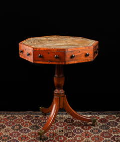
(19th c) ENGLISH OCTAGONAL (4) DRAWER STANDJohn McInnis Auctioneers,LLC4.6(504)See Sold PriceFeb 25, 2024
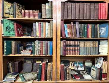
(18) SHELF FT OF CHILDREN'S, REF BOOKS & NOVELSJohn McInnis Auctioneers,LLC4.6(504)See Sold PriceFeb 25, 2024
Three American Military Style Knives, 20th c., M3- L.- Blade- 6 5/8 in., Overall- 11 1/2 in.;Crescent City Auction Gallery4.3(231)See Sold PriceMar 01, 2024
[YELLOWSTONE NATIONAL PARK, ETC.] A Photo Album/Scrapbook C...Potter & Potter Auctions4.6(544)See Sold PriceMar 07, 2024
Willem Blaeu, Etc. 17th C. Antiquarian Maps, 2Auctions at Showplace4.6(731)See Sold PriceMar 17, 2024
Estate Fresh Civil War Cavalry C. Roby 1863 With ScabbardRalph Fontaine Heritage Auctions Inc.4.7(234)See Sold PriceFeb 25, 2024
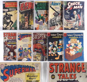
10PC Atlas DC Dell Golden Silver Age Comics GroupBruneau & Co. Auctioneers4.5(491)See Sold PriceFeb 24, 2024
Mostly U.S., Some Canada Maps etc (40 Pcs)Grant Zahajko Auctions, LLC4.7(1k)See Sold PriceMar 06, 2024


![US Navy Fleet Hand Made Cachet Covers, 37 [168272] (1 of 3)](https://p1.liveauctioneers.com/2699/299102/159226095_1_x.jpg?height=282&quality=70&version=1692053662)


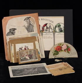

![[YELLOWSTONE NATIONAL PARK, ETC.] A Photo Album/Scrapbook C... (1 of 4)](https://p1.liveauctioneers.com/928/318880/171361310_1_x.jpg?height=282&quality=70&version=1707501302)