KONVOLUT AUS VIER LANDKARTEN RUSSLAND UND CHINA Abraham Ortelius, Willem Blaeu, Johannes Blaeu,Hargesheimer Kunstauktionen Duesseldorf4.5(136)See Sold PriceMar 09, 2024
SoldOrtelius Map of America 1593 State 3ORTELIUS, Abraham (1527-1598).America Sive Novi Orbis Nova Descriptio.Engraved map with original hand color.Antwerp, c. 1595 (State 3).13 3/4" x 19 1/4" visible, 21 1/2" x 26" framed.Very Fine exampleSee Sold Price
SoldOrtelius Map of America 1575ORTELIUS, Abraham (1527-1598). Americae sive novi Orbis, nova descriptio... Engraved map with original hand color in full. Antwerp: 1575 (1st Plate, 3rd State). 16 3/4" x 21 1/2" sheet. "The first depSee Sold Price
Ortelius Map of the AmericasORTELIUS, Abraham (1527-1598). America Sive Novi Orbis Nova Descriptio. Engraved map with original hand color. Antwerp, c. 1595 (State 3). 16 1/8" x 21 1/4" sheet, 28" x 33" framed. Very Fine exampleSee Sold Price
Ortelius Map of Tartary*** START PRICE IS THE RESERVE *** [Asia] ORTELIUS, Abraham (1527-1598). Tartariae sive magni chami regni typus. Engraved map with hand color in full. Antwerp, 1587 or later (State 3). 21 ¼Â” x 17See Sold Price
SoldOrtelius Map of the North Pacific[Asia] ORTELIUS, Abraham (1527-1598). Tartariae sive magni chami regni typus. Engraved map with hand color in full. Antwerp, 1587 or later (State 3). 21 1/4" x 17 1/2" sheet, 31" x 27 1/8" framed. ComSee Sold Price
SoldLattre Map of America, 1784LATTRE, Jean (fl. 1743-1793). Carte des Etats-Unis de l'Amerique... Engraved map with original hand color in outline. Paris: Delamarche, 1784 (c. 1792, State 3). 24 3/4" x 29 1/2" sheet, 33" x 40 1/2"See Sold Price
SoldHondius Map of AmericaHondius, Judocus (1563-1512). America Noviter delineata. Copperplate engraving with hand color in full. Amsterdam, c, 1623. 16 5/8" x 22" sheet, 25 1/2" x 30" framed. State 3 of this fine map. Right cSee Sold Price
SoldAllard Map of AmericaALLARD, Carol (1648 - 1709).Recentissima Novi Orbis Sive Americae Septentrionale et Meridionalis.From Atlas MinorCopperplate engraving with original hand color.Amsterdam: c. 1700 (State 3).20 1/2" x 2See Sold Price
ABRAHAM ORTELIUS - MAP OF AMERICA FROM THEATRUM ORBISAbraham Ortelius - Map Of America From Theatrum Orbis Terrarum - 36 X 26 3/8 In. - This Giclée Print Is Gallery Stretched And Ready To Hang Or Lean Against A Wall, Or Display On An Easel. - A GicléeSee Sold Price
Abraham Ortelius - Map Of America From Theatrum OrbisAbraham Ortelius - Map Of America From Theatrum Orbis Terrarum Size: 36 X 26 3/8 In. - This Is A Gallery Stretched Giclee Print On Canvas. The Piece Was Printed On High Quality Artist Grade 350 Gsm, ASee Sold Price
ABRAHAM ORTELIUS - MAP OF AMERICA FROM THEATRUM ORBISAbraham Ortelius - Map Of America From Theatrum Orbis Terrarum - 36 X 26 3/8 In. - This Giclée Print Is Gallery Stretched And Ready To Hang Or Lean Against A Wall, Or Display On An Easel. - A GicléeSee Sold Price
ABRAHAM ORTELIUS - MAP OF AMERICA FROM THEATRUM ORBISABRAHAM ORTELIUS - MAP OF AMERICA FROM THEATRUM ORBIS TERRARUM - Giclée on Canvas 36 x 26 3/8 in. - A Giclée Print Is The Highest Quality Print Available Today. Because There Is No Visible Dot ScreeSee Sold Price
SoldMAP OF AMERICA FROM THEATRUM ORBIS TERRARUM"ABRAHAM ORTELIUS"MAP OF AMERICA FROM THEATRUM ORBIS TERRARUM"36 x 26 3/8 in. This Giclée is high-resolution and of the highest quality, has a color permanence rating in excess of 100 years. Printed oSee Sold Price
SoldOrtelius' World MapTypus Orbis Terrarum. Abraham Ortelius (1527-1598). Engraved Map. Antwerp, 1595 (Latin, Plate 3, State 1). 15 3/4 x 22 inches sheet. This was a hugely important moment in the history of cartography, aSee Sold Price
Sold18th century German Map of North America by SeutterNova Orbis sive America Septentrionalis. Matthias Seutter (1678-1757). Engraved map with hand color in full. Augsburg, 1740 (State 3, 1744). 8 1/4 x 10 1/2 inches visible, 16 1/2 x 18 1/2 framed. NiceSee Sold Price
SoldSanson Map of N. America, 1650SANSON, Nicolas (1600-1667). Amerique Septentrionale... Engraved map with original hand color in outline. Paris, 1650 (1659; State 3). 16 7/8” x 22 3/4” sheet. All of North America, with CaliforniSee Sold Price
SoldHennepin Map of North AmericaCarte d’un tres grand pais...Louis de Hennepin (1626-1704). Engraved map with original hand color. 1698 (Leiden: 1704, state 3). 15 3/4 x 18 1/4 sheet. This significant map of eastern North AmericaSee Sold Price
Visscher Map of Eastern AmericaVisscher, Nicholas (1649-1702). Nova Tabula Geographica complecteus borealireum Americae partem. Engraving with original hand color. Amsterdam: Schenck, 1717. (State 3). 20 7/8" x 23 2/3" sheet. BurdeSee Sold Price
SoldAtlas for Willett's Geography in original wrappers 1826Heading: Author: Potter, Paraclete [and Jacob Willetts] Title: Atlas Designed To Illustrate Willetts' Geography, Containing The Following Maps: 1. The World. 2. North America. 3. United States. 4. SoSee Sold Price
Atlas for Willett's Geography in original wrappers 1826Heading: Author: Potter, Paraclete [and Jacob Willetts] Title: Atlas Designed To Illustrate Willetts' Geography, Containing The Following Maps: 1. The World. 2. North America. 3. United States. 4. SoSee Sold Price
SoldThe Earliest Dutch Map of South America - De JodeDE JODE, Cornelis (1568-1600). Brasilia et Peruvia. Engraved map. Antwerp, 1593. 15 3/4" x 20 1/2" sheet, 27 1/2" x 33 1/2" framed. RARE. THE EARLIEST DUTCH MAP OF SOUTH AMERICA. This unusual map appeSee Sold Price
SoldSanson Map of North AmericaSANSON, Nicholas (1600-1667). Amerique Septentrionale. Engraving with original hand color. Paris, (1650),1651 (1st Ed., 2nd State). 16 3/4" x 23 1/8" sheet. All of North America, with California depicSee Sold Price
SoldEarly Map of America, Eastern United States, M. SeutterTitled "Novi Belgii in America Septentrionali" with very elaborate cartouche and with vignette view of New Amsterdam (New York). Exquisite color, well preserved, laid down. Size: 19 7/8" x 22 3/4" (siSee Sold Price
3 MAPS United States, Mexico, South America 18893 SMALL MAPS. SIZE: 7.5 X 6 INCHES APPROXIMATELY. UNFRAMED. PRINTED IN ITALY 1889.See Sold Price
United States Map with American Flag 3-D Wall Mount PaintingWeatherham Estate Treasures3.9(157)See Sold PriceFeb 29, 2024
5 Dollars - Elizabeth II Map of North AmericaWeatherham Estate Treasures3.9(157)See Sold PriceMar 07, 2024
3 Piece Gilt Bronze Clock Garniture with Cherubs Candelabras SetWorld of Antiques, Inc.3.9(74)See Sold PriceFeb 29, 2024
[ENSLAVEMENT & ABOLITION]. 3 works related to enslavement, comprising:Freeman's | Hindman4.4(1.6k)See Sold PriceFeb 27, 2024
De Jode, Rare, pub. 1593 - Map of Africa (Africae Vera Forma, et Situs)Trillium Antique Prints & Rare Books4.5(30)See Sold PriceFeb 24, 2024
Map: A 19thC engraved and hand coloured map of South America. Published by the Society for theClaydon Auctioneers Ltd4.3(125)See Sold PriceFeb 26, 2024
Map: An 18thC engraved and hand coloured map of North America and South America, titled DeClaydon Auctioneers Ltd4.3(125)See Sold PriceFeb 26, 2024
1822 MAP of SOUTH AMERICA GEOGRAPHICAL STATISTICAL HISTORICAL antique 17.5x 22"Jasper524.5(9.8k)See Sold PriceFeb 27, 2024
Three (3) Seat Bench / Sofa in Navy Blue Velvet Set on a Chrome Base Attributed to Milo Baughman c.Bidhaus4.3(747)See Sold PriceMar 02, 2024
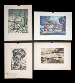
1930s American Etchings, Original Ltd. Editions (4)Artemis Fine Arts4.8(1.4k)See Sold PriceFeb 26, 2024
Cooke, George 1801 Antique Map. United States of AmericaAlbion Auctions4.6(336)See Sold PriceMar 01, 2024
Blackie (Pub) 1882 Folio Map. West USA - Pacific StatesAlbion Auctions4.6(336)See Sold PriceMar 01, 2024
Blackie (Pub) 1882 Folio Map. United States of North AmericaAlbion Auctions4.6(336)See Sold PriceMar 01, 2024
Map of United States of North America, 1785Antiques Online Auctions4.6(407)See Sold PriceMar 14, 2024


![[ENSLAVEMENT & ABOLITION]. 3 works related to enslavement, comprising: (1 of 4)](https://p1.liveauctioneers.com/197/319238/171468080_1_x.jpg?height=282&quality=70&version=1707520367)