2 Illuminated Books of Hours LeavesSchmidt's Antiques Inc. Since 19114.8(431)See Sold PriceMar 02, 2024
Illuminated Manuscript Leaf of The CrucifixionSchmidt's Antiques Inc. Since 19114.8(431)See Sold PriceMar 02, 2024
RARE 1930s AUTOGRAPH BOOK FEATURING RUTH & GEHRIGJohn McInnis Auctioneers,LLC4.5(505)See Sold PriceFeb 25, 2024
Timetable, Paper and Ephemera Lot-Eastern USA RailroadsJM Hobby Supply and Railroad Artifact Auctions4.4(127)See Sold PriceFeb 24, 2024
SCARCE 1971 Kim Il Sung Signed Book "ON THE WORK OF THE WOMAN'S UNION"Rbfinearts4.5(578)See Sold PriceFeb 24, 2024
1885 CIVIL WAR 1ed Famous Memoirs US Grant Sheridan Sherman 6v RARE LOT MapsSchilb Antiquarian Rare Books4.8(428)See Sold PriceMar 10, 2024
"WINTER AND SUMMER IN MAINE" 1904 PHOTO ALBUMJohn McInnis Auctioneers,LLC4.5(505)See Sold PriceFeb 25, 2024
1821 THE (3) VOYAGES of CAPT JAMES COOK VOL. I-VIIJohn McInnis Auctioneers,LLC4.5(505)See Sold PriceFeb 24, 2024
[BASEBALL]. [SHEET MUSIC]. KALBFLEISCH, J. H. The Live Oak ...Potter & Potter Auctions4.6(545)See Sold PriceMar 07, 2024
Illuminated Manuscript Leaf of The VisitationSchmidt's Antiques Inc. Since 19114.8(431)See Sold PriceMar 02, 2024
Illuminated Manuscript Leaf of GethsemaneSchmidt's Antiques Inc. Since 19114.8(431)See Sold PriceMar 02, 2024
c1700s RARE Arabic Handwritten Manuscript Middle East Persia Journal ARABIASchilb Antiquarian Rare Books4.8(428)See Sold PriceMar 10, 2024
SoldCollection of maps depicting the British Isles, EnglandCollection of maps depicting the British Isles, England and Wales (qty) - Stock Ref:255-41See Sold Price
SoldBritish Isles.- A large collection of over 140 maps ofNO RESERVE British Isles.- Collection of over 140 maps of England and Wales, many of the north of England, some by Morden, various road strip maps, and many others, engravings and lithographs, variousSee Sold Price
SoldGrp: 94 Misc Cartography BooksLarge lot of miscellaneous books on maps and cartography. Includes County Atlases of the British Isles: A Bibliography 1579-1850 by R. A. Skelton; The Malaspina Expedition "In the Pursuit of KnowledgeSee Sold Price
SoldNumismatic Books - SCBI 56 - J P Mass Collection - English Short Cross CoinsPublished 2001 A.D. Mass, Jeffrey P., The J. P. Mass Collection of English Short Cross Coins 1180-12147, British Academy, 2001, Sylloge of Coins of the British Isles 56; hardback with dustwrapper; fulSee Sold Price
SoldNumismatic Books - SCBI 39 - J J North Collection - Edwardian English Silver CoinsPublished 1989 A.D. North, J. J., The J. J. North Collection - Edwardian English Silver Coins 1279-1351, British Academy, 1989, Sylloge of Coins of the British Isles 39; hardback with dustwrapper; fulSee Sold Price
SoldBEATRIX POTTER SOCIETY PUBLICATIONS, ENGLAND (28)Collection of 28 vintage publications from the BEATRIX POTTER SOCIETY England. Includes: Illustrated map, books, studies etc. Condition: all in good condition.few duplicates. Provenance: private estatSee Sold Price
Catalogue: Items In The British Natural History MuseumCatalogue Of The Books Manuscripts Maps & Drawings In The British Museum (Natural History). A catalogue of one of the world's finest collections on natural history. Not just a checklist, but often conSee Sold Price
SoldA collection of Medical Books 8 Books, comprisingFlower, W.H. Diagrams of the Nerves. London: John Churchill, 1861. Folio, original boards, stamp of the British Medical Library Association; Cheyne, W. Watson Manual of the Antiseptic Treatment of WouSee Sold Price
SoldTallis, John (Pub) 1852 Map. British IslesSteel Engraved Map with Original Outline Hand Color Published 1852-56 by John Tallis, London for "The Universal Pronouncing Dictionary" by Thomas Wright. Drawn & Engraved by John Rapkin. Centre fold aSee Sold Price
SoldGuthrie, William 1799 Pair of Maps. British IslesCopper Engraved Maps Published 1799, London for "A New Geographical, Historical and Commercial Grammar..." by William Guthrie. The maps are by D. Ogilby & Son and others. Folds as issued. Paper Size:See Sold Price
SoldMap, British Isles, Joannes Jansson, mid 17th CenturyEarly map, British Isles, by Joannes Jansson (Amsterdam) mid 17th Century, "MONA INSULA Vulgo ANGLESEY. ; MONA INSULA Vulgo THE ISLE OF MAN. ; VECTIS INSULA Anglice THE ISLE WIGHT", 18" by 22"See Sold Price
SoldBartholomew, John 1904 Geological Map. British Isles"General Geological Features of the British Isles" Lithograph Map Published 1904, London for "The Survey Gazetteer of the British Isles" Uncommon First Edition by John Bartholomew. Centre fold as issuSee Sold Price
SoldBritish Isles.Reserve Reduced! Title/Content of Map: British Isles.Date: 1840 Cartographer: GREENLEAF, JEREMIAH Material/Medium: JEREMIAH GREENLEAF Size: 12.5 x 10.75 inches Showing topography, many place names. MaSee Sold Price
Seutter: Antique Map of the British Isles, 1740Title/Content of Map: British Isles by Seutter Date Printed: C1740 Cartographer: Matthaus Seutter Material/Medium: Paper Size: 23" x 19" Original hand colored copperplate engraved. Published in AugsbuSee Sold Price
Jansson 1653 Map of British IslesDESCRIPTION: "Magnae Brittaniae et Hiberniae Nova Descriptio." Based on Willem Blaeu's 1631 map of the British Isles, this map depicts towns, rivers, an inset of Orkney Islands. Strap work cartouchesSee Sold Price
SoldMunster: Antique Ptolemaic Map of British Isles, 1570Title: Britannischen Insula. 1570 woodcut Ptolemaic map of the British Isles Map maker: Sebastian Münster Place and Year: Basel, 1570 Dimensions: 25.0 x 16.5 cm (9.8 x 6.5 in) Technique: Woodblock prSee Sold Price
Thomson: Map of British Isles, 1815Map: British Isles Publication Date: 1815 Size: Elephant Folio – 23.60 H x 19.80 W Inches Authors: JOHN THOMSON & CO., THOMSON, JOHN Publisher: JOHN THOMSON & CO. Engraved for Thomson's New GeneralSee Sold Price
SoldThomson: Antique Map of British Isles, 1815Map: British Isles Publication Date: 1815 Cartographer: THOMSON, JOHN Publisher: JOHN THOMSON & CO. Size: Elephant Folio – 23.60 H x 19.80 W Inches Engraved for Thomson's New General Atlas. OriginalSee Sold Price
SoldGerard Mercator, (2) 16th c. maps of British IslesGerard Mercator, (2) 16th c. maps of British Isles, Gerard Mercator (German, 1512-1594), half sheets of Scotland and England, c. 1580s, 19.5"h x 22.5"w (sheet), unframed Provenance: Property from a maSee Sold Price
Sold2 Michael Mitchener books on British Isles Medals &2 Michael Mitchener books on British Isles Medals & TokensSee Sold Price
SoldCollection of British Isles Sterling Flatware andCollection of British Isles Sterling Flatware and Serving Pieces, Two large ladles {length 14 1/2 inches}, one Richard Crossley stuffing spoon {length 12 1/8 inches}, six Scottish Alexander Edmoston tSee Sold Price
SoldCary map of British Isles 1807Heading: (Maps) Author: Cary, John Title: A New Map of the British Isles from the Latest Authorities Place Published: London Publisher: Date Published: 1807 Description: EngSee Sold Price
Desnos / de la Tour: Antique Map of British Isles, 1771Les Isles Britanniques, assujetties aux observations astronomiques, combinées avec les itinéraires tant ancien, que moderne. Par le Sr. Brion, Ingénieur-Géographe du Roi. à Paris, chezSee Sold Price
SoldMap of British Isles. 1835.Print of steel engraving. Author J. Goldsmith.Engraved by S. Hall Bury.Published by Longman & Cᵒ. Paternoster Row.From „A grammar of general geography, for the use of schools and young personsSee Sold Price
Grand Trunk Railroad Across the Continent Through Canada Book-1917JM Hobby Supply and Railroad Artifact Auctions4.4(127)See Sold PriceFeb 24, 2024
AN ANTIQUE FOLDING MAP OF THE BRITISH ISLES DATED 1873Hutchinson Scott Auctioneers4.4(42)See Sold PriceFeb 28, 2024
Chatelain - 3 Maps of the British Isles (England, Ireland, Scotland)Trillium Antique Prints & Rare Books4.5(32)See Sold PriceFeb 24, 2024
De Jode, Rare, pub. 1593 - Map of the British Isles [England, Scotland, Ireland] (Angliae Scotiae etTrillium Antique Prints & Rare Books4.5(32)See Sold PriceFeb 24, 2024
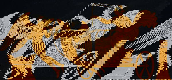
Hamilton - Engraving of a Painting from a Grecian Vase. 1Trillium Antique Prints & Rare Books4.5(32)See Sold PriceFeb 24, 2024
Hamilton - Engraving of a Painting from a Grecian VaseTrillium Antique Prints & Rare Books4.5(32)See Sold PriceFeb 24, 2024
Hamilton - Engraving of a Painting from a Grecian Vase. 2Trillium Antique Prints & Rare Books4.5(32)See Sold PriceFeb 24, 2024
Hamilton - Engraving of a Painting from a Grecian Vase. 32Trillium Antique Prints & Rare Books4.5(32)See Sold PriceFeb 24, 2024
Hamilton - Engraving of a Painting from a Grecian Vase. 114Trillium Antique Prints & Rare Books4.5(32)See Sold PriceFeb 24, 2024
Hamilton - Engraving of a Painting from a Grecian Vase. 5Trillium Antique Prints & Rare Books4.5(32)See Sold PriceFeb 24, 2024
Albin - Bald or Vulturine Eagle. 2-3Trillium Antique Prints & Rare Books4.5(32)See Sold PriceFeb 24, 2024
Albin - King Vulture or Warwounen. 2-4Trillium Antique Prints & Rare Books4.5(32)See Sold PriceFeb 24, 2024
Map: A 17thC engraved map of the British Isles titled A Generall Mapp of the Isles of GreatClaydon Auctioneers Ltd4.3(125)See Sold PriceFeb 26, 2024
Stanford, Edward 1901 Large Map. Geological Map of the British IslesAlbion Auctions4.7(341)See Sold PriceMar 01, 2024
Stanford, Edward 1901 Large Map. Hydrographical Map of the British IslesAlbion Auctions4.7(341)See Sold PriceMar 01, 2024
Stanford, Edward 1901 Large Map. Stereographical Map of The British IslesAlbion Auctions4.7(341)See Sold PriceMar 01, 2024
Paterson & Mogg 1822 Pair of British Road Maps. Isle of Thanet & WightAlbion Auctions4.7(341)See Sold PriceMar 01, 2024


![[BASEBALL]. [SHEET MUSIC]. KALBFLEISCH, J. H. The Live Oak ... (1 of 5)](https://p1.liveauctioneers.com/928/318880/171361400_1_x.jpg?height=282&quality=70&version=1707501302)


![De Jode, Rare, pub. 1593 - Map of the British Isles [England, Scotland, Ireland] (Angliae Scotiae et (1 of 2)](https://p1.liveauctioneers.com/6581/319571/171593327_1_x.jpg?height=282&quality=70&version=1707853304)