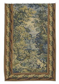
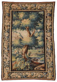
FRENCH WOVEN VERDURE WOODED LANDSCAPE TAPESTRYAustin Auction Gallery4.7(1.2k)See Sold PriceFeb 25, 2024
Antique American Hooked Rug Dog Portrait Textile TapestryCurated Gallery Auctions4.6(120)See Sold PriceFeb 25, 2024
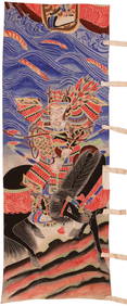
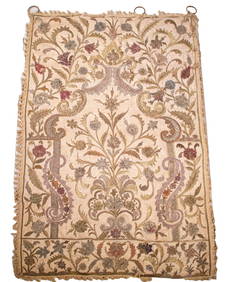
An Assorted Group of Seventeen Chinese Textiles and Textile FragmentsNazmiyal Auctions4.4(34)See Sold PriceFeb 26, 2024
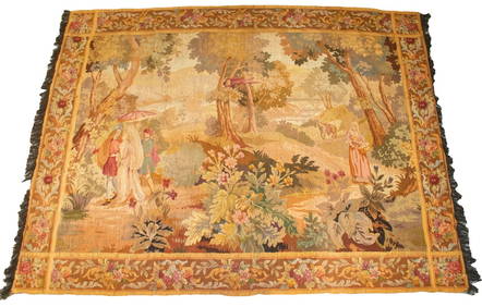
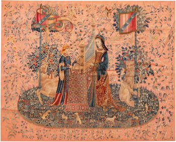
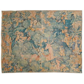
No Reserve Early 20th Century French Unicorn Design Tapestry 5 ft 9 in x 4 ft 8 in (1.75 m x 1.42 m)Nazmiyal Auctions4.4(34)See Sold PriceFeb 25, 2024
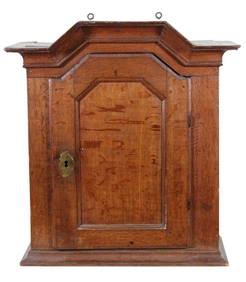
19th CENTURY GERMAN WALL HANGING CABINETLewis & Maese Antiques & Auction4.4(520)See Sold PriceFeb 25, 2024
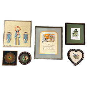
PAIR OF ANTIQUE TAPESTRY PILLOWS 10" X 16"THOS. CORNELL GALLERIES, LTD./CORNELL AUCTIONS, OBJECTS, AND TRADE4.5(313)See Sold PriceFeb 24, 2024
SoldFramed Cape Cod Needlework MapItem/Description: Vintage Cap Codd (Cape Cod) Embroidered Map. 'Cap Codd' as the locals say it, and as is spelled on this 1930s piece of Americana. (Textile Art, Sampler, Cross Stitch, Antique, MassacSee Sold Price
SoldMatted and Framed Map of Cape CodLater copy of a 1922 map of Barnstable County, Cape Cod. View shows the entire Cape from Bourne to Provincetown. Of special interest is the coastline near Chatham and Monomoy where major changes haveSee Sold Price
SoldFRAMED MAP OF CAPE CODFramed map of Cape Cod. Very colorful. Drawn by Clara Chase. 35H X 28WSee Sold Price
SoldFramed Map of Cape CodCopy of a map of Cape Cod after an original by Walker. Showing entire Cape with towns and major roads circa 1900. Nicely framed in burlwood. 31 x 31See Sold Price
SoldPrint of Cape CodFramed print of Cape Cod. Modern copy of a map of Barnstable County and Cape Cod by Walker of Boston. Dimensions: 30"x31"See Sold Price
Cape Cod Map, Barnstable county 1880Cape Cod Map, Barnstable county 1880. Barnstable County map from 1888.. Title: Map of Cape Cod (1888). Medium: Print. Size: 16 X 23 in. Framed.See Sold Price
HENRY GANNETT, Nantucket Sound Cape Cod Map 189319 x 14 in. (sight), 26 1/4 x 20 3/4 in. (framed)See Sold Price
SoldOrleans, Cape Cod map in burl frameFramed map of the town of Orleans on Cape Cod, Massachusetts. Detailed map showing Orleans' many lakes, ponds, bays and coves as well as roadways. This is a copy from a 1902 original. Mounted into a bSee Sold Price
Sold1857 HYDROGRAPHIC FRAMED CAPE COD CHARTDated 1857. Preliminary chart No. #4 of the coast of United states. From Plymouth Mass to Saughkonner River RI. Map later framed. 32 inches x 29 inches. Overall 39 inches x 29 inches. Weight 13 poundsSee Sold Price
1857 HYDROGRAHIC FRAMED CAPE COD CHARTDated 1857. Preliminary chart No. #4 of the coast of United states. From Plymouth Mass to Sakonnet River RI. Map later framed. 32 inches x 29 inches. Overall 39 inches x 29 inches. Weight 13 pounds. FSee Sold Price
Cape Cod Map of BarnstableLater copy of an 1891 Walker’s map of Barnstable Massachusetts with Falmouth, Mashpee, Sandwich, Bourne, Barnstable, etc.. Also showing Buzzard’s Bay and Wareham. Nicely framed. 32â€See Sold Price
SoldCape Cod Map of BarnstableLater copy of an 1891 Walker’s map of Barnstable Massachusetts with Falmouth, Mashpee, Sandwich, Bourne, Barnstable, etc.. Also showing Buzzard’s Bay and Wareham. Nicely framed. 32” x 23 1/2”See Sold Price
Original Cape Cod map of Falmouth119 year old map by Walker with Buzzard's Bay, Bourne, Falmouth, Mashpee, Barnstable Harbor, etc... Matted and framed. 28" high x 36" wideSee Sold Price
Cape Cod Map of Falmouth & SandwichFramed map showing the Cape Cod towns of Falmouth, Barnstable, Mashpee, Sandwich, Bourne and the shores of Buzzards Bay. Fitted to a silver painted wood frame. Overall Dimensions: 34 1/2" L x 25 1/2"See Sold Price
Sold1926 Map of Cape Cod by Elisabeth Leonard FramedVintage original map of Cape Cod by Melanie Elisabeth Leonard of Sandwich printed 1926. Colorful and whimsical details throughout. 24 x 34 visible. Framed to 25.75 x 36.5. Some fold lines. ExcellenSee Sold Price
Sold20th C. Map of the Coast of New EnglandFramed map showing the coast of Massachusetts, Cape Cod and the Island. Map highlights include Barnstable Bay, Buzzards Bay. Mounted into a gold frame. 43 x 34. Condition: very good. Late 20th CenturySee Sold Price
SoldEarly 20th century map of Cape CodColorful early twentieth century map of Cape Cod. All major attractions are listed. Map shows Plymouth and Barnstable County. Framed. Overall dimensions 28 inches x 39 inches.See Sold Price
SoldMID-20TH CENTURY GUIDE MAP OF CAPE COD, FEATURINGEDAVILLE RAILROAD. HAND PAINTED ON BOARD. FRAMED. OVERALL SIZE 93 1/2" X 50 1/2". OVERALL GOOD CONDITION.See Sold Price
Sold1930 Souvenir Map of Cape Cod, ProvincetownDetailed souvenir map of Cape Cod, signed "Published 1930, Town Crier Shop, Provincetown". Map matted and framed under glass, excellent condition. Measures framed: 30" H x 34" W,See Sold Price
SoldCRAWFORD PRESS MAP OF CAPE COD AND PLYMOUTH,CRAWFORD PRESS MAP OF CAPE COD AND PLYMOUTH, MASSACHUSETTS Circa 1936 15.5" x 16" sight. Framed 17.75" x 18".See Sold Price
SoldMAP OF CAPE COD Includes Nantucket and Martha'sMAP OF CAPE COD 19th Century Includes Nantucket and Martha's Vineyard. 8.5" x 7.5" sight. Framed 13" x 11".See Sold Price
Early 20th century map of Cape CodColorful early twentieth century map of Cape Cod. All major attractions are listed. Map shows Plymouth and Barnstable County. FramedSee Sold Price
SoldHAND-COLORED MAP OF CAPE COD AND THE ISLANDS Early 20thHAND-COLORED MAP OF CAPE COD AND THE ISLANDS Early 20th Century 16.5" x 26.5" sight. Framed 23" x 33".See Sold Price
SoldCOLORFUL MAP OF CAPE COD AND THE ISLANDS Circa 1956COLORFUL MAP OF CAPE COD AND THE ISLANDS Circa 1956 Designed by Clara Chase. Published by Atlantic Card Company. 24.75" x 18.5" sight. Framed 26.5" x 20.5".See Sold Price
George Adomeit (American 1879-1964) CAPE COD LandscapePremier Auction Galleries4.3(329)See Sold PriceMar 09, 2024
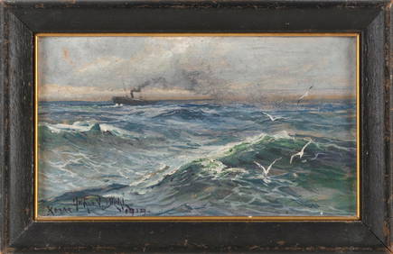
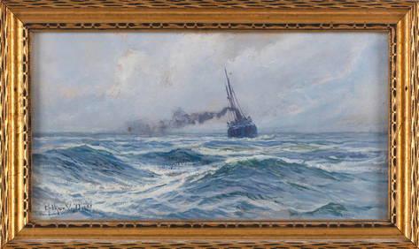
ARTHUR VIDAL DIEHL (Massachusetts/New York/England, 1870-1929), Steamship in open waters., Oil onEldred's4.7(409)See Sold PriceFeb 27, 2024
ARTHUR VIDAL DIEHL (Massachusetts/New York/England, 1870-1929), Steamship at sea., Oil on board, 6"Eldred's4.7(409)See Sold PriceFeb 27, 2024
CHRISTOPHER BLOSSOM (Connecticut, 1956-), "The Bark Superior in the Bering Strait"., Oil on canvas,Eldred's4.7(409)See Sold PriceFeb 27, 2024
SMALL CASED MODEL OF THE TWO-MASTED "SUE B." OF CAPE COD 20th Century Case height 9.75". LengthEldred's4.7(409)See Sold PriceFeb 27, 2024
Kilburg Geochron Lighted Scrolling Framed MapNadeau's Auction Gallery4.7(401)See Sold PriceFeb 24, 2024
GEORGE GUSTAV ADOMEIT (1879-1967) "CAPE COD".Amelia Jeffers, Auctioneers & Appraisers4.6(101)See Sold PriceMar 07, 2024
N. CAMERON WATSON (Massachusetts, 1955-), Portrait of a woman., Mixed media collage, 4.75" x 5"Eldred's4.7(409)See Sold PriceMar 13, 2024
ODIN KAESELAU SMITH (Massachusetts, 1965-), Two Cape Cod viewsEldred's4.7(409)See Sold PriceMar 13, 2024
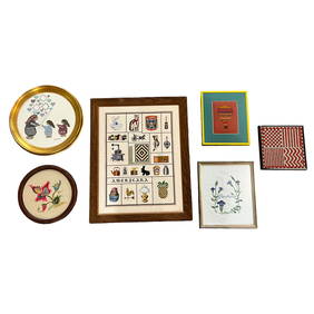
FOUR CAPE COD WATERCOLORS 20th Century Framed from 9" x 13" to 19" x 23".Eldred's4.7(409)See Sold PriceMar 07, 2024
Michael Davidoff (NY,France,b 1944) watercolor paintingBroward Auction Gallery4.8(277)See Sold PriceMay 19, 2024
Vintage Cape Cod Frolic One Gallon CoolerRapid Estate Liquidators and Auction Gallery4.5(1.1k)See Sold PriceFeb 26, 2024
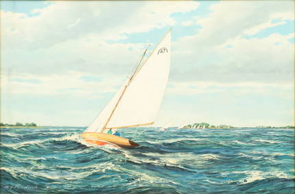
M. G. Friedrich (German/American (20th C.)) Oil on Canvas Ca. 1950, "Sailing Off Cape Cod", H 24" WDuMouchelles4.6(825)See Sold PriceMar 15, 2024