SoldGastaldi Map of Africa*** START PRICE IS THE RESERVE *** [Africa]. GASTALDI, Giacomo (1500-1566) & FORLANI, Paolo (fl. 1560-1571). La Descrittione dell'Africa. Engraved Map. Venice: Paolo Forlani, 1562. 19 x 25 1/4 inchesSee Sold Price
SoldEUROPAE. [Ortelius, Ca. 1584-1612.] Map.[Ortelius, Abraham] EUROPAE. [C. 1584-1612.] Engraved map by Ortelius based on Jenkinson’s Russia map and Gastaldi’s maps of Africa and Asia, Gerard Mercator’s 1564 map of Britain, a map of ScanSee Sold Price
SoldEUROPAE. [Ortelius, Ca. 1584-1612.] Map.[Ortelius, Abraham] EUROPAE. [C. 1584-1612.] Engraved map by Ortelius based on Jenkinson’s Russia map and Gastaldi’s maps of Africa and Asia, Gerard Mercator’s 1564 map of Britain, a map of ScanSee Sold Price
SoldGastaldi / Forlani Map of AfricaGastaldi, Giacomo (1500-1566) & Forlani, Paolo (Fl. 1560-1571) La Descripttione Dell'Africa. Engraved Map. Venice: Forlani, 1562. 19" x 25 1/4" sheet, 30 1/4" x 37" framed. The most important map of ASee Sold Price
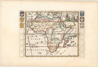
Gastaldi 1606 Map of Africa 108951Gastaldi's 1606 (1556) map of "parte De La Frica", which stretches from "Libia Interior" at the top to Castel de la Nuna in Guinea at the southern tip of Africa. Typical of Gastaldi, the map is full oSee Sold Price
SoldGastaldi and Forlani's 1562 Engraved Map of AfricaLa Descrittione dell'Africa. Giacomo Gastaldi (1500-1566) / Paolo Forlani (fl. 1560-1571). Engraved Map. Venice: Paolo Forlani, 1562. 19 x 25 1/4 inches sheet, 30 1/4 x 37 inches framed. The Most ImpoSee Sold Price
SoldGastaldi (Giacomo) Tabula Africae IIIIGastaldi (Giacomo) Tabula Africae IIIIwood-engraved map of northern Africa, small dog-headed figure at margin, 130 x 180mm., very light spotting, central vertical fold, c.1548 § Sanson (NicolaSee Sold Price
SoldForlani Map of AfricaFORLANI, Paolo (fl. 1560-1571) & GASTALDI, Giacomo (1500-1566). La Descrittione dell'Africa. Engraved Map. Venice: Paolo Forlani, 1562. 20 1/2" x 29 1/2" sheet, 25" x 34" framed. Beautiful impressionSee Sold Price
Important Walls Maps of Continents by Giacomo GastaldiFour Wall Maps of The Americas, Asia, Africa and Europe. Giacomo Gastaldi (1500-1566) & Stefano Scolari (Active 1652-1691). Venice: ca. 1662. Each Approximately, 43 x 57 inches sheet, 50 x 64 inches fSee Sold Price
Spain.- Gastaldi (Giacomo) Tabula Europæ IISpain.- Gastaldi (Giacomo) Tabula Europæ II,Ptolemaic map of Spain and Portugal, with part of North Africa, within a trapezoid border, with sea bird and sea monster, a serpent and a squirrel iSee Sold Price
SoldSpain.- Gastaldi (Giacomo) Tabula Europæ IISpain.- Gastaldi (Giacomo) Tabula Europæ II,Ptolemaic map of Spain and Portugal, with part of North Africa, within a trapezoid border, with sea bird and sea monster, a serpent and a squirrel iSee Sold Price
SoldTallis, John (Pub) 1852 Map. AfricaSteel Engraved Map with Original Outline Hand Color Published 1852-56 by John Tallis, London for "The Universal Pronouncing Dictionary" by Thomas Wright. Drawn & Engraved by John Rapkin. Centre fold aSee Sold Price
SoldLochhead (Pub) 1811 Rare Map. AfricaCopper Engraved Map Published 1811 by William Lochhead, Berwick for "Modern Geography: And a Compendious General Gazetteer" Rare. Folds as issued. Paper Size: 12 x 10 inch (30 x 26cm) Very minor toninSee Sold Price
SoldBarclay, James C1835 Hand Col Map. Africa ContinentHand Colored Copper Engraved Map Published C1835, London for "A Complete and Universal English Dictionary" by the Rev. James Barclay et al. Folds as issued. Paper Size: 11 x 8.5 inch (28 x 22cm) GoodSee Sold Price
SoldBarclay, James 1809 Hand Col Map. Africa ContinentHand Coloured Copper Engraved Map Published 1809, Leeds for "Barclay's Complete and Universal Dictionary of the English Language..." by the Rev. James Barclay. Folds as issued. Paper Size: 11 x 10 incSee Sold Price
SoldRasmusio and Gastaldi Map of Eastern Seaboard 160Giovanni Battista Rasmusio (1485-1557) and Giacomo Gastaldi (1500-1566), "La Nuova Francia," Venice, 1606. Woodcut map depicting the eastern seaboard of the United States and Canada from New York BaySee Sold Price
SoldGuthrie, William 1798 Map. Africa ContinentCopper Engraved Map Published 1798, London for "A New Geographical, Historical and Commercial Grammar..." by William Guthrie. The maps are by John Senex, Thomas Kitchin and others. Folds as issued. PaSee Sold Price
Sold1796 Map Africa PropriaANTIQUE MAP “AFRICA PROPRIA” CARTGAHE LIBYA, TRIPOLI, MALTA, BY CELLARIUS 1796. From: Geographia Antiqua London. Very Good, measures 15 x 10”, central fold. No Reserve Free shipping for this iteSee Sold Price
SoldNational Geographic Map Africa 1943National Geographic magazine map for Africa . Date: 1943. Editor: Gilbert Grosvenor. Measurement approximate: 31 x 29. Shipping cost: $15.00See Sold Price
SoldAfrica C1800 Map. Africa including the MediterraneanCopper Engraved Map Published C1800, London. Unknown Cartographer/Engraver. Very similar to a Map by Robert Wilkinson. Paper Size: 11.5 x 10 inch (29 x 26cm) Closed split on centre fold. Small chip toSee Sold Price
SoldMAP, Africa, LevasseurAfrica. Victor Levasseur, Afrique, 1850 (circa). Hand Color. This decorative 19th century map of the continent shows the colonial possessions and major tribal kingdoms. The interior is mostly void ofSee Sold Price
Sold1844 MAP AFRICA1844 MAP AFRICA, color, marked 7ink 1844pencil ; approx measure. 16in x 13.5 color atlas folded showing AFRICA lower mediterranean Europe southwest part of asia minor, folded, printed at bottom; PubliSee Sold Price
Sold1560 Gastaldi map of Balkan Peninsula & Aegean.[Balkans/Aegean] Jacopo Gastaldi (1550-1565). Totius Gratiae Descriptio Dni Jacobi De Gastaldis Cosmographi Generoso Ac Magnifico...1560. Double-page engraved map of Greece, Macedonia, Montenegro, AlbSee Sold Price
SoldThree Very Rare Gastaldi Maps of AsiaIl disegno della prima parte dell'Asia... Giacomo Gastaldi (c. 1500 - 1566). Engraved Map by Jacob Bos, on two sheets. Rome: Antonio Lafreri, 1561. Il disegno della seconda parte dell'Asia...EngravedSee Sold Price
De Jode, Rare, pub. 1593 - Map of Africa (Africae Vera Forma, et Situs)Trillium Antique Prints & Rare Books4.5(28)See Sold PriceFeb 24, 2024
AFRICA. French West Africa. Rio de Oro Rio Muni Nigeria. BARTHOLOMEW 1952 mapJasper524.5(9.7k)See Sold PriceFeb 28, 2024
AFRICA. Map pre-dating much exploration. Mountains of Kong. SDUK 1851 oldJasper524.5(9.7k)See Sold PriceFeb 28, 2024
AFRICA. Antiqua; Rome Carthage, start Punic War 1908 old antique map chartJasper524.5(9.7k)See Sold PriceFeb 28, 2024
Pre-colonial Africa. Mountains of Kong/Moon. Caravan routes. THOMSON 1817 mapJasper524.5(9.7k)See Sold PriceFeb 28, 2024
Colonial Africa. British German French Spanish Portuguese Italian TIMES 1900 mapJasper524.5(9.7k)See Sold PriceFeb 28, 2024
COLONIAL AFRICA. British East/Central/South Africa. Bechuanaland 1897 old mapJasper524.5(9.7k)See Sold PriceFeb 28, 2024
AFRICA. Africa. Britannica 9th edition 1898 old antique vintage map plan chartJasper524.5(9.7k)See Sold PriceFeb 28, 2024
Pre-SECOND WORLD WAR AFRICA. European colonies & German mandates 1942 old mapJasper524.5(9.7k)See Sold PriceFeb 28, 2024
NORTH EAST AFRICA. Libya Egypt Sudan Ethiopia Ubangi-Shari Chad 1952 old mapJasper524.5(9.7k)See Sold PriceFeb 28, 2024
ANCIENT NORTH AFRICA Septentrionalis. Mauretania Tripolitana ARROWSMITH 1828 mapJasper524.5(9.7k)See Sold PriceFeb 28, 2024
Africa by Arrowsmith & Lewis 1812 old antique vintage map plan chartJasper524.5(9.7k)See Sold PriceFeb 28, 2024


![EUROPAE. [Ortelius, Ca. 1584-1612.] Map. (1 of 3)](https://p1.liveauctioneers.com/179/82189/42599765_1_x.jpg?height=282&quality=70&version=1447864785)
![EUROPAE. [Ortelius, Ca. 1584-1612.] Map. (1 of 3)](https://p1.liveauctioneers.com/179/85723/44107985_1_x.jpg?height=282&quality=70&version=1456876561)