Sold1858 US Coast Survey Map of Charleston Harbor --Title/Content of Map: 1858 US Coast Survey Map of Charleston Harbor -- Preliminary Chart of Charleston Harbor and Its Approaches from a Trigonometrical Survey Under the Direction of A.D. Bache… CartSee Sold Price
1858 US Coast Survey Map of Charleston Harbor --Title/Content of Map: 1858 US Coast Survey Map of Charleston Harbor -- Preliminary Chart of Charleston Harbor and Its Approaches from a Trigonometrical Survey Under the Direction of A.D. Bache… DateSee Sold Price
1858 US Coast Survey Map of Charleston Harbor --Title/Content of Map: 1858 US Coast Survey Map of Charleston Harbor -- Preliminary Chart of Charleston Harbor and Its Approaches from a Trigonometrical Survey Under the Direction of A.D. Bache… CartSee Sold Price
1858 US Coast Survey Map of Charleston Harbor --Title/Content of Map: 1858 US Coast Survey Map of Charleston Harbor -- Preliminary Chart of Charleston Harbor and Its Approaches from a Trigonometrical Survey Under the Direction of A.D. Bache… DateSee Sold Price
1858 US Coast Survey Map of Charleston Harbor --Title/Content of Map: 1858 US Coast Survey Map of Charleston Harbor -- Preliminary Chart of Charleston Harbor and Its Approaches from a Trigonometrical Survey Under the Direction of A.D. Bache… DateSee Sold Price
1858 US Coast Survey Map of Charleston Harbor --Title/Content of Map: 1858 US Coast Survey Map of Charleston Harbor -- Preliminary Chart of Charleston Harbor and Its Approaches from a Trigonometrical Survey Under the Direction of A.D. Bache… DateSee Sold Price
1858 US Coast Survey Map of Charleston Harbor --Title/Content of Map: 1858 US Coast Survey Map of Charleston Harbor -- Preliminary Chart of Charleston Harbor and Its Approaches from a Trigonometrical Survey Under the Direction of A.D. Bache… DateSee Sold Price
1858 US Coast Survey Map of Charleston Harbor --Title: 1858 US Coast Survey Map of Charleston Harbor -- Preliminary Chart of Charleston Harbor and Its Approaches from a Trigonometrical Survey Under the Direction of A.D. Bache… Cartographer: US CoSee Sold Price
Sold2 U.S. Coast Survey Maps, Catalina Harbor & West CoastLot of two U.S. Coast Survey Maps to include: Catalina Harbor, "1852" and Reconnaissance of the Western Coast of the United States, middle sheet, from San Francisco to the Umpquah River, "1854," frameSee Sold Price
SoldUS GEOLOGICAL MAP CHARLESTON HARBOR APPROACHESLARGE US GEOLOGICAL SURVEY MAP CHARLESTON HARBOR APPROACHESSee Sold Price
Sold1871 US Coast Survey map of Burlington Harbor, VT1871 US Coast Survey map of Burlington Harbor, VT presented to H K Averill, Jr. by the Coast Survey Office 1874, hand colored & mtd by H K Averill, Jr. on its original rollers 29.5” x 23”See Sold Price
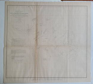
SoldCHARLESTON HARBOR. Map. U. S. Coast Survey, 1863.[Civil War/Charleston Harbor] CHARLESTON HARBOR. U. S. Coast Survey, A. D. Bache Supdt. 1863. Shows soundings and the street grid on shore. Lower margin: “Copied from surveys made between 1849 & 185See Sold Price
Sold60 nautical maps: US Coast Survey, [ca. 1858].[Coast Survey]. 60 maps from a United States Coast Survey annual report, most maps dated 1857. [Wash: GPO, c.1858]. 4to. Includes: ++ 3 copies of New England's coast (Map 1). ++ Seacoast of Part of AlSee Sold Price
19th C. British Admiralty and US Coast Survey MapBritish Admiralty and US Coast Survey map of the northeast coast of North America, 1862, sheet one Hydrographic Office of US Navy, with insets of: Halifax harbor, Rockport Harbor, Portland harbor, BuzSee Sold Price
Bache Coastal Chart of New York HarborBache, Alexander D. (1806-1867). Coast Chart No. 20 New York Bay and Harbor New York. Lithographed map. U.S. Coast Survey, 1877. 21" x 17 ¼" sheet. Extremely detailed map showing street plan of NewSee Sold Price
Large Chart of N.Y. Harbor With Street Plans of NY &Bache, Alexander D. (1806-1867). Coast Chart No. 20 New York Bay and Harbor New York. Lithographed map. U.S. Coast Survey, 1866. 30 ½" x 26 ½" sheet. Extremely detailed map showing street plan oSee Sold Price
Chart of Monterey Harbor California 1852MAP. Monterey Harbor California, U.S. Coast Survey. Engraved map, Engraved by S. Siebert. 13x11 3/4". Chart of Monterey Bay and the shore, with view of Pt. Pinos at bottom. Published: Washington. 1852See Sold Price
British Admirality and US Coast Survey 1862 MapBritish Admirality and US Coast Survey 1862 map of the northeast coast of North America, sheet one Hydrographic Office of US Navy, with insets of: Halifax harbor, Rockport Harbow, Portland harbor, BuzSee Sold Price
Sold205: Copper Plate. Wickford Harbor, Rhode Island. EtchCopper Plate. Wickford Harbor, Rhode Island. Etched copper plate produced for printing navigation map of Wickford Harbor, Rhode Island. Department of Commerce US Coast and Geodetic Survey, Map 327. WaSee Sold Price
SoldBoston Harbor U.S. Coast Survey 1857Title: Boston Harbor Massachusetts Author: U.S. Coast Survey Description: Engraved map/chart, modern hand-coloring. 73x92 cm. (28½x36").Nahant to Cambridge to Scituate with much land detail & full maSee Sold Price
SoldBoston Harbor U.S. Coast Survey 1857Title: Boston Harbor Massachusetts Author: U.S. Coast Survey Description: Engraved map/chart, modern hand-coloring. 73x92 cm. (28½x36").Nahant to Cambridge to Scituate with much land detail & full maSee Sold Price
Reconnaissance of Catalina Harbor 1852Title: Reconnaissance of Catalina Harbor and the Anchorage on the N.E. Side ... Author: U.S. Coast Survey Description: Lithographed map, hand-colored (modern). 38x27 cm. (15x10½"). Heading: zzf(CalifSee Sold Price
Reconnaissance of Catalina Harbor 1852Title: Reconnaissance of Catalina Harbor and the Anchorage on the N.E. Side ... Author: U.S. Coast Survey Description: Lithographed map, hand-colored (modern). 38x27 cm. (15x10½"). Heading: zzf(CalifSee Sold Price
Chart of Monterey Harbor California 1852Title: Monterey Harbor California Author: U.S. Coast Survey Description: Engraved map, modern hand-coloring. Engraved by S. Siebert. 33x29.5 cm. (13x11¾").Chart of Monterey Bay and the shore, with viSee Sold Price
Central Railroad of New Jersey Map of Sandy Hook Route-ca. 1903JM Hobby Supply and Railroad Artifact Auctions4.4(127)See Sold PriceFeb 24, 2024
Carl Kaiser Herbst (Austria,1858-1940) oil painting antiqueBroward Auction Gallery4.7(292)See Sold PriceMar 31, 2024
FLYING A TOURING SERVICE U.S. ROAD MAPS TIN WALL DISPLAY.Dan Morphy Auctions4.2(1.3k)See Sold PriceFeb 25, 2024
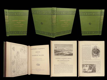
1874 HAWAII 1ed Northern California Oregon Pacific Island Travel Puget RedwoodsSchilb Antiquarian Rare Books4.8(428)See Sold PriceMar 10, 2024
1885 CIVIL WAR 1ed Famous Memoirs US Grant Sheridan Sherman 6v RARE LOT MapsSchilb Antiquarian Rare Books4.8(428)See Sold PriceMar 10, 2024
BOTH TITLE PAGES OF COLLINS" COASTAL SURVEY, 1776, IN MATCHING FRAMESThomaston Place Auction Galleries4.4(393)See Sold PriceFeb 24, 2024
[MAP]. NICHOLLS, Sutton (1668-1729). An Epitome of Sr. Will...Potter & Potter Auctions4.6(545)See Sold PriceMar 07, 2024
ALLEN, Macon B. (1816-1894). Two documents related to Macon Allen, the first African AmericanFreeman's | Hindman4.4(1.6k)See Sold PriceFeb 27, 2024
[VIETNAM]. A group of approx. 120 photographs assembled by African American soldier Vernon CliftonFreeman's | Hindman4.4(1.6k)See Sold PriceFeb 27, 2024
1852 CHART SHOWING POSITIONS of DAVIS'S SOUTH SHOAL & OTHER DANGERS antiqueJasper524.5(9.9k)See Sold PriceFeb 27, 2024
West Coast U.S. Vintage Travel Maps, Brochures 46Grant Zahajko Auctions, LLC4.7(1k)See Sold PriceMar 06, 2024


![60 nautical maps: US Coast Survey, [ca. 1858]. (1 of 3)](https://p1.liveauctioneers.com/179/14187/4432324_1_x.jpg?height=282&quality=70&version=1194393062)


![[MAP]. NICHOLLS, Sutton (1668-1729). An Epitome of Sr. Will... (1 of 1)](https://p1.liveauctioneers.com/928/318880/171361281_1_x.jpg?height=282&quality=70&version=1707501302)
![[VIETNAM]. A group of approx. 120 photographs assembled by African American soldier Vernon Clifton (1 of 6)](https://p1.liveauctioneers.com/197/319238/171468143_1_x.jpg?height=282&quality=70&version=1707520367)