SoldMitchell's 1846 Map of Texas, Oregon & CaliforniaTitle: A New Map of Texas, Oregon and California, with the Regions Adjoining. Compiled from the Most Recent Authorities Author: Mitchell, Samuel Augustus Description: Engraved pocket map, hand-coloredSee Sold Price
SoldMitchell's 1846 Map of Texas, Oregon & CaliforniaTitle: A New Map of Texas, Oregon and California, with the Regions Adjoining. Compiled from the Most Recent Authorities Author: Mitchell, Samuel Augustus Description: Engraved map, hand-colored. 53.5xSee Sold Price
SoldMitchell's 1846 Map of Texas, Oregon & CaliforniaTitle: A New Map of Texas, Oregon and California, with the Regions Adjoining. Compiled from the Most Recent Authorities Author: Mitchell, Samuel Augustus Description: Engraved map, hand-colored. 53.5xSee Sold Price
SoldMitchell's 1846 map of Texas, California & OregonHeading: Author: Mitchell, Samuel Augustus Title: A New Map of Texas, Oregon and California, with the Regions Adjoining. Compiled from the Most Recent Authorities Place Published: Philadelphia PublisSee Sold Price
SoldMitchell's 1846 map of Texas, California & OregonHeading: Author: Mitchell, Samuel Augustus Title: A New Map of Texas, Oregon and California, with the Regions Adjoining. Compiled from the Most Recent Authorities Place Published: Philadelphia PublisSee Sold Price
SoldMitchell's 1846 map of Texas, California & OregonHeading: Author: Mitchell, Samuel Augustus Title: A New Map of Texas, Oregon and California, with the Regions Adjoining. Compiled from the Most Recent Authorities Place Published: Philadelphia PublisSee Sold Price
Mitchell's 1846 map of Texas, California & OregonHeading: Author: Mitchell, Samuel Augustus Title: A New Map of Texas, Oregon and California, with the Regions Adjoining. Compiled from the Most Recent Authorities Place Published: Philadelphia PublisSee Sold Price
Mitchell: Antique Map of Texas Oregon California, 1846Mitchell, Samuel Augustus. . Philadelphia: Augustus S. Mitchell, 1846. The large folding map is approximately 22-1/2 x 21 inches, engraved and hand coloured. First edition. 46 pp text. 16mo when foldeSee Sold Price
Mitchell: New Map of Texas, Oregon & California, 1846MITCHELL, Samuel Augustus (1792 - 1868). Mitchell's New Map of Texas, Oregon and California with the Regions Adjoining. Philadelphia : Augustus S. Mitchell, 1846. 46 pp text. The large folding map isSee Sold Price
Mitchell Map of Texas, Oregon and California, 1846MITCHELL, Samuel Augustus (1790-1860). A New Map of Texas, Oregon and California with Regions Adjoining. Lithographed map with original hand color in full, Philadelphia: Mitchell, 1846. First Edition.See Sold Price
Mitchell's Reference & Distance Map of the U.S. 1846Mitchell's Reference & Distance Map of the United States by J.H. Young, with Inset Map of Texas, Oregon, and California, 1846 Mitchell’s Reference & Distance Map of the United States. Engraved bySee Sold Price
SoldS[amuel] Augustus Mitchell: A New Map of Texas,S[amuel] Augustus Mitchell: A New Map of Texas, Oregon and California, with the Regions Adjoining. 21" x 22.5", Philadelphia: S. Augustus Mitchell, 1846. Hand-colored, with ornate borders; this is theSee Sold Price
Mitchell, Map of the West, 1846A New Map of Texas, Oregon, and California, with the Regions Adjoining. Samuel Augustus Mitchell (1792-1868). Philadelphia: S. Augustus Mitchell, 1846. - Accompaniment to Mitchell's New Map of Texas,See Sold Price
Mitchell New Map of TX, OR, CA 1846Mitchell, Samuel Augustus (1790-1860). A new map of Texas, Oregon and California with Regions Adjoining. Lithographed map with original hand color in full. Philadelphia: Mitchell, 1846 (First edition)See Sold Price
SoldGold Rush Map 1846.Folding travel map titled A New Map of Texas Oregon and California With The Regions Adjoining. Compiled from the most recent authorities, Published by S. Augustus Mitchell, Philadelphia, 1846 and enteSee Sold Price
Accompaniment Book 1846 to Mitchells Map TX,OR, CA RegionsTexas, Oregon, California Accompaniment book to New Mitchells map issued in 1846. This is rare find. Published in Philadelphia by Augustus Mitchell Dimensions: 5.25 inches x 3.25 inches. Please referSee Sold Price
SoldMITCHELL'S NEW MAP of TEXAS, OREGON & CALIFORNIA1846 Philadelphia, S. Augustus Mitchell. hardcover leather bound. 5 1/4 x 3 1/4 inches. Map unfolded 22 x 20 1/2 inches and presented in a custom frame 23 1/2 x 22 inches (overall)See Sold Price
Mitchell. New Map of Texas… 1846Rarest Form Mitchell's New Map of Texas Oregon & California 111. [MAP]. MITCHELL, S[amuel] Augustus. A New Map of Texas Oregon and California with the Regions Adjoining. Compiled from the MosSee Sold Price
SoldMitchells Map of the United States, 18461846 United States map by Mitchells, includes map of Texas, Oregon, and California, 55" x 71".See Sold Price
SoldA New Map of Texas Oregon and California... 1846.[Southwest/California]. A New Map of Texas Oregon and California With the Regions Adjoining, compiled from the most recent authorities. Philadelphia: Published by S. Augustus Mitchell N.E. Corner of MSee Sold Price
Mitchell: New Map of Texas Oregan California, 1846Map: Mitchell's New Map of Texas, Oregon and California with the Regions Adjoining Maker: Samuel Augustus Mitchell Published in: Philadelphia Date: 1846 46 pp text Size: The large folding map is approSee Sold Price
SAMUEL AUGUSTUS MITCHELL - A NEW MAP OF TEXAS OREGONSAMUEL AUGUSTUS MITCHELL - A NEW MAP OF TEXAS OREGON AND CALIFORNIA, 1846 - Giclée on Canvas 33 1/4 x 36 in. - A Giclée Print Is The Highest Quality Print Available Today. Because There Is No VisiblSee Sold Price
SAMUEL AUGUSTUS MITCHELL - A NEW MAP OF TEXAS ORESamuel Augustus Mitchell - A New Map Of Texas Oregon And California, 1846 - Giclée On Canvas - 33 1/4 X 36 In.See Sold Price
Samuel Augustus Mitchell - A New Map Of Texas OregonSamuel Augustus Mitchell - A New Map Of Texas Oregon And California, 1846 Size: 33 1/4 X 36 In. - This Is A Gallery Stretched Giclee Print On Canvas. The Piece Was Printed On High Quality Artist GradeSee Sold Price
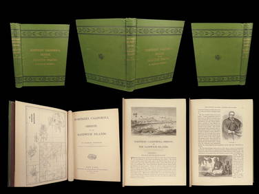
1874 HAWAII 1ed Northern California Oregon Pacific Island Travel Puget RedwoodsSchilb Antiquarian Rare Books4.8(422)See Sold PriceMar 10, 2024
1849 Mitchell School ATLAS 24 MAPS America Holy Land France Africa Egypt AsiaSchilb Antiquarian Rare Books4.8(422)See Sold PriceMar 31, 2024
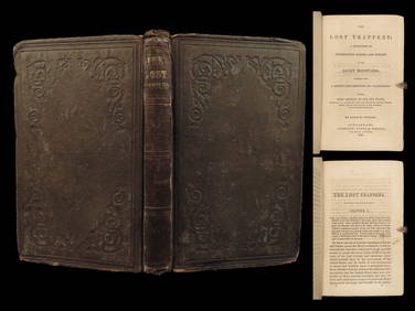
1859 Lost Trappers Rocky Mountains California Fur Trade Western Frontier ExploreSchilb Antiquarian Rare Books4.8(422)See Sold PriceMar 31, 2024
E John Robinson (Oregon,CA,1922-2008) oil paintingBroward Auction Gallery4.8(285)See Sold PriceMay 05, 2024
Mitchell - Map of the City of Washington (Washington, DC)Trillium Antique Prints & Rare Books4.5(30)See Sold PriceFeb 24, 2024


![S[amuel] Augustus Mitchell: A New Map of Texas, (1 of 1)](https://p1.liveauctioneers.com/906/193377/97524938_1_x.jpg?height=282&quality=70&version=1612303405)