John Gibson signed 8x10 photo PSA/DNA Anaheim Ducks Autographed3 Kings Auction4.3(194)See Sold PriceFeb 27, 2024
SoldAntique Collection of Flintshire,North Wales MapsAntique Collection of Flintshire,North Wales Maps to Include: John Seller Circa 1701. 14 x 11 cm. John Gibson Circa 1759. 11 x 6.5cm. J.Owen & E.Bowen Circa 1730. Mounted 18 x 11.5 cm. Archer/DugdaleSee Sold Price
Antique Collection of Flintshire,North Wales MapsAntique Collection of Flintshire,North Wales Maps to Include: John Seller Circa 1701. 14 x 11 cm. John Gibson Circa 1759. 11 x 6.5cm. J.Owen & E.Bowen Circa 1730. Mounted 18 x 11.5 cm. Archer/DugdaleSee Sold Price
SoldAntique Collection of Flintshire,North Wales MapsAntique Collection of Flintshire,North Wales Maps to Include: John Seller Circa 1701. 14 x 11 cm. John Gibson Circa 1759. 11 x 6.5cm. J.Owen & E.Bowen Circa 1730. Mounted 18 x 11.5 cm. Archer/DugdaleSee Sold Price
SoldAntique Collection of Flintshire,North Wales MapsAntique Collection of Flintshire,North Wales Maps to Include: John Seller Circa 1701. 14 x 11 cm. John Gibson Circa 1759. 11 x 6.5cm. J.Owen & E.Bowen Circa 1730. Mounted 18 x 11.5 cm. Archer/DugdaleSee Sold Price
SoldAntique Collection of Flintshire,North Wales MapsAntique Collection of Flintshire,North Wales Maps to Include: John Seller Circa 1701. 14 x 11 cm. John Gibson Circa 1759. 11 x 6.5cm. J.Owen & E.Bowen Circa 1730. Mounted 18 x 11.5 cm. Archer/DugdaleSee Sold Price
SoldAntique Collection of Flintshire,North Wales MapsAntique Collection of Flintshire,North Wales Maps to Include: John Seller Circa 1701. 14 x 11 cm. John Gibson Circa 1759. 11 x 6.5cm. J.Owen & E.Bowen Circa 1730. Mounted 18 x 11.5 cm. Archer/DugdaleSee Sold Price
SoldAntique Collection of 5 North Wales MapsAntique Collection of North Wales Maps to Include: Robert Morden 1722. T.Badeslade & W.H.Toms 1741. John Ellis 1766. John Carey 1793. George A.Walpoole 1794. (5 Items)See Sold Price
Principatus Wallae pars Borealis by Jan Jansson, 17thAmsterdam: ca. 1646, copper engraved map of North Wales including Anglesey, Caernavonshire, Denbighshire, Flintshire, Merioneth and Montgomery. With antique coloring, decorative title cartouche,See Sold Price
Hall: Antique Map of North & South Wales, 1856TITLE/CONTENT OF MAP: 'North & South Wales' DATE PRINTED: 1856 IMAGE SIZE: Approx 61.5 x 43.0cm, 24.25 x 17 inches (Large); Please note that this is a folding map. TYPE: Antique atlas map with originaSee Sold Price
Sidney Hall: Antique Map of England & Wales (North)Title/Content of Map: 'England and Wales [North sheet]' Date Printed: c1845 Image Size: Approx 42.5 x 57.0cm, 16.75 x 22.25 inches (Large); Please note that this is a folding map. Type: Antique atlasSee Sold Price
Johnston: Antique Map of North England and WalesTITLE/CONTENT OF MAP: 'England and Wales (Northern Sheet)' DATE PRINTED: 1879 IMAGE SIZE: Approx 47.5 x 61.0cm, 18.75 x 24 inches (Large); Please note that this is a folding map. TYPE: Large, folio anSee Sold Price
Weller: Antique Map of England & Wales NW, 1863Title/Content of Map: 'England & Wales, North-West sheet' Cumbria Lancashire Welsh coast Isle of Man. Date Printed: 1863 Image Size: Approx 45.5 x 32.5cm, 17.75 x 12.75 inches (Large) Type: Antique maSee Sold Price
SoldWeller: Antique Map of England & Wales NW, 1863TITLE/CONTENT OF MAP: 'England & Wales, North-West sheet' Cumbria Lancashire Welsh coast Isle of Man. DATE PRINTED: 1863 IMAGE SIZE: Approx 45.5 x 32.5cm, 17.75 x 12.75 inches (Large) TYPE: Antique maSee Sold Price
Weller: Antique Map of England Northeast Coast, 1863Title/Content of Map: 'England and Wales [north east sheet]' Lincs Yorks Durham Northumbs. >Berwick Date Printed: c1863 Image Size: Approx 45.0 x 33.5cm, 17.75 x 13.25 inches (Large) Type: Antique mapSee Sold Price
A Generall Mapp of North Wales by Richard Blome 1673 old antique chartTitle: A Generall Mapp of North Wales by Richard Blome 1673 old antique chart Description: A Generall Mapp of North Wales wherein are ye Countys of Montgomy; Merioneth; Denbigh; Fflint; Carnarvan & yeSee Sold Price
SoldCOLLECTION OF 7 ANTIQUE US MAPSCOLLECTION OF 7 ANTIQUE US MAPS: To include 1) 1806 "A map of Virginia, North Carolina, South Carolina and Georgia". Engraved by Samuel Neele, published by Richard Phillips. Sight size 15" x 10 1/2".See Sold Price
SoldCollection of Antique MapsAntique maps to include, Europe, North America, etc., eight (8) total, 16" x 18". Provenance: Cambridge, Massachusetts collection.See Sold Price
8 Maps from Cary’s New and Correct Atlas 1793Including: South Wales (rough) North Wales Surrey Sussex Worcestershire Warwickshire Oxfordshire Rutlandshire Measures: 9 ¾ x 11 ½ Condition:See Sold Price
SoldAntique Atlas CollectionThis is a collection of three atlases. Included is "Geologic Atlas of the United States Paw-Paw Hancock Folio Maryland West Virginia Pennsylvania", "Geologic Atlas of the United States Patuxent FolioSee Sold Price
SoldBritish Isles.- A large collection of over 140 maps ofNO RESERVE British Isles.- Collection of over 140 maps of England and Wales, many of the north of England, some by Morden, various road strip maps, and many others, engravings and lithographs, variousSee Sold Price
Soldc1910 MANITOBA NORTH WEST ONTARIO Map GeographicThis antique map is part of a large collection we are selling during this auction - check out our other auctions to view more vintage and antique maps, prints and artwork. Buy more than one item and sSee Sold Price
SoldAntique Map of North America 1826Antique Map of North America. Size: 11 X 8.5 inches approx. Unframed. Printed 1826.See Sold Price
SoldNorth Italy & Switzerland Antique Map 1826Antique Map of North Italy & Switzerland. Size: 11 X 8.5 inches approx. Unframed. Printed 1826.See Sold Price
SoldMap of North America by John Senex dated 1710.English map of North America by John Senex dated 1710. From the collection of Shreve, Crump and Low Co., Boston MA. Framed 1950 in Salzburg, Austria.29" x 41 1/2" Advertised in Antiques" April 1, 1975See Sold Price
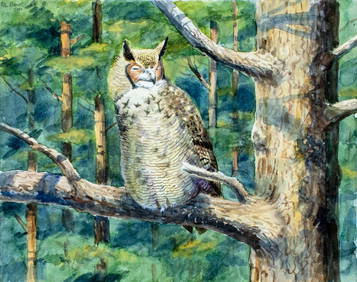
Peter Barrett (UK,b 1935) watercolor paintingBroward Auction Gallery4.8(277)See Sold PriceApr 14, 2024
Peter Barrett (UK,b 1935) watercolor paintingBroward Auction Gallery4.8(277)See Sold PriceApr 14, 2024
Portfolio of 15 County Maps by Robert Morden (English 1650-1703)Nadeau's Auction Gallery4.7(401)See Sold PriceFeb 24, 2024
W. Taylor Oughton (American, 1925-2018) Romance Illustration Art, Man & WomanHoch LTD.4.5(73)See Sold PriceFeb 25, 2024
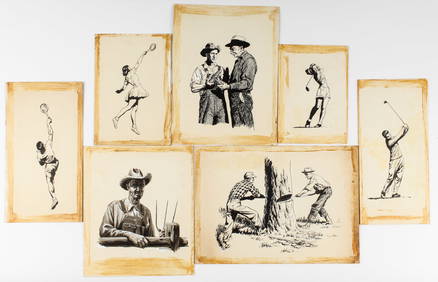
W. Taylor Oughton (American, 1925-2018) Illustration Art, Sports, FarmersHoch LTD.4.5(73)See Sold PriceFeb 25, 2024
W. Taylor Oughton (American, 1925-2018) Western Illustration Art, CowboysHoch LTD.4.5(73)See Sold PriceFeb 25, 2024
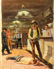
W. Taylor Oughton (American, 1925-2018) Cowboys in a Saloon, Western Illustration Art PaintingHoch LTD.4.5(73)See Sold PriceFeb 25, 2024
W. Taylor Oughton (American, 1925-2018) Illustration Art, Incl. WWIIHoch LTD.4.5(73)See Sold PriceFeb 25, 2024
W. Taylor Oughton (American, 1925-2018) Fishermen, Illustration Art PaintingHoch LTD.4.5(73)See Sold PriceFeb 25, 2024
W. Taylor Oughton (American, 1925-2018) Illustration Art, Men & WomenHoch LTD.4.5(73)See Sold PriceFeb 25, 2024
1816 MAP SOUTHERN PART OF RUSSIA or MUSCOVY in EUROPE copper engraving ANTIQUEJasper524.5(9.8k)See Sold PriceFeb 27, 2024
1816 MAP NORTHERN PART OF RUSSIA or MUSCOVY in EUROPE copper engraving ANTIQUEJasper524.5(9.8k)See Sold PriceFeb 27, 2024
Fine Victorian Signed Oil Painting Figures by Waterfall Capel Curig WalesJasper524.5(9.8k)See Sold PriceFeb 28, 2024