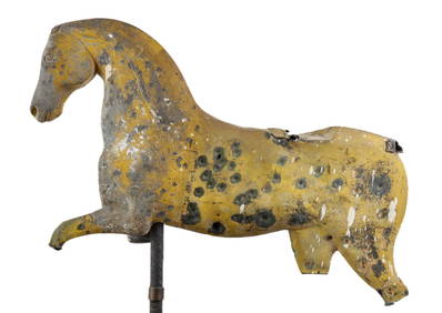
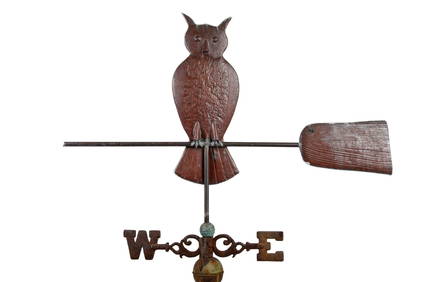
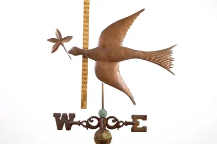
(19th c) RUNNING HORSE WEATHERVANE FRAGMENTJohn McInnis Auctioneers,LLC4.6(504)See Sold PriceFeb 25, 2024
L. Currier Richards Bronze SundialSchmidt's Antiques Inc. Since 19114.8(431)See Sold PriceMar 02, 2024
Very Rare Sundial 18 Century signed Macquart ,PARISBasel Auction House4.5(46)See Sold PriceFeb 24, 2024
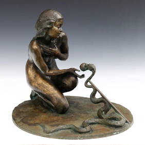
Bronze Mermaid with Sea Shell Fountain SculptureHill Auction Gallery 4.7(1k)See Sold PriceFeb 28, 2024
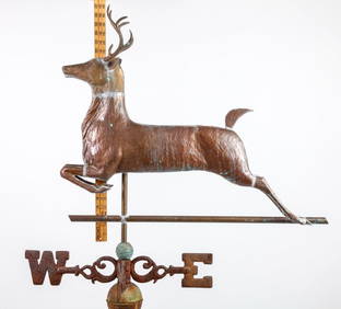
OWL on BROOM by NEW ENGLAND WEATHERVANE SHOPJohn McInnis Auctioneers,LLC4.6(504)See Sold PriceFeb 25, 2024
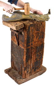
WASHBURN WEATHERVANE CO WORKSHOP SHAPING BLOCKJohn McInnis Auctioneers,LLC4.6(504)See Sold PriceFeb 25, 2024
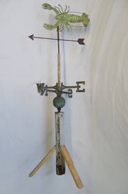
LOBSTER FORM COPPER WEATHER VANE 55"HTHOS. CORNELL GALLERIES, LTD./CORNELL AUCTIONS, OBJECTS, AND TRADE4.5(318)See Sold PriceFeb 24, 2024
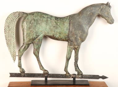
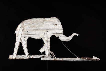
(Late 19th c) FOLK ART ELEPHANT WEATHERVANEJohn McInnis Auctioneers,LLC4.6(504)See Sold PriceFeb 25, 2024
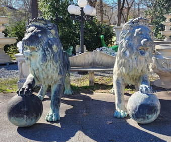
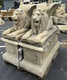
DEEP CONCRETE BIRD BATH W/ GREEK RUIN BASE 33 1/2" X 023/" WIDETHOS. CORNELL GALLERIES, LTD./CORNELL AUCTIONS, OBJECTS, AND TRADE4.5(318)See Sold PriceFeb 24, 2024
1790 NEW MORAL SYSTEM OF GEOGRAPHY antique in ENGLISHNEW MORAL SYSTEM OF GEOGRAPHY Containing An Account Of The Different Nations, Ancient And Modern... Including, a Description of Each Country With folding map of the world; medallion-like miniatures -See Sold Price
1790 NEW MORAL SYSTEM OF GEOGRAPHY antique in ENGLISHNEW MORAL SYSTEM OF GEOGRAPHY Containing An Account Of The Different Nations, Ancient And Modern... Including, a Description of Each Country With folding map of the world; medallion-like miniatures -See Sold Price
Sold~1820, “RUSSIAN EMPIRE”, Russia.Print from steel engraving titled “RUSSIAN EMPIRE”. Published by Thomas Kelly, London circa 1820 in "Kelly's New System of Universal Geography"A copper engraved antique map of the early 19th centuSee Sold Price
Sold2 PC ANTIQUE 18th c ENGLISH PORCELAIN COALPORT +1- Antique English New Hall Cup in hand painted "The Boy & the Butterfly" pattern c. 1790. New Hall produced hybrid hard paste porcelain tea wares between 1781 and 1835 in Shelton, Staffordshire. MostSee Sold Price
Sold18TH CENTURY MAP OF NORTH AMERICA.A New & Accurate Mape of North America; with the new discovered Islands on the North East coast of Asia, engraved for Thomas Bankes's New System of Geography, London, ca. 1790, engraving on paper. LaiSee Sold Price
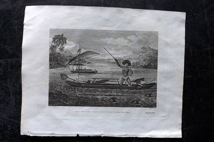
19th Century Engraving "A Canoe of the SandwichIslands, with the Rowers masked, c.1790, after John Webber engraved for Bankes new systems of Geography, published by Royal Authority, 16cm x 21cmSee Sold Price
SoldFenning & Collyer 1765 Antique Map of Europe"A New & Accurate Map of Europe" Copper Engraved Map Published 1764-65, London for "A New System of Geography: or, A General Description of the World" by Daniel Fenning & Joseph Collyer. Maps by G. RoSee Sold Price
Sold1790 ENGRAVING PRINT HANDCOLORED FROM BANKESEngraving print titled "Habit of a Horseman in Barbary and the Manner in which the Women Travel" originally published in Banke's New System of Geography. This series was published from 1787-90. The woSee Sold Price
A TURKISH DRESSES ENGRAVING BY BAKER, 19TH CAn engraving for Bankes's New System of Geography published by Royal Authority depicting three persons: Bashaw of three Tails, officer of the Janissaries superintendent of their Kitchen, Turkish gentlSee Sold Price
SoldA TURKISH DRESSES ENGRAVING BY BAKER, 19TH CAn engraving for Bankes's New System of Geography published by Royal Authority depicting three persons: Bashaw of three Tails, officer of the Janissaries superintendent of their Kitchen, Turkish gentlSee Sold Price
1785 NEW SYSTEM of HUSBANDRY antique by CHARLES VARLO AMERICANANEW SYSTEM of HUSBANDRY by CHARLES VARLO Volume I Philadelphia; 1785 Size: 5 by 7 3/4" 364 pages Original leather Very good condition, minor wear and foxing. Text on English Reserve: $201.00 ShiSee Sold Price
1785 NEW SYSTEM of HUSBANDRY antique by CHARLES VARLO AMERICANANEW SYSTEM of HUSBANDRY by CHARLES VARLO Volume I Philadelphia; 1785 Size: 5 by 7 3/4" 364 pages Original leather Very good condition, minor wear and foxing. Text on English Reserve: $201.00 Shipping:See Sold Price
SoldThomas Bowen. Map of North America, circa 1770(British, d. 1790). "A New and Accurate Map of North America," hand colored engraving for Middleton's Complete System of Geography, 11 1/4 x 17 3/4 in., framedSee Sold Price
SoldNorth America Map, 1811 John Russell"North America, Drawn from the Best Authorities" engraved by John Russell, published by Wilkie, Robinson, J. Mawman, London, 1811. From "New System of Modern Geography" by William Guthrie. Copper platSee Sold Price
SoldItaly 1779 Folio Antique Print. Venice, Grand CanalCopper Plate Published 1777-9 by J.Cooke, London for "A New and Complete System of Geography" by Charles Theodore Middleton. Paper Size: 13.5 x 8 inch (34 x 21cm) Good Condition.See Sold Price
SoldGreece 1779 Antique Print. Ruins of Athens. MiddletonCopper Plate Published 1777-9 by J.Cooke, London for "A New and Complete System of Geography" by Charles Theodore Middleton. Paper Size: 13.5 x 8 inch (34 x 21cm) Good Condition.See Sold Price
SoldChina 1782 Folio Antique Print of the the Great WallCopper Plate Published 1782 London for "Millar's New Complete & Universal System of Geography" by George Henry Millar. Paper Size: 14.5 x 8.5 inch (37 x 22cm) Image very slightly off-centre. A coupleSee Sold Price
SoldRussia 1779 Antique Print. St. PetersburgCopper Plate Published 1777-9 by J.Cooke, London for "A New and Complete System of Geography" by Charles Theodore Middleton. Paper Size: 13.5 x 8 inch (34 x 21cm) Very minor toning. Good Condition.See Sold Price
SoldA New Chart of the English Channel... A New Chart oMillar, A New Chart of the English Channel... A New Chart of the Coasts of France & Spain..., engraving, from Millar's New Complete & Universal System of Geography (London, ca. 1780), 7.5 x 13 7.5 x 1See Sold Price
SoldRussia 1818-1835 Pair of Antique Maps"Russian Empire" Copper Engraved Map Published 1818, London for "A New and Complete System of Universal Geography" by Christopher Kelly. Together with "Russia in Europe Part V" Steel Engraved Map PublSee Sold Price
SoldKentucky Map, 1800 Payne"The State of Kentucky with Adjoining Territories" Map, by John Payne, engraved by John Scoles, published by John Low, New York, 1800. From "A New and Complete System of Universal Geography" by John PSee Sold Price
Sold4 geography books4 geography books including 1882 Monteith's Independent Course Comprehensive Geography; 1855 McNally's System of Geography; Maury's New Complete Geography; 1896 Barnes's Complete geography. Stains; foSee Sold Price
4 geography books4 geography books including 1882 Monteith's Independent Course Comprehensive Geography; 1855 McNally's System of Geography; Maury's New Complete Geography; 1896 Barnes's Complete geography. Stains; foSee Sold Price
SoldEgypt C1790 Antique Print. Pyramids, Sphinx, NileCopper Plate Published C1790 London for "A New Royal Authentic and Complete System of Universal Geography Antient and Modern" by Thomas Bankes. Paper Size: 14.5 x 9 inch (37 x 23cm) Good ConditionSee Sold Price
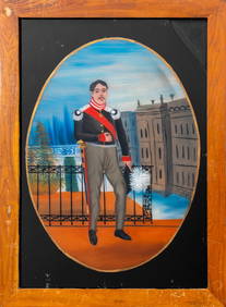
British Colonial Reverse Glass Painting, 19th C.Auctions at Showplace4.6(731)See Sold PriceMar 12, 2024
1800 MUNGO PARK TRAVELS to AFRICA 2 VOLS w/ MAP antique in ENGLISHJasper524.5(9.8k)See Sold PriceFeb 27, 2024
1682 HISTORY of ETHIOPIA KINGDOM OF ABESSINIA ILLUSTRATED antique in ENGLISHJasper524.5(9.8k)See Sold PriceFeb 27, 2024
1738 RUSSIA SIBERIA & GREAT TARTARY Description illustrated ANTIQUE in ENGLISHJasper524.5(9.8k)See Sold PriceFeb 27, 2024
Cooke, George 1801 Print. Maori Tattoo Man, Warrior of New ZealandAlbion Auctions4.6(341)See Sold PriceMar 07, 2024
Cooke, George 1801 Print. Papua New Guinea Man hunting Wild HogsAlbion Auctions4.6(341)See Sold PriceMar 07, 2024
Cooke, George 1801 Print. Savage of New Caledonia, PacificAlbion Auctions4.6(341)See Sold PriceMar 07, 2024
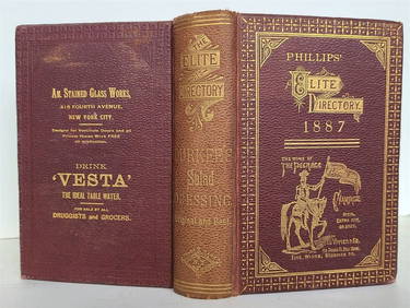
1887 ANTIQUE NEW YORK CITY SHOPPING GUIDE - PHILLIPS' ELITE DIRECTORYNY Elizabeth 4.3(85)See Sold PriceMar 03, 2024
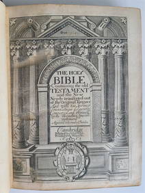
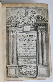
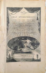
1820 ANTIQUE FOLIO AMERICANA NEW YORK, SELF-INTERPRETING ENGLISH BIBLENY Elizabeth 4.3(85)See Sold PriceMar 03, 2024
Francis McNally - Antique Map of Nebraska, Kansas, Dakota, Colorado & MontanaProverde Auctions4.3(3)See Sold PriceFeb 28, 2024
Francis McNally - Antique Map of California & MinnesotaProverde Auctions4.3(3)See Sold PriceFeb 28, 2024
Francis McNally - Antique Map of Ohio, Indiana & KentuckyProverde Auctions4.3(3)See Sold PriceFeb 28, 2024
Francis McNally - Antique Map of Washington, Oregon, Idaho, Nevada, Utah & ArizonaProverde Auctions4.3(3)See Sold PriceFeb 28, 2024
Francis McNally - Antique Map of Illinois, Missouri & IowaProverde Auctions4.3(3)See Sold PriceFeb 28, 2024