SoldLondon.- Ordnance Survey.- Mudge (Lt. Col. William)London.- Mudge (Lt. Col. William) Four Ordnance Survey maps covering the environs of London, numbered I, VI, VII, and VIII, showing from Great Marlow to the mouth of the River Medway, and East GrinsteSee Sold Price
SoldOrdnance Survey.- MudgeOrdnance Survey.- Mudge (Lt. Col. William) Ordnance Survey of Great Britain Part the IVth, containing nearly the whole of Dorsetshire, With Portions of the adjoining counties, sheets XV-XVIII,See Sold Price
SoldOrdnance Survey.- MudgeOrdnance Survey.- Mudge (Lt. Col. William) Ordnance Survey of Great Britain Part the Vth, containing nearly the whole of Sussex, With Portions of Kent and Hampshire, including The Isle of WighSee Sold Price
SoldOrdnance Survey.- MudgeOrdnance Survey.- Mudge (Lt. Col. William) Ordnance Survey of Great Britain Part the VIIIth, containing the greater part of Kent, With Portions of Surrey and Sussex, sheets III and VI, engraveSee Sold Price
SoldOrdnance Survey.- MudgeOrdnance Survey.- Mudge (Lt. Col. William) Ordnance Survey of Great Britain Part the III, containing the western part of Cornwall, And Part of Devonshire, sheets XXIX-XXXIII, engraved map in 5See Sold Price
SoldOrdnance Survey.- MudgeOrdnance Survey.- Mudge (Lt. Col. William) Ordnance Survey of Great Britain Part the 1st, containing the county of Essex, With Portions of Suffolk, Cambridgeshire, Hertfordshire, Surrey, Kent,See Sold Price
SoldOrdnance Survey.- MudgeOrdnance Survey.- Mudge (Lt. Col. William) Ordnance Survey of Great Britain Part the VIth, containing nearly the whole of Surrey, With Portions of Hampshire, Wiltshire, Berkshire, Middlesex anSee Sold Price
SoldOrdnance Survey.- MudgeOrdnance Survey.- Mudge (Lt. Col. William) Ordnance Survey of Great Britain Part the VIIth, containing the central part of Wiltshire, A Portion of Somersetshire, and the remaining Part of HampSee Sold Price
SoldOrdnance Survey.- MudgeOrdnance Survey.- Mudge (Lt. Col. William) Ordnance Survey of Great Britain Part the IXth, containing nearly the whole of Pembrokeshire, With Portions of Cardiganshire and Caermarthenshire, anSee Sold Price
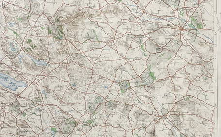
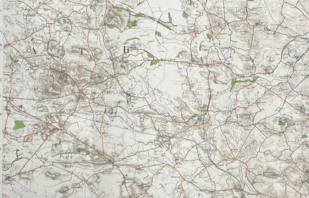
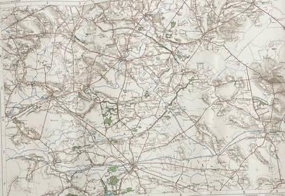
SoldEngland.Ordnance Survey.- Mudge (Lt. Col. William)England.Ordnance Survey.- Mudge (Lt. Col. William) 4 adjoining sheets of mostly Berkshire, Hampshire and Wiltshire,sheets XII, XIII, XIV and XXXIV, encompassing Oxford, Reading, Basingstoke, SSee Sold Price
SoldMudge - Ordnance Survey map sheets of the coast of( Lt. Col. William) Ordnance Survey map sheets of the coast of Kent, Sussex and Hampshire , sheets IV, V, IX, X and XI, New Romney, Lewes, Chichester, Isle of Wight and Southampton, respectively, 5 enSee Sold Price
SoldLt. Col. Mudge Ordnance Survey Map of EssexMudge (Lt. Col. ) Ordnance Survey Map of Essex And South Suffolk, plate XLVIII depicting the coastline from Orfordness to the mouth of the river Colne, engraving, 640 x 920mm., two areas of daSee Sold Price
SoldEngland.- A group of 16 Ordnance Survey maps, mainlyEngland.- A group of 16 Ordnance Survey maps, including a Col. Mudge map of Kent showing Whitstable, Ramsgate and Dover, 4 Col. Colby maps sold by Letts, Son & Co. of Essex, Kent, Berkshire, and HampsSee Sold Price
SoldSouth East England.- Mudge (Lt. Col. William) OrdnanceSouth East England.- Mudge (Lt. Col. William) Ordnance Survey maps covering Surrey, Sussex, and Kent, four sections, engraved maps, each approx. 635 x 920 mm. (25 x 36 1/4 in), dissected and mounted oSee Sold Price
SoldCumberland and Midlands.- Geological maps.- Mudge (Lt.Cumberland and Midlands.- Geological maps.- Mudge (Lt. Col. William) [Geological Ordnance Survey Map of Cumberland], a composite map of single sheets from the 'Geological Survey of Great Britain' joinSee Sold Price
SoldOrdnance Survey. The West CountryOrdnance Survey. The West Country,sheets 17-33, covering Somerset, Devon and Cornwall, by Lt. Col. Mudge, Major Colby, and others, bearing original issue dates, but updated to include some raiSee Sold Price
SoldOrdnance Survey. Kent, Sussex, SurreyOrdnance Survey. Kent, Sussex, Surrey,4 sheets by Col. Mudge, V, VI, VIII and IX, East and West Sussex each with a folding extension, engraved maps, each c.645 x 960mm., dissected, linen-backeSee Sold Price
SoldOrdnance Survey. WalesOrdnance Survey. Wales,sheets 36-43, 55-60, and 74, covering all of South, Central and most of North Wales, by Lt. Col. Mudge, Major Colby, and others, bearing original issue dates, but updateSee Sold Price
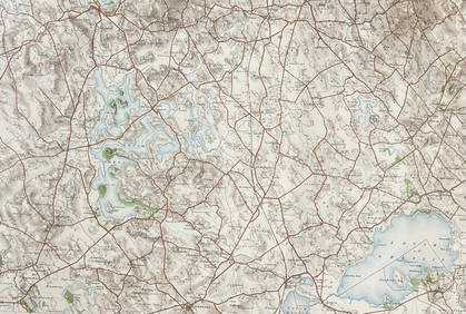
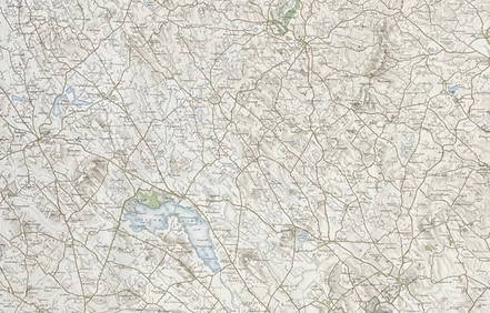
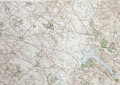
SoldOrdnance Survey. England and WalesOrdnance Survey. England and Wales,index map and 82 sheets, of 84 indicated, as far north as Shropshire and Lincolnshire, by Lt. Col. Mudge, Major Colby, and others, lacking sheets 8 and 9, SuSee Sold Price
Ordnance Survey. England and WalesOrdnance Survey. England and Wales,index map and 82 sheets, of 84 indicated, as far north as Shropshire and Lincolnshire, by Lt. Col. Mudge, Major Colby, and others, lacking sheets 8 and 9, SuSee Sold Price
SoldMudge (Capt. William) - General Survey of England andengraved 4-sheet ordnance survey map, with original hand-colouring to the roads, each sheet 600 x 880mm., approx. 1190 x 1750mm. if joined, each dissected and linen-backed, folding into later marbledSee Sold Price
SoldOrdnance Survey maps,South West England and Wales, late 19th century, double page coastal maps/charts, including Falmouth Harbour, Menai Strait 1464, Newquay to Holyhead 1411, Milford Haven, Bristol Channel 1179, TrevoseSee Sold Price
SoldOrdnance Survey maps,West Coast of Scotland, late 19th century with some revisions, approx 60 sheets, some with vignettes, including Lochs, Western Isles, Skye, Harris, Hebrides etc, condition varies (c.60)See Sold Price
SoldOrdnance Survey coastal maps/charts, late 19th century,mostly Ireland, engraved by J & C Walker, Davies et al., sheets 2046 (Waterford Harbour), 1787 (Wexford and Wicklow), 45 & 46 (Larne to Bloody Foreland), 1825B Irish Channel, 44 Dundalk Bay, 1468 (DubSee Sold Price
BOTH TITLE PAGES OF COLLINS" COASTAL SURVEY, 1776, IN MATCHING FRAMESThomaston Place Auction Galleries4.4(389)See Sold PriceFeb 24, 2024
Rand McNally & Co's New Ideal State and County Survey and Atlas 1911North American Artifact Auctions4.6(184)See Sold PriceApr 20, 2024
Birds of the World: A Survey of the Twenty-Seven Orders and One Hundred and Fifty-Five FamiliesNorth American Artifact Auctions4.6(184)See Sold PriceApr 20, 2024
1955 Gough Island Tristan Da Cunha Cover To England Scientific Survey BlackMynt Auctions4.6(689)See Sold PriceFeb 27, 2024
Nottingham.- Ordnance Survey Office (publisher) Collection 8 geological maps on the environs ofForum Auctions4.3(53)See Sold PriceFeb 29, 2024
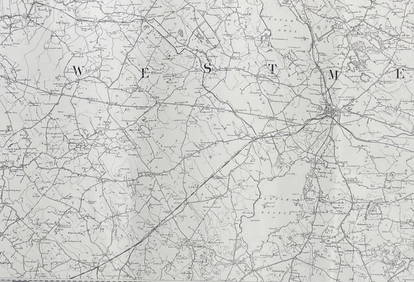
ORDNANCE SURVEY OF IRELAND/ Sheet No. 79/ CAVAN, LEITRIM, LONGFORD, MEATH & WESTMEATH Revised 1899Churchill Galleries3.7(216)See Sold PriceFeb 26, 2024
ORDNANCE SURVEY OF IRELAND/ Sheet No. 80/ CAVAN, MEATH & MONAGHAN/ Surveyed 1837 - 39. Printed inChurchill Galleries3.7(216)See Sold PriceFeb 26, 2024
ORDNANCE SURVEY OF IRELAND/ Sheet No. 89/ LONGFORD, MEATH & WESTMEATH/ Published in 1903Churchill Galleries3.7(216)See Sold PriceFeb 26, 2024
ORDNANCE SURVEY OF IRELAND/ Sheet No. 89/ LONGFORD, MEATH & WESTMEATH/ Published in 1903Churchill Galleries3.7(216)See Sold PriceFeb 26, 2024
ORDNANCE SURVEY OF IRELAND/ Sheet No. 89/ LONGFORD, MEATH & WESTMEATH/ Published in 1903Churchill Galleries3.7(216)See Sold PriceFeb 26, 2024
ORDNANCE SURVEY OF IRELAND/ Sheet No. 89/ LONGFORD, MEATH & WESTMEATH/ Published in 1903Churchill Galleries3.7(216)See Sold PriceFeb 26, 2024
ORDNANCE SURVEY OF IRELAND/ Sheet No.90/ MEATH & WESTMEATH/ Published in 1903Churchill Galleries3.7(216)See Sold PriceFeb 26, 2024
ORDNANCE SURVEY OF IRELAND/ Sheet No.90/ MEATH & WESTMEATH/ Published in 1903Churchill Galleries3.7(216)See Sold PriceFeb 26, 2024
ORDNANCE SURVEY OF IRELAND/ Sheet No.90/ MEATH & WESTMEATH/ Published in 1903Churchill Galleries3.7(216)See Sold PriceFeb 26, 2024
ORDNANCE SURVEY OF IRELAND/ Sheet No.90/ MEATH & WESTMEATH/ Published in 1903Churchill Galleries3.7(216)See Sold PriceFeb 26, 2024
ORDNANCE SURVEY OF IRELAND/ Sheet No.90/ MEATH & WESTMEATH/ Published in 1903Churchill Galleries3.7(216)See Sold PriceFeb 26, 2024
ORDNANCE SURVEY OF IRELAND/ Sheet No.99/ KILDARE, MEATH, KINGS & WESTMEATH/ Published in 1902Churchill Galleries3.7(216)See Sold PriceFeb 26, 2024
ORDNANCE SURVEY OF IRELAND/ Sheet No.100/ KILDARE, MEATH & WESTMEATH/ Published in 1903Churchill Galleries3.7(216)See Sold PriceFeb 26, 2024
ORDNANCE SURVEY OF IRELAND/ Sheet No.100/ KILDARE, MEATH & WESTMEATH/ Published in 1903Churchill Galleries3.7(216)See Sold PriceFeb 26, 2024
ORDNANCE SURVEY OF IRELAND/ Sheet No.100/ KILDARE, MEATH & WESTMEATH/ Published in 1903Churchill Galleries3.7(216)See Sold PriceFeb 26, 2024
ORDNANCE SURVEY OF IRELAND/ Sheet No.100/ KILDARE, MEATH & WESTMEATH/ Published in 1903Churchill Galleries3.7(216)See Sold PriceFeb 26, 2024
ORDNANCE SURVEY OF IRELAND/ Sheet No.100/ KILDARE, MEATH & WESTMEATH/ Published in 1903Churchill Galleries3.7(216)See Sold PriceFeb 26, 2024
ORDNANCE SURVEY OF IRELAND/ SHEET NO.109/ KING CO. & CO. WESTMEATH. / PUBLISHED IN 1900Churchill Galleries3.7(216)See Sold PriceFeb 26, 2024