Chaim Soutine (Belarusian/French, 1893-1943) - La Petite Fille dans la VerdureFreeman's | Hindman4.5(158)See Sold PriceFeb 27, 2024
Elisabeth Frink (British, 1930-1993) - Harbinger Bird IFreeman's | Hindman4.5(158)See Sold PriceFeb 27, 2024
AMERICAN SEASCAPE PAINTING BY ROSS EMBROSE MOFFETTAntique Arena Inc.4.5(852)See Sold PriceMar 02, 2024
CHARLES HENRY GIFFORD (Massachusetts, 1839-1904), Luminist view of three sailboats in a quietEldred's4.7(409)See Sold PriceFeb 28, 2024
RARE MANHATTAN PROJECT GLASS LEADED FROM THE MANHATTAN PROJECT WORLD WAR II WW2 724 GRAMSCol. Christie Hatman Auctioneers4.5(312)See Sold PriceFeb 26, 2024
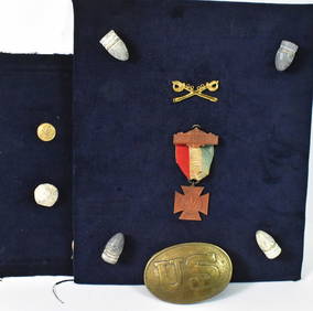
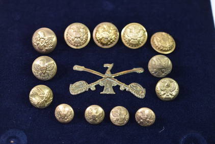
Estate Fresh Civil War Cavalry C. Roby 1863 With ScabbardRalph Fontaine Heritage Auctions Inc.4.7(235)See Sold PriceFeb 25, 2024
ABSTRACT ARAB LEBANESE OIL PAINTING BY ETEL ADNANAntique Arena Inc.4.5(852)See Sold PriceMar 02, 2024
SoldAntique Civil War Military MapPhelps and Watsons Historical and Military Map of the Border of the Southern States. Published by Phelps & Watson, 18 Beekman Street, New York 1864. The piece gives very interesting and detailed inforSee Sold Price
SoldAntique Civil War Military Map1865 Civil War Map of General Sherman's March through Georgia and the Carolinas. Printed by Julius Bien and Co. Litho NY. H18 1/2" W29 1/2"See Sold Price
SoldJohnson: Antique 1st Edition Civil War Military Map1st edition Johnson’s Civil War Military Map, Johnson & Browning. Scarce 1861 map by A. J. Johnson showing the military deportment of the United States in 1860, just before war broke out in the statSee Sold Price
SoldCivil War Military Map Antique Lithograph GroupingGrouping includes (4) Civil War military map Antique lithographs by Julius Bien & Co published in the Atlas to Accompany the Official Records of the Union and Confederate Armies. Including Plate #133See Sold Price
SoldCivil War Miltary Map Antique Lithograph GroupingGrouping includes (4) Civil War military map Antique lithographs by Julius Bien & Co published in the Atlas to Accompany the Official Records of the Union and Confederate Armies. Includes Map Plate #8See Sold Price
SoldMap: Fort Henry and Fort DonelsonCivil War related military map: "Sketch Showing the Relative Positions of Fort Henry and Fort Donelson, Feb. 1862," issued by the U.S. War Department circa 1875, ref. Stephenson, #415. 15-3/4" x 21-1/See Sold Price
Sold2 Colton Civil War Maps, Military Stations & Forts, 3Two (2) Colton Civil War maps, 3 items total. 1st item: J.H. Colton, Civil War era map of the United States showing Military Stations and Forts, prepared for The Rebellion Record, New York: G.P. PutnaSee Sold Price
SoldAtlanta Civil War Campaign MapsComplete set of five 19th century maps illustrating the Civil War Atlanta campaign (note that one map is in very poor condition). U.S. Army Corps of Engineers: "Map[s] Illustrating the Military OperatSee Sold Price
Sold1861 CIVIL WAR MILITARY MAP BY JAMES WYLD1861 CIVIL WAR MILITARY MAP BY JAMES WYLD Folds up into a book. By James Wyld, the geographer to the Queen, whose office was in London. Map measures 35" tall (88.9cm) x 24" wide (60.96cm). Depicting NSee Sold Price
Johnson Civil War Military Map of US, 1862Map: Johnson Civil War Military Map of US - Johnson's New Military Map of the United States Showing the Forts, Military Posts &c. all the Military Divisions with Enlarged Plans of Southern Harbors CarSee Sold Price
SoldJohnson: Antique Civil War Map of Richmond, 1862Scarce and important 1862 A. J. Johnson map of the vicinity of Richmond, Virginia, during the American Civil War. Full title: “Johnson’s Map of the Vicinity of Richmond, and Peninsular CaSee Sold Price
Sold1862 Johnson Civil War Military Map of US1862 Johnson Civil War Military Map of US -- Johnson's New Military Map of the United States Showing the Forts, Military Posts &c. all the Military Divisions with Enlarged Plans of Southern Harbors…See Sold Price
Ettling: Antique Civil War Map of North America, 1860U. S. & North America with oddly shaped Dakota--Ettling c1860. This uncommon Civil War era engraved map shows a very unusual configuration for Dakota. In this map the borders of Wyoming Territory haveSee Sold Price
SoldCivil War Military Map of the U.S. - 1862Excellent example of the more desirable of the two extant variants of this map. This variant, showing a layout of the states rather than military zones, offers a wonderful insight into the political sSee Sold Price
Sold35Pcs Chromolithographs ANTIQUE CIVIL WAR & MILITARYDetails: This lot consists of the approximately 35 Civil War and military lithographs and sheet music shown in the corresponding images.Lithographs date c1897 and include chromolithographs of UniformSee Sold Price
Johnson: Antique Civil War Map of United States, 1864Title/Content of Map: 1864 Johnson Map of the United States -- Johnson's United States Date Printed: 1864, New York Cartographer: A Johnson Size: 16.9 x 23.1 in. This is a large, highly detailed CivilSee Sold Price
Sold1861 Civil War military map in full hand-colorLarge format, double-page “Johnson’s New Military Map of the United States showing the Forts, Military Posts &c. with Enlarged Plans of Southern Harbors” by Johnson and Ward. Original and vividSee Sold Price
SoldAntique Civil War Map - Nashville Defenses Fort MortonCivil War Map - Nashville Defenses Fort Morton Sill Capitol Defense Tennessee | Original antique lithographed map of Confederate defenses in Nashville and Chattanooga, Tennessee, printed more than 119See Sold Price
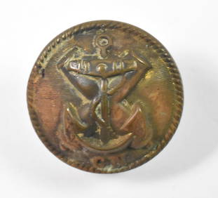
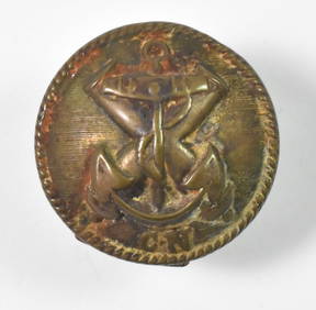
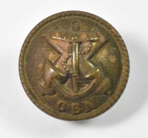
SoldANTIQUE CIVIL WAR MILITARY SUIT COAT BUTTONSC 14 Av. South Carolina state seal. Medium size. Marked Horstmann & Allien / NY. Confederate button. Dimensions: Dia. .75" Condition: Patch of tarnish near top.See Sold Price
SoldCIVIL WAR MILITARY MAP OF EASTERN VIRGINIACIVIL WAR MILITARY MAP OF EASTERN VIRGINIA drawn by H. Lundenkohl. Housed in a modern frame. Together with a map of "Eastern Virginia showing the positions of the armies on March 15, 1862", from the "See Sold Price
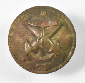
SoldANTIQUE CIVIL WAR MILITARY SUIT COAT BUTTONPA 18 B Pennsylvania state seal, coat size. Horstmann. Dimensions: Dia. 1" Condition: No issues to note.See Sold Price
SoldAntique Civil War Map - Chattanooga Chickamauga AtlantaAntique Original Engraved & Colored Civil War Map of the 1864 Campaigns from Chattanooga to Atlanta with dates and Union & Rebel Defenses Battle of Peachtree Creek, July 20, 1864 From an OrigiSee Sold Price
SoldAN ANTIQUE CIVIL WAR MAP, "Colton's Map of the SouthernAN ANTIQUE CIVIL WAR MAP, "Colton's Map of the Southern States," NEW YORK, CIRCA 1862, "...including Maryland, Delaware, Virginia, Kentucky, Tennessee, Missouri, North Carolina, South Carolina, GeorgiSee Sold Price
SoldCIVIL WAR MILITARY MAP OF VIRGINIACIVIL WAR MILITARY MAP OF VIRGINIA from the "Atlas to Accompany The Official Records of the Union and Confederate Armies", published by the Government Printing Office, 1891-1895, being Plate XLI, depiSee Sold Price
Civil War Map, Positions of the Army of the Ohio Front oh Dalton GA Dated 1864 34"L x 24"TSwisher Bros. Auction LLC4.4(241)See Sold PriceFeb 24, 2024
Civil War Map, Positions of the 16th Army Corps Dated 1864 34"L x 24"TSwisher Bros. Auction LLC4.4(241)See Sold PriceFeb 24, 2024
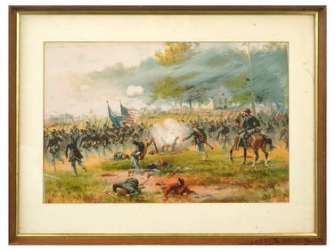
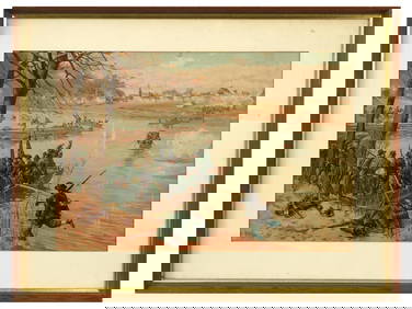
ANTIQUE AMERICAN CIVIL WAR LITHO BY THURE DE THULSTRUPAntique Arena Inc.4.5(852)See Sold PriceFeb 24, 2024
ANTIQUE AMERICAN CIVIL WAR LITHO BY THURE DE THULSTRUPAntique Arena Inc.4.5(852)See Sold PriceFeb 24, 2024
ANTIQUE AMERICAN CIVIL WAR LITHO BY THURE DE THULSTRUPAntique Arena Inc.4.5(852)See Sold PriceFeb 24, 2024
World War 2 Europe Battle of the Atlantic 1939-43 Axis Expansion limits 1959 mapJasper524.5(9.8k)See Sold PriceFeb 28, 2024
Operation Torch Nov 1942-May 1943. World War 2. Western Mediterranean 1966 mapJasper524.5(9.8k)See Sold PriceFeb 28, 2024
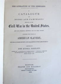
1866 BOOK CATALOGUE: UNITED STATES' CIVIL WAR HISTORY ANTIQUE AMERICANANY Elizabeth 4.3(84)See Sold PriceMar 03, 2024


![[Tintype] Massive Bowie knife (1 of 1)](https://p1.liveauctioneers.com/7226/317626/170485482_1_x.jpg?height=282&quality=70&version=1706368022)
![[Ambrotype] Magnificent Portrait (1 of 1)](https://p1.liveauctioneers.com/7226/317626/170485477_1_x.jpg?height=282&quality=70&version=1706368022)


![[Tintype] Native American Man w/ Knife (1 of 2)](https://p1.liveauctioneers.com/7226/317626/170485453_1_x.jpg?height=282&quality=70&version=1706368022)
![[REES, Charles] Enlistedman w/ Bowie Knife (1 of 1)](https://p1.liveauctioneers.com/7226/317626/170485489_1_x.jpg?height=282&quality=70&version=1706368022)
![[Ambrotype] Wounded at Gettysburg (1 of 1)](https://p1.liveauctioneers.com/7226/317626/170485471_1_x.jpg?height=282&quality=70&version=1706368022)


![[Ambrotype] Young Soldier w/ Bowie Knife (1 of 1)](https://p1.liveauctioneers.com/7226/317626/170485459_1_x.jpg?height=282&quality=70&version=1706368022)

![[Daguerreotype] Soldier w/ Bowie Knife (1 of 2)](https://p1.liveauctioneers.com/7226/317626/170485458_1_x.jpg?height=282&quality=70&version=1706368022)
![[Tintype] Soldier w/ Flowers (1 of 1)](https://p1.liveauctioneers.com/7226/317626/170485495_1_x.jpg?height=282&quality=70&version=1706368022)
![[Tintype] Identified North Carolina Infantryman (1 of 2)](https://p1.liveauctioneers.com/7226/317626/170485474_1_x.jpg?height=282&quality=70&version=1706368022)