2012 Famous Fabrics President John F. Kennedy & Marilyn Monroe Signed Cut 1/1Mynt Auctions4.6(711)See Sold PriceFeb 26, 2024
1952 JOHN F. KENNEDY LETTER to MS. HELEN KEYESJohn McInnis Auctioneers,LLC4.5(505)See Sold PriceFeb 25, 2024
Group of FDR and Truman Political Campaign and Satire ButtonsDana J. Tharp Auctions4.7(271)See Sold PriceFeb 24, 2024
Large Collection of Antique Buttons DisplayPremier Auction Galleries4.3(338)See Sold PriceMar 09, 2024
"THE PRESIDENTS OF THE UNITED STATES" N. CURRIERJohn McInnis Auctioneers,LLC4.5(505)See Sold PriceFeb 25, 2024
THE JOHN F. KENNEDY MEMORIAL at RUNNYMEDEJohn McInnis Auctioneers,LLC4.5(505)See Sold PriceFeb 25, 2024
JOHN F. KENNEDY, Jr. & AUCHINCLOSS GRANDCHILDRENJohn McInnis Auctioneers,LLC4.5(505)See Sold PriceFeb 25, 2024
1930's / 40's Chicago Political Campaign Umbrella.Direct Auction Galleries 4.7(339)See Sold PriceFeb 24, 2024
Union Pacific RR Across The Continent West From Omaha, NE Book-April 2, 1868JM Hobby Supply and Railroad Artifact Auctions4.4(127)See Sold PriceFeb 24, 2024
JOHN F. KENNEDY, Jr. with COUSIN CECIL in 1964John McInnis Auctioneers,LLC4.5(505)See Sold PriceFeb 25, 2024
Large Group of John F. Kennedy Campaign Ephemera With Rare Sealed PacketsDana J. Tharp Auctions4.7(271)See Sold PriceFeb 24, 2024
SOLON FRANCIS MONTECELLO BADGER (Massachusetts, 1873-1919), Portrait of the four-masted schoonerEldred's4.7(423)See Sold PriceFeb 28, 2024
2009 Medalcraft Inauguration of President Barack Obama 3 Medal Set; 14k, Bronze and .999 Silver inDana J. Tharp Auctions4.7(271)See Sold PriceFeb 24, 2024
SoldPershing's Map of the Western Front at the End of WorldPershing John Pershing's Map of the Western Front at the End of World War I Illustrating His Strategic Planning This map of northeastern France and the German territory of Alsace-Lorraine includes a bSee Sold Price
Literary Digest Map of the Western Front of The GreatTitle: Literary Digest Map of the Western Front of The Great World War. Cartographer: MATTHEWS-NORTHRUP WORKS. BUFFALO Date: c1918 Publisher: FUNK & WAGNALLS Size: 33.25Height - 49.25Width AdditionalSee Sold Price
Antique Literary Digest Pull Down Liberty MapLiterary Digest Liberty Map of the Western Front of the Great World War, published by Funk & Wagnals, 1918. Notice to bidders: Condition reports and additional photographs are provided by request as aSee Sold Price
SoldFIRST WORLD WAR WESTERN FRONT. Lens & Arras. 1915-17TITLE/CONTENT OF MAP: 'Western Front Lens & Arras' DATE PRINTED: 1920 IMAGE SIZE: Approx 32.0 x 21.5cm, 12.75 x 8.5 inches (Large) TYPE: Vintage colour map; Scale 1:90,000 CONDITION: Good; suitable foSee Sold Price
WORLD WAR 1.Dixmude-Arras; Ypres Hills Flanders MarshesTITLE/CONTENT OF MAP: 'Western Front Dixmude to Arras; Inset map of The Ypres Hills and the Flanders Marshes ' DATE PRINTED: 1920 IMAGE SIZE: Approx 32.5 x 21.5cm, 12.75 x 8.5 inches (Large) TYPE: VinSee Sold Price
SoldWORLD WAR 2. Maginot & Siegfried lines defences. Pre-invasion. Belgium 1940 mapTITLE/CONTENT OF MAP: 'Western Front showing forests and main defences: Section 2' DATE PRINTED: March 1940 IMAGE SIZE: Approx 26.5 x 42.0cm, 10.25 x 16.5 inches (Large) TYPE: Vintage colour map; ScalSee Sold Price
WORLD WAR 2. Siegfried & Maginot lines defences. Pre-invasion. Belgium 1940 mapTITLE/CONTENT OF MAP: 'Western Front showing forests and main defences: Section 2' DATE PRINTED: 1940 IMAGE SIZE: Approx 26.5 x 42.0cm, 10.25 x 16.5 inches (Large) TYPE: Vintage colour map; Scale 1:75See Sold Price
WORLD WAR 1.Western Front Loos Hohenzollern RedoubtTITLE/CONTENT OF MAP: 'Western Front Loos & Hohenzollern Redoubt' DATE PRINTED: 1920 IMAGE SIZE: Approx 32.0 x 21.5cm, 12.5 x 8.25 inches (Large) TYPE: Vintage colour map CONDITION: Good; suitable forSee Sold Price
WORLD WAR 2. Maginot & Siegfried line defences. Pre-invasion of France 1940 mapTITLE/CONTENT OF MAP: 'Western Front showing forests and main defences: Section 1' DATE PRINTED: March 1940 IMAGE SIZE: Approx 43.0 x 26.5cm, 17 x 10.5 inches (Large) TYPE: Vintage colour map; Scale 1See Sold Price
WORLD WAR 2. Maginot & Siegfried line defences. Pre-invasion of France 1940 mapTITLE/CONTENT OF MAP: 'Western Front showing forests and main defences: Section 1' DATE PRINTED: March 1940 IMAGE SIZE: Approx 43.0 x 26.5cm, 17 x 10.5 inches (Large) TYPE: Vintage colour map; Scale 1See Sold Price
WORLD WAR 1.Neuve Chapelle Festubert Aubers Ridge. 1915TITLE/CONTENT OF MAP: 'Western Front Neuve Chapelle Festubert & Aubers ridge ' DATE PRINTED: 1920 IMAGE SIZE: Approx 32.5 x 21.5cm, 12.75 x 8.5 inches (Large) TYPE: Vintage colour map CONDITION: Good;See Sold Price
WORLD WAR 2. Maginot & Siegfried lines defences. Pre-invasion. Belgium 1940 mapTITLE/CONTENT OF MAP: 'Western Front showing forests and main defences: Section 2' DATE PRINTED: March 1940 IMAGE SIZE: Approx 26.5 x 42.0cm, 10.25 x 16.5 inches (Large) TYPE: Vintage colour map; ScalSee Sold Price
WORLD WAR 1.Western Front Cambrai & Bourlon wood battleTITLE/CONTENT OF MAP: 'Western Front Cambrai and Bourlon wood; Inset map of Cambrai; Banteux' DATE PRINTED: 1920 IMAGE SIZE: Approx 31.5 x 21.5cm, 12.5 x 8.25 inches (Large) TYPE: Vintage colour map CSee Sold Price
WORLD WAR 2. Siegfried & Maginot line defences. Pre-invasion of France 1940 mapTITLE/CONTENT OF MAP: 'Western Front showing forests and main defences: Section 1' DATE PRINTED: 1940 IMAGE SIZE: Approx 43.0 x 26.5cm, 17 x 10.5 inches (Large) TYPE: Vintage colour map; Scale 1:750,0See Sold Price
WORLD WAR 2. Siegfried & Maginot lines defences. Pre-invasion. Belgium 1940 mapTITLE/CONTENT OF MAP: 'Western Front showing forests and main defences: Section 2' DATE PRINTED: 1940 IMAGE SIZE: Approx 26.5 x 42.0cm, 10.25 x 16.5 inches (Large) TYPE: Vintage colour map; Scale 1:75See Sold Price
SoldPERSHING HEADQUARTERS MAP FROM ARMISTICE, NOV. 11, 1918PERSHING HEADQUARTERS MAP FROM ARMISTICE, NOV. 11, 1918 Rare U.S. Army printed map: "Order of Battle on Western Front 11 A.M., Nov. 11, 1918", 33 1/2" x 42", marked: "SECRET MAP ROOM G-3 G.H.Q." and hSee Sold Price
SoldPERSHING HEADQUARTERS MAP FROM ARMISTICE, NOV. 11, 1918Rare U.S. Army printed map: 'Order of Battle on Western Front 11 A.M., Nov. 11, 1918', 33.5 x 42 in., marked 'SECRET MAP ROOM G-3 G.H.Q.' and hand-numbered 'Copy No. 119'. This important map reflectsSee Sold Price
SoldWW I Gen JOHN J "BLACK JACK" PERSHING - His Book SignedJohn J. Pershing (1860-1948) General. Pershing served as the commander of the American Expeditionary Force (AEF) on the Western Front in World War I, 1917–18. He rejected British and French demandsSee Sold Price
SoldGENERAL JOHN J. PERSHING BY RENESCHWWI Poster of General John J. Pershing, commander of the American Expeditionary Forces on the Western Front during World War I, art by E.G. Renesch, Chicago, 1918, 16 x 11.75 inches. Minor loss at botSee Sold Price
SoldJohn J. Pershing Signed PhotographAmerican general (1860–1948) remembered as the commander of the American Expeditionary Force on the Western Front in World War I. Vintage matte-finish 7.5 x 9.75 photo of Pershing in his four-star mSee Sold Price
John J. Pershing Typed Letter SignedAmerican general (1860–1948) remembered as the commander of the American Expeditionary Force on the Western Front in World War I. TLS, one page, 6 x 7, American Expeditionary Forces, Office of the CSee Sold Price
SoldJohn J. Pershing Signed CheckAmerican general (1860–1948) remembered as the commander of the American Expeditionary Force on the Western Front in World War I. German National Bank check, 6 x 2.75, filled out and signed by JohnSee Sold Price
SoldJohn J. PershingAmerican general (1860-1948) remembered as the commander of the American Expeditionary Force on the Western Front in World War I. Fountain pen signature, "John J. Pershing," on an off-white slip handsSee Sold Price
Literary Digest Liberty Map of The Western FrontTitle: Literary Digest Liberty Map of The Western Front Publication Date: c1918 Cartographer: FUNK & WAGNALLS Publisher: FUNK & WAGNALLS COMPANY Dimension: 39.5Height - 49.5Width OF THE GREAT WORLD WASee Sold Price
The First World War A Photographic History 1933. 1st EditionNorth American Artifact Auctions4.7(201)See Sold PriceApr 20, 2024
War Diary of 354th Infantry - 89th Division 1919North American Artifact Auctions4.7(201)See Sold PriceApr 20, 2024
[WORLD WAR II – OKINAWA]. Okinawa Shima Western Beaches Top...Potter & Potter Auctions4.6(550)See Sold PriceMar 07, 2024
1905 20th Century Atlas of Boone County IllinoisMatthew Bullock Auctioneers4.7(1.9k)See Sold PriceFeb 24, 2024
First World War.- Petre (F.Loraine), Wilfrid Ewart & Major General Lowther. The Scots Guards in theForum Auctions4.4(54)See Sold PriceFeb 29, 2024
World War 2 Europe Battle of the Atlantic 1939-43 Axis Expansion limits 1959 mapJasper524.5(9.9k)See Sold PriceFeb 28, 2024
Operation Torch Nov 1942-May 1943. World War 2. Western Mediterranean 1966 mapJasper524.5(9.9k)See Sold PriceFeb 28, 2024
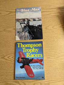
The Blue Max And Thompson Trophy Racers SoftcoversRapid Estate Liquidators and Auction Gallery4.5(1.1k)See Sold PriceFeb 25, 2024


![[WORLD WAR II – OKINAWA]. Okinawa Shima Western Beaches Top... (1 of 1)](https://p1.liveauctioneers.com/928/318880/171361141_1_x.jpg?height=282&quality=70&version=1707501302)