Vintage Ca. 1940's International Panel Delivery Truck Converted into Stationary Food Truck, WasSwisher Bros. Auction LLC4.4(255)See Sold PriceFeb 25, 2024
Martin Custom Acoustic Guitar 000 Body Style Rosewood with Hard CaseHess Fine Auctions4.5(210)See Sold PriceMar 02, 2024
1968 Gibson LG-0 Acoustic Dreadnought Parlor GuitarHess Fine Auctions4.5(210)See Sold PriceMar 02, 2024
Replica Robinson 1862 Sharps CarbineSchmidt's Antiques Inc. Since 19114.8(431)See Sold PriceMar 02, 2024
PAIR (18th c) OF FLINTLOCK DUELING PISTOLSJohn McInnis Auctioneers,LLC4.5(505)See Sold PriceFeb 24, 2024
PAIR T KETLAND of LONDON .60 CAL FLINTLOCK PISTOLSJohn McInnis Auctioneers,LLC4.5(505)See Sold PriceFeb 25, 2024
Gibson ES335 Semi Hollow Vintage Sunburst Electric Guitar with Certificate of Authenticity Hand MadeHess Fine Auctions4.5(210)See Sold PriceMar 02, 2024
WALT DISNEY WORLD - Figment Animatronic Character Skin from EPCOT's Journey Into ImaginationPropstore4.2(6)See Sold PriceMar 12, 2024
Lot Of 3 Early Large Three-Ring Binders Full Of Thousands Of StampsRbfinearts4.5(578)See Sold PriceFeb 24, 2024
A FINE PERSIAN MALAYER PRAYER RUG WITH CYPRESS C. 1860Soulis Auctions4.8(953)See Sold PriceFeb 24, 2024
Thomas Hart Benton; 20thC. American Regionalist Oil SignedMid-Hudson Auction Galleries4.4(471)See Sold PriceFeb 24, 2024
Fender USA Stratocaster Electric Guitar Classic Candy Red and White Original Stickers with Gig BagHess Fine Auctions4.5(210)See Sold PriceMar 02, 2024
1986 Fender Stratocaster Japan Blue-Green with White Pickguard and Gig Bag JapaneseHess Fine Auctions4.5(210)See Sold PriceMar 02, 2024
Sold1858 Map of Public Survey Progress of KS and NEFor your consideration is this 1858 Map of Public Survey Progress of KS and NE. The condition of this public survey is pristine and in display/ museum quality condition. The Public Land Survey SystemSee Sold Price
1858 Map of Public Surveys in California...This remarkable large format map of California reports the extent of the Land Office Survey through 1858, just eight years after it had become the 31st state in the Union. The map is highly detailed wSee Sold Price
U.S. MAP OF KANSAS AND NEBRASKA TERRITORIES, 1860"Map showint the progress of Public surveys in the Territories of Kansas and Nebraska, to accompany the Annual Report of the Surveyor General, 1860, includes rivers and streams, many Indian reservatioSee Sold Price
SoldU.S. MAP OF KANSAS AND NEBRASKA TERRITORIES, 1860"Map showing the progress of Public surveys in the Territories of Kansas and Nebraska, to accompany the Annual Report of the Surveyor General, 1860, includes rivers and streams, many Indian reservatioSee Sold Price
SoldU.S. MAP OF KANSAS AND NEBRASKA TERRITORIES, 1860"Map showing the progress of Public surveys in the Territories of Kansas and Nebraska, to accompany the Annual Report of the Surveyor General, 1860, includes rivers and streams, many Indian reservatioSee Sold Price
Map Showing the Progress of the Public Surveys inTitle: Map Showing the Progress of the Public Surveys in Kansas and Nebraska to Accompany Annual Report of The Surveyor General 1863 Publication Date: 1864 Cartographer: DELAHAY, M.W. Publisher: SURVESee Sold Price
Public Surveys in Kansas & Nebraska 1840Map: Map Showing the Progress of the Public Surveys in Kansas and Nebraska Maker: Surveyor General, Mark W. Delahay Publishing: Washington DC 1840 Size: 23.3 x 18.25 inches "To accompany the annual reSee Sold Price
SoldCoast Survey Reports: 1855 (in 1856) & 1857 (1858[Coast Survey]. 3 Titles. 4to. ++ Report Of The Superintendent Of The Coast Survey, Showing the Progress of the Survey during the Year 1857. Wash: William A. Harris, 1858. 445pp. 29 maps. Binding shabSee Sold Price
USCGS: Antique Survey Map of New England, 1889United States Coast and Geodetic survey sketch showing the progress of the survey in sections 1&2 Inset maps of St. Croix River and N.E. Boundary; sketch showing the progress of the survey in SectionSee Sold Price
SoldAMERICAN HISTORICAL SURVEY VOLUMEAMERICAN HISTORICAL SURVEY VOLUME Alexander Dallas Bache, "REPORT OF THE SUPERINTENDENT OF THE COAST SURVEY, SHOWING THE PROGRESS OF THE SURVEY DURING THE YEAR 1857", 1858, printed by James B. SteedmaSee Sold Price
SoldMAPS PUBLIC SURVEYS OF MICHIGANMAPS, PUBLIC SURVEYS OF MICHIGAN, 6:Sketch of the Public Surveys Northern Michigan W.D. Stone, 25" x 15". Office of Detroit 1855, A. Hoen & Co. 21" x20". Michigan, North Part W.D. Stone, Wash. 18" x 1See Sold Price
Map of Wisconsin & Territory of Minnesota, 1849Map: Public Surveys in the State of Wisconsin and Territory of MinnesotaPublisher: G.L.O., Washington DC, 1849 Size: Folio – 17.75 H x 22.50 W Inches Sparse topography and surveys. Slightly foxed. PSee Sold Price
SoldMap of Public Surveys, Washington Territory, 1863Anson L. Henry, surveyor general. Shows areas of gold mines, Steven’s proposed northern route of the Pacific Railroad, Na Chee Pass, Yakima Indian Reservation, surveys that have been executed aSee Sold Price
Sold"Map of Public Surveys in California, Public Grants,""Map of Public Surveys in California, Public Grants," 1862, H. - 25 in., W. - 17 5/8 in.See Sold Price
Map of Public Surveys in California to Accompany ReportReserve Reduced! Title: Map of Public Surveys in California to Accompany Report of Surveyor General Publication Date: 1856 Cartographer: John C. Hays Publisher: U.S. Geological Survey Size (inches): HSee Sold Price
SoldMap of Public Surveys in New MexicoSketch of the public surveys in New Mexico. Surveyor General - 1855.See Sold Price
SoldMap of Public Surveys Washington TerritoryAmercia.- Map of Public Surveys Washington Territory to accompany Report of Surv: Genl: 1863,lithographic map, 430 x 540mm., four vertical folds, two horizontal folds, each reinforced verso, fSee Sold Price
Map of Public Surveys in California to Accompany ReportTitle: Map of Public Surveys in California to Accompany Report of Surveyor Genl. Publication Date: 1860 Cartographer: J.W. Mundeville Publisher: J. Bien Size: 36.8X30.3 California Surveys With 340 PriSee Sold Price
Sold"Map of Public Surveys in California," 1855, H.- 37 1/2"Map of Public Surveys in California," 1855, H.- 37 1/2 in., W.- 31 3/4 in.See Sold Price
Map of Public Surveys in CaliforniaPublication Date: 1861 Title: Map of Public Surveys in California Cartographer: BEALE, E. F. Publisher: SURVEYOR GENERAL Height: 35.75 Width: 30 "to accompany report of Surveyor Genl. 1861." Very largSee Sold Price
Map of Public Surveys in CaliforniaTitle/Content of Map: Map of Public Surveys in California Cartographer: HAYS, JOHN C. Date: 1854-09-28 Publisher: HOUSE OF REPRESENTATIVES Size: 20Height - 45Width to accompany report of Surveyor GenlSee Sold Price
Map of Public Surveys in CaliforniaTitle/Content of Map: Map of Public Surveys in California Date Printed: 1861 Cartographer: BEALE, E. F. Material/Medium: SURVEYOR GENERAL Size: 35.75X30 "to accompany report of Surveyor Genl. 1861." VSee Sold Price
SoldMaps Including Mexican Boundary Survey & N.T.Mexican boundary surveys - 7 maps - 1851 and map of public survey in Nevada Territory - Surveyor General - 1862 (8 maps in the lot of varying size)See Sold Price
Sold1862 MAP OF NEVADA TERRITORYFull title being: “Map of Public Survey in Nevada Territory to Accompany Report of Surveyor Genl. 1862”, by E.T. Bade, 21.5” x 31.5”.See Sold Price
Union Pacific RR Across The Continent West From Omaha, NE Book-April 2, 1868JM Hobby Supply and Railroad Artifact Auctions4.4(127)See Sold PriceFeb 24, 2024
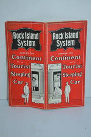
Chicago Rock Island and Pacific RY August 1903 Westbound Edition Public TimetableJM Hobby Supply and Railroad Artifact Auctions4.4(127)See Sold PriceFeb 24, 2024
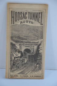
Fitchburg Railroad 1880 Hoosac Tunnel Route Public TimetableJM Hobby Supply and Railroad Artifact Auctions4.4(127)See Sold PriceFeb 24, 2024
Great Western RY November 1, 1880 Public TimetableJM Hobby Supply and Railroad Artifact Auctions4.4(127)See Sold PriceFeb 24, 2024
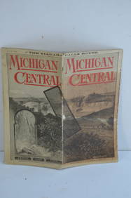
Michigan Central RR May 18, 1884 Public TimetableJM Hobby Supply and Railroad Artifact Auctions4.4(127)See Sold PriceFeb 24, 2024
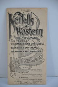
Norfolk and Western RY May 1898 Public TimetableJM Hobby Supply and Railroad Artifact Auctions4.4(127)See Sold PriceFeb 24, 2024
Oregon Short Line RR April 1899 Public TimetableJM Hobby Supply and Railroad Artifact Auctions4.4(127)See Sold PriceFeb 24, 2024
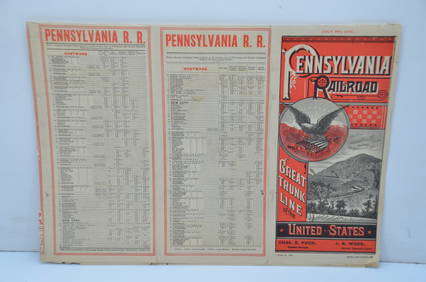
Pennsylvania Railroad July 8, 1885 Public TimetableJM Hobby Supply and Railroad Artifact Auctions4.4(127)See Sold PriceFeb 24, 2024
Thirty Pieces of Lackawanna Railroad Ephemera - Chief Engineer Timebook, Map, Public Timetables,Rail & Road Auctions4.6(165)See Sold PriceMar 07, 2024
Group of New York Central Railroad Paper - Rule Books, Employee Timetables, Stationary, Log Books,Rail & Road Auctions4.6(165)See Sold PriceMar 07, 2024
Nottingham.- Ordnance Survey Office (publisher) Collection 8 geological maps on the environs ofForum Auctions4.3(53)See Sold PriceFeb 29, 2024
INDIA WITHIN THE GANGES SUSAN GOLE ILLUSTRATED MAPS EARLY CARTOGRAPHYJasper524.5(9.9k)See Sold PriceFeb 27, 2024
Framed Space Age Rand McNally Map of Planets Poster, 1958PUBLIC SALE4.7(226)See Sold PriceMar 02, 2024
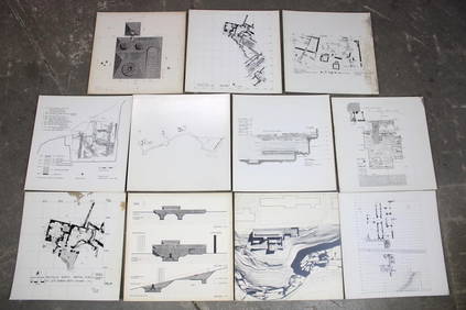
Set of 11 Mid Century Modern Architectural Plans & Site Map RenderingsPUBLIC SALE4.7(226)See Sold PriceMar 02, 2024
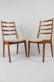
Pair of Danish Modern Teak Dining Chairs, Korup StolefabrikPUBLIC SALE4.7(226)See Sold PriceMar 02, 2024
AFRICA. Map pre-dating much exploration. Mountains of Kong. SDUK 1851 oldJasper524.5(9.9k)See Sold PriceFeb 28, 2024
Monmouth, Illinois Vintage Topography MapRapid Estate Liquidators and Auction Gallery4.5(1.1k)See Sold PriceFeb 28, 2024