GUIDO DROCCO - ROBERTO GABETTI - AIMARO ISOLA. Tetralogy floor lamp. G.B. MILAN for ARBOViscontea Casa d'Aste srl4.4(15)See Sold PriceFeb 29, 2024
SoldThree Maps by the Hydrographic Office U. S. Navy,Three Maps by the Hydrographic Office U. S. Navy, consisting of "Central American, West Coast of Nicaragua, Corinto Harbor and Approaches," 1929, H. - 30 in., W. - 42 in.; with "South Africa, BritishSee Sold Price
SoldThree Maps from the Hydrographic Office U. S. Navy,Three Maps from the Hydrographic Office U. S. Navy, consisting of "England & France, Southern Approaches to Dover Strait,"1915, H. - 45 3/4 in., W. -34 in.; with "Eastern Archipelago, Straits BetweenSee Sold Price
SoldThree Maps from the Hydrographic Office U. S. Navy, theThree Maps from the Hydrographic Office U. S. Navy, the first "North Pacific Ocean, Caroline Islands, North Coast of Ponape Island, Ponape Harbor to Talak Passage," 1944, H. -30 in., W. -42 in.; withSee Sold Price
SoldThree Maps by the Hydrographic Office U. S. Navy,Three Maps by the Hydrographic Office U. S. Navy, consisting of "South Pacific Ocean, Bismark Archipelago, Duke of York Group," 1921, H. - 42 in., W. - 30 in.; the "South Pacific Ocean, Bismark ArchipSee Sold Price
SoldThree Maps by the Hydrographic Office U. S. Navy,Three Maps by the Hydrographic Office U. S. Navy, consisting of "South Pacific Ocean, New Caledonia, New Caledonia Isle of Pines to Ven Island," 1921, H. - 42 in., W. -29 in.; with "South Pacific OceaSee Sold Price
SoldThree Maps from the Hydrographic Office U. S. Navy, theThree Maps from the Hydrographic Office U. S. Navy, the first "Eastern Archipelago, Lombok to Flores including Paternoster and Postillion Is.," 1924, H. - 27 1/8 in., W. - 39 5/8 in.; with "North PaciSee Sold Price
SoldThree Maps by the Hydrographic Office U. S. Navy,Three Maps by the Hydrographic Office U. S. Navy, consisting of "North Pacific Ocean, Marshall Islands, Northern Portion," 1945, H. - 32 in., W. - 50 in.; "France, West Coast, Le Sabe to D'Olonne," anSee Sold Price
Osaka, Kobe & Hiogo, Japan With Street Plans 1886Bartlett, J. R. Japan. Gulf of Osaka. Hiogo and Osaka. Lithographed map. Hydrographic Office, U.S. Navy, 1886. 17" x 22 ½" sheet. With two insets. Plan of city of Osaka. Soundings. Scarce.See Sold Price
SoldTwo Maps by the Hydrographic Office U. S. Navy,Two Maps by the Hydrographic Office U. S. Navy, consisting of "China- East Coast- Hwangpoo River, Kaokiao Creek to Yangtzepoo Creek," 1931, H. - 42 in., W. - 30 in.; together with "China- East Coast-See Sold Price
SoldTwo Maps from the Hydrographic Office U. S. Navy, theTwo Maps from the Hydrographic Office U. S. Navy, the first "Asia, Korea, Southeast Coast, Fusan Ko," 1945, H. - 42 in., W. - 30 in.; together with "England- East Coast, North Foreland to Orfordness,See Sold Price
SoldFive Maps by the Hydrographic Office U. S. Navy,Five Maps by the Hydrographic Office U. S. Navy, consisting of "England West Coast- Start Point to Needles Channel," 1933, H. -28 3/4 in., W. - 36 1/2 in.; "England East Coast- River Thames Entrance,See Sold Price
SoldTwo Maps by the Hydrographic Office U. S. Navy,Two Maps by the Hydrographic Office U. S. Navy, consisting of "South Pacific Ocean, Anchorages in the Fiji Islands, 1925, H. - 23 3/8 in., W. - 33 1/2 in.; together with "South Pacific Ocean, Plans inSee Sold Price
SoldFive Maps by the Hydrographic Office U. S. Navy,Five Maps by the Hydrographic Office U. S. Navy, consisting of "Pertuis D'Antioche and Approaches to La Rochelle and Rochefort," 1922, H. - 29 3/4 in., W. - 42 in.; "France North Coast- Port of CherboSee Sold Price
SoldFour Maps by the Hydrographic Office U. S. Navy,Four Maps by the Hydrographic Office U. S. Navy, consisting of "English Channel, Eastern Sheets," 1935, H. - 41 in., W.- 27 1/2 in.; "English Channel, Middle Sheet," 1938, H. - 42 in., W. -27 7/8 in.;See Sold Price
SoldFour Maps by the Hydrographic Office U. S. Navy,Four Maps by the Hydrographic Office U. S. Navy, consisting of "Japan- Tsushima, Kaikyo," 1922, H. - 42 in., W. - 30 in.; "Japan- West Coast of Honshu, Tsuchizaki to Noshiro," 1941, H. - 42 in., W. -See Sold Price
SoldU.S. NAVY HYDROGRAPHIC OFFICE MAP MANILA BAYU.S. NAVY HYDROGRAPHIC OFFICE MAP, H 44'', W 31 1/2'', WEST COAST OF LUZON, APPROACHES TO MANILA BAY FRAMED UNDER GLASS. VIS: H 44'', W 31 1/2''. FRAME: H 48'', W 34 3/4''.See Sold Price
Sea Chart Mid Atlantic StatesDessez, L. & Evans, H. C. North America Atlantic Coast of the United States. Lithographed Map. U.S. Navy Hydrographic Office, 1890. 44 ¼" x 29 ½" sheet. "BUZZARD'S BAY TO CAPE LOOKOUT compiled fSee Sold Price
American Sea Chart of S. Florida, Keys & Bahamas WithBritish & American Surveys. Bahama Banks and Gulf of Florida, Sheet 1. Lithographed Map. U.S. Navy Hydrographic Office, 1870. 38" x 48 ½" sheet. "by J.R. Rodgers Lt. U.S.N." Shows southern 2/3 of FSee Sold Price
U.S. Navy Chart On Linen - Definitive S. Atlantic CoastFillmore, John H. North America. Atlantic Coast of the United States. Cape Hatteras to Cape Canaveral... Lithographed map. U.S. Navy Hydrographic Office, 1890. 44" x 29 ¼" sheet. U.S. Navy chart, lSee Sold Price
Owen Chart of Great Bahama BankOwen, R. / Barnett, E. Great Bahama Bank from Great Isaac to 23" 40' N. Latitude... Lithographed map. U.S. Navy Hydrographic Office, 1871. 38" x 26 ¼" sheet. "...Surveyed by Commanders r. Owen andSee Sold Price
SoldPolar.- Atlas.- Hydrographic Office, U.S. Navy. IcePolar.- Atlas.- Hydrographic Office, U.S. Navy. Ice Atlas of the Northern Hemisphere, first edition, 'Index Chart' as front pastedown, full- and half-page maps and charts, divisional titles, tables, gSee Sold Price
SoldNaval Chart of the Pacific and Western AtlanticU.S. CONGRESS, HYDROGRAPHIC OFFICE. U.S. NAVY, 1894, Folio – 22.25 H x 25.50 W Inches, Congressional reprint of a Navy chart that shows Trust terriories claimed by Britain, France and Germany. NiceSee Sold Price
British Admirality and US Coast Survey 1862 MapBritish Admirality and US Coast Survey 1862 map of the northeast coast of North America, sheet one Hydrographic Office of US Navy, with insets of: Halifax harbor, Rockport Harbow, Portland harbor, BuzSee Sold Price
19th C. British Admiralty and US Coast Survey MapBritish Admiralty and US Coast Survey map of the northeast coast of North America, 1862, sheet one Hydrographic Office of US Navy, with insets of: Halifax harbor, Rockport Harbor, Portland harbor, BuzSee Sold Price
1885 CIVIL WAR 1ed Famous Memoirs US Grant Sheridan Sherman 6v RARE LOT MapsSchilb Antiquarian Rare Books4.8(428)See Sold PriceMar 10, 2024
Three Delaware & Hudson Canal Company Railroad Annual Passes - 1884, 1885, and 1886Rail & Road Auctions4.6(165)See Sold PriceMar 08, 2024
1938 American Armies and Battlefields by the American Battle Monuments CommissionNorth American Artifact Auctions4.7(198)See Sold PriceApr 20, 2024
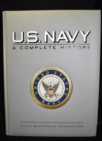
U.S. NAVY - A Complete History by Goodspeed, M. Hill 2003 MintNorth American Artifact Auctions4.7(198)See Sold PriceApr 20, 2024
U.S. Seabee Naval Construction Battalion Collection.Van Eaton Galleries4.6(99)See Sold PriceMar 02, 2024
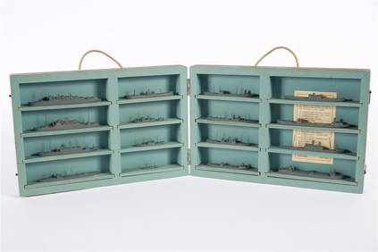
South Salem Studios, US Navy Ship Model CaseStefek's Auctioneers & Appraisers4.6(113)See Sold PriceFeb 28, 2024
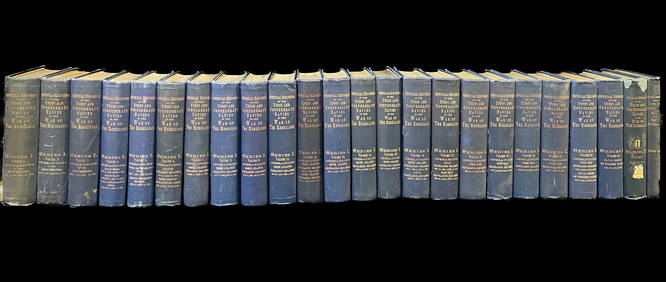
OFFICIAL RECORDS OF THE UNION AND CONFEDERATE NAVIES IN THE WAR OF THE REBELLION, 1894, 24 VOLUMESThe Rug Life4.3(13)See Sold PriceMar 07, 2024
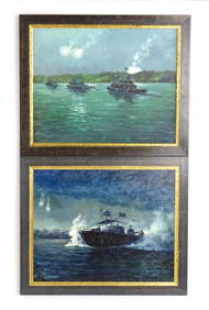
20th century, American Marine School, Oil on canvas, A pair, A coastal scene with a U. S. Navy boatClaydon Auctioneers Ltd4.3(125)See Sold PriceFeb 26, 2024
Bronze Compote of Three Boys Holding A Tray On Marble BaseMannys Jewelry4.6(335)See Sold PriceMar 14, 2024
Handmade Geometric Kazak Farmhouse Decor 4X6 Oriental Rug Tribal Office CarpetMynt Auctions4.6(697)See Sold PriceMar 01, 2024
West Indies Islands. Guadaloupe. | Mariegalante &C. | Antigua.Jasper524.5(9.9k)See Sold PriceFeb 27, 2024
West Indies. Rand, McNally & Co.'S Indexed Atlas Map of the West Indies.Jasper524.5(9.9k)See Sold PriceFeb 27, 2024