Vintage Ca. 1940's International Panel Delivery Truck Converted into Stationary Food Truck, WasSwisher Bros. Auction LLC4.4(241)See Sold PriceFeb 25, 2024
Martin Custom Acoustic Guitar 000 Body Style Rosewood with Hard CaseHess Fine Auctions4.5(197)See Sold PriceMar 02, 2024
1968 Gibson LG-0 Acoustic Dreadnought Parlor GuitarHess Fine Auctions4.5(197)See Sold PriceMar 02, 2024
Replica Robinson 1862 Sharps CarbineSchmidt's Antiques Inc. Since 19114.8(431)See Sold PriceMar 02, 2024
PAIR (18th c) OF FLINTLOCK DUELING PISTOLSJohn McInnis Auctioneers,LLC4.6(502)See Sold PriceFeb 24, 2024
PAIR T KETLAND of LONDON .60 CAL FLINTLOCK PISTOLSJohn McInnis Auctioneers,LLC4.6(502)See Sold PriceFeb 25, 2024
Gibson ES335 Semi Hollow Vintage Sunburst Electric Guitar with Certificate of Authenticity Hand MadeHess Fine Auctions4.5(197)See Sold PriceMar 02, 2024
WALT DISNEY WORLD - Figment Animatronic Character Skin from EPCOT's Journey Into ImaginationPropstore4.2(6)See Sold PriceMar 12, 2024
Lot Of 3 Early Large Three-Ring Binders Full Of Thousands Of StampsRbfinearts4.4(571)See Sold PriceFeb 24, 2024
A FINE PERSIAN MALAYER PRAYER RUG WITH CYPRESS C. 1860Soulis Auctions4.8(953)See Sold PriceFeb 24, 2024
Thomas Hart Benton; 20thC. American Regionalist Oil SignedMid-Hudson Auction Galleries4.4(468)See Sold PriceFeb 24, 2024
Fender USA Stratocaster Electric Guitar Classic Candy Red and White Original Stickers with Gig BagHess Fine Auctions4.5(197)See Sold PriceMar 02, 2024
1986 Fender Stratocaster Japan Blue-Green with White Pickguard and Gig Bag JapaneseHess Fine Auctions4.5(197)See Sold PriceMar 02, 2024
SoldVirgin Islands Map from English & Danish SurveysHand colored map of the Virgin Islands includes 12 profile views of the islands by Thomas Jefferys, Geographer to King George III. Measures 24.5"H x 30.25"W framed; 17.5"H x 22.75"W unframed. ConditioSee Sold Price
Early Virgin Islands MapHigh Quality Reprint of Map by Sayer and Bennett London 1775. Hand colored, printed for Barre Publishers in 1968. The Virgin Islands from English and Danish surveys, by Thomas Jefferys, Geographer toSee Sold Price
SoldMAP OF THE VIRGIN ISLANDS FROM ENGLISH AND DANISHMAP OF THE VIRGIN ISLANDS FROM ENGLISH AND DANISH SURVEYS . After the original by Thomas Jefferys - 20 3/4 in. 16 1/4 in., sight size.See Sold Price
SoldJeffery's map of Virgin IslandsTitle: The Virgin Islands from English and Danish Surveys Author: Jefferys, Thomas Description: Copper-engraved map, hand-colored (later). 46x61 cm. (18x24").Finely engraved map of the Virgin IslandsSee Sold Price
Antique Reproduction Maps Antwerp & Virgin Islands2 Antique Reproduction Maps Antwerp & The Virgin Islands. Includes "View of Antwerp" by Bruan & Hogenberg and "The Virgin Islands from English and Danish Surveys" by Thomas Jeffreys. Larger map measurSee Sold Price
SoldVirgin Islands Carribbean Sea ChartThe Virgin Islands from English and Danish Surveys by Thomas Jefferys. English map. Sight 18 1/2" x 24 1/2".See Sold Price
Reproduction Map, After Thomas JefferysAfter Thomas Jefferys (British, 18th century), "The Virgin Islands from English and Danish Surveys," photo mechanical reproduction print of copper plate engraved map, overall (with frame): 24.25"h x 3See Sold Price
SoldThe Virgin Islands from English and Danish Surveys byThe Virgin Islands from English and Danish Surveys by Thomas Jefferys Geographer to the King, sight size: 18 1/2" x 24" Provenance: Estate of Peggy & David Rockefeller having stamp/label.See Sold Price
The Virgin Islands from English and Danish Surveys, byReprint, 19 3/4 x 25 1/2 inches, sight.See Sold Price
English Engraved Map of the Virgin Islands RelateEnglish Engraved Map of the Virgin Islands Related to the Slave Trade, c. 1826, drawn by James Basire, printed by Luke Hansard & Sons, entitled "The Virgin Islands: accompanying the Report of Major MoSee Sold Price
CARIBBEAN West Indies Central America Danish Virgin islands JOHNSTON 1901 mapTITLE/CONTENT OF MAP: 'West India Islands and Central America' DATE PRINTED: 1901 IMAGE SIZE: Approx 36.0 x 46.5cm, 14.25 x 18.25 inches (Large); Please note that this is a folding map. TYPE: AntiqueSee Sold Price
CARIBBEAN West Indies Central America Danish Virgin islands JOHNSTON 1901 mapTITLE/CONTENT OF MAP: 'West India Islands and Central America' DATE PRINTED: 1901 IMAGE SIZE: Approx 36.0 x 46.5cm, 14.25 x 18.25 inches (Large); Please note that this is a folding map. TYPE: AntiqueSee Sold Price
West Indies.- Jefferys (Thomas) St. Lucia Done FromWest Indies.- Jefferys (Thomas) St. Lucia Done From Surveys And Observations Made By The English..., map of the island of St. Lucia, from Robert Sayer's "West Indian Atlas", showing the plantations, mSee Sold Price
English Engraved Map of the Caribbean Islands, c.English Engraved Map of the Caribbean Islands, c. 1784, by L.S. De La Rochette and printed by William Faden, entitled "A Chart of the Antilles, or Charibbee, or, Caribs Islands, with the Virgin Isles"See Sold Price
SoldThe Island Sainte Croix, 1831 British Admiralty Nautical ChartScarce Original 1831 British Admiralty Nautical Chart: The Island Sainte Croix, of From the 1799 Danish Survey of General Oxholm. An Extraordinary 18th-Century Map of the Danish Sugar-Plantation IslanSee Sold Price
COLONIAL CARIBBEAN. West Indies. Danish Virgin Islands.Telegraph cables 1886 mapTITLE/CONTENT OF MAP: 'The West India Islands, and Central America; Inset map of Jamaica' DATE PRINTED: 1886 IMAGE SIZE: Approx 36.0 x 52.0cm, 14.25 x 20.5 inches (Large); Please note that this is a fSee Sold Price
COLONIAL CARIBBEAN. West Indies. Danish Virgin Islands.Telegraph cables 1886 mapTITLE/CONTENT OF MAP: 'The West India Islands, and Central America; Inset map of Jamaica' DATE PRINTED: 1886 IMAGE SIZE: Approx 36.0 x 52.0cm, 14.25 x 20.5 inches (Large); Please note that this is a fSee Sold Price
SoldMAP, Guadeloupe, LaurieGuadeloupe. Richard Holmes Laurie, Guadaloupe, Done from Actual Surveys and Observations of the English, Whilst the Island Was in Their Possession, with Subsequent Improvements, 1830 (dated). Hand ColSee Sold Price
SoldMap of Martinique 1775Title: Martinico, done from Actual Surveys and Observations, made by English Engineers whilst the Island was in their Possession Author: Jefferys, Thomas Description: Copper-engraved map. 46x61 cm. (1See Sold Price
Early Map of Martinico, MartiniqueHigh Quality Reprint of Map Hand colored, printed for Barre Publishers in 1968. Martinico, done from actual surveys and observations, made by English engineers whilst the Island was in their possessioSee Sold Price
Map of Guadaloupe 1775Title: Guadaloupe Done from Actual Surveys and Observations of the English, whilst the Island was in their Possession with Improvements Author: Jefferys, Thomas Description: Copper-engraved map, hand-See Sold Price
Map of Guadaloupe 1775Title: Guadaloupe Done from Actual Surveys and Observations of the English, whilst the Island was in their Possession with Improvements Author: Jefferys, Thomas Description: Copper-engraved map, hand-See Sold Price
SoldVirgin Islands Map with Artist's Story on BackVirgin Islands Map with Artist's Story on Back. Measures 24" tall x 30" wide. This sale will be broadcast live on sale day with an auctioneer and caller calling full descriptions of each lot being solSee Sold Price
Bruce Elliot Roberts (NY,FL,1917-1993) oil paintingBroward Auction Gallery4.8(277)See Sold PriceMar 10, 2024
Bruce Elliot Roberts (NY,FL,1917-1993) oil paintingBroward Auction Gallery4.8(277)See Sold PriceMar 17, 2024
Portfolio of 15 County Maps by Robert Morden (English 1650-1703)Nadeau's Auction Gallery4.7(401)See Sold PriceFeb 24, 2024
Catesby, Folio - Tumble-Turds (Dung Beetle) with Canada Lily. Sup-11Trillium Antique Prints & Rare Books4.5(30)See Sold PriceFeb 24, 2024
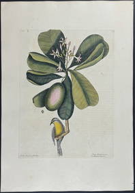
Catesby, Folio - American Goldfinch with Acacia. 1-43Trillium Antique Prints & Rare Books4.5(30)See Sold PriceFeb 24, 2024
Catesby, Folio - Bahama Titmouse with Seven Years Apple. 1-59Trillium Antique Prints & Rare Books4.5(30)See Sold PriceFeb 24, 2024
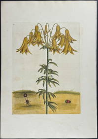
Catesby, Folio - American Partridge with Attamusco Lily. Sup-12Trillium Antique Prints & Rare Books4.5(30)See Sold PriceFeb 24, 2024
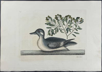
Catesby, Folio - Little Brown Duck with Soap-Wood. 1-98Trillium Antique Prints & Rare Books4.5(30)See Sold PriceFeb 24, 2024
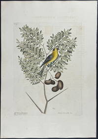
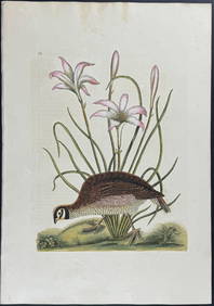
Catesby, Folio - Red Bellied Woodpecker & Hairy Woodpecker with Black Oak. 1-19Trillium Antique Prints & Rare Books4.5(30)See Sold PriceFeb 24, 2024
1764 Bellin Map of Lesser Antilles Northern Portion -- Petites Antilles ou Isles du Vent 3e. Partie.Jasper524.5(9.8k)See Sold PriceFeb 27, 2024
A23 United States in the Caribbean Denoyer-Geppert Social Science MapsJasper524.5(9.8k)See Sold PriceFeb 27, 2024
Evelyn Metzger (NY,Brazil,1911-2007) oil paintingBroward Auction Gallery4.8(277)See Sold PriceMay 19, 2024