Marc Chagall-Limited Edition -Paris Opera Ceiling after ChagallArt Legacy Auctions4.5(223)See Sold PriceFeb 24, 2024
Salvador Dali Pantagruel Limited Edition Lithograph Hand signed and numberedArt Legacy Auctions4.5(223)See Sold PriceFeb 24, 2024
Pablo Picasso Bouquet of Peace Collection Domaine Picasso Limited Edition on paper.Art Legacy Auctions4.5(223)See Sold PriceFeb 24, 2024
A RARE MAXFIELD PARRISH JACK AND THE BEANSTALK PRINTSoulis Auctions4.8(953)See Sold PriceFeb 24, 2024
LARGE MECHANICAL PRINT 'STARS' AFTER MAXFIELD PARRISHSoulis Auctions4.8(953)See Sold PriceFeb 24, 2024
Heinrich Aldegrever, etc. 15 old master prints. 16th-17th centuries. Aldegrever works include "ManTremont Auctions4.5(297)See Sold PriceFeb 25, 2024
VANDERMAELEN. Largest Scale Colonial Maps of TXLargest Scale Colonial Maps of Texas—“difficult to assemble”—Streeter 369. [MAP]. VANDERMAELEN, Ph[See Sold Price
Vandermaelen large scale maps of Russia in AsiaHeading: Author: Vandermaelen, Philippe Marie Guillaume Title: Asie... Partie de la Russie d'Asie Place Published: [Brussels] Publisher: Date Published: [c.1827] Description:See Sold Price
Vandermaelen large scale maps of parts of AsiaHeading: Author: Vandermaelen, Philippe Marie Guillaume Title: Four large-scale maps of parts of Asia Place Published: [Brussels] Publisher: Date Published: [c.1827] Description: <See Sold Price
Large Framed Map of TX RailroadsVintage large scale map of Tx showing the existing railroads and topographical features. Measures 26x37 inches. Archival framing. Good clean condition and easy to read.See Sold Price
SoldLarge-scale map of North Texas 1827Title: Amér. Sep. Partie des États Unis. No. 55 Author: Vandermaelen, Philippe Marie Guillaume Description: Lithographed map, hand-colored in outline. 46x51 cm. (18x20").Very large scale map of theSee Sold Price
SoldLarge-scale map of Idaho & Montana 1827Title: Amér. Sep. Partie des États Unis. No. 39 Author: Vandermaelen, Philippe Marie Guillaume Description: Lithographed map. 47x53 cm. (18½x21").Large-scale map of Idaho and western Montana, withSee Sold Price
SoldLarge-scale map of North Texas 1827Title: Amér. Sep. Partie des États Unis. No. 55 Author: Vandermaelen, Philippe Marie Guillaume Description: Lithographed map, hand-colored in outline. 46x51 cm. (18x20").Very large scale map of theSee Sold Price
Partie de la Suède et de la Norwège #4 Norway Sweden. VANDERMAELEN 1827 mapTITLE/CONTENT OF MAP: 'Western Front Battle lines March to Nov. 1918' DATE PRINTED: 1920 IMAGE SIZE: Approx 21.5 x 32.5cm, 8.5 x 12.75 inches (Large) TYPE: Vintage colour map; Scale 1:1,500,000. ThisSee Sold Price
ASIA. Asia Middle East political colonial 1910 old antique map plan chartTITLE/CONTENT OF MAP: 'Asia' DATE PRINTED: 1910 IMAGE SIZE: Approx 123.0 x 161.5cm, 48.5 x 63.75 inches (Large); Please note that this is a folding map. TYPE: Antique colour map; Scale 1:30,000,000 COSee Sold Price
SoldLot of 3 Vintage Framed MapsProvenance: The Collection of T Bar M, New Braunfels, TX 40". X 34" wide/ LargestSee Sold Price
SoldFive Rix Products HO scale kits plus two othersFive Rix Products HO scale kits plus two others. includes three Maxwell Avenue houses, an Atlas Kates Colonial home, Rix 628-0030 telephone poles and 628-0123 wrought iron 150' highway overpass anSee Sold Price
SoldTwo Spanish Colonial Retablos on ClothTwo Spanish Colonial Retablos on Cloth, depicting Archangel Michael holding a scale, and Gabriel with horn and drum {Dimensions of largest 24 x 17 inches}See Sold Price
SoldTwo Spanish Colonial Retablos on ClothTwo Spanish Colonial Retablos on Cloth, depicting Archangel Michael holding a scale, and Gabriel with horn and drum {Dimensions of largest 24 x 17 inches}See Sold Price
SoldCrystal and Metal Single-Bar Scale with 2 CandlesticksProvenance: A San Antonio, TX Estate 22.5" tall x 18.5" wide / largestSee Sold Price
MAP - Eastern US & Canada. D'AnvilleColonial Eastern United States & Canada. Jean Baptiste Bourguignon d'Anville, [On 4 Sheets] Canada Louisiane et Terres Angloises, 1755 (dated). Black & White. This large-scale map covers the region frSee Sold Price
1745 Land of the Hebrews or Israelites Map 1st PrintingThis is the first printing of the map in 1745 with traced map lines in green. Later edition in 1797 was colored fully. Original map, on paper in the form, (80/55 cm) Scale of 76 Miles not geometric, oSee Sold Price
SoldJOHANNES JANSSONIUS (DUTCH, 1588-1664) COLONIAL MAP OFJOHANNES JANSSONIUS (DUTCH, 1588-1664) COLONIAL MAP OF THE SOUTHEAST COAST OF NORTH AMERICA AND THE WEST INDIES, hand-colored engraving, on laid paper, title in cartouche to upper left quadrant, letteSee Sold Price
SoldA Large Scale 17th Century Map of Poland andSANSON, N and JAILLOT, A.H., Paris 1685, titled 'Les Estates de Couronnede de Pologne en leurs Palatinatsqui comprennet Le Royaume de Pologne, Le Grande Duche de Lithuanie', Large scale map of PolandSee Sold Price
J.N. Bellin: Map of St. Christopher Island, 1758Carte Réduite De L'Isle De Saint Christophe is a highly detailed large-scale engraved map of St. Christopher island (a.k.a. St. Kitts) with topography, several place names, and a beautiful title cartSee Sold Price
de l'Isle: Antique Map of Colonial North America, 1745Carte du Mexique et de la Floride'. Colonial North America. This early map of North America shows it divided into colonies of Spain (red), France (blue) and Great Britain (yellow), with the then BritiSee Sold Price
Sold1848 New York History 59 County Atlas Maps Dutch1848 New York History 59 County Atlas Maps Dutch Colonial Mather ‘A Geographical History of the State of New York’ is a text with detailed sections on the physical features of the state, its naturSee Sold Price
Sold14 Corgi Toys Vehicles in Original Boxes.14 Corgi Toys Vehicles in Original Boxes. Die-cast scale model toys. Largest measures 10"l. Condition: As new in original slightly worn boxes.See Sold Price
Sold2 Maps incl: Aestivarum Insulae... [ca 1680-1700].[Colonial US/Bermuda]. 2 Maps. ++ Aestivarum Insulae at Barmudas. Marks locations of 11 forts, with letters corresponding to a key at lower left. A derivative of John Speed’s map (of 1627), this marSee Sold Price
SoldFour Graziella Laffi silver and mixed-metal articulatedThird quarter 20th century; Peru Each stamped for Graziella Laffi; Further stamped: 925 Each fish designed with articulated scales, 4 pieces Largest: 6.25" H x 13.25" W x 3.25" D 35.410 gross oz.See Sold Price
Important Antique Natural Baltic Butterscotch AmberSan Diego Art Auction4.3(9)See Sold PriceFeb 24, 2024
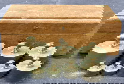
Vintage Brass Scale Weights In Wooden BoxThe Benefit Shop Foundation Inc.4.3(2.9k)See Sold PriceFeb 28, 2024
Rand McNally Railroad Map Cabinet w/ 21 Railroad MapsRail & Road Auctions4.6(165)See Sold PriceMar 08, 2024
Afrique. Limba Soulimana #26. Guinea Sierra Leone Liberia. VANDERMAELEN 1827 mapJasper524.5(9.9k)See Sold PriceFeb 28, 2024
Afrique. Partie du Sahara #16. Niger & Chad Libya. VANDERMAELEN 1827 old mapJasper524.5(9.9k)See Sold PriceFeb 28, 2024
Afrique. Partie du Désert de Sahara #13. Mauritania Mali. VANDERMAELEN 1827 mapJasper524.5(9.9k)See Sold PriceFeb 28, 2024
Afrique. Côte Déserte #48. Skeleton Coast. Namibia. VANDERMAELEN 1827 old mapJasper524.5(9.9k)See Sold PriceFeb 28, 2024
Afrique Pays… sud du Lac Tchad 30 Central African Republic VANDERMAELEN 1827 mapJasper524.5(9.9k)See Sold PriceFeb 28, 2024
Afrique. Partie du Sahara #12. Mauritania. Western Sahara. VANDERMAELEN 1827 mapJasper524.5(9.9k)See Sold PriceFeb 28, 2024
Afrique. Benguela #44. Southern Angola & Northern Namibia. VANDERMAELEN 1827 mapJasper524.5(9.9k)See Sold PriceFeb 28, 2024
Afrique. Bambara #20 Niger River. Western Mali. Mauritania VANDERMAELEN 1827 mapJasper524.5(9.9k)See Sold PriceFeb 28, 2024
Afrique. Pays des Hottentots #50. Namibia South Africa VANDERMAELEN 1827 mapJasper524.5(9.9k)See Sold PriceFeb 28, 2024
COLONIAL CENTRAL AFRICA. Kenya Tanzania Belgian Congo Angola. JOHNSTON 1912 mapJasper524.5(9.9k)See Sold PriceFeb 28, 2024
COLONIAL AFRICA. British French German Italian Portugal Spain.STANFORD 1906 mapJasper524.5(9.9k)See Sold PriceFeb 28, 2024
COLONIAL CENTRAL AFRICA. Kenya Tanzania Belgian Congo Angola. JOHNSTON 1913 mapJasper524.5(9.9k)See Sold PriceFeb 28, 2024
Lot Of Mid Century Ephemera, Including Maps & 1957 License PlatesClark's Auction Company4.6(443)See Sold PriceMar 03, 2024
Grouo of 3 Hubley Die-Cast Metal Model Vehicle KitsMatthew Bullock Auctioneers4.7(1.8k)See Sold PriceMar 02, 2024


![2 Maps incl: Aestivarum Insulae... [ca 1680-1700]. (1 of 4)](https://p1.liveauctioneers.com/179/49347/23134455_1_x.jpg?height=282&quality=70&version=1388425910)