1952 MAY, J.F.K. HANDWRITTEN LETTER & ENVELOPEJohn McInnis Auctioneers,LLC4.6(502)See Sold PriceFeb 25, 2024
WARNER BECKMAN'S TIGER MAPLE CELLO / SEABROOK NHJohn McInnis Auctioneers,LLC4.6(502)See Sold PriceFeb 25, 2024
Victor Skrebneski Lingerie Fashion PhotographsEpic Auctions and Estate Sales4.6(204)See Sold PriceMar 02, 2024
[DOUGLASS, Frederick (1818-1895)]. ROBERTS, J.B., photographer. CDV of Frederick Douglass.Freeman's | Hindman4.4(1.6k)See Sold PriceFeb 27, 2024
1952 J.F.K. for SENATE TEAS & RECEPTION MATERIALJohn McInnis Auctioneers,LLC4.6(502)See Sold PriceFeb 25, 2024
HUGH D. AUCHINCLOSS' 70th BIRTHDAY with FAMILYJohn McInnis Auctioneers,LLC4.6(502)See Sold PriceFeb 25, 2024
CAROLINE KENNEDY at BAILEYS BEACH, NEWPORT, RIJohn McInnis Auctioneers,LLC4.6(502)See Sold PriceFeb 25, 2024
WILLIAM LINSMAN PHOTO SIGNED by JACKIE KENNEDYJohn McInnis Auctioneers,LLC4.6(502)See Sold PriceFeb 25, 2024
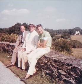
COURSE OF THE RIVER MOLE 19TH C. HAND-COLORED MAPDated 1848. Dimensions: (Frame) H 15" x W 22", (Sight) H 9.5" x W 16.5" Condition: Toning to mat. Crease down center from folding. Light wear to frame.See Sold Price
Sold19thc Hand-colored Harper's Weekly Engravings, St.Pair of 1861 Harper's Weekly pages with hand-colored maps & engravings of river boats, The Mississippi River, St Louis & Jefferson City. Four hand-colored engravings total between 2 pages dated July 6See Sold Price
SoldLot of 5 prints including Victorian chromolithograpLot of 5 prints including Victorian chromolithograph farm scene, hand colored large folio print "View of Portsmouth in Piscataqua River (probably late 19thc - with water damage to mat), map of GreaterSee Sold Price
SoldJohnson's 19th c. Map of the Vicinity of RichmondHand colored. Full Title: ohnson's Map of the Vicinity of Richmond, Peninsular Campaign in Virginia. Showing also the interesting localities along the James, Chickahominiy and York Rivers. . . ConsideSee Sold Price
SoldA GROUP OF 13 BEAUTIFULLY FRAMED 17TH-19TH CENTUA GROUP OF 13 BEAUTIFULLY FRAMED 17TH-19TH CENTURY HAND-COLORED MAPS including Russia, c. 1750, after M. deL'Isle, 7 inches x 10.25 inches; also from Travels to the Source of the Missouri River and AcSee Sold Price
SoldFramed map Danubius Fluvius Maximus, A Fontibus AdFramed map Danubius Fluvius Maximus, A Fontibus Ad Ostia, c. 1636-1642, map maker J. Jansson, depicts the Course of the Danube River from its sources in the Alps to the Black Sea, hand colored, most lSee Sold Price
Sold19th c. Hand-colored map19th c. Hand-colored map- ''Nouveau Plan du Port et de la ville D'Acapulco situee dans la Nouvelle Es Pagne sur la Cote de la Mer du Zud'', laid down, some age staining throughout. 16 1/4 x 22''See Sold Price
Sold19th c. Hand-colored map19th c. Hand-colored map- of Turkey in Europe and Hungary- engraved for Carey's American edition of Gutherie's Geography improved, some age toning. 13 x 14''See Sold Price
Sold6 19th c. hand-colored maps of Asia6 19th c. hand-colored maps of Asia- ''Map of Asia Showing Its Political Divisions''; ''Map of Hindoostan, Farther India, China and Tibet''; ''China''; ''Asia'' (2 copies); Russia in Asia and Tartary'See Sold Price
Sold19th C Hand Colored Map of State of Maine FRAMEDPublished by S.Augustus Mitchell, Jr. having a published date year of 1860. This hand colored map contains maps of the various countries of the world and plans of cities. Inset at lower right featuresSee Sold Price
Sold18th / 19th c. hand-colored map18th / 19th c. hand-colored map- ''Nuova / e corretta carta dell' / Indie Occidentali / cavata dalle migliori / autorita''. 10 5/8 x 13 1/2''See Sold Price
SoldBiloxi Bay, 19th c., hand colored map, framed, H.Biloxi Bay, 19th c., hand colored map, framed, H.- 14 1/2 in., W.- 16 1/2 in.See Sold Price
Sold"Johnson's West Indies," 19th c., hand colored map,"Johnson's West Indies," 19th c., hand colored map, framed, H.- 15 1/2 in., W.- 21 1/2 in.See Sold Price
19th C. Hand Colored Map of the Black SeaHand-colored map of the Black Sea and surrounding countries, print, depicting countries of Asia Minor and East Europe, published by Grays circa 1877, featuring European Russia, Turkey and Austria-HungSee Sold Price
Sold(3) 19th c. hand colored maps of ConnecticutGrouping of three circa 1867 hand colored maps and one black and white advertisement from the "Atlas of New York and Vicinity" by Beers, Ellis & Soule, the drawings based on land surveys performed undSee Sold Price
Sold(4) 19th c. hand colored maps of ConnecticutGrouping of four circa 1867 hand colored maps and one black and white advertisement from the "Atlas of New York and Vicinity" by Beers, Ellis & Soule, the drawings based on land surveys performed undeSee Sold Price
Sold(4) Mid 19th c. hand colored maps of New YorkGrouping of four circa 1867 hand colored maps and one black and white advertisement from the "Atlas of New York and Vicinity" by Beers, Ellis & Soule, the drawings based on land surveys performed undeSee Sold Price
Sold(3) 19th c. hand colored maps of ConnecticutGrouping of three circa 1867 hand colored maps from the "Atlas of New York and Vicinity" by Beers, Ellis & Soule, the drawings based on land surveys performed under the direction of F.W. Beers, includSee Sold Price
Sold(4) Mid 19th c. hand colored maps of New YorkGrouping of four circa 1867 hand colored maps from the "Atlas of New York and Vicinity" by Beers, Ellis & Soule, the drawings based on land surveys performed under the direction of F.W. Beers, includeSee Sold Price
Sold(3) Mid 19th c. hand colored maps of New YorkGrouping of three circa 1867 hand colored maps from the "Atlas of New York and Vicinity" by Beers, Ellis & Soule, the drawings based on land surveys performed under the direction of F.W. Beers, includSee Sold Price
Sold(4) 19th c. hand colored maps of ConnecticutGrouping of four circa 1867 hand colored maps from the "Atlas of New York and Vicinity" by Beers, Ellis & Soule, the drawings based on land surveys performed under the direction of F.W. Beers, includeSee Sold Price
Sold(4) Mid 19th c. hand colored maps of New YorkGrouping of four circa 1867 hand colored maps from the "Atlas of New York and Vicinity" by Beers, Ellis & Soule, the drawings from surveys by and under the direction of F.W. Beers, includes (1) PlansSee Sold Price
Sold(4) 19th c. hand colored maps of ConnecticutGrouping of four circa 1867 hand colored maps and one black and white advertisement from the "Atlas of New York and Vicinity" by Beers, Ellis & Soule, the drawings based on land surveys performed undeSee Sold Price
Sold(4) 19th c. hand colored maps of ConnecticutGrouping of four circa 1867 hand colored maps from the "Atlas of New York and Vicinity" by Beers, Ellis & Soule, the drawings based on land surveys performed under the direction of F.W. Beers, includeSee Sold Price
Rare 19thc German Handcolored Costume Plates, 17thc NobilityConnoisseur Auctions4(333)See Sold PriceMar 02, 2024
(13) 19th C. Prints Great Homes of Britain PrintsEpic Auctions and Estate Sales4.6(204)See Sold PriceMar 02, 2024
Pr. English 19th C. Floral Botanical PrintsEpic Auctions and Estate Sales4.6(204)See Sold PriceMar 02, 2024
Johann Homann Hand-Colored Map Engraving, c. 1730Auctions at Showplace4.5(726)See Sold PriceMar 17, 2024
Map: A 19thC engraved and hand coloured map of Buckingham titled A New Map of BuckinghamshireClaydon Auctioneers Ltd4.3(125)See Sold PriceFeb 26, 2024
Two Hand-Colored 19th Century Maps of New Orleans and Louisiana, Larger- H.- 12 1/2 in., W.- 15 1/2Crescent City Auction Gallery4.3(229)See Sold PriceMar 08, 2024
T. Rowlandson (19th C) Hand Colored Engravings (2)Keystone Auction LLC4.6(922)See Sold PriceMar 01, 2024
Rare 19thc German Handcolored Costume Plates, ByzantinesConnoisseur Auctions4(333)See Sold PriceMar 16, 2024
Rare 19thc Handcolored Costume Plates, 15thc KnightsConnoisseur Auctions4(333)See Sold PriceMar 16, 2024
Rare 19thc Colton Map, Argentine Republic, Chile, Uruguay, PataguayConnoisseur Auctions4(333)See Sold PriceMar 16, 2024
Napoleon Bonaparte Hand-Colored Engraving, 19th C.Auctions at Showplace4.5(726)See Sold PriceApr 16, 2024