SoldSet of 3 Hawaiian Island Maps, published at WashiSet of 3 Hawaiian Island Maps, published at Washington, D.C., by the U.S. Coast and Geodetic Survey, some with plot points marked: 1) Oahu to Niihau, Mar 1931, 2) Hawaii to Oahu, Jun 1928, 3) Hawaii,See Sold Price
SoldMaps, Oahu Hawaiian Islands(lot of 3) Hawaiian School (20th century), "Oahu Hawaiian Islands," copper-engraved map with hand-painting, reproduced in 1984, "General Map of the Island of Maui" copper-engraved map with hand-paintiSee Sold Price
Bruce, James 1813 Set of 3 Maps. Battle of SerbraxosCopper Plate Published 1813, Edinburgh for "Travels to discover the source of the Nile" by James Bruce. Paper Size: 12 x 9.5 inch (30 x 24cm) Water stain in top margin/title, otherwise fineSee Sold Price
SoldMap of Hawaii with steamship routesHeading: (Hawaii) Author: Title: Map of Hawaiian Islands showing steamship routes of the Inter-Island Steam Navigation Co., Limited Place Published: Honolulu, Hawaii Publisher:Inter-Island Steam NaviSee Sold Price
Map of Hawaii with steamship routesHeading: (Hawaii) Author: Title: Map of Hawaiian Islands showing steamship routes of the Inter-Island Steam Navigation Co., Limited Place Published: Honolulu, Hawaii Publisher:Inter-Island Steam NaviSee Sold Price
SoldBartholomew, John 1922 Lot of 3 Maps. PacificSouth Pacific Ocean, North Pacific Ocean and Islands of Oceania. Large Lithograph Maps Published 1922 by The Times, London for "The Times Survey Atlas of the World" Maps by John George Bartholomew ofSee Sold Price
SoldBartholomew, John 1922 Group of 3 Maps of the Pacific"South Pacific Ocean" "North Pacific Ocean" and "Islands of Oceania" Large Lithograph Maps Published 1922 by The Times, London for "The Times Survey Atlas of the World" Maps by John George BartholomewSee Sold Price
Bartholomew, John 1922 Group of 3 Maps of the Pacific"South Pacific Ocean" "North Pacific Ocean" and "Islands of Oceania" Large Lithograph Maps Published 1922 by The Times, London for "The Times Survey Atlas of the World" Maps by John George BartholomewSee Sold Price
Bartholomew, John 1922 Group of 3 Maps of the Pacific"South Pacific Ocean" "North Pacific Ocean" and "Islands of Oceania" Large Lithograph Maps Published 1922 by The Times, London for "The Times Survey Atlas of the World" Maps by John George BartholomewSee Sold Price
SoldMap & view of Hawaii, c.1785Heading: (Hawaii) Author: Title: French map of the Hawaiian Islands & view of Karakakooa, framed together. Place Published: Paris Publisher: Date Published: c.1785 Description:See Sold Price
SoldJordan (David Starr) and Barton Warren Evermann. TJordan (David Starr) and Barton Warren Evermann. The Aquatic Resources of the Hawaiian Islands,first edition, 3 vols., chromolithograph and photographic plates, large folding colour map in reaSee Sold Price
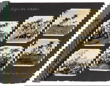
SoldShipwrecked On HawaiiMan is being entertained by a semi-nude Hawaiian woman. Published by Island Curio Co., Steiner, Hol., HI, # 2, 3, 4, 5, 6. All real photos of various views of Hawaiians. Six pieceSee Sold Price
Maldive Islands - Indian Ocean, 3 sheets, BritishTitle/Content of Map: Maldive Islands - Indian Ocean, 3 sheets, British Admiralty Charts 66a, 66 b and 66c, published in 1839 Date Printed: Sheet 1 Engraved: 1839 Edition: 1918 Sheet 2 Engraved: 1839See Sold Price
Maldive Islands - Indian Ocean, 3 sheets, BritishTitle/Content of Map: Maldive Islands - Indian Ocean, 3 sheets, British Admiralty Charts 66a, 66 b and 66c, published in 1839 Date: Sheet 1 Engraved: 1839 Edition: 1918 Sheet 2 Engraved: 1839 Edition:See Sold Price
General Progress Sketch Hawaiian Islands | Porto RicoTitle/Content of Map: General Progress Sketch Hawaiian Islands | Porto Rico Date Printed: 6/30/1910 Cartographer: U.S. GEOLOGICAL SURVEY Size: 14X14.3 Two maps on same sheet. Shows triangulated areas,See Sold Price
Maldive Islands - Indian Ocean, 3 sheets, BritishTitle/Content of Map: Maldive Islands - Indian Ocean, 3 sheets, British Admiralty Charts 66a, 66 b and 66c, published in 1839 Date: Sheet 1 Engraved: 1839 Edition: 1918 Sheet 2 Engraved: 1839 Edition:See Sold Price
Sold(3) ASSORTED VINTAGE FRAMED MAP SECTIONS - Long island(3) ASSORTED VINTAGE FRAMED MAP SECTIONS - Long island map set in serving tray; (2) French map supplements framed - Condition: Age appropriate wear; All items sold as is.See Sold Price
SoldSet of four celestial maps published by F. J. HunSet of four celestial maps published by F. J. Huntington, 1835, 13 3/4'' x 13''.See Sold Price
SoldMitchell: Antique Map of Pacific Ocean Islands, 1869Title/Content of Map: Pacific Ocean Islands with Australia Date Printed: 1869 Cartographer: Augustus S. Mitchell Material/Medium: Paper Size: 15 1/3" x 12" Hand colored engraved Map. Published in PhilSee Sold Price
SoldFlora of the Hawaiian Islands 1888Title: Flora of the Hawaiian Islands: A Description of Their Phanerogams and Vascular Cryptograms Author: Hillebrand, William Description: xcvi, 673 pp. 4 maps at rear (3 folding). (8vo) original blacSee Sold Price
Marvelous pictorial map of HonoluluHeading: (Hawaii) Author: MacLeod, Alexander Samuel Title: A map of Honolulu and the Sandwich Islands, which we now call the Hawaiian Islands Place Published: New York Publisher:Henry M. Snyder DSee Sold Price
Soldfauna Fauna Hawaiiensis: being the Land-Fauna offauna Fauna Hawaiiensis: being the Land-Fauna of the Hawaiian Islands, edited by David Sharp, 12 parts in 3 vol., 12 photogravure portraits and plates, double-page map and 69 lithographed platSee Sold Price
Sold4 TN & KY Maps, 3 Framed1st item: "Tennessee" Map, by Anthony Finley, engraved by Young and Delleker, published by Anthony Finley, Philadelphia, 1824. From "A New General Atlas, Comprising a Complete Set of Maps" by AnthonySee Sold Price
Bay of Bengal - East Coast, sheet 3 Koronge Island toTitle/Content of Map: Bay of Bengal - East Coast, sheet 3 Koronge Island to White Point British Admiralty Chart 823, published in 1873 Date Printed: 1873 Cartographer: British Admiralty Material/MediuSee Sold Price
DAVID ROBERTS - Holy Land / Syria / Egypt etc. 3 x Folio Volumes 1849 Very RareLuis Porretta Fine Arts4.3(10)See Sold PriceMar 02, 2024
LATE 17TH C. FRENCH MAP OF THE NEW WORLD BY ALEXIS-HUBERT JAILLOT (1632-1712)Thomaston Place Auction Galleries4.4(393)See Sold PriceFeb 24, 2024
VENET / DEBUCOURT (1755-1832) Set 3 x Aquatint Engraved Hunting Scenes 23" x 16"Luis Porretta Fine Arts4.3(10)See Sold PriceMar 02, 2024
The Secret Diary of Harold L. Ickes, 3 Volumes, hardcover , 1954Cain Modern Auctions4.4(45)See Sold PriceFeb 28, 2024
Chatelain - 3 Maps of the British Isles (England, Ireland, Scotland)Trillium Antique Prints & Rare Books4.5(32)See Sold PriceFeb 24, 2024
Donovan's The Natural History of British Shells - 5 Volumes in 3 Books with 180 EngravingsTrillium Antique Prints & Rare Books4.5(32)See Sold PriceFeb 24, 2024
Coast & Islands between Cape Roxo. Guinea-Bissau & Bissagos. KITCHIN 1745 mapJasper524.5(9.9k)See Sold PriceFeb 28, 2024
Blackie (Pub) 1882 Folio Map. West India Islands & Central AmericaAlbion Auctions4.7(341)See Sold PriceMar 01, 2024
Set of 3 Gentlemen’s Fashion Prints - Journal des Dames et des Modes: Men’s FashionProverde Auctions4.3(3)See Sold PriceFeb 28, 2024
Paul Louis Oudart - Set of 3 Antique Prints - Herpetology, Reptile - Bernard Germain Etienne De LaProverde Auctions4.3(3)See Sold PriceFeb 28, 2024
Per Olof Christopher Aurivillius (1843-1928) - Set of 3 Prints - ButterfliesProverde Auctions4.3(3)See Sold PriceFeb 28, 2024
Per Olof Christopher Aurivillius (1843-1928) - Set of 3 Prints - Butterflies - ScandinaviaProverde Auctions4.3(3)See Sold PriceFeb 28, 2024
Set of 3 Maps - Netherlands - Belgien - Switzerland - J. BarlowProverde Auctions4.3(3)See Sold PriceFeb 28, 2024
PAVEL MURATOV 2008 IMAGES OF ITALY BOOKS IN 3 VOLAntique Arena Inc.4.5(878)See Sold PriceJun 15, 2024