SoldGill (M.) Wondergound Map of London TownGill (MacDonald) The Wondergound Map of London Town,The heart of Britain's Empire, Here is spread out for your view, It shows how many stations, And bus routes not a few, You have not the timeSee Sold Price
SoldThe Wonderground Map of London Town 1915 MacDonalLeslie MacDonald Gill (1884-1947), "The Wonderground Map of London Town," London, 1915. This highly detailed and eye-catching map was commissioned by the London Underground to entertain passengers waiSee Sold Price
SoldGILL, Macdonald (1884-1947) Wonderground Map of LoGILL, Macdonald (1884-1947) Wonderground Map of London Town,lithograph in colours, 1914, cond B+, printed and published by The Westminster Press, not backed 29 1/2 x 37 in. (75 x 94cm.)See Sold Price
The Wonderground map of London Town, drawn by MacdonaldThe Wonderground map of London Town, drawn by Macdonald Gill, printed and published by The Westminster Press, London 1924, 93.5cm x 75cmSee Sold Price
Sold1928 MacDonald Gill Pictorial Map of London -- TheTitle/Content of Map: 1928 MacDonald Gill Pictorial Map of London -- The Wonderground Map of London Town Date: 1928, London Cartographer: L MacDonald Gill Size: 30 X 37 in. This is rare, rather largeSee Sold Price
SoldSouthern Railway London Town Wall MapSouthern Railway London town wall map, 38"h x 50"w, 55"w (rod).See Sold Price
GILL, Macdonald (1884-1947) after LONDON TOWN, BriGILL, Macdonald (1884-1947) after LONDON TOWN, British Railwayslithograph in colours, c.1955, printed by Chromoworks Ltd., London cond B, not backed 40 x 50in. (102 x 127cm.)See Sold Price
SoldGREAT BRITAIN -- Richard DIGHTON. Characters at thGREAT BRITAIN -- Richard DIGHTON. Characters at the West End of the Town.London: Thomas M'Lean, 1825 [plates watermarked 1822]. Small folio (355 x 250 mm). 40 hand-colored etched plates. LaSee Sold Price
SoldM.F.K. Fisher Map of Another Town inscribedHeading: Author: Fisher, M.F.K. Title: Map of Another Town. A Memoir of Provence Place Published: Boston Publisher:Lit Date Published: [1964] Description: (8vo) cloth, dustSee Sold Price
SoldFarjeon, Eleanor. 6 Titles. Lon: Mostly Collins,Farjeon, Eleanor. 6 Titles. Lon: Mostly Collins, vd. Mostly 8vo. Original cloth. Largely very good. Illustrated. Mostly 1st editions. ++ Nursery Rhymes Of London Town. Macdonald Gill illus. (1916). ++See Sold Price
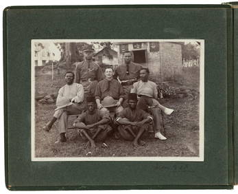
SoldSport British East AfricaProfit and sport in British East Africa. Being a Second Edition , Revised and Enlarged, of "A Colony in the Making" by Capt. The Lord Cranworth, M.C. with Maps and Illustrations. London Macmillan 1919See Sold Price
SoldTiddeman, Map of New YorkTIDDEMAN, Mark (fl. c. 1724 - c. 1760). Draught of New York from the Hook to New York Town (Map). Engraving. London: Mount & T. Page upon Tower Hill. 18 1/2" x 23" visible, 20 1/2" x 24 3/4" framed. CSee Sold Price
Sold2 1778 English Sterling Silver Serving Spoons, Mo2 1778 English Sterling Silver Serving Spoons, Monogrammed M.H.S and M.W.S. Town Mark "London" crowned leopard's head (1478 – 1822), Date letter 1778, Makers mark T.C. 8 1/4" long, 1.60 troy ouncesSee Sold Price
1784 Map of Ancient AthensAuthor: Barbie Title: 1784 Map of Ancient Athens Medium: Ink on Paper Dimensions: 14"X10" Description: Map of ancient Athens dated 1784. Drawn and engraved by M. Barbie. Published London Map is basedSee Sold Price
1784 Map of Ancient AthensAuthor: Barbie Title: 1784 Map of Ancient Athens Medium: Ink on Paper Dimensions: 14'X10" Map of ancient Athens dated 1784. Drawn and engraved by M. Barbie. Published London Map is based on the voyageSee Sold Price
Sold6 1781 English Sterling Silver Teaspoons. Monogra6 1781 English Sterling Silver Teaspoons. Monogrammed M.A.J., Town Mark "London" crowned leopard's head (1478 – 1822), Date letter 1781, Makers mark W.B. 5 1/4" long, .51 troy ounces each.See Sold Price
SoldWhitbread (Josiah) Reduced Ordnance Map of LondonWhitbread (Josiah) Reduced Ordnance Map of London,showing from Kentish Town down to Denmark Hill, and Bow across to Notting Hill, lithograph, with some hand-colouring, 570 x 815mm., linen-backSee Sold Price
LONDON antique town city map plan. Building profiles.TITLE/CONTENT OF MAP: 'LONDON' The top image on the right hand side shows the entire map. To view a close up of the map showing the level of printed detail, please click on the bottom image on the rigSee Sold Price
LONDON antique town city map plan. Building profiles.TITLE/CONTENT OF MAP: 'LONDON' This map is folding hence the centrefold line may show on the image below DATE PRINTED: This map was originally published by Baldwin & Cradock in 1836; this date is prinSee Sold Price
LONDON antique town city map plan. Building profiles.TITLE/CONTENT OF MAP: 'LONDON' DATE PRINTED: This map was originally published by Baldwin & Cradock in 1836; this date is printed on the map. This edition of the map was printed and published by ChapmSee Sold Price
LONDON antique town city map plan. Building profiles.TITLE/CONTENT OF MAP: 'LONDON' The top image on the right hand side shows the entire map. To view a close up of the map showing the level of printed detail, please click on the bottom image on the rigSee Sold Price
LONDON antique town city map plan. Building profiles.TITLE/CONTENT OF MAP: 'LONDON' DATE PRINTED: This map was originally published by Baldwin & Cradock in 1836; this date is printed on the map. This edition of the map was printed and published by ChapmSee Sold Price
LONDON antique town city map plan. Building profiles.TITLE/CONTENT OF MAP: 'LONDON' DATE PRINTED: This map was originally published by Baldwin & Cradock in 1836; this date is printed on the map. This edition of the map was printed and published by ChapmSee Sold Price
LONDON antique town city map plan. Building profiles.TITLE/CONTENT OF MAP: 'LONDON' This map is folding hence the centrefold line may show on the image below DATE PRINTED: This map was originally published by Baldwin & Cradock in 1836; this date is prinSee Sold Price
Hammonds Map of Kentucky and Tennessee Railroads-1910JM Hobby Supply and Railroad Artifact Auctions4.4(126)See Sold PriceFeb 24, 2024
Kenyons Pocket Map and Shippers Guide of Wisconsin-1914JM Hobby Supply and Railroad Artifact Auctions4.4(126)See Sold PriceFeb 24, 2024
HONEST JOHN OLIVER by James Morton 1st Edition Inscribed by Author ScarceLuis Porretta Fine Arts4.3(10)See Sold PriceMar 02, 2024
FRANK MARMINGTON c1910 National Gallery Canada Signed Engraving London St. Pauls 20" x 16"Luis Porretta Fine Arts4.3(10)See Sold PriceMar 02, 2024
Judaean Lead Sealing with Menorah and InscriptionTimeLine Auctions Ltd.4.6(182)See Sold PriceMar 07, 2024
1937 Holland, Michigan, Tulip Time Map Guide, FramedLakeshore Event Center4.6(105)See Sold PriceMar 02, 2024
"Map of the Parishes of Iberville Most of West Baton Rouge and Including Parts of the Parishes ofCrescent City Auction Gallery4.3(231)See Sold PriceMar 09, 2024
Ornately Carved Walnut English Aneroid BarometerKeystone Auction LLC4.6(927)See Sold PriceMar 01, 2024
Churchill & Nieuhof 1744 Folio Map. Batavia Indonesia East IndiesAlbion Auctions4.6(341)See Sold PriceMar 01, 2024