(2) UNITED STATES & NORTH AMERICA, 1910 MAPS
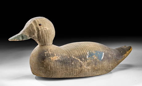
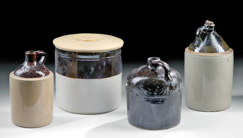
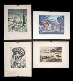
Arrowsmith & Lewis - Map of the United StatesFeb 24, 2024Carey, pub. 1796 - Map of the Tennassee State formerly part of North Carolina (Tennessee)Feb 24, 20242 vols. Who's Who in Colored AmericaMar 07, 2024Zebulon Pike's Exploratory Travels 1st U.K. edMar 07, 2024Large map of the Americas 1794Mar 07, 202415 Maps of North America 1st half of 19th centuryMar 07, 2024Texas Brags humorous pictorial mapMar 07, 2024Large wall map of U.S. & Central AmericaMar 07, 2024Wall map of North America 1856Mar 07, 202420th C. American Wood Decoy Mallard DuckFeb 26, 2024Early 20th C. American Pottery Jugs & CrockFeb 26, 20241930s American Etchings, Original Ltd. Editions (4)Feb 26, 2024Blackie (Pub) 1882 Folio Map. West USA - Pacific StatesMar 01, 2024Blackie (Pub) 1882 Folio Map. United States of North AmericaMar 01, 2024Authentic! Verdura 18k Yellow Gold 22k Yellow Gold $10 US Coin Pin BroochMar 02, 2024Map of United States of North America, 1785Mar 14, 202420th C. American Clarinet by Romain BraudeFeb 26, 20241930s Gilded Porcelain Box Adorned w/ Roman BustFeb 26, 2024MAPS, United States, Scarborough Co.Mar 12, 2024MAP, Eastern US, StockdaleMar 12, 2024ENGRAVING, Native American, McKenneyMar 12, 2024Native American Woodlands Game DiscoidalsMar 01, 2024Early 19th C. American Hide Document BoxMar 01, 2024Early 1800s American Hide Stagecoach TrunkMar 01, 2024 


![[NORTH AMERICA]. A group of 2 engraved maps of (1 of 3)](https://p1.liveauctioneers.com/197/151909/76680358_1_x.jpg?height=282&quality=70&version=1570472488)