mixed group of maps of WalesKitchin (Thomas) An Accurate Map of Carmarthen Shire; An Accurate Map of Glamorgan Shire,2 maps on one sheet, each with an inset view of Carmathen and Cardiff, respectively, the lower map withSee Sold Price
SoldA small, mixed gruop of maps of WalesA small, mixed group of maps of Wales, the Mail Roads between Holyhead and Bangor Ferry, the Holyhead road in the county of Salop, the Menai Strait including the Site of the New Bridge & TheSee Sold Price
SoldA small, mixed group of maps of OceaniaOceania.- A small, mixed group of maps of Oceania, including New South Wales with an inset plan of Sydney, several of Polynesia and the Pacific Islands, by or for De La Rochette, Edward WellerSee Sold Price
SoldMiscellany.- A mixed, group of maps and views-. A mixed group of maps, views and decorative items,including maps of the City of Dublin (Sewers) , North Wales, Worcestershire, Northamptonshire, Westmorland, Warwickshire, Staffordshire, viSee Sold Price
SoldBritish Isles.- Mixed group of mapsMixed group of maps of the British Isles,comprising c.65 sectional maps from Cary's New Map of England and Wales, 4to,1794, and c.130 strip road map sheets, most with maps printed both sides,See Sold Price
SoldMiscellany.- A mixed group of maps,Miscellany.- A mixed group of maps, including facsimilies of 16th & 17th maps by Blaeu, Mercator and others, and of England, Scotland and Wales by Ortelius, with a quantity of printed maps incSee Sold Price
SoldA mixed group of maps of the British IslesA large mixed group of maps of the British Isles, including several county maps, small road maps (10), and others of England, Wales, Scotland and Ireland, engravings and lithographs, severalSee Sold Price
SoldBritain.- a mixed group of mapsa mixed group of maps, the entire British Isles, also national and regional maps of England and Wales, Scotland, and Ireland, by or after Rapin, Macpherson, Dower and others, engraved or lithSee Sold Price
SoldBENG A large mixed group of maps of the U.K.BENG A large mixed group of maps of the U.K.including editions of Bartholomew's Half-Inch to Mile Map of England & Wales, with editions of Ordnance Survey New Popular Edition One-Inch MapsSee Sold Price
SoldA Small Group Of Maps Of The British IslesA Small, Mixed Group Of Maps Of The British Isles, including several of Scotland (7), Ireland (5), England and Wales (12), by S.Hall, J. Bartholemew, and others, lithographs and engravings, vSee Sold Price
SoldJigsaw. World. - A mixed group of jigsaw mapsincluding a set of 6 continents with England and Wales by Bacon, colour-printed on square cut cardboard, each 200 x 245mm., all supplied with key maps, stamped Made in Bavaria ; a group of 4 also by BSee Sold Price
SoldWales.- A small, mixed group of county mapsWales.- A small, mixed group of county mapsby or after Walker, Weller, Pigot and others, including Monmouthshire, Glamorganshire and elsewhere with a plan of Cardiff, engraved maps, some hand-See Sold Price
SoldEngland and Wales.- a small, mixed, group of counA small, mixed, group of county maps,including a small Morden map of Hertfordshire, a Moll map of Cambridgeshire, Owen and Bowen's The Road from Prestain to Carmarthen, and Caermarthen ShireSee Sold Price
SoldEngland- mixed group of county mapsA small, mixed, group of county maps,Leicestershire, Bedfordshire and Cambridgeshire, several of the latter including duplicates, also duplicate city plans of Oxford and a map of England andSee Sold Price
SoldGreek Islands.- a mixed group of maps and plansGreek Islands.- a mixed group of maps and plans,including Tobias Conrad Lotter's Graeciae Antiquae Designatio Nova ..., and with maps by or after Kauffer, Tardieu, d'Anville, and others, engraSee Sold Price
Soldmixed group of maps (A)mixed group of maps (A)including a Seutter map, Ducatus Sabaudiae Principat Pedemonti, and antique and modern maps of Italy, by or after Seale, Neele, and others, v.s., largest 500 x 590mm.,See Sold Price
SoldMediterranean.- A mixed group of maps and plansMediterranean.- A mixed group of maps and plans,including 43 maps by Joseph Roux, from 'Plans et Rades de la Méditerraneé', and others by or after Tardieu, Bernard, Gouffier, and others, engraSee Sold Price
SoldEurope.- a small mixed group of mapsEurope.- a small mixed group of maps,including 5 maps of Spain and Portugal, and maps of Greece, Sicily, and Corsica, by or after Vandermaelen, Tardieu, Alt, and others, engravings, some hand-See Sold Price
SoldWest Indies.- - A small mixed group of maps,comprising A New and Accurate Map of the Island of Antigua or Antego, by Emanuel Bowen; Map of the Island of Tobago, by Bryan Edwards; The Island of St Christophers alias St. Kits, by Herman Moll; PiaSee Sold Price
SoldItaly.- a mixed group of mapsItaly.- a mixed group of maps,general and regional maps, by or after Tardieu and Pachoux, engravings, v.s., largest 480 x 670mm, central vertical folds, some tears affecting the folds, minor sSee Sold Price
SoldA mixed group of maps of Japan, China & Korea-. A mixed group of maps of Japan, China and Korea, Formosa, Central China, Cochinchina, Loochoo & Formosa, the Canton river from Macau to Hong Kong, by, for or after Francis Garnier, P. BinetSee Sold Price
SoldSDUK. A large mixed group of mapsSDUK. A large mixed group of mapsregional and country maps including Russia, several of Italy and elsewhere, engraved maps, hand-coloured outlines, 390 x 310mm., [1845]; with 8 other maps of ISee Sold Price
SoldA mixed group of maps of India, East Asia, and RuA mixed group of maps of India, East Asia, and Russia,by Wyld, Cadell & Davies, de L'Isle, F.A. Garnier, Bonne, and many others, including a Chanlaire & Mentelle map of Russia in Europe, engrSee Sold Price
Solda mixed group of maps and plansa mixed group of maps and plans,including maps by or after Blome, Bowen, Arrowsmith, and others, mainly of the Middle East, particularly of the Levant, with a small section of plates relatingSee Sold Price
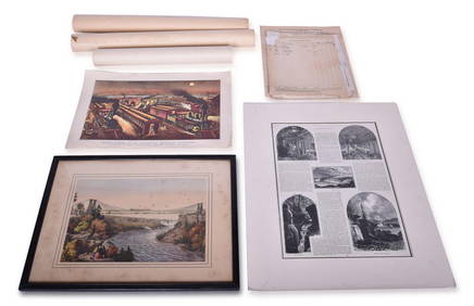
Mixed Group of Railroad Paper - 1895 Telegraph Registers, Art Prints, Profile Blueprint, Way-Bills,Rail & Road Auctions4.6(165)See Sold PriceMar 07, 2024
Mixed Group of Railroad Paper - Nickel Plate Road, Norfolk & Western, and WabashRail & Road Auctions4.6(165)See Sold PriceMar 07, 2024
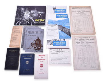
Assortment of Railroad Paper - Rule Books, Stationary, Ink Blotter, Map, Timetables, and MoreRail & Road Auctions4.6(165)See Sold PriceMar 07, 2024
Mixed Group of Railroad Paper, Cross Sections, and Ephemera - Pennsylvania, Reading, Union Pacific,Rail & Road Auctions4.6(165)See Sold PriceMar 07, 2024
Mixed Group of Eastern Railroad Uniform Cap Badges, Patches, and Pins - Amtrak, Jersey CentralRail & Road Auctions4.6(165)See Sold PriceMar 07, 2024
Group of Ten Railroad Photographs, Maps, and Prints - New Jersey, Long Island, and New YorkRail & Road Auctions4.6(165)See Sold PriceMar 07, 2024
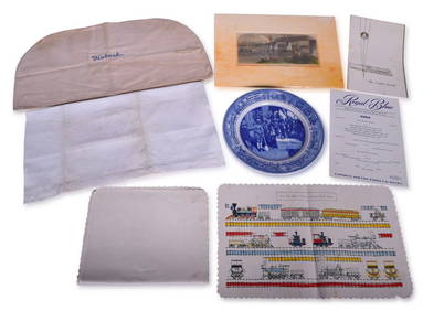
Mixed Group of Railroad Items - Baltimore & Ohio Railroad Menus, Sesquicentennial Plate, WabashRail & Road Auctions4.6(165)See Sold PriceMar 08, 2024
Mixed Group Sterling and Silver PlateBroken Arch Auction Gallery NCFL#93994.6(300)See Sold PriceMar 04, 2024
Mixed group of Lionel postwar O accessoriesToystrainsandotheroldstuff LLC4.8(444)See Sold PriceMar 02, 2024
Mixed Group of Ten American Federal Carved Mahogany Dining Chair, early 19th c., Largest Armchair-Crescent City Auction Gallery4.3(231)See Sold PriceMar 09, 2024
Mixed Group of Small Steiff - Mouse, Hedgehog, Pig and MoreAmanda Auction Gallery, LLC4.4(23)See Sold PriceMar 03, 2024