18/19TH C. WEST INDIES MAPS, 218/19TH C. WEST INDIES MAPS, 2, 18" X 21 & 19" X 25": ANTILLES BY S. ROBERT, 1750; BAHAMAS, C. 1827:Both hand colored; Antilles Islands, signed and dated, 19 1/4" x 24 5/8", 21 3/4" x 32 1/4" paper, cSee Sold Price
18/19TH C. MAPS OF THE WEST INDIES, 518/19TH C. MAPS OF THE WEST INDIES, 5, 10" X 8" TO 18 3/4" X 13":Sizes are plate sizes. St. St. Dominica, by M. Bellin, "Suivant la Decouverte de l'Anne 1492", 1754, hand colored, Tom XII No. 2, 9" XSee Sold Price
Sold"Johnson's West Indies," 19th c., hand colored map,"Johnson's West Indies," 19th c., hand colored map, framed, H.- 15 1/2 in., W.- 21 1/2 in.See Sold Price
SoldVarious. 2 maps of the West Indies. c.1740/1817.[Caribbean] 2 maps. (1) Homann Heirs. Dominia Anglorum in Praecipuis Insulis Americae ut sunt Insula S. Christophori Antegoa Iamaica Barbados nec non Insulae Bermudes vel Sommers. c.1740. Engraved mapSee Sold Price
Sold(16) 19TH C. MAPS OF THE WEST INDIES IN FOLIO,Including: "L'Isle de Ste. Domingue, et celle de Porto Rico", by Bonne, hand colored engraving,1778, 10" x 14 1/2"; PLUS "West Indies", Smith's Atlas, 1808, hand colored engraving, 1808, 11" x 14"; PLSee Sold Price
SoldVan Keulen west indies mapVan Keulen, Johannes (1654-1715). Pascaerte van Westindien... Engraved map with original hand color. Amsterdam: J. van Keulen, c.1680. 20 1/2" x 24" visible, 33 1/2" x 36 1/2" framed.See Sold Price
Sold[Map] Seale, Richard. Map of North AmericaSeale, Richard William. A Map of North America with the European Settlements & Whatever Else is Remarkable in ye West Indies.... [London, c.1745.] Sheet measuring 505mm x 408mm. Rather toned, 2" closeSee Sold Price
Van Keulen Map of the West IndiesPascaerte van Westindien. Johannes van Keulen (1654-1715) Hand-colored Copper-engraved map. Amsterdam: J. van Keulen, c.1680. 20 1/2 x 24 inches visible, 33 1/2 x 36 1/2 inches framedSee Sold Price
SoldCOLTON, G. W. and C. B. Colton's Map of the UnCOLTON, G. W. and C. B. Colton's Map of the United States of America, the British Provinces, Mexico and the West Indies. Hand-colored engraved 2-sheet folding pocket map, 980x1130 mm overall; few scatSee Sold Price
Sold5 Framed maps of France and the West Indies.[Various] 5 maps. (1) Moll, Hermann. “The Island of Jamaica.” c.1720. (2) Bellin, Jacques. “Carte Des Isles Lucayes.” Paris, 1764. (3) “The Bermudas or Summer Islands.&rdSee Sold Price
[WEST INDIES]. West India Islands. Double-pag[WEST INDIES]. West India Islands. Double-page engraved map by Kirkwood & Sons, Edin., c.1821. 19 3/4 x 20 1/2, outline color. Very good condition. Features Dominica and Martinico, with inset map of CSee Sold Price
SoldTwo Maps by Johnson & Ward, consisting of "Prussia,Two Maps by Johnson & Ward, consisting of "Prussia, Norway, Sweden, and Denmark," 19th c., hand colored, H.- 26 1/2 in., W.- 18 1/4 in.; together with Johnson & Ward, "West Indies," 1863-1866, hand coSee Sold Price
SoldWest Indies.- [Caribbean Islands]Arrowsmith (John) [Caribbean Islands],including the Windward and Leeward Islands, and Jamaica, by John Arrowsmith, and 2 of Antigua published by W. Phillips, mixed group of c.15 engraved maps,See Sold Price
Perthes: West Indies & Central AmericaMap: West-Indien und Centro-America. Cartographer: Justus Perthes Place/Date: Gotha / 1835/c.1850 Size: 9 5/8" x 7 1/2" Condition: Wash color; overall age toning, minor browning in margins A detailedSee Sold Price
Perthes: West Indies & Central AmericaMap Title: West-Indien und Centro-America. Cartographer: Justus Perthes Place/Date: Gotha / 1835/c.1850 Size: 9 5/8" x 7 1/2" Condition: Wash color; overall age toning, minor browning in margins A detSee Sold Price
SoldPerthes: West Indies & Central AmericaMap Title: West-Indien und Centro-America. Cartographer: Justus Perthes Place / Date: Gotha / 1835/c.1850 Size: 9 5/8" x 7 1/2" Condition: Wash color; overall age toning, minor browning in margins A dSee Sold Price
SoldAncient Map Collection of 5 Printed 1790-1801This is an Ancient map Collection of 5 unframed maps Printed in London 1790-1801 Map 1) Africa 11" X 9" Map 2) West Indies 13.5" X 9" Map 3) Westphalia 1791 (Europe) 14" X 9" Map 4) Africa (Full ColorSee Sold Price
SoldMaps, West Indies, Wales(lot of 2) Framed maps, ''West Indies'' showing Posessions of the European Powers, overall: 15.5''h x 18.25''w; ''Wales,'' 20th century reproduction, overall: 15.25''h x 20''wSee Sold Price
SoldVarious. 2 maps of the West Indies. c.1740/1817.[Caribbean] 2 maps. (1) Homann Heirs. “Dominia Anglorum in Praecipuis Insulis Americae ut sunt Insula S. Christophori Antegoa Iamaica Barbados nec non Insulae Bermudes vel Sommers.” c.1740See Sold Price
SoldEarly MapsLot (2) early unframed maps "WEST INDIES" (London, (E) Published By Charles Wilson..., 26" x 39 1/2"), "LONG ISLAND SOUND" (London, 27 1/4" x 40 1/4").See Sold Price
SoldMELISH, JOHN. A Geographical Description of thMELISH, JOHN. A Geographical Description of the United States, with the Contiguous Countries, including Mexico and the West Indies. 13 engraved maps. 8vo, publisher's 1/2 roan, covers detached, wear aSee Sold Price
WEST INDIES. Caribbean Windward Leeward Islands Antilles. BARTHOLOMEW 1924 mapTITLE/CONTENT OF MAP: 'West Indies Section 2; Inset maps of Porto Rico; Trinidad' DATE PRINTED: 1924 IMAGE SIZE: Approx 22.0 x 34.0cm, 8.75 x 13.5 inches (Large) TYPE: Vintage colour map; Scale 1:5,00See Sold Price
WEST INDIES. Caribbean Windward Leeward Islands Antilles. BARTHOLOMEW 1924 mapTITLE/CONTENT OF MAP: 'West Indies Section 2; Inset maps of Porto Rico; Trinidad' DATE PRINTED: 1924 IMAGE SIZE: Approx 22.0 x 34.0cm, 8.75 x 13.5 inches (Large) TYPE: Vintage colour map; Scale 1:5,00See Sold Price
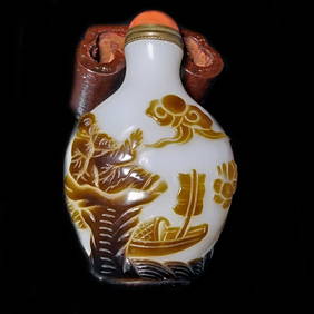
ANTIQUE CHINESE PEKING GLASS SNUFF BOTTLE 18-19TH C BROWN WHITE PEOPLE BOATSNoble House Collection Gallery4.6(124)See Sold PriceFeb 28, 2024
Willem Blaeu, Etc. 17th C. Antiquarian Maps, 2Auctions at Showplace4.6(744)See Sold PriceMar 17, 2024
Carey, pub. 1796 - Map of KentuckyTrillium Antique Prints & Rare Books4.5(33)See Sold PriceFeb 24, 2024
Carey, pub. 1796 - Map of the Tennassee State formerly part of North Carolina (Tennessee)Trillium Antique Prints & Rare Books4.5(33)See Sold PriceFeb 24, 2024
Mid Century & Vintage Postcards Germany, Paris +The Benefit Shop Foundation Inc.4.3(3k)See Sold PriceMar 13, 2024
West Indies Islands. Guadaloupe. | Mariegalante &C. | Antigua.Jasper524.5(9.9k)See Sold PriceFeb 27, 2024
Map of Part of the West Indies, Etc., Showing the Exact Position Of The U.S. War Steamer SanJasper524.5(9.9k)See Sold PriceFeb 27, 2024
West Indies. Rand, McNally & Co.'S Indexed Atlas Map of the West Indies.Jasper524.5(9.9k)See Sold PriceFeb 27, 2024
Geographical, Statistical, and Historical Map of the West Indies.Jasper524.5(9.9k)See Sold PriceFeb 27, 2024
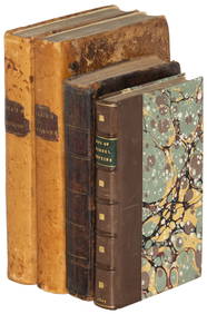
Tour of the Dutch East Indies, with exceptional platesPBA Galleries4.7(389)See Sold PriceMar 07, 2024
OLD MAP of the West Indies/ Carta Esperica/ 1804Churchill Galleries3.7(217)See Sold PriceFeb 26, 2024
Cooke, George 1801 Antique Map. West Indies CaribbeanAlbion Auctions4.7(341)See Sold PriceMar 01, 2024
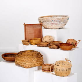
A Historic collection of 60 photographs in Albums each 20 x 25 cm, Agriculture on plantations in varHannam's Auctioneers Ltd4.3(399)See Sold PriceMar 01, 2024
Framed Tropical West Indies Map PrintRapid Estate Liquidators and Auction Gallery4.5(1.1k)See Sold PriceFeb 26, 2024


![[Map] Seale, Richard. Map of North America (1 of 4)](https://p1.liveauctioneers.com/3532/91776/46880446_1_x.jpg?height=282&quality=70&version=1469669287)


![[WEST INDIES]. West India Islands. Double-pag (1 of 0)](https://p1.liveauctioneers.com/dist/images/placeholder.jpg?height=282&quality=70)

![West Indies.- [Caribbean Islands] (1 of 1)](https://p1.liveauctioneers.com/410/16866/5605128_1_x.jpg?height=282&quality=70&version=1220278581)