SoldDES BARRES, J. F. W. [Untitled map of the environDES BARRES, J. F. W. [Untitled map of the environs of Philadelphia.]London: 1777. 2-sheet engraved map, hand-colored in outline (770 x 1055 mm). Condition: dampstaining extending from the lefSee Sold Price
SoldDES BARRES, J. F. W. A Chart of Delawar [sic] BayDES BARRES, J. F. W. A Chart of Delawar [sic] Bay with Soundings and Nautical Observations.London: 1779. Double-page engraved map (770 x 560 mm). Printed on LVG watermarked paper. ConditionSee Sold Price
SoldMAP OF BOSTON HARBOR, C. 1870, LITHOGRAPHArtist: J. F. W. DesBarres, Title: Map of Boston Harbor, Pub: A. Meisel, Date: C. 1870, Medium: Lithograph, Paper size: 28 x 40 1/2, Inscribed: Cartographer & lithographer identified within matrix, CoSee Sold Price
SoldDesBarres, Map of Cape AnnJoseph Frederick Wallet DesBarres (Swiss, 1721-1824), map of Cape Ann, inscribed "Published according to Act May 6,1776 by J. F. W. DesBarres, Esq.," framed under glass; 42" h x 29" w (view), 57" h xSee Sold Price
SoldDes Barres, J. F. W. The Coast, Rivers and Inlets ofDes Barres, J. F. W. The Coast, Rivers and Inlets of the Province of Georgia(London, February 1, 1780), copperplate engraving with hand-coloring, from the Atlantic Neptune, a monumental folio atlas ofSee Sold Price
SoldDES BARRES. A Chart of the Delaware. 1779.MAP - DES BARRES, J. W. A Chart of the Delawar [sic.] River from Bombay Hook to Ridley Creek, with Soundings &c taken by Lt. Knight.London: 1779. Hand-colored engraved map (850x640 mm). On JSee Sold Price
A View of Boston Taken on the Road to DorchesterWilliam Pierie (engraved by James Newton). engraving. Boston: J. F. W. Des Barres, 1776. 22 3/4 x 32 1/4 inches, 35 x 44 1/2 inches framed. Pre-Revolutionary War view of Boston, showing the city's earSee Sold Price
Sold[Map]. Joseph F.W. Des Barres. A chart of the harbor of<B>[Map]. Joseph F.W. Des Barres.&nbsp;</B></I><B><I>A chart of the harbor of Boston</B></I></B></I><B>.</B></I>&nbsp;41See Sold Price
SoldDes Barres Map of the Delaware RiverDES BARRES, Joseph F. W. (1721-1824). A Chart of The Delaware River from Bombay Hook to Ridley Creek,...includes insert: "A Plan of Delaware River from Chester to Philadelphia... On 15 Novr. 1777... bSee Sold Price
Des Barres Map of New YorkA Sketch of the Operations of His Majesty's Fleet and Army under the Command of Vice Admiral the Rt. Hble. Lord Viscount Howe and Genl…" Joseph F. W. Des Barres (1721-1824). from Valentine's Manual.See Sold Price
W. H. Smith & Son's Reduced Series of Ordnance Maps forTitle: W. H. Smith & Son's Reduced Series of Ordnance Maps for Tourists by J. Bartholomew, F.R.G.S.. Environs of Windermere, Coniston, &C. [Lake District] Cartographer: Smith, W.H. & Son Publisher: W.See Sold Price
SoldDes Barres, Joseph, F. W., [A Plan ofthe Posts of York and Gloucester in the Province of Virginia. Established by his Majesty’s Army under the Command of Lieut. General Earl Cornwallis, together with the Attacks under Operations of theSee Sold Price
RARE REVOLUTIONARY WAR ERA NAUTICAL CHART - Des Barres,RARE REVOLUTIONARY WAR ERA NAUTICAL CHART - Des Barres, Joseph F. W. (Joseph Frederick Wallet), 1722-1824; "Massachusetts Bay", encompassing the shore from above Cape Ann to south of Plymouth Bay, incSee Sold Price
"A View of Boston.." Engraved Aquatint after W PierrieAnd colored aquatint, "A view of Boston, taken on the road to Dorchester" after original by W. Pierrie depicts Boston Harbor, engraving by James Newton and published by Joseph F.W. Des Barres (CanadiaSee Sold Price
"A View of Boston" Aquatint after W. Pierrie EngravedAnd colored aquatint, "A view of Boston, taken on the road to Dorchester" after original by W. Pierrie depicts Boston Harbor, engraving by James Newton and published by Joseph F.W. Des Barres (CanadiaSee Sold Price
SoldNice example of Des Barres Plan of Port Royal andPort Royal in South Carolina: taken from surveys deposited at the Plantation Office. Joseph F. W. Des Barres (1722-1824). Engraving. London: Des Barres, 1777. 32 1/2 x 24 3/8 inches sheet, 41 1/2 x 33See Sold Price
Sold[The Atlantic Neptune,] Four Volumes"Published for the Use of the Royal Navy of Great Britain by Joseph F.W. Des Barres, Barre Publishers, 1966", one of 500 copies, 36 x 24 in., loose as issued in cloth folios with ribbon ties, near finSee Sold Price
Views of BostonJoseph F.W. Des Barres(1721-1824). Boston: Des Barres, 1777. Engraving with original hand color. 23 x 31 inches sheet, 32 3/4 x 40 1/2 niches framed. " Des Barres had been sent to America by the BritiSee Sold Price
Sold[MAPS] - DES BARRES, J.W. A Chart of the Delaware[MAPS] - DES BARRES, J.W. A Chart of the Delaware River from Bombay Hook to Ridley Creek ... from Chester to Philadelphia ...Hand-colored engraved chart of the Delaware River (760 x 560 mm). CSee Sold Price
SoldMAPS - DES BARRES, J.W. A Chart of the Delaware RMAPS - DES BARRES, J.W. A Chart of the Delaware River from Bombay Hook to Ridley Creek ... from Chester to Philadelphia ...Hand-colored engraved chart of the Delaware River (760 x 560 mm). CoSee Sold Price
SoldFRENCH MAP OF BOSTON HARBOR, 1780;FRENCH MAP OF BOSTON HARBOR, 1780; Carte Particuliere du Havre de Boston; after the English Map of J. E. S. Des Barres....of 1778.....drawn for the service and vessels of the King [of France]....by orSee Sold Price
SoldLondon.- Emslie (J. & W.) Official Railway Map ofLondon.- Emslie (J. & W.) Official Railway Map of London and its Environs, showing the extents from Barnet down to Sutton and Goodmayes across to Rickmansworth, lithograph with some outline hand-colouSee Sold Price
SoldSchelling, Fr. W. J.: Vorlesung über die MethodeSchelling, F. W. J. Vorlesung über die Methode des academischen Studium. IV, 326 S. , 1 Bl. 17 x 10,5 cm. Kartonage d. Z. Tübingen, Cotta, 1803. Goedeke V, 12, 27, 13. Schneeberger 79. Erste AusgabeSee Sold Price
SoldMap of Hudson River by Joseph F. Wallet Des BarresMap of Hudson River by Joseph F. Wallet Des Barres, Joseph F. Wallet Des Barres (British, 1722-1824), "Part of Hudson's River, A Plan of Fort Montgomery & Fort Clinton", 1779, inscribed "Published asSee Sold Price
1963 J.F.K. for US PRESIDENT RE-ELECTION MATERIALJohn McInnis Auctioneers,LLC4.5(505)See Sold PriceFeb 25, 2024
[ENSLAVEMENT & ABOLITION]. "Agreement of Registry" regarding the lease of lands and employment ofFreeman's | Hindman4.4(1.6k)See Sold PriceFeb 27, 2024
Albin - Bald or Vulturine Eagle. 2-3Trillium Antique Prints & Rare Books4.5(33)See Sold PriceFeb 24, 2024
Albin - King Vulture or Warwounen. 2-4Trillium Antique Prints & Rare Books4.5(33)See Sold PriceFeb 24, 2024
1739 NEW TESTAMENT BIBLE HISTORY ILLUSTRATED w/ 47 ENGRAVINGS antique VELLUMJasper524.5(9.9k)See Sold PriceFeb 27, 2024
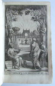
Napoleonic Wars.- [Lullin de Chateauvieux (J.F.)] Manuscrit venu de St. Hélène, d'une manièreForum Auctions4.4(54)See Sold PriceFeb 29, 2024
Railways & Transport.- [Prospectus] The Dorking, Brighton, and Arundel Atmospheric Railway, byForum Auctions4.4(54)See Sold PriceFeb 29, 2024
Boxed Set of Scientific Instruments and Tools by J.F. LuhmeGray's Auctioneers4.5(187)See Sold PriceMar 06, 2024
MEDICAL OFFPRINTS. A large lot of medical offprints and excerpts, mostly on neurology and the ne...Bonhams4.1(326)See Sold PriceJun 18, 2024


![DES BARRES, J. F. W. A Chart of Delawar [sic] Bay (1 of 2)](https://p1.liveauctioneers.com/839/17444/5912352_1_x.jpg?height=282&quality=70&version=1226588954)


![[Map]. Joseph F.W. Des Barres. A chart of the harbor of (1 of 1)](https://p1.liveauctioneers.com/906/140659/71307905_1_x.jpg?height=282&quality=70&version=1556216881)


![[The Atlantic Neptune,] Four Volumes (1 of 6)](https://p1.liveauctioneers.com/33/39968/17154820_1_x.jpg?height=282&quality=70&version=1366317164)

![[MAPS] - DES BARRES, J.W. A Chart of the Delaware (1 of 1)](https://p1.liveauctioneers.com/839/21828/7548112_1_x.jpg?height=282&quality=70)


![[ENSLAVEMENT & ABOLITION]. "Agreement of Registry" regarding the lease of lands and employment of (1 of 2)](https://p1.liveauctioneers.com/197/319238/171468066_1_x.jpg?height=282&quality=70&version=1707520367)


![Napoleonic Wars.- [Lullin de Chateauvieux (J.F.)] Manuscrit venu de St. Hélène, d'une manière (1 of 1)](https://p1.liveauctioneers.com/5458/319736/171654615_1_x.jpg?height=282&quality=70&version=1708010439)
![Railways & Transport.- [Prospectus] The Dorking, Brighton, and Arundel Atmospheric Railway, by (1 of 1)](https://p1.liveauctioneers.com/5458/319736/171654703_1_x.jpg?height=282&quality=70&version=1708010439)