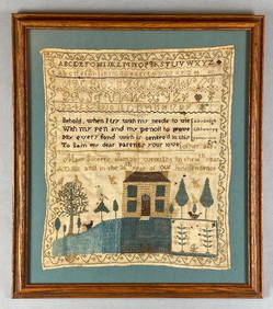
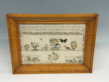
(18th c) SAMPLER by SARAH BROWN born 1780.John McInnis Auctioneers,LLC4.6(502)See Sold PriceFeb 25, 2024
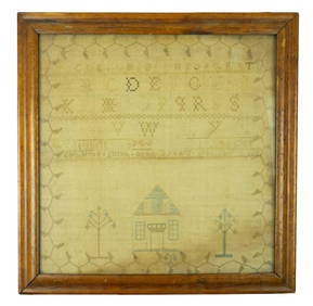
1811 36th Year of Independence Mary Gilbert American Needlepoint SamplerMatthew Bullock Auctioneers4.7(1.8k)See Sold PriceMar 02, 2024
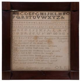
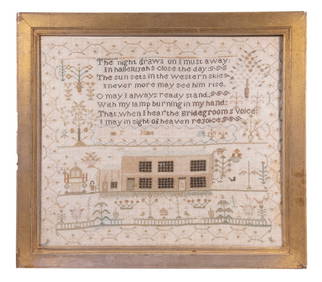
Hand Stitched Turn of the Century Sampler in Tiger Maple FrameDana J. Tharp Auctions4.7(268)See Sold PriceFeb 24, 2024
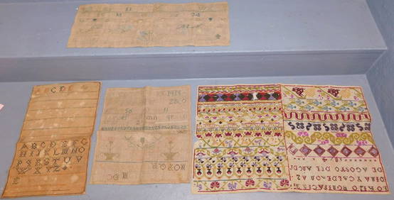
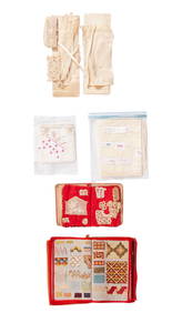
A Needlework Sampler Book, Together with a Smaller Crochet Sampler Book, Annontated NeedleworkNazmiyal Auctions4.4(34)See Sold PriceFeb 26, 2024
3 pcs Framed Vintage Americana Art Pieces. 1 Antiqued Sampler Signed Emily T. July 1776. See pics.Crawford Family Auctions LLC4.5(112)See Sold Price
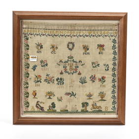
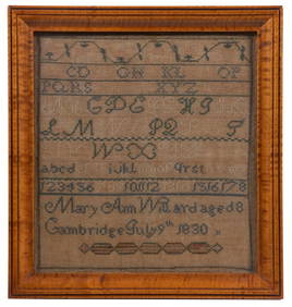
Early Sampler in Gold Frame, Dated 1828 20"T 16"WSwisher Bros. Auction LLC4.4(241)See Sold PriceFeb 24, 2024
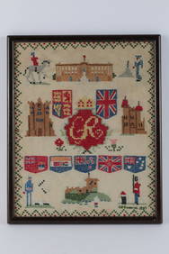
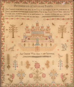
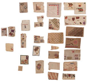
SoldBRITISH ISLES PICTURAL SAMPLER.BRITISH ISLES PICTURAL SAMPLER. Christian Cleghorn, probably Scottish, 1798, silk on wool. Finely executed in a variety of minute stitches, a delicate floral vine and swags surround a moral verse, oveSee Sold Price
Sold1871 British Isles SamplerCross stitch sampler, "Parish Ch Schools A. Kate Dean Feb 28th 1871 Aged 11 years", map of the British Isles with upper right box outline of Shetland Isles, very fine closely woven linen ground with tSee Sold Price
SoldFramed needlepoint map sampler BritainFramed needlepoint map sampler, dated 1791, of the British Isles, with divisions of Yorkshire into North Riding, West Riding, and East Riding, 25.5''h x 22.5''wSee Sold Price
SoldThree Needlework Map SamplersLot 371 Three English Silk Needlework Maps of the British Isles Three English silk needlework maps of the British Isles, map of England & Wales By Mary Skinner 1803, Map of Ireland, Map of England,See Sold Price
Sold1788 British Sampler with Birds Trees FlowersBritish Alphabet sampler with extensive floral and nature motifs, and two beautiful birds sitting atop a lengthy quote from the book of Isaiah, 1788, done by Mary Smith who was 10 years old at the timSee Sold Price
SoldTOBIAS LOTTER MAP OF BRITISH ISLESOriginal hand-colored engraving. 18th century. Three different hand-colored heraldic devices. Dimensions: (Frame) H 30.5" x W 26.5", (Sight) H 23.75" x W 20" Condition: Some light foxing. Unexamined oSee Sold Price
British Isles, Pieter Goos 1665-66Title: Pas-Caart vant Canaal Vertoonende in 't Gheheel Engelandt, Schotlandt, Yrlandt, en een Gedeelte van Vrancryck Subject: British Isles Maker: Pieter Goos Date: 1665-66, Amsterdam Materials: HandSee Sold Price
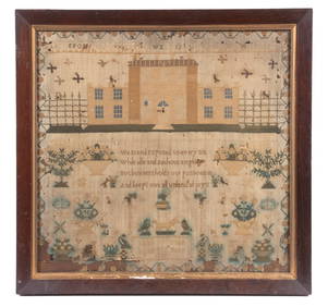
Sold1807 British Sampler with Nautical Scene and HymnBritish, ca. 1807. A framed needlework sampler featuring a nautical scene with ships along with two blocks of text. One block reads When I Survey The Wondrous Cross On Which The Prince Of Glory Dyed [See Sold Price
Sold1889 1ed ZigZag Journeys British Isles Liverpool Lands End London Bridge CASTLES1889 1ed ZigZag Journeys British Isles Liverpool Lands End London Bridge CASTLES American author Hezekiah Butterworth is best remembered for his enormous, seventeen volume work Zig-Zag Journeys. WrittSee Sold Price
SoldBritish Sampler Extensive Design William JacksonSampler by William Jackson and Margarate Chape age 11, British, the date appears to say 1807 (but could also be 1837), extensive design with house and flowers in blue, pink, red and yellow, 17 x 13 inSee Sold Price
Sold1695 Morden Map of the British Isles in Roman Times --Title/Content of Map: 1695 Morden Map of the British Isles in Roman Times -- Britannia Romana Date: 1695, London Cartographer: R Morden Size: 14 X 16.8 in. This is a handsome map of the British IslesSee Sold Price
Sold1796 MAP OF THE BRITISH ISLESItalian map. Caleographia Camerale. Engraving. Dimensions: (Frame) H 22.25"x W 16.75", (Sight) H 21.25" x W 15.75" Condition: Some creases to paper.See Sold Price
Janssonius: Sea Chart of British Isles, Gold Leaf, 1660Title: Pascaart vant Canaal, Tusschen Engelant en Vrancryck, alsmede ge heel Ierlant en Schotlant Map maker: J. Janssonius, Atlantis Majoris Quinta Pars Orbem Maritimum Place and Year: Amsterdam, 1660See Sold Price
Bonne: Antique Map of the British Isles, 1780TITLE/CONTENT OF MAP: 'Carte Des Isles Britanniques contenant les Royaumes d'Angleterre, d'Ecosse et d'Irlande' A map of the British Isles DATE PRINTED: 1780 IMAGE SIZE: Approx 34.5 x 23.0cm, 13.5 x 9See Sold Price
Bonne: Antique Map of the British Isles, 1780Title/Content of Map: 'Carte Des Isles Britanniques contenant les Royaumes d'Angleterre, d'Ecosse et d'Irlande'. A map of the British Isles Date Printed: 1780 Image Size: Approx 34.5 x 23.0cm, 13.5 xSee Sold Price
SoldTallis, John (Pub) 1852 Map. British IslesSteel Engraved Map with Original Outline Hand Color Published 1852-56 by John Tallis, London for "The Universal Pronouncing Dictionary" by Thomas Wright. Drawn & Engraved by John Rapkin. Centre fold aSee Sold Price
SoldEARLY 19th c. OIL ON BOARD BRITISH ISLESAntique early 19th c. Oil on Board of a Coastal Castle Vista. Very well done and professionally framed in a gilt wood carved frame by Moormans Gallery. The painting does have some minor age appropriatSee Sold Price
SoldClaudius Ptolemy's Map of the British IslesPublished 1599 AD. Taken from volume two of La Geografia di Claudio Tolomeo Alessandrino, Venice, translated by Girolamo Ruscelli and Gioseffo Rosaccio as 'Nuouamente tradotta di Greco in Italiano'; cSee Sold Price
SoldFamous Speed may of British IslesHeading: (Great Britaine) Author: Speed, John Title: The Kingdome of Great Britaine and Ireland Place Published: London Publisher:Roger Rea the Elder and younger Date Published: 1610-[1665]See Sold Price
SoldBritish Isles stoneware Ginger Beer bottlesBritish Isles stoneware Ginger Beer bottles (9 pcs)See Sold Price
SoldKeulen: Antique Map of the British Isles, 1678Map: British Isles Date Printed: 1678-1682 Cartographer: J Keulen Material/Medium: Paper Size: 21" x 24" Printed on thick paper. Double page map. Rare map of the British isles with north oriented to tSee Sold Price
SoldRalph Lauren British Isles Round Wicker TableCircular top on a quatrepartite pedestal base. Height 28 inches, diameter 48 inches. Notice to bidders: Condition reports and additional photographs are provided by request as a courtesy to our clientSee Sold Price
SoldMaps of the British Isles, Plus, Lot of NineMaps of the British Isles, Plus, Lot of Nine Lot of eight maps of locations on the British Isles, including: British, ca. 1695. Robert Morden (British, 1650-1703), Cornwall. Title and artist identifieSee Sold Price
Jansson 1653 Map of British IslesDESCRIPTION: "Magnae Brittaniae et Hiberniae Nova Descriptio." Based on Willem Blaeu's 1631 map of the British Isles, this map depicts towns, rivers, an inset of Orkney Islands. Strap work cartouchesSee Sold Price
LATE 17TH C. FRENCH MAP OF THE NEW WORLD BY ALEXIS-HUBERT JAILLOT (1632-1712)Thomaston Place Auction Galleries4.4(386)See Sold PriceFeb 24, 2024
ATTR TO LIBERTY COMPANY ARTS CRAFTS COPPER MIRRORAntique Arena Inc.4.5(852)See Sold PriceFeb 24, 2024
ARTS AND CRAFTS HAMMERED LAMP BY FREDRICK FIFIELDAntique Arena Inc.4.5(852)See Sold PriceFeb 24, 2024
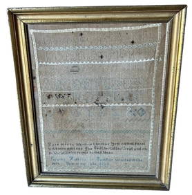
AN ANTIQUE FOLDING MAP OF THE BRITISH ISLES DATED 1873Hutchinson Scott Auctioneers4.4(39)See Sold PriceFeb 28, 2024
Chatelain - 3 Maps of the British Isles (England, Ireland, Scotland)Trillium Antique Prints & Rare Books4.5(30)See Sold PriceFeb 24, 2024
De Jode, Rare, pub. 1593 - Map of the British Isles [England, Scotland, Ireland] (Angliae Scotiae etTrillium Antique Prints & Rare Books4.5(30)See Sold PriceFeb 24, 2024
Map: A 17thC engraved map of the British Isles titled A Generall Mapp of the Isles of GreatClaydon Auctioneers Ltd4.3(125)See Sold PriceFeb 26, 2024
Stanford, Edward 1901 Large Map. Geological Map of the British IslesAlbion Auctions4.6(336)See Sold PriceMar 01, 2024
Stanford, Edward 1901 Large Map. Hydrographical Map of the British IslesAlbion Auctions4.6(336)See Sold PriceMar 01, 2024
Stanford, Edward 1901 Large Map. Stereographical Map of The British IslesAlbion Auctions4.6(336)See Sold PriceMar 01, 2024
Paterson & Mogg 1822 Pair of British Road Maps. Isle of Thanet & WightAlbion Auctions4.6(336)See Sold PriceMar 01, 2024


![De Jode, Rare, pub. 1593 - Map of the British Isles [England, Scotland, Ireland] (Angliae Scotiae et (1 of 2)](https://p1.liveauctioneers.com/6581/319571/171593327_1_x.jpg?height=282&quality=70&version=1707853304)