Sold3 map references, incl Goss BLAEU'S GRAND ATLAS..[Atlas References]. 3 Titles. Folio. ++ Blaeu's The Grand Atlas Of The 17th Century World. John Goss compiler. NY: Rizzoli, (1991). Cloth. Near fine in vg dj. Reproduces 100 maps in color. ++ A.E. NorSee Sold Price
SoldSet of 6 tourist maps: 1) Asian map, 2) Saint-GerSet of 6 tourist maps: 1) Asian map, 2) Saint-Germain Des Pres Paris, Artga 1989, 3) World Map (true size) from Johan Blaeu's Le Grand Atlas, reprinted in facsimile three centuries after its originalSee Sold Price
SoldBlaeu Reference Antique MapsLarge Reference Book. Joan Blaeu, Atlas Maior of 1665. Recent publication by Taschen. Illustrated with maps. Book, 17 3/4" x 11 1/4" x 2 3/4" D.See Sold Price
Sold3 Books incl: Broecke. ORTELIUS ATLAS MAPS. (1996)[Reference] 3 Titles. 8vo/4to. 2 hardcover in dj, 1 softcover. Near fine. ++ Mary Sponberg Pedley. BEL ET UTILE: The Work of the Robert de Vaugondy Family of Mapmakers. Map Collector Publications, 199See Sold Price
Sold3 Books incl: Penzer THE HAREM. (1936).[Exploration & Travel] 3 Titles. ++ N. M. Penzer. THE HAREM: An Account of the Institution as it Existed in the Palace of the Turkish Sultans with a History of the Grand Seraglio from its Foundation tSee Sold Price
3 Map References incl: THE COUNTIES OF BRITAIN.[Reference]. 3 Titles. 4to. Cloth; near fine in dj. Djs lightly soiled. ++ J. B. Harley and David Woodward (eds.). THE HISTORY OF CARTOGRAPHY. Volume One: CARTOGRAPHY IN PREHISTORIC, ANCIENT, AND MEDISee Sold Price
Sold3 Map Reference Books incl: DEGREES OF LATITUDE.[Map Reference] 3 Titles. ++ Margaret Beck Pritchard and Henry G. Taliaferro. DEGREES OF LATITUDE: MAPPING COLONIAL AMERICA. Colonial Williamsburg Foundation/ Harry N. Abrams, (2002). ++ Seymour I. ScSee Sold Price
SoldThe Library Atlas of the World, 2 Vols (1912-1913[Atlas/ Map Reference]. 3 Titles (4 Vols). ++ The Library Atlas Of The World. 2 Vols. Chi/NY: Rand McNally, (1912-1913). Folio. Blue cloth; moderately worn and soiled, contents very good. Color maps (See Sold Price
Sold3 maps incl: De Vaugondy. L'EMPIRE DE LA CHINE.[Asia/China/Britain/Mideast] 3 Maps: ++ Robert de Vaugondy. L’EMPIRE DE LA CHINE Dressee d’Apries les Cartes de l’Atlas Chinois. [No date in cartouche. The same engraving plate was used for theSee Sold Price
Sold3 Maps, incl. Helwig, Ortelius, Munster, and VaugondyThree (3) maps by European mapmakers, including Helwig, Ortelius, Munster, and Vaugondy. 1st item: Silesiae Typus A Martino Helwigio Sissense descriptus map by Martin Helwig (German, 1516-1574) and AbSee Sold Price
Sold3 Maps incl PA and NCAlso includes "A correct map of North America". MEASUREMENTS: 14" high X 17 1/2" wide. Status Republica Genuensis. MEASUREMENTS: 15-1/2” high X 18-1/2” wide. Pennsylvania map printed by Singerly aSee Sold Price
Sold3 Maps incl: Map Of Boston And Adjacent Cities.[World/ Massachusetts/Europe] 3 Maps. ++ A New Map Of The World On The Globular Projection. Phila: Thomas, Cowperthwait & Co., (1850). Hemispheres. Outer edge of overall border: 9 1/2 x 14 1/8 in. TonSee Sold Price
Sold3 Maps incl. Mitchells National Map3 Maps incl. Mitchells National Map of the American Republic, Crams Map of Asia, and Map of Breasted Ancient History Series - Mitchells map is approx 41" H x 49" WSee Sold Price
3 Maps incl: Le Cours Du Po... Covens and Mortier[Italy/Middle East] 3 Maps. ++ Le Cours Du Po Dans Le Piemont… Shows rivers of the Po River Valley in Italy. Amst: Jean Covens and Corneille Mortier, (nd). From an edition of “Atlas Nouveau, ConteSee Sold Price
Sold3 Maps Incl French ConstantinopleDESCRIPTION: Three maps. Includes: 1) 1819 Plan of Constantinople. BY J.D. Barbie of Bocage. Marked "F.P. Michele Sculp" lower left. 26" x 39". Rolled with one vertical fold crease line at center. 2)See Sold Price
Sold3 maps incl 2 1826 maps by L. Rossini.3 maps. The first 2 listed below are by L. Rossini and from: Le Antichità De’ Contorni Di Roma, 1826. Includes: Illa Adriana por tuto il vasto Impero Romano..., 1826. Image: 14 1/4" x 27 3/4See Sold Price
Sold3 Maps incl: Veteris Hispaniae Tabulam. 1710.[De Rossi/Sanson] 4 Maps from Giovanni Giacomo de Rossi’s “Mercurio Geografico Overo Guida Geografica in Tutte le Parti del Mondo.” Double page. Hand colored outline. ++ Veteris Hispaniae TabulaSee Sold Price
MAP, Chile, BlaeuChile. Willem Blaeu, Chili, from Le Grand Atlas, 1663 (circa). Hand Color. This striking map covers the known coastal region of Chile from around Antofagasta in the north to Cabo Gallegos in the southSee Sold Price
Sold3 Bellin Maps, incl. Louisiana, Florida, 1760sThree (3) Jacques-Nicolas Bellin (1703-1772) copper plate engraved maps with hand coloring and decorative cartouches on laid paper, all from "Le Petit Atlas Maritime", 1764. 1st item: Embouchures du FSee Sold Price
Sold3 Southern Maps, incl. 2 Antonio Zatta 1778, SC 1796Three (3) Southern Maps, including two (2) Antonio Zatta 1778, one (1) South Carolina 1796. 1st-2nd items: Two (2) Antonio Zatta (Italian, fl. 1757-1797) maps of Virginia, Maryland, and the Carolinas,See Sold Price
2 Boxes of Map Reference Books Incl. Phillips 252 Boxes of Map Reference Books Incl. Phillips 25 volumes-- Dimensions: ---See Sold Price
8 map reference books incl Schwartz and Ehrenberg.[Reference] 8 Titles. 4to/folio. Hardcover (7 in dj). Good to near fine. ++ Seymour I. Schwartz and Ralph E. Ehrenberg. THE MAPPING OF AMERICA. Wellfleet Press, (2001). ++ Stefan Lorant (ed.). THE NEWSee Sold Price
SoldAtlas of the World & Blaeu's AtlasAtlas of the World Millennium Edition 15" x 11" x 1"; and Blaeu's The Grand Atlas of the 17th Century World. 1997. 14.5" x 11.25" x 1". We ship most items in-house with the exception of furniture, larSee Sold Price
SoldThird Centenary Edition of Johan Blaeu's Atlas 1/1000Heading: Author: Blaeu, Johan Title: The Third Centenary Edition of Johan Blaeu Le Grand Atlas Ou Cosmographie Blaviane. Amsterdam, 1663 Place Published: Amsterdam Publisher:Theatrum Orbis TerrarumSee Sold Price
LARGE LATE 17TH C. DUTCH CHART OF CANADA, GREAT LAKES, NEW FRANCE, LABRADOR, HUDSON BAY, BY PIERREThomaston Place Auction Galleries4.4(393)See Sold PriceFeb 24, 2024
EARLY 18TH C. DUTCH CHART OF PACIFIC OCEAN BY FREDERIK DE WIT (1629-1706) WITH CALIFORNIA AS ANThomaston Place Auction Galleries4.4(393)See Sold PriceFeb 24, 2024
COVENS & MORTIER 1745 MAP OF THE GLOBEThomaston Place Auction Galleries4.4(393)See Sold PriceFeb 24, 2024
WILLEM JANSZOON BLAEU (NETHERLANDS, 1571-1638) MAP OF UMBRIAThomaston Place Auction Galleries4.4(393)See Sold PriceFeb 24, 2024
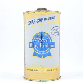
Pabst Blue Ribbon Beer Quart Snap Cap MILWAUKEE HIGH GRADE 217-3Morean Auctions4.5(33)See Sold PriceFeb 25, 2024
Willem Blaeu, Etc. 17th C. Antiquarian Maps, 2Auctions at Showplace4.6(740)See Sold PriceMar 17, 2024
[KING, Martin Luther, Jr. (1929-1968)]. 2 posters featuring Martin Luther King, Jr., incl. I am onFreeman's | Hindman4.4(1.6k)See Sold PriceFeb 27, 2024
Map: An 18thC engraved and hand coloured map of North America and South America, titled DeClaydon Auctioneers Ltd4.3(125)See Sold PriceFeb 26, 2024
1822 MAP of NORTH & SOUTH AMERICA GEOGRAPHICAL STATISTICAL HISTORICAL antiqueJasper524.5(9.9k)See Sold PriceFeb 27, 2024
Antique Pennsylvania Map Fragment incl Wellersburg and New CentervilleCordier Auctions & Appraisals4.4(1.5k)See Sold PriceMar 02, 2024
20 Pcs Vintage Ephemera incl Political Cigar BansCordier Auctions & Appraisals4.4(1.5k)See Sold PriceMar 02, 2024


![[KING, Martin Luther, Jr. (1929-1968)]. 2 posters featuring Martin Luther King, Jr., incl. I am on (1 of 2)](https://p1.liveauctioneers.com/197/319238/171467879_1_x.jpg?height=282&quality=70&version=1707520367)