MATTHEWS c1856 Map Of Upper Canada Ontario Indian Land Agency Divisions Scarce!Luis Porretta Fine Arts4.3(10)See Sold PriceMar 02, 2024
DEVINE c1856 Dr Salters Map Of Lake Huron Ontario Indian Lands etc. No. 7 ScarceLuis Porretta Fine Arts4.3(10)See Sold PriceMar 02, 2024
DUNLEVIE c1856 Map Counties Of Gaspe & Bonaventure Quebec Canada SCARCE! #1Luis Porretta Fine Arts4.3(10)See Sold PriceMar 02, 2024
DUNLEVIE c1856 Map Counties Of Gaspe & Bonaventure Quebec Canada SCARCE! #2Luis Porretta Fine Arts4.3(10)See Sold PriceMar 02, 2024
Map UNITED COUNTIES LEEDS & GRENVILLE by Walling 1861 Rare Canada Map 5ft x 5ftLuis Porretta Fine Arts4.3(10)See Sold PriceMar 02, 2024
Ambroise TARDIEU c1822 Map Venice Napoleon Italian Campaign 17" x 11"Luis Porretta Fine Arts4.3(10)See Sold PriceMar 02, 2024
SoldBradford: Antique Map of Kentucky & Tennesee, 1835Title/Content of Map: Kentucky & Tennesee by Bradford Date Printed: 1835 Cartographer: T.G. Bradford Material/Medium: Paper Size: 13" x 9 1/2" A Comprehensive Atlas Geographical, Historical & CommerciSee Sold Price
Sold3 19th cent. Maps, 1 of TN and KY, 2 of TN1st item: "Tennessee & Kentucky" Map, drawn by Thomas G. Bradford, engraved by George W. Boynton, published by William D. Ticknor, Boston, 1835. From "A Comprehensive Atlas. Geographical, Historical,See Sold Price
Sold4 19th Cent. TN & KY MapsFour (4) 19th century Tennessee and Kentucky maps. 1st item: "Tennessee & Kentucky" Map by Thomas G. Bradford, engraved by George W. Boynton, published by William D. Ticknor, Boston, 1835. From "A ComSee Sold Price
Sold5 Kentucky and Tennessee Maps1st item: "Tennessee & Kentucky" Map, by Thomas G. Bradford, engraved by George W. Boynton, published by William D. Ticknor, Boston, 1835. From "A Comprehensive Atlas, Geographical, Historical & CommeSee Sold Price
4 19th Cent. TN & KY Maps1st item: "Tennessee & Kentucky" Map by Thomas G. Bradford, engraved by George W. Boynton, published by William D. Ticknor, Boston, 1835. From "A Comprehensive Atlas, Geographical, Historical & CommerSee Sold Price
SoldBradford: Antique Map of Kentucky, 1838Title/Content of Map: Kentucky by Bradford Date Printed: 1838/1841 Cartographer: Thomas G. Bradford Material/Medium: Paper Size: 16 1/2" x 13" Hand colored. A General Atlas of the World with a SeparatSee Sold Price
SoldBradford: Antique Map of Massachusetts, 18351835 Bradford map of Massachusetts. Nice early map of the state of Massachusetts by Thomas Gamaliel Bradford. Original hand coloring. Clean with good margins. 7.5 x 10 inches. Thomas G. Bradford was tSee Sold Price
SoldBradford: Antique Map of Egypt, 1835Map: Egypt by Bradford Date Printed: 1835 Cartographer: T. G. Bradford Material/Medium: Paper Size: 11 1/2" x 10" Hand colored outlines. Published in Boston. From 'A Comprehensive Atlas Geographical,See Sold Price
SoldBradford: Antique Map of Louisiana & Arkansas, 1835Title/Content of Map: Louisiana & Arkansas Date Printed: 1835 Cartographer: T. G. Bradford Material/Medium: Paper Size: 9 1/2" x 13" A Comprehensive Atlas Geographical, Historical & Commercial. PublisSee Sold Price
SoldBradford: Antique Map of European Ciites, 1835Title/Content of Map: Ciites of London, Paris, Edinburgh, Madrid, Brussels, Vienna Date Printed: 1835 Cartographer: T.G. Bradford Material/Medium: Paper Size: 10" x 13" Hand colored outlines. PublisheSee Sold Price
SoldBradford: Antique Map of Atlantic Ocean, 1835Map: Atlantic Ocean Date Printed: 1835 Cartographer: T. G. Bradford Material/Medium: Paper Size: 10" x 13" Hand colored outlines. Published in Boston. From 'A Comprehensive Atlas Geographical, HistoriSee Sold Price
Bradford: Antique Map of Southern Europe, 1835Title/Content of Map: Southern Europe Date Printed: 1835 Cartographer: T. G. Bradford Publisher: William D. Ticknor / Wiley & Long 1835 Boston/New York Size: Quarto – 7.75 H x 10.0 W Inches Page 101See Sold Price
SoldBradford: Antique Map of Holland & Belgium, 1835Map: Holland & Belgium Date Printed: 1835 Cartographer: T.G. Bradford Material/Medium: Paper Size: 10" x 13" Condition: Very Good. Foxing on edges. One of the earliest Maps of the region. Hand coloredSee Sold Price
SoldBradford: Antique Map of British Canada, 1835Map: British Canada 1835 Date Printed: 1835 Cartographer: Thomas G. Bradford Material/Medium: Paper Size: 13' x 10" Hand colored outlines. From a Comprehensive Atlas Geographical, Historical & CommercSee Sold Price
Bradford: Antique Map of Spain & Portugal, 1835Title/Content of Map: Spain & Portugal Date Printed: 1835 Cartographer: T.G. Bradford Material/Medium: Paper Size: 13" x 9 3/4" Hand colored outlines. Published in Philadelphia. A comprehensive AtlasSee Sold Price
Bradford: Antique Map of Chile & Patagonia, 1835Map: Untitled provinces Chile and Patagonia Date Printed: 1835 Cartographer: Thomas G. Bradford Material/Medium: Paper Size: 9 1/2" x 12" Hand colored outlines. From a Comprehensive Atlas GeographicalSee Sold Price
Bradford: Antique Map of Northern China, 1835Title/Content of Map: Northern China with Mongolia and Siberia, Central Asia to Korea Date Printed: 1835 Cartographer: T.G. Bradford Material/Medium: Paper Size: 13" x 10" Condition: Excellent Hand coSee Sold Price
Bradford: Antique Map of North Africa, 1835Title/Content of Map: North Africa by Bradford Date Printed: 1835 Cartographer: T.G. Bradford Material/Medium: Paper Size: 13" x 10" A comprehensive Atlas Geographical, Historical & Commercial. PublisSee Sold Price
Bradford: Antique Map, Rome, Athens & Jerusalem, 1835Title/Content of Map: Cities of Rome, Athens and Jerusalem Date Printed: 1835 Cartographer: T.G. Bradford Material/Medium: Paper Size: 13" x 10" A Comprehensive Atlas Geographical, Historical & CommerSee Sold Price
Bradford: Antique Map of Northern Africa, 1835Map: Northern Africa by Bradford Date Printed: 1835 Cartographer: T. G. Bradford Material/Medium: Paper Size: 13" x 10" Hand colored outlines. Published in Boston. From 'A Comprehensive Atlas GeographSee Sold Price
Bradford: Antique Map of Germany & Switzerland, 1835Title/Content of Map: Germany & Switzerland Date Printed: 1835 Cartographer: T.G. Bradford Material/Medium: Paper Size: 10" x 13" Hand colored outlines. Published in Philadelphia. A comprehensive AtlaSee Sold Price
Bradford: Antique Map of Northern Asia, 1835Map: Northern Asia Date Printed: 1835 Cartographer: T.G. Bradford Material/Medium: Paper Size: 13" x 10" Condition: Excellent Hand colored outlines. First edition and first issue of the first AmericanSee Sold Price
SoldBradford: Antique Map Connecticut & Rhode Island, 1835Title/Content of Map: Connecticut & Rhode Island Date Printed: 1835 Cartographer: T. G. Bradford Material/Medium: Paper Size: 9 1/2" x13" A Comprehensive Atlas Geographical, Historical & Commercial. PSee Sold Price
SoldBradford: Antique Map of Siberia & Central Asia, 1835Map: Siberia & Central Asia Date Printed: 1835 Cartographer: T.G. Bradford Material/Medium: Paper Size: 13" x 9 1/2" Condition: Very Good. Some foxing on edges. Does not affect Map. Hand colored outliSee Sold Price
17TH C. ANTIQUE MAP SIEGE OF LA ROCHELLE, FRANCE, FRAMEDThomaston Place Auction Galleries4.4(386)See Sold PriceFeb 24, 2024
18TH C. ANTIQUE MAP: FRENCH & INDIAN WAR, FRAMEDThomaston Place Auction Galleries4.4(386)See Sold PriceFeb 24, 2024
Civil War Map, Positions of the Army of the Ohio Front oh Dalton GA Dated 1864 34"L x 24"TSwisher Bros. Auction LLC4.4(241)See Sold PriceFeb 24, 2024
Civil War Map, Positions of the 16th Army Corps Dated 1864 34"L x 24"TSwisher Bros. Auction LLC4.4(241)See Sold PriceFeb 24, 2024
Arrowsmith & Lewis - Map of the United StatesTrillium Antique Prints & Rare Books4.5(30)See Sold PriceFeb 24, 2024
Putnam - First Map of the State of Ohio by Rufus PutnamTrillium Antique Prints & Rare Books4.5(30)See Sold PriceFeb 24, 2024
Carey, pub. 1796 - Map of GeorgiaTrillium Antique Prints & Rare Books4.5(30)See Sold PriceFeb 24, 2024
Carey, pub. 1796 - Map of The State of South CarolinaTrillium Antique Prints & Rare Books4.5(30)See Sold PriceFeb 24, 2024
Carey, pub. 1796 - Map of KentuckyTrillium Antique Prints & Rare Books4.5(30)See Sold PriceFeb 24, 2024
Carey, pub. 1796 - Map of the Tennassee State formerly part of North Carolina (Tennessee)Trillium Antique Prints & Rare Books4.5(30)See Sold PriceFeb 24, 2024
De Jode, Rare, pub. 1593 - Map of the Middle East, Eastern Asia (Primae Partis Asiae accurataTrillium Antique Prints & Rare Books4.5(30)See Sold PriceFeb 24, 2024
De Jode, Rare, pub. 1593 - Map of Africa (Africae Vera Forma, et Situs)Trillium Antique Prints & Rare Books4.5(30)See Sold PriceFeb 24, 2024
Gould - Natterer's Aracari or ToucanTrillium Antique Prints & Rare Books4.5(30)See Sold PriceFeb 24, 2024
Churchill & Nieuhof 1744 Folio Map. Batavia Indonesia East IndiesAlbion Auctions4.6(336)See Sold PriceMar 01, 2024
Cooke, George 1801 Antique Map. United States of AmericaAlbion Auctions4.6(336)See Sold PriceMar 01, 2024
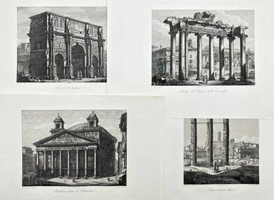
Domenico Amici - Set of 4 prints - Tempio di Giove Statore - Arco di Costantino in Rome, ItalyProverde Auctions4.3(3)See Sold PriceFeb 28, 2024
Francis McNally - Antique Map of Ohio, Indiana & KentuckyProverde Auctions4.3(3)See Sold PriceFeb 28, 2024
Antique Map of Poland, 1700 by Guillaume De Lisle, ParisAntiques Online Auctions4.6(407)See Sold PriceMar 14, 2024