Bowen map of British America 1754Title: A Map of the British American Plantations, extending from Boston in New England to Georgia; including all the back Settlements in the respective Provinces, as far as the Mississippi Author: BowSee Sold Price
SoldBowen Map of British American Plantations 1754Title: A Map of the British American Plantations, Extending from Boston in New England to Georgia; Including All the Back Settlements in the Respective Provinces, as Far as the Mississipi Author: BoweSee Sold Price
Emanuel John Bowen GibsonEmanuel John Bowen Gibson. An accurate map of North America […] British and Spanish dominions and […] also all the West India Island. London: printed for Robert Sayer, 1775. Incisione in rame coSee Sold Price
SoldColonial America: 1754 Hand-Colored Map. 12" x 9Colonial America: 1754 Hand-Colored Map. 12" x 9.25" engraved map on laid paper, titled:See Sold Price
SoldAmerica and Canada.- Bowen (Thomas) A Map of theNO RESERVE America and Canada.- Bowen (Thomas) A Map of the British and French Settlements in North America: (Part the First...) [together with] [Part the Second...], two-part folding map of the NorthSee Sold Price
SoldBowen maps of the American coloniesHeading: Author: Bowen, Thomas Title: A Map of the British and French Settlements in North America... Place Published: London Publisher: Date Published: 1759 Description: TSee Sold Price
SoldThomas Bowen Map, "A Correct Map of the United StateThomas Bowen Map, "A Correct Map of the United States of North America Including the British & Spanish Territories Carefully Laid Down Agreeable to the Treaty of 1784", English, c. 1790, from Banke'sSee Sold Price
SoldMap of British American Plantations - 1754Historic MapsMap of "British American Plantations" by Eman & Bowen July 1754, THE GENTLEMAN'S MAGAZINE,With Map, London, England, Choice Very Fine. By Sylvanus Urban, "Printed by D. HeSee Sold Price
SoldMap of the American Colonies from December, 1754This map is titled 'An Accurate Map of the English Colonies in North America bordering on the River Ohio', a scarce early map of the British Colonies in North America and one of the earliest maps to aSee Sold Price
SoldEman Bowen Georg (1714-1767) map, to His Majesty andEman Bowen Georg (1714-1767) map, to His Majesty and John Gibson, Engraver (1750-1792) An Accurate map of North America describing and distinguishing the British and Spanish Dominions on this Great CoSee Sold Price
SoldJohn Cary (1754-1835) British. A New Map of America,John Cary (1754-1835) British. A New Map of America, Map, 18.25" x 20.5".See Sold Price
SoldThomas Bowen. Map of North America, circa 1770(British, d. 1790). "A New and Accurate Map of North America," hand colored engraving for Middleton's Complete System of Geography, 11 1/4 x 17 3/4 in., framedSee Sold Price
1754, Gentleman's Magazine, LondonMap of "British American Plantations" by Eman & Bowen July 1754, THE GENTLEMAN'S MAGAZINE, London, England, Choice Very Fine. By Sylvanus Urban, "Printed by D. Henry and R. Cave, at St. John's Gate,"See Sold Price
With Kino map of Passage to CaliforniaHeading: (Mexico & California) Author: Bowen, Emanuel Title: An Accurate Map of North America. Describing and Distinguishing the British and Spanish Dominions on this Great Continent... [lower left shSee Sold Price
SoldNorth Atlantic.- Bowen (Emanuel) A Map of the King ofNorth Atlantic.- Bowen (Emanuel) A Map of the King of Great Britain's Dominions in Europe, Africa, and America, map drawn on a circular projection showing the extent of the British Empire in the 18thSee Sold Price
SoldEmanuel Bowen and John GibsonEmanuel Bowen and John Gibson, "An Accurate Map of North America, Describing and Distinguishing the British and Spanish Dominions According to The Definitive Treaty Concluded at Paris 10th Feby. 1763"See Sold Price
18TH CENTURY COPPERPLATE ENGRAVING OF THE WESTERN18TH CENTURY COPPERPLATE ENGRAVING OF THE WESTERN HEMISPHERE Engraved map of the Atlantic Ocean and North and South America, 11 1/2" x 10", executed by British engraver THOMAS BOWEN (d. 1790). The mapSee Sold Price
SoldCary Map of Florida, Georgia, North Carolina, SouthCary, John (British, 1754-1835). A New Map of Part of the United States of North America, Containing the Carolinas and Georgia, also the Floridas and Part of the Bahama Islands. London: 1806. EngravedSee Sold Price
SoldJohn Cary (British, 1754-1835)John Cary (British, 1754-1835), "A New Map of Part of The United States of North America Containing the Carolinas and Georgia, also The Floridas and Part of The Bahama Islands & C.", London, 1806, hanSee Sold Price
SoldCary Map of the Western Territory, Kentucky,Cary, John (British, 1754-1835). A New Map of Part of the United States of North America, Exhibiting the Western Territory, Kentucky, Pennsylvania, Maryland, Virginia &c. Also, the Lakes Superior, MicSee Sold Price
Sold[An Accurate Map of North AmericaDescribing and distinguishing the British, Spanish and French Dominions on this great Continent, et al.] by Emanuel Bowen (1720-1767) and John Gibson (1750-1792), circa 1763, Tooley 49(b), the scarceSee Sold Price
SoldTallis, John (Pub) 1852 Map. British America. CanadaSteel Engraved Map with Original Outline Hand Color Published 1852-56 by John Tallis, London for "The Universal Pronouncing Dictionary" by Thomas Wright. Drawn & Engraved by John Rapkin. Centre fold aSee Sold Price
hnd colored engraved map - British America 1808 imhnd colored engraved map - British America 1808 image size 13 1/4 x 15 1/4See Sold Price
SoldBRITISH AMERICA. Shows Hudson's Bay CompanyTITLE/CONTENT OF MAP: 'British America' The key indicates that the orange dots are forts and principal stations of the Hudson's Bay Company. Vignettes: Whale fishing; Esquimaux; Polar bears; Seal; MonSee Sold Price
LATE 17TH C. FRENCH MAP OF THE NEW WORLD BY ALEXIS-HUBERT JAILLOT (1632-1712)Thomaston Place Auction Galleries4.4(386)See Sold PriceFeb 24, 2024
Arrowsmith & Lewis - Map of PolynesiaTrillium Antique Prints & Rare Books4.5(28)See Sold PriceFeb 24, 2024
Arrowsmith & Lewis - Map of North AmericaTrillium Antique Prints & Rare Books4.5(28)See Sold PriceFeb 24, 2024
Arrowsmith & Lewis - Map of the World on Mercator's ProjectionTrillium Antique Prints & Rare Books4.5(28)See Sold PriceFeb 24, 2024
Arrowsmith & Lewis - Map of LouisianaTrillium Antique Prints & Rare Books4.5(28)See Sold PriceFeb 24, 2024
Arrowsmith & Lewis - Map of the United StatesTrillium Antique Prints & Rare Books4.5(28)See Sold PriceFeb 24, 2024
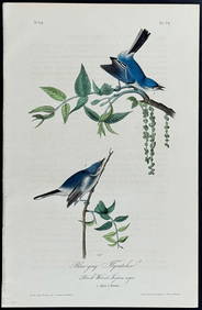
Audubon - Blue-grey Flycatcher. 70Trillium Antique Prints & Rare Books4.5(28)See Sold PriceFeb 24, 2024
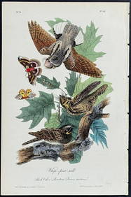
Audubon - Common Osprey Fish Hawk. 15Trillium Antique Prints & Rare Books4.5(28)See Sold PriceFeb 24, 2024
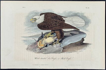
Audubon - White-headed Sea Eagle or Bald Eagle. 14Trillium Antique Prints & Rare Books4.5(28)See Sold PriceFeb 24, 2024
Audubon, Imperial Folio - American Cross Fox. 6Trillium Antique Prints & Rare Books4.5(28)See Sold PriceFeb 24, 2024
Audubon, Imperial Folio - Canada Lynx. 16Trillium Antique Prints & Rare Books4.5(28)See Sold PriceFeb 24, 2024
New and Correct Map of North America With the West India Islands,Jasper524.5(9.7k)See Sold PriceFeb 27, 2024
First 50 plates from Audubon's Quad Quarto (all in Vol. I)PBA Galleries4.7(381)See Sold PriceMar 07, 2024
Nearly complete set of plates from Vol. III Quad QuartoPBA Galleries4.7(381)See Sold PriceMar 07, 2024
American White Pelican plate from Audubon's Royal OctavoPBA Galleries4.7(381)See Sold PriceMar 07, 2024
Herman Moll A New Map of Ye North Parts of AmericaWillow Auction House4.5(280)See Sold PriceMar 14, 2024