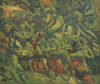
Chaim Soutine (Belarusian/French, 1893-1943) - La Petite Fille dans la VerdureFreeman's | Hindman4.5(158)See Sold PriceFeb 27, 2024
Elisabeth Frink (British, 1930-1993) - Harbinger Bird IFreeman's | Hindman4.5(158)See Sold PriceFeb 27, 2024
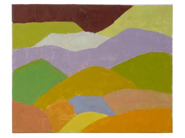
AMERICAN SEASCAPE PAINTING BY ROSS EMBROSE MOFFETTAntique Arena Inc.4.5(866)See Sold PriceMar 02, 2024
CHARLES HENRY GIFFORD (Massachusetts, 1839-1904), Luminist view of three sailboats in a quietEldred's4.7(418)See Sold PriceFeb 28, 2024
RARE MANHATTAN PROJECT GLASS LEADED FROM THE MANHATTAN PROJECT WORLD WAR II WW2 724 GRAMSCol. Christie Hatman Auctioneers4.5(323)See Sold PriceFeb 26, 2024
Estate Fresh Civil War Cavalry C. Roby 1863 With ScabbardRalph Fontaine Heritage Auctions Inc.4.7(234)See Sold PriceFeb 25, 2024
ABSTRACT ARAB LEBANESE OIL PAINTING BY ETEL ADNANAntique Arena Inc.4.5(866)See Sold PriceMar 02, 2024
Sold[World War One - Maps] Trench Maps, Vimy and[World War One - Maps] Trench Maps, Vimy and Wytschaete, Lot of 3 Lot of 3. Two for Vimy, edition 8A (corrected to Feb. 10, 1917) and 9A (Corrected to June 26, 1917). Latter with "A Coy" in ink on froSee Sold Price
Sold[World War One - Maps] WWI Trench Maps of Belgium, Lot[World War One - Maps] WWI Trench Maps of Belgium, Lot of 3 Lot of 3 linen-backed maps of Belgium, Sheet 28, N.W. (Edition 6A), N.E. (edition 7A) and S.W. (edition 3B). Scale 1:20,000, 5 metre contourSee Sold Price
Sold[World War One - Maps] WWI Trench Maps of France and[World War One - Maps] WWI Trench Maps of France and Belgium, Lot of 3 Three British military maps of the European Front in WWI, approx. 25.5 x 35 in., linen-backed. Scale 1:20,000, 5 meter contour inSee Sold Price
Sold[World War One - Maps] WWI Trench Maps, Belgium and[World War One - Maps] WWI Trench Maps, Belgium and France, Lot of 2 First is St. Julien (France), 28 N.W. 2 (edition 6A). Scale 1:10,000; trenches corrected to June 30, 1917. This larger scale map alSee Sold Price
SoldRARE WORLD WAR ONE MAPS - PASSCHENDAELETwo RARE World War I military maps, depicting the advancing Battle for Passchendaele, 29 September 1917 and 29 October 1917. The maps depict the British (Canadian) front lines, German trenches, concreSee Sold Price
SoldGerman WWI maps and aerial photographGrouping of two German World War I maps and one aerial photograph of French battlefields, with color coded locations of trenches, mines, and positions of regiments, includes (1) color map marked GeheiSee Sold Price
Sold[World War One - Maps] WWI Military Maps of North West[World War One - Maps] WWI Military Maps of North West Europe, Belgium and France, Lot of 3 Three Military maps issued by the British Army, Geographical Services. Typical topographic maps with towns,See Sold Price
Sold[World War One - Maps] WWI Military Maps of Belgium -[World War One - Maps] WWI Military Maps of Belgium - Linen Backed Maps produced by the Geographical Services division of the British army. Most of these maps are 25 x 35, plus or minus a half inch inSee Sold Price
[world War One - Maps] WWI Military Maps of North West[world War One - Maps] WWI Military Maps of North West Europe, Belgium and France, Lot of 4 Belgium and Part of France. Edition 3. Scale 1:40,000. (British) Ordnance Survey November 1917. TopographicaSee Sold Price
[World War One - Maps] WWI Military Maps of Belgium,[World War One - Maps] WWI Military Maps of Belgium, Lot of 3 Brussels 6. Scale 1:100,000; contour interval 10 metres. "Drawn at the War Office and Photo Etched at the Ordnance Survey Office, SouthampSee Sold Price
[World War One - Maps] WWI Military Maps of Belgium,[World War One - Maps] WWI Military Maps of Belgium, France and North West Europe Lot of 4 maps produced by the Geographical Section of the British army, linen-backed. Belgium and Part of France. EditSee Sold Price
Four Belgium and France World War I trench mapsFour Belgium and France World War I trench mapsSee Sold Price
Four Belgium and France World War I trench mapsFour Belgium and France World War I trench mapsSee Sold Price
SoldA World War 1 Trench Map Arras 51b N.W. 3 Edition 4AA World War 1 Trench Map Arras 51b N.W. 3 Edition 4A Scale 1:10,000 Corrected to October 1916, folded and mounted on cloth with glossary; another map Lens 11, scale 1: 100,000 1915 folded and mountedSee Sold Price
Sold[Military - World War One - Maps] Group of 50 Highly[Military - World War One - Maps] Group of 50 Highly Detailed WWI Maps, Supplement to National Review Fifty maps issued as supplements to the National Review (London). The National Review was a conserSee Sold Price
[World War One - Maps] Group of 3 Linen-Backed WWI[World War One - Maps] Group of 3 Linen-Backed WWI Military Maps, France and Belgium Lot of 3 WWI military maps. Linen backed, approx. 25 x 35 (some a half-inch larger in one or both directions). BelgSee Sold Price
Allied Advance 1918 - World War One MapAllied Advance 1918 - World War One World War I One. Linen backed. Map 9 - Ordnance Survey - Large Map with Scale Publisher British Dated: 1919 Type:See Sold Price
Third Battle of Ypres 1917 MapThird Battle of Ypres - Summer and Autumn 1917 World War I One. Linen backed. Map 4 - Ordnance Survey - Large Map with Scale Publisher British Dated: 1919<See Sold Price
Battle of Cambrai - Nov. Dec. 1917 MapBattle of Cambrai - November December 1917 World War I One. Linen backed. Map 5 - Ordnance Survey - Large Map with Scale Publisher British Dated: 1919See Sold Price
Final British Offensive August - November 1918 MapFinal British Offensive August to November 1918 World War I One. Linen backed. Map 8 - Ordnance Survey - Large Map with Scale Publisher British Dated: 1919See Sold Price
German Offensive On the Somme - March 1916 MapGerman Offensive On the Somme - March 1916 World War I One. Linen backed. Map 6 - Ordnance Survey - Large Map with Scale Publisher British Dated: 1919 TSee Sold Price
The Battle of Arras - Spring 1917 MapThe Battle of Arras - Spring 1917 World War I One. Linen backed. Map 3 - Ordnance Survey - Large Map with Scale Publisher British Dated: 1919 Type: CSee Sold Price
Battle of the Somme - 1916 MapBattle of the Somme - 1916 World War I One. Linen backed. Map 1 - Ordnance Survey - Large Map with Scale Publisher British Dated: 1919 Type: ColoredSee Sold Price
The German Offensive on the Lys - April 1918 MapThe German Offensive on the Lys - April 1918 World War I One. Linen backed. Map 7 - Ordnance Survey - Large Map with Scale Publisher British Dated: 1919See Sold Price
Jerusalem Map for British Soldiers in Palestine - WW2Levy Auction House4.3(11)See Sold PriceFeb 27, 2024
Collection of Allied Military Silk Printed Maps, WWII Era and LaterMaterial Culture4.6(769)See Sold PriceFeb 29, 2024
The First World War A Photographic History 1933. 1st EditionNorth American Artifact Auctions4.6(184)See Sold PriceApr 20, 2024
War Diary of 354th Infantry - 89th Division 1919North American Artifact Auctions4.6(184)See Sold PriceApr 20, 2024
[WORLD WAR II – OKINAWA]. Okinawa Shima Western Beaches Top...Potter & Potter Auctions4.6(544)See Sold PriceMar 07, 2024
First World War.- Petre (F.Loraine), Wilfrid Ewart & Major General Lowther. The Scots Guards in theForum Auctions4.3(53)See Sold PriceFeb 29, 2024
Map of Part of the West Indies, Etc., Showing the Exact Position Of The U.S. War Steamer SanJasper524.5(9.8k)See Sold PriceFeb 28, 2024
SECOND WORLD WAR AFRICA. European colonies & German mandates 1940 old mapJasper524.5(9.8k)See Sold PriceFeb 28, 2024
Pre-SECOND WORLD WAR AFRICA. European colonies & German mandates 1942 old mapJasper524.5(9.8k)See Sold PriceFeb 28, 2024
World War 2 Europe Battle of the Atlantic 1939-43 Axis Expansion limits 1959 mapJasper524.5(9.8k)See Sold PriceFeb 28, 2024
Operation Torch Nov 1942-May 1943. World War 2. Western Mediterranean 1966 mapJasper524.5(9.8k)See Sold PriceFeb 28, 2024
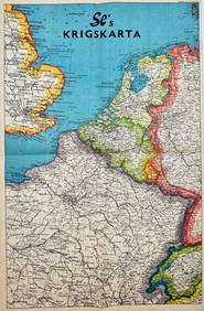
Vintage Map - Krigskarta - War Map - Second World War, published 1940Proverde Auctions4.3(3)See Sold PriceFeb 28, 2024
![[World War One - Maps] Trench Maps, Vimy and First Image](https://p1.liveauctioneers.com/46/113409/58240775_1_x.jpg?height=282&quality=95&version=1512492316&width=282)
![[World War One - Maps] Trench Maps, Vimy and First Image](https://p1.liveauctioneers.com/46/113409/58240775_1_x.jpg?height=282&quality=1&version=1512492316&width=282)
![[Tintype] Massive Bowie knife (1 of 1)](https://p1.liveauctioneers.com/7226/317626/170485482_1_x.jpg?height=282&quality=70&version=1706368022)
![[Ambrotype] Magnificent Portrait (1 of 1)](https://p1.liveauctioneers.com/7226/317626/170485477_1_x.jpg?height=282&quality=70&version=1706368022)


![[Tintype] Native American Man w/ Knife (1 of 2)](https://p1.liveauctioneers.com/7226/317626/170485453_1_x.jpg?height=282&quality=70&version=1706368022)
![[REES, Charles] Enlistedman w/ Bowie Knife (1 of 1)](https://p1.liveauctioneers.com/7226/317626/170485489_1_x.jpg?height=282&quality=70&version=1706368022)
![[Ambrotype] Wounded at Gettysburg (1 of 1)](https://p1.liveauctioneers.com/7226/317626/170485471_1_x.jpg?height=282&quality=70&version=1706368022)


![[Ambrotype] Young Soldier w/ Bowie Knife (1 of 1)](https://p1.liveauctioneers.com/7226/317626/170485459_1_x.jpg?height=282&quality=70&version=1706368022)

![[Daguerreotype] Soldier w/ Bowie Knife (1 of 2)](https://p1.liveauctioneers.com/7226/317626/170485458_1_x.jpg?height=282&quality=70&version=1706368022)
![[Tintype] Soldier w/ Flowers (1 of 1)](https://p1.liveauctioneers.com/7226/317626/170485495_1_x.jpg?height=282&quality=70&version=1706368022)
![[Tintype] Identified North Carolina Infantryman (1 of 2)](https://p1.liveauctioneers.com/7226/317626/170485474_1_x.jpg?height=282&quality=70&version=1706368022)
![[World War One - Maps] Trench Maps, Vimy and (1 of 2)](https://p1.liveauctioneers.com/46/113409/58240775_1_x.jpg?height=282&quality=70&version=1512492316)
![[World War One - Maps] WWI Trench Maps of Belgium, Lot (1 of 2)](https://p1.liveauctioneers.com/46/113409/58240774_1_x.jpg?height=282&quality=70&version=1512492316)
![[World War One - Maps] WWI Trench Maps of France and (1 of 2)](https://p1.liveauctioneers.com/46/113409/58240773_1_x.jpg?height=282&quality=70&version=1512492316)
![[World War One - Maps] WWI Trench Maps, Belgium and (1 of 2)](https://p1.liveauctioneers.com/46/113409/58240772_1_x.jpg?height=282&quality=70&version=1512492316)


![[World War One - Maps] WWI Military Maps of North West (1 of 2)](https://p1.liveauctioneers.com/46/113409/58240767_1_x.jpg?height=282&quality=70&version=1512492316)
![[World War One - Maps] WWI Military Maps of Belgium - (1 of 2)](https://p1.liveauctioneers.com/46/113409/58240766_1_x.jpg?height=282&quality=70&version=1512492316)
![[world War One - Maps] WWI Military Maps of North West (1 of 2)](https://p1.liveauctioneers.com/46/113409/58240769_1_x.jpg?height=282&quality=70&version=1512492316)
![[World War One - Maps] WWI Military Maps of Belgium, (1 of 2)](https://p1.liveauctioneers.com/46/113409/58240770_1_x.jpg?height=282&quality=70&version=1512492316)
![[World War One - Maps] WWI Military Maps of Belgium, (1 of 2)](https://p1.liveauctioneers.com/46/113409/58240768_1_x.jpg?height=282&quality=70&version=1512492316)


![[Military - World War One - Maps] Group of 50 Highly (1 of 7)](https://p1.liveauctioneers.com/46/113409/58240777_1_x.jpg?height=282&quality=70&version=1512492316)
![[World War One - Maps] Group of 3 Linen-Backed WWI (1 of 2)](https://p1.liveauctioneers.com/46/113409/58240771_1_x.jpg?height=282&quality=70&version=1512492316)


![[WORLD WAR II – OKINAWA]. Okinawa Shima Western Beaches Top... (1 of 1)](https://p1.liveauctioneers.com/928/318880/171361141_1_x.jpg?height=282&quality=70&version=1707501302)