MAP - PIETER SCHENK / VALK / JANSSEN Hand Colored superb Map Central Italy c1702Luis Porretta Fine Arts4.3(10)See Sold PriceMar 02, 2024
CHARLES ROLLIN c1828 Ceasar Hand Colored Africa Military MapLuis Porretta Fine Arts4.3(10)See Sold PriceMar 02, 2024
MAP - Dufour, A. H. ( Malte / Brun ) :MAP - ESPAGNE PARTIE SUD DIVISEE EN PROVINCES ANCIENNES ( MAPLuis Porretta Fine Arts4.3(10)See Sold PriceMar 02, 2024
RIGOBERT BONNE c1787 Original Colored Map Germany & Region 15" x 12"Luis Porretta Fine Arts4.3(10)See Sold PriceMar 02, 2024
AMBROISE TARDIEU c1822 Napoleonic War Map GermanyLuis Porretta Fine Arts4.3(10)See Sold PriceMar 02, 2024
MAP - AMBROISE TARDIEU c1822 Napoleonic Miltary Map GermanyLuis Porretta Fine Arts4.3(10)See Sold PriceMar 02, 2024
1822 Rare Map by Ambroise Tardieu Napoleon Caldiero Battle of Vento 17" x 11Luis Porretta Fine Arts4.3(10)See Sold PriceMar 02, 2024
PIETER SCHENK / VALK / JANSSEN Hand Colored Map of Rhodes Greece ca1702 vgcLuis Porretta Fine Arts4.3(10)See Sold PriceMar 02, 2024
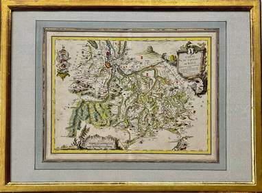
Map: Carte du Canton de Bale, Jacques Clermont, Paris, 1788Kensington Estate Auction4.6(216)See Sold PriceFeb 26, 2024
SoldSDUK: Antique Map of Northeast France, 1845TITLE/CONTENT OF MAP: 'FRANCE, II., North-East, from Paris to the Rhine' DATE PRINTED: 1845 IMAGE SIZE: Approx 33.5 x 32.5cm, 13.25 x 12.75 inches (Large) TYPE: Antique steel engraved map with originaSee Sold Price
SDUK: Antique Map of Northeast France, 1845Title/Content of Map: 'FRANCE, II., North-East, from Paris to the Rhine' Champagne Alsace Lorraine Picardie Bourgogne Nord. Date Printed: 1845 Image Size: Approx 33.5 x 32.5cm, 13.25 x 12.75 inches (LSee Sold Price
SDUK: Antique Map of Northeast France, 1845TITLE/CONTENT OF MAP: 'FRANCE, II., North-East, from Paris to the Rhine' Champagne Alsace Lorraine Picardie Bourgogne Nord. DATE PRINTED: 1845 IMAGE SIZE: Approx 33.5 x 32.5cm, 13.25 x 12.75 inches (LSee Sold Price
SDUK: Antique Map of Northeast France, 1845Title/Content of Map: 'FRANCE, II., North-East, from Paris to the Rhine' FRANCE N EAST. Champagne Alsace Lorraine Picardie Bourgogne Nord. Date Printed: 1845 Image Size: Approx 33.5 x 32.5cm, 13.25 xSee Sold Price
SDUK: Antique Map of North East France, 1845Title/Content of Map: 'FRANCE, II., North-East, from Paris to the Rhine' Champagne Alsace Lorraine Picardie Bourgogne Nord. Date Printed: 1845 Image Size: Approx 33.5 x 32.5cm, 13.25 x 12.75 inches (LSee Sold Price
SDUK: Antique Map of France in Provinces, 1845TITLE/CONTENT OF MAP: 'FRANCE IN PROVINCES.' DATE PRINTED: 1845 IMAGE SIZE: Approx 32.5 x 32.5cm, 12.75 x 12.75 inches (Large) TYPE: Antique steel engraved map with original outline hand colouring CONSee Sold Price
SDUK: Antique Map of Northeast England Coast, 1845Title/Content of Map: 'ENGLAND No 1 [North East]' Coast. North York Moors. Yorkshire Durham &c. Date Printed: 1845. This date is printed on the map Image Size: Approx 33.5 x 40.5cm, 13.25 x 16 inchesSee Sold Price
SDUK: Antique Map of France before 1790, c1845Title/Content of Map: 'FRANCE IN PROVINCES.' Shows provinces <1790. Original hand colour. Date Printed: 1845 Image Size: Approx 32.5 x 32.5cm, 12.75 x 12.75 inches (Large) Type: Antique steel engravedSee Sold Price
SDUK: Antique Map of Northeast United States, 1846TITLE/CONTENT OF MAP: 'NORTH AMERICA, SHEET VI., New York, Vermont, Maine, New Hampshire, Massachusetts, Connecticut, Rhode Island, New Jersey' DATE PRINTED: 1846 IMAGE SIZE: Approx 36.5 x 33.5cm, 14.See Sold Price
Antique Map of Northeast France on Linen, 1908Carte Routière Taride pour Cyclistes & Automobiles du Nord-Est de la France (n. 2). Paris: A. Taride, 1908. A map of the North East of France on linen. Measures 89 x 68 cm. Light toning and soiling tSee Sold Price
SoldSDUK: Antique Map of Italy, 1845Title/Content of Map: 'ITALY IV, General map including Sicily, Malta, Sardinia, and Corsica' Date Printed: 1845 Image Size: Approx 40.5 x 34.5cm, 16 x 13.5 inches (Large) Type: Antique steel engravedSee Sold Price
SoldSDUK: Antique Map of Portugal, 1845TITLE/CONTENT OF MAP: 'PORTUGAL' Provinces. Algarve Alentejo Estremadura Beira etc. DATE PRINTED: 1845 IMAGE SIZE: Approx 37.5 x 27.5cm, 14.75 x 10.75 inches (Large) TYPE: Antique steel engraved map wSee Sold Price
SDUK: Antique Map of Europe, 1845Title/Content of Map: 'EUROPE; inset table of population by country'. The map shows Lombardia-Venetia as part of the Austrian Empire, the independent Ionian Islands, and Turkish Crete Date Printed: 18See Sold Price
SDUK: Antique Map of Italy, 1845Title/Content of Map: 'ITALY IV, General map including Sicily, Malta, Sardinia, and Corsica' Date Printed: 1845 Image Size: Approx 40.5 x 34.5cm, 16 x 13.5 inches (Large) Type: Antique steel engravedSee Sold Price
SoldSDUK: Antique Map of Europe, 1845TITLE/CONTENT OF MAP: 'EUROPE; inset table of population by country' The map shows Lombardia-Venetia as part of the Austrian Empire, the independent Ionian Islands, and Turkish Crete DATE PRINTED: 184See Sold Price
SDUK: Antique Map of Italy, 1845TITLE/CONTENT OF MAP: 'ITALY IV, General map including Sicily, Malta, Sardinia, and Corsica' DATE PRINTED: 1845 IMAGE SIZE: Approx 40.5 x 34.5cm, 16 x 13.5 inches (Large) TYPE: Antique steel engravedSee Sold Price
SDUK: Antique Map of Scandinavia, 1845Title/Content of Map: 'SWEDEN, NORWAY, AND DENMARK'. Scandinavia. Population table. Date Printed: The map was originally published in 1841. This date is printed on the map. This edition of the map wasSee Sold Price
SDUK: Antique Map of Scandinavia, 1845TITLE/CONTENT OF MAP: 'THE NORTHERN PROVINCES OF SWEDEN AND NORWAY WITH PART I OF RUSSIA' DATE PRINTED: The map was originally published in 1834. This date is printed on the map. This edition of the mSee Sold Price
SDUK: Antique Map of Switzerland, 1845TITLE/CONTENT OF MAP: 'SWITZERLAND. SCHWEIZ LA SUISSE; inset heights of mountains and passes' DATE PRINTED: 1845 IMAGE SIZE: Approx 34.0 x 41.5cm, 13.5 x 16.5 inches (Large) TYPE: Antique steel engravSee Sold Price
SDUK: Antique Map of Marseille, France, 1847Title/Content of Map: 'MARSEILLE. ANCIENT MASSILIA'. Antique town city map. Date Printed: This map was originally published in 1840. This date is printed on the map. This edition of the map was publisSee Sold Price
Mallet: Antique Map of Benelux & Northeast France, 1683TITLE OF THE MAP: 'Cercle de Bourgogne' Includes Luxembourg. Belgium. Parts of France and Germany. DATE PRINTED: 1683 IMAGE SIZE: Approx Overall page size 13 x 21cm approximately (5 x 8 inches); imageSee Sold Price
SDUK: Antique Map of Russia, 1845TITLE/CONTENT OF MAP: 'RUSSIA IN EUROPE, PART II., Arkhangel, Vologda, Viatka, Perm' DATE PRINTED: 1845 IMAGE SIZE: Approx 34.0 x 41.5cm, 13.5 x 16.25 inches (Large) TYPE: Antique steel engraved map wSee Sold Price
SDUK: Antique Map of Russia, 1845TITLE/CONTENT OF MAP: 'RUSSIA IN EUROPE, PART II., Arkhangel, Vologda, Viatka, Perm' DATE PRINTED: 1845 IMAGE SIZE: Approx 34.0 x 41.5cm, 13.5 x 16.25 inches (Large) TYPE: Antique steel engraved map wSee Sold Price
SDUK: Antique Map of Switzerland, 1845TITLE/CONTENT OF MAP: 'SWITZERLAND. SCHWEIZ LA SUISSE; inset heights of mountains and passes' DATE PRINTED: 1845 IMAGE SIZE: Approx 33.0 x 41.0cm, 13 x 16 inches (Large) TYPE: Antique steel engraved mSee Sold Price
17TH C. ANTIQUE MAP SIEGE OF LA ROCHELLE, FRANCE, FRAMEDThomaston Place Auction Galleries4.4(386)See Sold PriceFeb 24, 2024
Framed Hand Colored Antique Map of the Department of Nord, FranceDonny Malone Auctions4.5(1.7k)See Sold PriceMar 04, 2024
1760 MAP CARTE PARTICULIERE DE L'ISLE DE JUAN FERNANDES antique Robinson CrusoeJasper524.5(9.8k)See Sold PriceFeb 27, 2024
WEST AFRICA Explorers' routes Senegal Ashanti. Mountains of Kong. SDUK 1857 mapJasper524.5(9.8k)See Sold PriceFeb 28, 2024
AFRICA. Map pre-dating much exploration. Mountains of Kong. SDUK 1851 oldJasper524.5(9.8k)See Sold PriceFeb 28, 2024
NORTH AFRICA OF BABRBARY V Parts of Tripoli & Egypt. Libya Tribes. SDUK 1846 mapJasper524.5(9.8k)See Sold PriceFeb 28, 2024
WEST AFRICA explorers' routes. Beaufort Gray Park Dochard Caillie. SDUK 1874 mapJasper524.5(9.8k)See Sold PriceFeb 28, 2024
NORTH AFRICA BARBARY. Parts of Tripoli (Libya) & Egypt. Tribes. SDUK 1844 mapJasper524.5(9.8k)See Sold PriceFeb 28, 2024
WEST AFRICA I Explorers' routes Senegal Ashanti Ivory Gold Coast. SDUK 1851 mapJasper524.5(9.8k)See Sold PriceFeb 28, 2024
NORTH AFRICA BARBARY. Parts of Tripoli (Libya) & Egypt. Tribes. SDUK 1844 mapJasper524.5(9.8k)See Sold PriceFeb 28, 2024
NIGERIA explorers' routes. Lander Clapperton Oudney Denham Allen. SDUK 1874 mapJasper524.5(9.8k)See Sold PriceFeb 28, 2024
WEST AFRICA II. NIGERIA. Bight of Benin-Lake Chad. Yariba Houssa. SDUK 1851 mapJasper524.5(9.8k)See Sold PriceFeb 28, 2024
NORTH AFRICA OF BABRBARY V Parts of Tripoli & Egypt. Libya Tribes. SDUK 1851 mapJasper524.5(9.8k)See Sold PriceFeb 28, 2024
Colonial Africa North-East. Hejaz Kenya Abyssinia Sudan. THE TIMES 1895 mapJasper524.5(9.8k)See Sold PriceFeb 28, 2024
NIGERIA early explorers' routes. Lake Chad. Yariba Houssa Borgou SDUK 1844 mapJasper524.5(9.8k)See Sold PriceFeb 28, 2024
NORTH AFRICA BARBARY. Parts of Tripoli (Libya) & Egypt. Tribes. SDUK 1848 mapJasper524.5(9.8k)See Sold PriceFeb 28, 2024
Colonial Africa North-East. Hejaz Kenya Abyssinia Colonial. THE TIMES 1900 mapJasper524.5(9.8k)See Sold PriceFeb 28, 2024
WEST AFRICA showing early explorers' routes & Mountains of Kong. SDUK 1844 mapJasper524.5(9.8k)See Sold PriceFeb 28, 2024
Antique Map of France, 1703 by Gillaume Del Isle PrintAntiques Online Auctions4.6(407)See Sold PriceMar 14, 2024