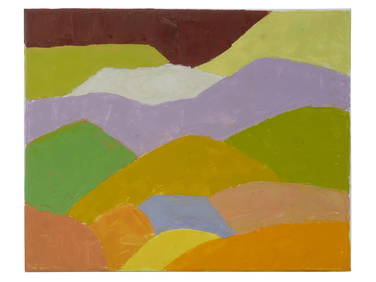
Chaim Soutine (Belarusian/French, 1893-1943) - La Petite Fille dans la VerdureFreeman's | Hindman4.5(158)See Sold PriceFeb 27, 2024
Elisabeth Frink (British, 1930-1993) - Harbinger Bird IFreeman's | Hindman4.5(158)See Sold PriceFeb 27, 2024
AMERICAN SEASCAPE PAINTING BY ROSS EMBROSE MOFFETTAntique Arena Inc.4.5(866)See Sold PriceMar 02, 2024
CHARLES HENRY GIFFORD (Massachusetts, 1839-1904), Luminist view of three sailboats in a quietEldred's4.7(418)See Sold PriceFeb 28, 2024
RARE MANHATTAN PROJECT GLASS LEADED FROM THE MANHATTAN PROJECT WORLD WAR II WW2 724 GRAMSCol. Christie Hatman Auctioneers4.5(323)See Sold PriceFeb 26, 2024
Estate Fresh Civil War Cavalry C. Roby 1863 With ScabbardRalph Fontaine Heritage Auctions Inc.4.7(234)See Sold PriceFeb 25, 2024
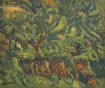
ABSTRACT ARAB LEBANESE OIL PAINTING BY ETEL ADNANAntique Arena Inc.4.5(866)See Sold PriceMar 02, 2024
Military Map of Palestine, Asia and Syria - Fr...Asie Mineure et Syrie, Jerusalem Feuille Est, Reproduit et imprime au Service geographique de l'Armee pour les besoins exclusifs de l'Armee [Map of Asia Minor, Syria and East Jerusalem. Produced and pSee Sold Price
SoldA Rare & Unusual Military Map of Palestine,dated 1942, title reads 'NOT TO BE PUBLISHED, Palestine North Sheet', map bordering Lebanon, Syria and showing Gaza in the south, with some red pencil marks to Nazareth, Jenin and Beit Nabala, dimensiSee Sold Price
Bartholomew, John 1922 Lot of 4 Maps. Holy LandIncl Persia, Palestine, Asia Minor/Syria/Mesopotamia, and South Western Asia. Large Lithograph Maps Published 1922 by The Times, London for "The Times Survey Atlas of the World" Maps by John George BaSee Sold Price
Bartholomew, John 1922 Lot of 4 Maps. Holy LandIncl Persia, Palestine, Asia Minor/Syria/Mesopotamia, and South Western Asia. Large Lithograph Maps Published 1922 by The Times, London for "The Times Survey Atlas of the World" Maps by John George BaSee Sold Price
Bartholomew, John 1922 Lot of 4 Maps. Holy LandIncl Persia, Palestine, Asia Minor/Syria/Mesopotamia, and South Western Asia. Large Lithograph Maps Published 1922 by The Times, London for "The Times Survey Atlas of the World" Maps by John George BaSee Sold Price
MIDDLE EAST. Turkey Transjordan Palestine Israel Syria Levant States 1938 mapTITLE/CONTENT OF MAP: 'Western Asia; Palestine' DATE PRINTED: 1938 IMAGE SIZE: Approx 26.5 x 35.5cm, 10.25 x 14 inches (Large) TYPE: Vintage colour map: Scale 1:10,000,000; 1:1,400,000 CONDITION: GoodSee Sold Price
SoldBartholomew, John 1922 Lot of 5 Maps Egypt & Holy LandIncl Egypt and The Nile, Lower Egypt, Asia Minor/Syria/Mesopotamia, Palestine and Persia. Large Lithograph Maps Published 1922 by The Times, London for "The Times Survey Atlas of the World" Maps by JoSee Sold Price
SoldBartholomew, John 1922 Lot of 3 Maps of the Holy Land"Asia Minor, Syria & Mesopotamia" "Palestine" and "Persia" Large Lithograph Maps Published 1922 by The Times, London for "The Times Survey Atlas of the World" Maps by John George Bartholomew of the EdSee Sold Price
Bartholomew, John 1922 Lot of 5 Maps Egypt & Holy LandIncl Egypt and The Nile, Lower Egypt, Asia Minor/Syria/Mesopotamia, Palestine and Persia. Large Lithograph Maps Published 1922 by The Times, London for "The Times Survey Atlas of the World" Maps by JoSee Sold Price
SoldBartholomew, John 1922 Mixed Lot of 9 Large MapsIncl Mapping of the World, World Climate, Germany East, Southern Russia, Asia Minor/Syria/Mesopotamia, Palestine, Indian Ocean, North America - Political, North Atlantic Ocean. Large Lithograph Maps PSee Sold Price
SoldDamaged Maps 18th-19th Cent. Lot of 18Lot of approx 18 Maps in poor condtion. Mostly 19th Century, Lithographed. A few Copper & Steel Engraved. Incl France, South Atlantic, China, Syria, Palestine, South America, America Continent, Asia,See Sold Price
SoldOttoman Empire in Asia. Turkey, Iraq, Jordan, Syria,Title: Ottoman Empire in Asia. Turkey, Iraq, Jordan, Syria, Lebanon and Palestine. 1850 by Thomas. Date/Period: c1850. Materials: Hand colored steel engraved Size: 16 1/2 x 13 1/2 inches. c1850 by ThoSee Sold Price
TURKEY IN ASIA. Cyprus Levant Iraq Kurdistan. Ottoman.TITLE/CONTENT OF MAP: 'Turkey in Asia' Includes Asia Minor (Modern Turkey), the Levant (Syria, Lebanon, Jordan & Palestine) and part of Iraq. "Koordistan" (Kurdistan) is shown as a province straddlingSee Sold Price
Sharp and scarce 1833 Finley map of Turkey in AsiaImportant map of the lands claimed by the Ottoman Empire in the 19th century. Covers the modern-day countries of Turkey, Georgia, Iraq, Lebanon, Syria, Jordan, Cyprus, Palestine and Israel. Clearly deSee Sold Price
SoldJewish Settlements 1946 WALL MAP OF PALESTINE SyriaDetails: This lot consists of the 1946 Wall Map of Palestine shown in the corresponding images.This scarce map of Palestine is titled in English and Hebrew. Produced by Meyer Breen, C.E., prior to thSee Sold Price
SoldMap. Asia Minor and Syria. 1829.Print from steel engraving titled „III. Asia minor et Syria“.From Schul-Atlas der alten Welt. Published by Gotha Perthes. 1829.Orbis Terrarum Antiquus. School Atlas of the Ancient World edited bySee Sold Price
SoldHughes: Antique Map of Asia Minor & Syria, 1856Map: Asia Minor and the Northern Part of Syria Date: 1856 By William Hughes from Long's Classical Atlas Size: 13 x 10 inches Please note that this lot has a confidential reserve. When you leave a bidSee Sold Price
Map of Egypt Palestine Syria and Phoenicia. Africa.1835Print of hand colored steel engraving titled Egypte Palestine Syria et Phoenicie“.Author C. V. Monin.Engraved by unknown.From the Atlas Universel de Geography“ by C. V. Monin. Parsi. 1835.Egypt ofSee Sold Price
SoldMilitary Telegraph Lines Map - Philippines - Asia - National Geographic 1950sTitle/Content: Military Telegraph Lines Map - Philippines - Asia - National Geographic 1950s Date: 1950s Material: Paper Dimensions: 35” x 34” inches / 90 cm x 86 cm (х2) 35” xSee Sold Price
Sold3 Hand Colored Maps of Syria, Palestine & Europe3 Hand Colored Maps of Syria, Palestine & Europe. Dimensions of Largest- Sight- L-15" x W-20", Frame- L- 20" x W-23.5".See Sold Price
SoldWWI - WWII WORLD BOOK, MANUAL, MAP & POSTCARD LOTWWI - WWII WORLD BOOK, MANUAL, MAP & POSTCARD LOT WWI collection of military operation maps in Egypt & Palestine, and France & Belgium. Some photos & postcard prints of world sites, in photo album.See Sold Price
Sold1876 Mitchell Map of China, India and SouthEast AsiaReserve Reduced! Title/Content of Map: 1876 Mitchell Map of China, India and SouthEast Asia [verso] Palestine -- Map of Hindoostan, Farther India, China, Tibet [verso] A New Map of Palestine or the HoSee Sold Price
SoldWyld (James) Central AsiaWyld (James) (publisher) Military Staff Map of Central Asia, Turkistan, and Afghanistan,Central Asia, lithographed map, dissected into 32 sheets, linen-backed, original outline hand-colouring,See Sold Price
1876 Mitchell Map of China, India and SouthEast AsiaTitle/Content of Map: 1876 Mitchell Map of China, India and SouthEast Asia [verso] Palestine -- Map of Hindoostan, Farther India, China, Tibet [verso] A New Map of Palestine or the Holy Land Date PrinSee Sold Price
CHARLES ROLLIN c1828 Ceasar Hand Colored Africa Military MapLuis Porretta Fine Arts4.3(10)See Sold PriceMar 02, 2024
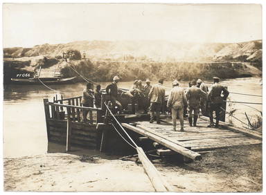
7 Photos - Palestine Front - German Military - WWILevy Auction House4.3(11)See Sold PriceFeb 27, 2024
Jerusalem Map for British Soldiers in Palestine - WW2Levy Auction House4.3(11)See Sold PriceFeb 27, 2024
The Holy Land Tours - Hamburg American Line - 1911Levy Auction House4.3(11)See Sold PriceFeb 27, 2024
18 Booklets Collection - War Graves of Palestine - WWILevy Auction House4.3(11)See Sold PriceFeb 27, 2024
1886 Cities of BASHAN Holy Land SYRIA Palestine Israel Jerusalem History BibleSchilb Antiquarian Rare Books4.8(422)See Sold PriceMar 31, 2024
Collection of Allied Military Silk Printed Maps, WWII Era and LaterMaterial Culture4.6(769)See Sold PriceFeb 29, 2024
D'Entrecasteaux - Map of Australia (New Holland), New Zealand, and southern Asia and surroundingTrillium Antique Prints & Rare Books4.5(30)See Sold PriceFeb 24, 2024
Carey, pub. 1796 - A Chart of the West IndiesTrillium Antique Prints & Rare Books4.5(30)See Sold PriceFeb 24, 2024
Carey, pub. 1796 - Map of the State of MarylandTrillium Antique Prints & Rare Books4.5(30)See Sold PriceFeb 24, 2024
Carey, pub. 1796 - Map of GeorgiaTrillium Antique Prints & Rare Books4.5(30)See Sold PriceFeb 24, 2024
Carey, pub. 1796 - Map of The State of South CarolinaTrillium Antique Prints & Rare Books4.5(30)See Sold PriceFeb 24, 2024
Carey, pub. 1796 - Map of KentuckyTrillium Antique Prints & Rare Books4.5(30)See Sold PriceFeb 24, 2024
Carey, pub. 1796 - Map of the Tennassee State formerly part of North Carolina (Tennessee)Trillium Antique Prints & Rare Books4.5(30)See Sold PriceFeb 24, 2024
De Jode, Rare, pub. 1593 - Map of the Middle East, Eastern Asia (Primae Partis Asiae accurataTrillium Antique Prints & Rare Books4.5(30)See Sold PriceFeb 24, 2024


![[Tintype] Massive Bowie knife (1 of 1)](https://p1.liveauctioneers.com/7226/317626/170485482_1_x.jpg?height=282&quality=70&version=1706368022)
![[Ambrotype] Magnificent Portrait (1 of 1)](https://p1.liveauctioneers.com/7226/317626/170485477_1_x.jpg?height=282&quality=70&version=1706368022)


![[Tintype] Native American Man w/ Knife (1 of 2)](https://p1.liveauctioneers.com/7226/317626/170485453_1_x.jpg?height=282&quality=70&version=1706368022)
![[REES, Charles] Enlistedman w/ Bowie Knife (1 of 1)](https://p1.liveauctioneers.com/7226/317626/170485489_1_x.jpg?height=282&quality=70&version=1706368022)
![[Ambrotype] Wounded at Gettysburg (1 of 1)](https://p1.liveauctioneers.com/7226/317626/170485471_1_x.jpg?height=282&quality=70&version=1706368022)


![[Ambrotype] Young Soldier w/ Bowie Knife (1 of 1)](https://p1.liveauctioneers.com/7226/317626/170485459_1_x.jpg?height=282&quality=70&version=1706368022)

![[Daguerreotype] Soldier w/ Bowie Knife (1 of 2)](https://p1.liveauctioneers.com/7226/317626/170485458_1_x.jpg?height=282&quality=70&version=1706368022)
![[Tintype] Soldier w/ Flowers (1 of 1)](https://p1.liveauctioneers.com/7226/317626/170485495_1_x.jpg?height=282&quality=70&version=1706368022)
![[Tintype] Identified North Carolina Infantryman (1 of 2)](https://p1.liveauctioneers.com/7226/317626/170485474_1_x.jpg?height=282&quality=70&version=1706368022)