MATTHEWS c1856 Map Of Upper Canada Ontario Indian Land Agency Divisions Scarce!Luis Porretta Fine Arts4.3(10)See Sold PriceMar 02, 2024
DEVINE c1856 Dr Salters Map Of Lake Huron Ontario Indian Lands etc. No. 7 ScarceLuis Porretta Fine Arts4.3(10)See Sold PriceMar 02, 2024
DUNLEVIE c1856 Map Counties Of Gaspe & Bonaventure Quebec Canada SCARCE! #1Luis Porretta Fine Arts4.3(10)See Sold PriceMar 02, 2024
DUNLEVIE c1856 Map Counties Of Gaspe & Bonaventure Quebec Canada SCARCE! #2Luis Porretta Fine Arts4.3(10)See Sold PriceMar 02, 2024
Map UNITED COUNTIES LEEDS & GRENVILLE by Walling 1861 Rare Canada Map 5ft x 5ftLuis Porretta Fine Arts4.3(10)See Sold PriceMar 02, 2024
Ambroise TARDIEU c1822 Map Venice Napoleon Italian Campaign 17" x 11"Luis Porretta Fine Arts4.3(10)See Sold PriceMar 02, 2024
SoldHondius: Antique Map of Virginia & the Carolinas, 1606Map: 1606 Hondius Map of Virginia and the Carolinas - Virginiae item ed Floridae Americae provinciarum, nova descripto Cartographer: J Hondius Year / Place: 1606 c., Amsterdam Map Dimensions: 13.5 X 1See Sold Price
1606 Hondius Map of Virginia and the Carolinas1606 Hondius Map of Virginia and the Carolinas - Virginiae item ed Floridae Americae provinciarum, nova descripto J Hondius 1606 c., Amsterdam 13.5 X 19.3 in. This highly attractive map of Virginia anSee Sold Price
SoldHondius' Map of Virginia and Florida Hondius' Map of Virginia and Florida Virginiae Item et Floridae Americae Provinciarum, Nova Descriptio. An early example of Hondius' map of Virginia, the Carolinas, and Northern Florida, extending fSee Sold Price
SoldHondius 1628 map of Virginia and the Carolinas[Hondius/Southeast America] VIRGINIAE ITEM ET FLORIDAE AMERICAE PROVINCIARUM, NOVA DESCRIPTIO or a New Description of Virginia and Florida of Provincial America. [From a French-language edition of HonSee Sold Price
SoldHondius map of Virginia 1619Heading: Author: Hondius, Jodocus Title: Virginiae Item et Floridae Americae Provinciarum, Nova Descriptio Place Published: Amsterdam Publisher: Date Published: 1606-[1619] DescriptionSee Sold Price
Hondius map of Virginia 1619Heading: Author: Hondius, Jodocus Title: Virginiae Item et Floridae Americae Provinciarum, Nova Descriptio Place Published: Amsterdam Publisher: Date Published: 1606-[1619] DescriptionSee Sold Price
SoldJODOCUS HONDIUS (Dutch. 1563-1612) ANTIQUE MAP OFVerso inscribed Hondius. 1606. Measuring 14 1/2” by 19”. Framed under Plexiglas. (Cond: creasing, toning, soiling, tears) (1000/1500)See Sold Price
SoldHericus Hondius "Map of Virginia" engraved antique handHERICUS HONDIUS (Dutch 1597-1651) "Nova Virginiae Tabula" (Map of Virginia) Hand-colored engraving on laid paper. Sheet: 19 1/8 x 22 7/8 inches. Published in Amsterdam, based on John Smith's map of 16See Sold Price
SoldAntique Map: John Smith's Map of VirginiaFramed antique map. John Smith's Map of Virginia. Well-engraved early 19th century reproduction. Discovered and Described by Captain John Smith, 1606. First published in 1612, this was one of the mostSee Sold Price
SoldJODOCUS HONDIUS (Dutch. 1563-1612)Antique Map of The Mediterranean. Verso inscribed Hondius. 1606. Measuring 14 1/2” by 19”. Framed under Plexiglas. (Cond: creasing, toning, soiling, tears)See Sold Price
SoldEaly map of Virginia 1609Heading: (Virginia & Carolina) Author: Hondius, Jodocus Title: Virginiae Item et Floridae Americae Provinciarum, Nova Descriptio Place Published: Amsterdam Publisher: Date Published: 1606-[16See Sold Price
SoldEaly map of Virginia 1634Heading: (Virginia & Carolina) Author: Hondius, Jodocus Title: Virginiae Item et Floridae Americae Provinciarum, Nova Descriptio Place Published: Amsterdam Publisher: Date Published: 1606-[16See Sold Price
SoldWillem Janszoon Blaeu Virginia & Florida MapDutch, c. 1640, Virginiae Partis australis, et Floridae partis orientalis, after the Mercator-Hondius 1606 map, two sheets adhered at center, black and white engraving with hand colored highlights, deSee Sold Price
SoldEaly map of Virginia 1609Heading: Author: Hondius, Jodocus Title: Virginiae Item et Floridae Americae Provinciarum, Nova Descriptio Place Published: Amsterdam Publisher: Date Published: 1606-[1609] DescriptionSee Sold Price
SoldEaly map of Virginia 1636Heading: Author: Hondius, Jodocus Title: Virginiae Item et Floridae Americae Provinciarum, Nova Descriptio Place Published: Amsterdam Publisher: Date Published: 1606-[1636] DescriptionSee Sold Price
SoldHondius Map of VA - Nova Virginiae Tabula, 1636-1641NOVA VIRGINIAE TABULA by Hondius, Amsterdam, copper-engraved map of Virginia based on the 1612 Virginia map by John Smith, engraved on laid paper. Framed with double sided glass showing English text eSee Sold Price
Reproduction of Early Seventeenth Century Colonial MapReproduction of a 1606 map of Florida and Virginia colonies by Jocodus Hondius, printed by Hammond Incorporated in authentic colors from original print, unframed. Paper has some minor tears along theSee Sold Price
SoldHondius: Antique Map of the Western Hemisphere, 1630Title/Content of Map: Western Hemisphere by H Hondius with sea monsters Date Printed: c1630-1634 Cartographer: Henricus Hondius Material/Medium: Paper Size: Approx 17" x 21" Magnificent Map. PublishedSee Sold Price
Mercator / Hondius: Antique Map of North Pole with GoldTitle: SEPTENTRIONALIUM Terrarum descriptio. Per Gerardum Mercatore. 1623 Mercator & Hondius North Pole heightened in gold and filled with cartographic myths Map maker: Gerard Mercator & Jocodus HondiSee Sold Price
SoldHondius: Antique Map of the Western Hemisphere, 1631Title: America noviter delineata. Hondius 1631 western hemisphere with polar inserts Map maker: Henricus Hondius Place and Year: Amsterdam, 1631 Dimensions: 37.7 x 49.8 cm (14¾ x 19½ in) Technique:See Sold Price
SoldMercator / Hondius: Antique Map Cuba / Hispaniola, 1607Title/Content of Map: Cuba Insul/Hispaniola Cartographer: Mercator / Hondius Place & Date: Amsterdam / 1607/1620s Size: 7 1/8" x 5 5/8" Condition: full color; overall age-toning and some staining; resSee Sold Price
Hondius: Antique Map of the Western Hemisphere, 1630Map: Western Hemisphere Date Printed: c 1630-1634 Cartographer: Henricus Hondius Material/Medium: Paper Size: *** Approx 17" x 21" Thick paper. Script on verso. Amsterdam, Dutch edition. Based on HondSee Sold Price
Hondius: Antique Map of the World, 1630Map: Terravm Orbis Maker: H. Hondius Date Printed: 1630 Material/Medium: Ink on paper Size: 33 x 24 in Nova Totivs Please note that this lot has a confidential reserve. When you leave a bid in advanceSee Sold Price
SoldHondius: Antique Map of Chile, 1635Title: Chili. Rare English edition of the Mercator-Hondius map of Chile Map maker: Henricus Hondius Place and Year: Amsterdam, c. 1635 Dimensions: 48. 3 x 36.8 cm (19 x 14.5 in) Technique: CopperplateSee Sold Price
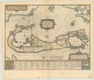
RARE 1638 HONDIUS MAP OF BERMUDA, FRAMEDThomaston Place Auction Galleries4.4(393)See Sold PriceFeb 24, 2024
17TH C. ANTIQUE MAP SIEGE OF LA ROCHELLE, FRANCE, FRAMEDThomaston Place Auction Galleries4.4(393)See Sold PriceFeb 24, 2024
18TH C. ANTIQUE MAP: FRENCH & INDIAN WAR, FRAMEDThomaston Place Auction Galleries4.4(393)See Sold PriceFeb 24, 2024
1636 MAP of SWITZERLAND DAS WIFISPURGERGOU antique 15 by 19"Jasper524.5(9.9k)See Sold PriceFeb 27, 2024
Cooke, George 1801 Antique Map. United States of AmericaAlbion Auctions4.6(341)See Sold PriceMar 01, 2024
Map of Yorktown - York County in Virginia - United StatesProverde Auctions4.3(3)See Sold PriceFeb 28, 2024
Mary Jane Thomas Stokes - Map of Lighthouses of the Chesapeake Bay. Past and PresentProverde Auctions4.3(3)See Sold PriceFeb 28, 2024
Antique Map of Poland, 1700 by Guillaume De Lisle, ParisAntiques Online Auctions4.6(415)See Sold PriceMar 14, 2024