SoldNew Haven, Ct. city map dated 1830. Folds, creaseNew Haven, Ct. city map dated 1830. Folds, creases, some loss around edge and at folds. Measures 16" X 15" image.See Sold Price
Sold1884 Map Of The City Of New Haven Connecticut FramedFramed map of the City Of New Haven Connecticut. Produced by Price, Lee & Company. Survey by S.W. Searle. Folds, creases, paper loss, and toning. Not inspected out of frame.&nbsSee Sold Price
SoldMAX, Peter. Original Illustration on Cloth Napkin.Signed and dated 1984 lower right. Peter Max, American/German, b. 1937. From a New City, NY home. Dimensions: 21.5" high x 22" wide. Condition: Unframed, fold crease marks, some original food stains.See Sold Price
SoldEarly South Carolina Map Dated 1799Engraving titled "The State of South Carolina from the best Authorities 1799"; published by I. Low, New York; unframed; 8 1/2"W, 7 1/2"H; fold lines, creases--Private collection, Spartanburg, South CaSee Sold Price
SoldAtlas of New Haven ConnecticutEarly 20th atlas Folio of Maps for the City of New Haven CT, compiled by Streuli & Puckhafer, dated 1911. Large size (24" x 16" full color detailed maps of the town by neighborhood, streets, etc. inclSee Sold Price
Map of New England States 1830Map of New England States Hand Colored Map. Cartographer: E. Huntington Publisher H & F J Huntington Dated: 1830 Dimensions: 18 x 10 1/2"See Sold Price
SoldAntique Map Plan Of The Town Of New Haven 1748Antique map of New Haven Connecticut. Dated 1748, likely published later. Toning, water spots, foxing, folds, paper loss, and creases. Not inspected out of frame. Fair.See Sold Price
SoldColton (G.W. & C.B.) - New Map of the City of Brooklynengraved map with extensive original hand-colouring, on tissue-thin paper, 620 x 775mm., old folds with one or two minor splits, a printer's crease lower left, otherwise a crisp clean copy, folding inSee Sold Price
SoldMAP OF THE MOST INHABITED PARTS OF NEW ENGLANDBY THOMAS JEFFERYS, DATED 1774. INCLUDES MASS BAY, NH WITH THE COLONIES OF CT & RI. HAND COLORED, EXCELLENT CONDITION BUT SHOWS CREASES FROM FOLDING. SIGHT SIZE 41" X 39 1/2", OVERALL 43 3/4" X 42 1/4See Sold Price
Sold1838 Colorful New York City Lower Manhattan MapHistoric Maps 1838 Hand-Tinted New York City Lower Manhattan Map 1838-Dated, Vintage Colorful Hand-Tinted Folding Map titled, “City of New York”, republished by W.P. Stone, Ithaca, N.Y., Very FineSee Sold Price
SoldTwo Antique New York City Colored Map EngravingsTwo antique New York City colored map engravings, one dated 1852. 12" H x 10" W and 12 3/4" H x 8 5/8" W under mats, very good condition.See Sold Price
SoldIconic New York City Subway Map, 1987Iconic New York City Subway Map. 1987, approx. 26x22 inches, folds to approx. 3.5x6.5 inches, printed on both sides. No Reserve: This lot starts at $1 and has no reserve as a courtesy so that collectoSee Sold Price
1940 Atlantic City New Jersey Map W Kents Restaurant AdVintage 1940 Atlantic City, New Jersey Map with KENTS RESTAURTS and STEEL PIER Advertisements. Map folds into a brochure which is about 3-3/4" x 9". Actual map size when completely unfolded is aSee Sold Price
SoldHepplewhite Tilt Top Table Circa 1830Hepplewhite Tilt Top Table Circa 1830. Accompanied By Copy Of Antique Shop Purchase Receipt From New York City, Dated 1943. Top Measures 22.75" X 20.75". Table Is 29" Tall. Some Warping To Top.See Sold Price
Sold2 New York City Maps, to include: "Greater New York and2 New York City Maps, to include: "Greater New York and Jersey city" dated may 1889, 77" h, 61-1/2" w, with losses; together with "A Map of The City of New York" published by Hyde & Company 1898, 83-1See Sold Price
Sold(3) OLD NEW YORK CITY MAPS, VALENTINE'S MANUALIncluding "Old New York, The Bouwery," 1862. Dimensions: (Largest) H 16.75'" x W 20.5" Conditions: Removed from books, folds, edge damages, toning.See Sold Price
Sold(3) OLD NEW YORK CITY MAPS, VALENTINE'S MANUALIncluding "Plan of the Central Park, city of New York, 1860." Hand colored Dimensions: (Largest) H 18.5" x W 14" Condition: Removed from books, folds, edge damages, toning.See Sold Price
Sold(3) OLD NEW YORK CITY MAPS, VALENTINE'S MANUALIncluding "Plan of the City of New York (1755)" 1849. Dimensions: (Largest) H 18" x W 10.75" Condition: Removed from book, folds, edge losses, toningSee Sold Price
Laminated Unique Media New York City MapLaminated Unique Media "New York City And Region" Map. The map is approx 27" x 18 1/4" and it weighs 0.29lb. The map is in a good, used condition with light creases and scratches. Please see the imageSee Sold Price
Laminated Unique Media New York City MapLaminated Unique Media "New York City And Region" Map. The map is approx 27" x 18 1/4" and it weighs 0.29lb. The map is in a good, used condition with light creases and scratches. Please see the imageSee Sold Price
Sold-. Wells (Edward) A New Map of Iberia, Europaea Al-. Wells (Edward) A New Map of Iberia, Europaea Aloas Celtiberia or Ancient Spain,title in decorative cartouche lower right, engraved map, 375 x 490mm., central vertical fold, handling creasesSee Sold Price
SoldUlysses S. Grant (1822-1885) Lettertwo-page letter signed "U.S. Grant" from New York City, dated January 30th 1882, written to A. S. Shaper, Albany Grant Club, declining an invitation to dinner, 7-7/8 x 4-7/8 in. evidence of folds otheSee Sold Price
SoldVintage Map GroupingIncluding cloth map by Ideal Tours dated 1915, a visitors map and hotel directory of New York City, maps of San Francisco and Albuquerque and more.See Sold Price
Crams Railroad Map of New York-1881JM Hobby Supply and Railroad Artifact Auctions4.4(126)See Sold PriceFeb 24, 2024
Crams Township and Railroad Map of New York-1890JM Hobby Supply and Railroad Artifact Auctions4.4(126)See Sold PriceFeb 24, 2024
Hammonds Map of Kentucky and Tennessee Railroads-1910JM Hobby Supply and Railroad Artifact Auctions4.4(126)See Sold PriceFeb 24, 2024
Kenyons Pocket Map and Shippers Guide of Wisconsin-1914JM Hobby Supply and Railroad Artifact Auctions4.4(126)See Sold PriceFeb 24, 2024
Rand McNally Railroad Map of Arizona-1909JM Hobby Supply and Railroad Artifact Auctions4.4(126)See Sold PriceFeb 24, 2024
Rand McNally Railroad Map of Colorado-1929JM Hobby Supply and Railroad Artifact Auctions4.4(126)See Sold PriceFeb 24, 2024
Rand McNally Township County and Railroad Map of Illinois-1879JM Hobby Supply and Railroad Artifact Auctions4.4(126)See Sold PriceFeb 24, 2024
Erie Railway Tourist Book/Magazine-1874JM Hobby Supply and Railroad Artifact Auctions4.4(126)See Sold PriceFeb 24, 2024
1888 Hand Book of the Pennsylvania Lines Containing Maps of Principal Cities - First EditionRail & Road Auctions4.6(165)See Sold PriceMar 07, 2024
Keith Haring - Ink on New York Map, Best Buddies, Inscribed, Signed, and DatedSapphire Auction Gallery4(67)See Sold PriceMar 02, 2024
1867 Map of the Railroads of The State of New YorkRail & Road Auctions4.6(165)See Sold PriceMar 08, 2024
Oil on Board signed Crescencio Camejo and dated 1957 lower leftBasel Auction House4.4(43)See Sold PriceFeb 24, 2024
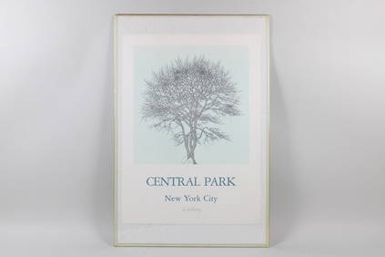
Jacques Hnizdovsky Pencil Signed Poster, Sour Gum Central Park 1982PUBLIC SALE4.7(217)See Sold PriceMar 02, 2024
Coca Cola 1993 New Orleans Basketball TubeRapid Estate Liquidators and Auction Gallery4.5(1.1k)See Sold PriceFeb 27, 2024
Laminated Unique Media New York City MapRapid Estate Liquidators and Auction Gallery4.5(1.1k)See Sold PriceFeb 29, 2024
Herman Moll A New Map of Ye North Parts of AmericaWillow Auction House4.5(283)See Sold PriceMar 14, 2024