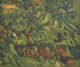
Chaim Soutine (Belarusian/French, 1893-1943) - La Petite Fille dans la VerdureFreeman's | Hindman4.5(158)See Sold PriceFeb 27, 2024
Elisabeth Frink (British, 1930-1993) - Harbinger Bird IFreeman's | Hindman4.5(158)See Sold PriceFeb 27, 2024
AMERICAN SEASCAPE PAINTING BY ROSS EMBROSE MOFFETTAntique Arena Inc.4.5(878)See Sold PriceMar 02, 2024
CHARLES HENRY GIFFORD (Massachusetts, 1839-1904), Luminist view of three sailboats in a quietEldred's4.7(419)See Sold PriceFeb 28, 2024
RARE MANHATTAN PROJECT GLASS LEADED FROM THE MANHATTAN PROJECT WORLD WAR II WW2 724 GRAMSCol. Christie Hatman Auctioneers4.5(333)See Sold PriceFeb 26, 2024
Estate Fresh Civil War Cavalry C. Roby 1863 With ScabbardRalph Fontaine Heritage Auctions Inc.4.7(236)See Sold PriceFeb 25, 2024
ABSTRACT ARAB LEBANESE OIL PAINTING BY ETEL ADNANAntique Arena Inc.4.5(878)See Sold PriceMar 02, 2024
SoldMap, Ortelius, Abraham, Antwerp c. 1570-(??)MAP. Ortelius, Abraham, Galliae Regni Potentiss. Nova Descriptio, Ioanne Ioliveto Auctore, Antwerp c.1570-[??], Copper-engraved map, hand-colored. 34.5x50 cm. (13½x19¾"). France in the second half oSee Sold Price
Ortelius Engraved Map of AfricaAfrica Tabula Nova. Abraham Ortelius (1527-1598). Engraved map with original hand color. Antwerp, c. 1570-1588. 21 1/2 x 17 1/8 inches sheet, 33 1/2 x 29 1/4 inches framed.See Sold Price
ORTELIUS, ABRAHAM, PICTONUM VICINARUM, 1570Ortelius, Abraham PICTONUM VICINARUM QUE PERGIONUM FIDISS DESRIPTIO [Antwerp, c. 1570] H. 36.5cm W. 50.5cm Engraved map, partially hand-coloured.See Sold Price
SoldORTELIUS, ABRAHAM. PoictovOrtelius, Abraham PICTONUM VICINARUM QUE PERGIONUM FIDISS DESCRIPTIO. [Antwerp, c. 1570] H. 36.5cm W. 50.5cm Engraved map, partially hand-coloured.See Sold Price
SoldAbraham Ortelius (1527-1598) Copperplate EngravedAbraham Ortelius (1527-1598) Copperplate Engraved Map, "Tartariae Sive Maeni Chami Regni Typus", Antwerp, c. 1570-1612, hand colored, Latin text en verso, depicted are Northern Asia and Northwestern NSee Sold Price
Ortelius Map of Africa*** START PRICE IS THE RESERVE *** [Africa] ORTELIUS, Abraham (1527-1598). Africae Tabula Nova. Engraved map with original hand color in full. Antwerp, c. 1570. 16 3/4" x 20 3/4" sheet. Comparable: OlSee Sold Price
SoldOrtelius Map of AfricaOrtelius, Abraham (1527-1598). Africa Tabula Nova. Engraved map with original hand color. Antwerp, c. 1570-1588. 21 ½" x 17 ⅛" sheet, 33 ½" x 29 ¼" framed. A magnificent early map of ASee Sold Price
SoldOrtelius map of Gemany 1570Heading: Author: Ortelius, Abraham Title: Germania Place Published: Antwerp Publisher: Date Published: [c.1570] Description: Copper-engraved map, hand-colored. 36.5x50.5 cm (14½See Sold Price
Sold16TH C. HAND COLORED MAP OF RUSSIA & CENTRAL ASIA16TH C. HAND COLORED MAP OF RUSSIA & CENTRAL ASIA. Abraham Ortelius Antwerp (1570-1592). Auctore Antonio Jenkensono Anglo edita Londini anno 1562. Original copperplate engraved map with hand coloring.See Sold Price
Sold[MAPS] [ORTELIUS, ABRAHAM] Asiae Nova Descriptio.[MAPS] [ORTELIUS, ABRAHAM] Asiae Nova Descriptio. [Antwerp: 1570?]. * America Sive Orbis. Nova Descriptio. [Antwerp: 1570?]. Engraved maps colored by hand. Each 23 1/4 x 28 1/4 inches. Uniformly frameSee Sold Price
Soldc. 1570 Abraham Ortelius Map of Britain"Angliae, Scotiae, Et Hiberniae, Sive Britannicar: Insvlarvm Descriptio."; detailed map of the British Isles from the first "modern" atlas, Ortelius' Theatrum Orbis Terrarum; north oriented to the rigSee Sold Price
SoldA RENAISSANCE MAP, "Europæ," ABRAHAM ORTELIUS, ANTWERP,A RENAISSANCE MAP, "Europæ," ABRAHAM ORTELIUS, ANTWERP, 1570-1612, hand colored copperplate engraving on paper, a fragment from an edition of Theatrum Orbis Terrarum, considered the "first modernSee Sold Price
Sold(MAP) ORTELIUS, ABRAHAM. Russiae, moscoviae, et Tar(MAP) ORTELIUS, ABRAHAM Russiae, Moscoviae, et Tartariae Descriptio. (Antwerp: 1570-1612). Hand-colored engraved map from an original of 1562 by Anthony Jenkinson. Latin text to verso. Framed. Size ofSee Sold Price
Sold(MAP) ORTELIUS, ABRAHAM. Anglia Regni Florentissim(MAP) ORTELIUS, ABRAHAM Anglia Regni Florentissimi Nova Descriptio. [Antwerp: Plantin, 1570 or later]. Engraved map with hand-coloring. Framed and matted. Vertical crease to the center. 17 x 20 1/2 inSee Sold Price
SoldA RENAISSANCE MAP, "Asiæ Nova Descriptio," ABRAHAMA RENAISSANCE MAP, "Asiæ Nova Descriptio," ABRAHAM ORTELIUS, ANTWERP, 1570-1612, hand colored engraving on paper, a fragment from an edition of Theatrum Orbis Terrarum, considered the "first modeSee Sold Price
SoldA RENAISSANCE MAP, "Africæ Tabula Nova," ABRAHAMA RENAISSANCE MAP, "Africæ Tabula Nova," ABRAHAM ORTELIUS, ANTWERP, 1570-1612, a hand colored copperplate engraving on paper, a fragment from the atlas Theatrum Orbis Terrarum, compiledSee Sold Price
Sold(MAP) ORTELIUS, ABRAHAM Size of frame 20 x 26 1/4 i(MAP) ORTELIUS, ABRAHAM A group of two maps of the Holy Land and surrounding Mediterranean. (Antwerp, c. 1580). Hand-colored. Framed and matted. Palestinae sive totius terrae promissionis nova descripSee Sold Price
Sold(Map and Charts, Polar Regions), Ortelius, Abraham(Map and Charts, Polar Regions), Ortelius, Abraham (1527-1598), Septentrionalium descrip., [Antwerp, c. 1590 or later], depicting northern Europe, the north Atlantic Ocean, Northern Canada, Iceland anSee Sold Price
SoldABRAHAM ORTELIUS MAP OF FEZZAE AND MOROCCO, 1570Abraham Ortelius (1528-1598), from 'Theatrum Orbis Terrarum,' Antwerp, 1570, widely considered the first modern atlas. Professionally matted and framed, 16.25 x 20.5 inch sight size, 24 x 28.5 inchesSee Sold Price
SoldFramed 18th century French maps, Abraham Ortelius(lot of 2) Framed 18th century French maps, including an Abraham Ortelius (1528-1598), Poictou / Pictonum Vicinarum que Regionum Fidiss Descripto., Antwerp, C. Plantin, 1579, hand colored map of the PSee Sold Price
Abraham Ortelius map of Russia Belgian (1527-1598)Abraham Ortelius map of Russia Belgian (1527-1598) "Russiae, Moscoviae et Tartariae Decsriptio. Auctore Antonio Jenkensono Anglo edita Londini Anno 1562" [Antwerp, c.1584 or later] hand-colored engravSee Sold Price
Abraham Ortelius map of Latin America Belgian (152Abraham Ortelius map of Latin America Belgian (1527-1598) "Peruviae Auriferae Regionis Typus -- La Florida -- Guastecan Reg[io]" [Antwerp, c.1584 or later]; three hand-colored engraved maps on one sheSee Sold Price
Sold(2pc) EARLY MAPS OF ITALYincluding ‘INSULARUM ALIQUOT MARIS MEDITERRANES DESCRIPTO’ by Abraham Ortelius, Antwerp, 1570 or later, engraving with hand-coloring, depicting the islands of Sicily, Malta, Cerfu, Elba, and ZerbiSee Sold Price
SoldOrtelius, Abraham Islandia [Iceland]Ortelius, Abraham Islandia [Iceland] [Antwerp, c.1590 or later]. Hand-coloured engraved map (platemark 33.5 x 48.5cm, sheet size 43.5 x 55.5cm), incorporating sea-monsters, polar bears and Hekla volcaSee Sold Price
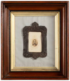
ABRAHAM ORTELIUS (1527-1598) MAP OF ROMAN GAUL (FRANCE)Thomaston Place Auction Galleries4.4(393)See Sold PriceFeb 24, 2024
De Jode, Rare, pub. 1593 - Map of Africa (Africae Vera Forma, et Situs)Trillium Antique Prints & Rare Books4.5(32)See Sold PriceFeb 24, 2024
Vintage Holy Bible Old & New Testaments Illustrated 1904The Benefit Shop Foundation Inc.4.3(2.9k)See Sold PriceMar 13, 2024


![[Tintype] Massive Bowie knife (1 of 1)](https://p1.liveauctioneers.com/7226/317626/170485482_1_x.jpg?height=282&quality=70&version=1706368022)
![[Ambrotype] Magnificent Portrait (1 of 1)](https://p1.liveauctioneers.com/7226/317626/170485477_1_x.jpg?height=282&quality=70&version=1706368022)


![[Tintype] Native American Man w/ Knife (1 of 2)](https://p1.liveauctioneers.com/7226/317626/170485453_1_x.jpg?height=282&quality=70&version=1706368022)
![[REES, Charles] Enlistedman w/ Bowie Knife (1 of 1)](https://p1.liveauctioneers.com/7226/317626/170485489_1_x.jpg?height=282&quality=70&version=1706368022)
![[Ambrotype] Wounded at Gettysburg (1 of 1)](https://p1.liveauctioneers.com/7226/317626/170485471_1_x.jpg?height=282&quality=70&version=1706368022)


![[Ambrotype] Young Soldier w/ Bowie Knife (1 of 1)](https://p1.liveauctioneers.com/7226/317626/170485459_1_x.jpg?height=282&quality=70&version=1706368022)

![[Daguerreotype] Soldier w/ Bowie Knife (1 of 2)](https://p1.liveauctioneers.com/7226/317626/170485458_1_x.jpg?height=282&quality=70&version=1706368022)
![[Tintype] Soldier w/ Flowers (1 of 1)](https://p1.liveauctioneers.com/7226/317626/170485495_1_x.jpg?height=282&quality=70&version=1706368022)
![[Tintype] Identified North Carolina Infantryman (1 of 2)](https://p1.liveauctioneers.com/7226/317626/170485474_1_x.jpg?height=282&quality=70&version=1706368022)


![[MAPS] [ORTELIUS, ABRAHAM] Asiae Nova Descriptio. (1 of 1)](https://p1.liveauctioneers.com/292/8142/1390884_1_x.jpg?height=282&quality=70&version=1130939458)


![Ortelius, Abraham Islandia [Iceland] (1 of 2)](https://p1.liveauctioneers.com/94/251108/130828919_1_x.jpg?height=282&quality=70&version=1655281539)