SoldATLAS OF FREDERICK COUNTY MARYLAND. 1873.[Atlas] ATLAS OF FREDERICK COUNTY MARYLAND. From actual Surveys by and under the direction of D. J. Lake, C. E. Philadelphia: C. O. Titus & Co., 1873. 33 pages of local maps + folding map of MarylandSee Sold Price
SoldAtlases Maryland (1873), Frederick Co. VA (1895)[Maryland & Virginia]. 2 Atlases + 4 Maps. ++ Atlas Of Frederick County, Virginia. Phila: D. J. Lake & Co., 1895. Folio. Leather-backed cloth. Covers worn, detached, but present. Collated. IncompleteSee Sold Price
Rand McNally & Co's Map of Frederick County MarylandTitle/Content of Map: Rand McNally & Co's Map of Frederick County Maryland Date: c1900 Cartographer: RAND MCNALLY & CO. Publisher: RAND MCNALLY & CO. Size: 28Height - 21Width Attractively lithographedSee Sold Price
Antique Map of Maryland Counties, 1873Map: Dorcester, Wicomico, Somerset & Worcester Counties (Maryland) Date: 1873 Original engraving from the Topographical Atlas of Maryland by Stedman & Brown, 1873 Dimensions: 20" x 29" Please note thaSee Sold Price
SoldCarroll & Frederick Counties Map published Atlas ofOriginal engraving published by Stedmann & Brown, 1873. Dimensions: 17" x 14 1/2"See Sold Price
Cecil & Kent County Map published Atlas of Maryland,Original engraving published by Stedmann & Brown, 1873. Dimensions: 17" x 14 1/2"See Sold Price
Lloyd Map of NY, NJ, PA, OH, DE, MD, VA, WV, ON, 1873Map: Lloyd Atlas Map of NY, NJ, PA, OH, DE, MD, VA, WV, ON - County Map of New York, New Jersey, Pennsylvania, Ohio, Delaware, Maryland, Virginia, West Virginia, Province of Ontario Cartographer: H LlSee Sold Price
Sold1873 Lloyd Map of Parts of Eastern and Midwestern US --Title/Content of Map: 1873 Lloyd Map of Parts of Eastern and Midwestern US -- County Map of New York, New Jersey, Pennsylvania, Ohio, Deleware, Maryland, Virginia, West Virginia, Province of Ontario CSee Sold Price
1873 Lloyd Map of Parts of Eastern and Midwestern US --Title/Content of Map: 1873 Lloyd Map of Parts of Eastern and Midwestern US -- County Map of New York, New Jersey, Pennsylvania, Ohio, Deleware, Maryland, Virginia, West Virginia, Province of Ontario CSee Sold Price
Lloyd: Antique Map of Eastern and Midwestern US, 1873Title/Content of Map: 1873 Lloyd Map of Parts of Eastern and Midwestern US -- County Map of New York, New Jersey, Pennsylvania, Ohio, Deleware, Maryland, Virginia, West Virginia, Province of Ontario DSee Sold Price
1873 Lloyd Map of Parts of Eastern and Midwestern US --Reserve Reduced! Title/Content of Map: 1873 Lloyd Map of Parts of Eastern and Midwestern US -- County Map of New York, New Jersey, Pennsylvania, Ohio, Deleware, Maryland, Virginia, West Virginia, ProvSee Sold Price
1873 Lloyd Map of Parts of Eastern and Midwestern US --Title: 1873 Lloyd Map of Parts of Eastern and Midwestern US -- County Map of New York, New Jersey, Pennsylvania, Ohio, Deleware, Maryland, Virginia, West Virginia, Province of Ontario Date: 1873 ChicaSee Sold Price
1873 Lloyd Map of Parts of Eastern and Midwestern US --Title/Content of Map: 1873 Lloyd Map of Parts of Eastern and Midwestern US -- County Map of New York, New Jersey, Pennsylvania, Ohio, Deleware, Maryland, Virginia, West Virginia, Province of Ontario DSee Sold Price
1873 Lloyd Map of Parts of Eastern and Midwestern US --Title/Content of Map: 1873 Lloyd Map of Parts of Eastern and Midwestern US -- County Map of New York, New Jersey, Pennsylvania, Ohio, Deleware, Maryland, Virginia, West Virginia, Province of Ontario DSee Sold Price
Antique 1873 Lloyd Map of Eastern and Midwestern USTitle/Content of Map: 1873 Lloyd Map of Parts of Eastern and Midwestern US -- County Map of New York, New Jersey, Pennsylvania, Ohio, Deleware, Maryland, Virginia, West Virginia, Province of Ontario DSee Sold Price
1873 Lloyd Map of Parts of Eastern and Midwestern US --Title: 1873 Lloyd Map of Parts of Eastern and Midwestern US -- County Map of New York, New Jersey, Pennsylvania, Ohio, Deleware, Maryland, Virginia, West Virginia, Province of Ontario Date: 1873 ChicaSee Sold Price
1873 Lloyd Map of Parts of Eastern and Midwestern US --Title/Content of Map: 1873 Lloyd Map of Parts of Eastern and Midwestern US -- County Map of New York, New Jersey, Pennsylvania, Ohio, Deleware, Maryland, Virginia, West Virginia, Province of Ontario DSee Sold Price
1873 Lloyd Map of Parts of Eastern and Midwestern US --Title/Content of Map: 1873 Lloyd Map of Parts of Eastern and Midwestern US -- County Map of New York, New Jersey, Pennsylvania, Ohio, Deleware, Maryland, Virginia, West Virginia, Province of Ontario DSee Sold Price
1873 Lloyd Map of Parts of Eastern and Midwestern US --Title/Content of Map: 1873 Lloyd Map of Parts of Eastern and Midwestern US -- County Map of New York, New Jersey, Pennsylvania, Ohio, Deleware, Maryland, Virginia, West Virginia, Province of Ontario DSee Sold Price
SoldFREDERICK COUNTY, MARYLAND WALNUT BLANKET CHESTFREDERICK COUNTY, MARYLAND WALNUT BLANKET CHEST, dovetailed case, single-board hinged breadboard lid, original wrought-iron strap hinges and lock escutcheon, applied molded base on bracket feet, interSee Sold Price
SoldQUALITY PETER WHITE LONG RIFLE, c1810, FREDERICK COUNTY, MARYLAND AND BEDFORD COUNTY, PENNSYLVANIASigned on the brl, Peter White, and initialed, P.W. on the lock. 58” O.A., 43” wrought iron octagonal brl.48cal. Flintlock, striped maple stock, raised and incised carving. All brass hardwSee Sold Price
SoldFREDERICK COUNTY, MARYLAND (ATTRIBUTED) CHIPPENDALEFREDERICK COUNTY, MARYLAND (ATTRIBUTED) CHIPPENDALE WALNUT SIDE CHAIR, the squared crest rail over a solid vasiform splat set into an applied separate shoe, above a trapezoidal molded-edge seat frame,See Sold Price
SoldFREDERICK COUNTY, MARYLAND WALNUT BLANKET CHESTFREDERICK COUNTY, MARYLAND WALNUT BLANKET CHEST, dovetailed case, single-board hinged breadboard lid, original wrought-iron strap hinges and lock escutcheon, applied molded base on bracket feet, interSee Sold Price
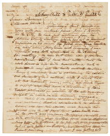
Sold1760 Frederick County MARYLAND SLAVE DOCUMENTBlack History 1760 Colonial Frederick County Maryland Slave Document March 28, 1760 French & Indian War Colonial Period, Frederick County Maryland Slave Bill of Sale Document, Very Fine. This ManuscriSee Sold Price
Lot of Six Mixed Atlas Box Cars-HO Scale-New in BoxJM Hobby Supply and Railroad Artifact Auctions4.4(126)See Sold PriceFeb 25, 2024
EARLY 18TH C. DUTCH CHART OF PACIFIC OCEAN BY FREDERIK DE WIT (1629-1706) WITH CALIFORNIA AS ANThomaston Place Auction Galleries4.4(386)See Sold PriceFeb 24, 2024
General Books - Nicolson - The Counties of Britain - A Tudor Atlas by John SpeedTimeLine Auctions Ltd.4.5(183)See Sold PriceMar 08, 2024
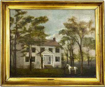
Early American Montgomery County Maryland Oil Painting on Canvas Gilt FramedChina Luban Art & Antique, Inc.4.4(78)See Sold PriceFeb 24, 2024
Rand McNally & Co's New Ideal State and County Survey and Atlas 1911North American Artifact Auctions4.6(182)See Sold PriceApr 20, 2024
[CIVIL RIGHTS]. Voting registration examination. [Etowah County, Alabama], n.d.Freeman's | Hindman4.4(1.6k)See Sold PriceFeb 27, 2024
[RECONSTRUCTION]. A group of documents related to the McKinlay family of South Carolina, incl.Freeman's | Hindman4.4(1.6k)See Sold PriceFeb 27, 2024
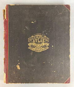
1872 New Combination Atlas of Lee County Illinois BookMatthew Bullock Auctioneers4.7(1.8k)See Sold PriceFeb 24, 2024
1905 20th Century Atlas of Boone County IllinoisMatthew Bullock Auctioneers4.7(1.8k)See Sold PriceFeb 24, 2024
Carey, pub. 1796 - Map of the State of MarylandTrillium Antique Prints & Rare Books4.5(30)See Sold PriceFeb 24, 2024
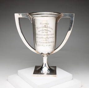
SCHOFIELD STERLING PRESENTATION CUP.Amelia Jeffers, Auctioneers & Appraisers4.6(101)See Sold PriceMar 09, 2024
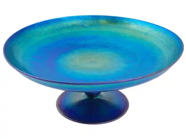
ART DECO STEUBEN GLASS COMPOTE BY FREDRICK CARDERAntique Arena Inc.4.5(852)See Sold PriceMar 02, 2024
DULEEP SINGH FREDERICK: (1868-1926)International Autograph Auctions Europe S.L.4.5(52)See Sold PriceMar 14, 2024


![[CIVIL RIGHTS]. Voting registration examination. [Etowah County, Alabama], n.d. (1 of 2)](https://p1.liveauctioneers.com/197/319238/171467858_1_x.jpg?height=282&quality=70&version=1707520367)
![[RECONSTRUCTION]. A group of documents related to the McKinlay family of South Carolina, incl. (1 of 2)](https://p1.liveauctioneers.com/197/319238/171468094_1_x.jpg?height=282&quality=70&version=1707520367)