SoldREPORTS RAILROAD PACIFIC 1856 Lithographs Maps EtTitle: Reports of Explorations and Surveys, to Ascertain the Most Practicable and Economical Route for a Railroad from the Mississippi River to the Pacific Ocean Publisher: Beverley Tucker Printing YSee Sold Price
SoldPacific Railroad Report Volume XII, Part IDescription:Illustrated with 69 color lithograph plates, 1 folding; 3 large folding maps in back. (4to) 11½x8¾, brown cloth, rebacked with original spine material laid on. Senate Issue. The heavilySee Sold Price
SoldUnited States Congress REPORTS OF EXPLORATIONS ANDUnited States Congress REPORTS OF EXPLORATIONS AND SURVEYS RAILROAD MISSISSIPPI RIVER TO PACIFIC OCEAN 1853-54 1856 Lieutenant Robert Stockton Williamson Corps Topographical Engineers Geology Botany ZSee Sold Price
SoldMaps from Pacific Railroad ReportsTitle: Fifteen folding maps from Vol. XI of the Pacific Railroad Reports, plus 9 steel-engraved plates, 5 of them folding panoramas Author: ** Description: Various sizes, loose.Important maps from theSee Sold Price
SoldMaps of Pacific Railroad Reports Vol. XITitle: Reports of Explorations and Surveys, to Ascertain the Most Practicable and Economical Route for a Railroad from the Mississippi River to the Pacific Ocean. Made Under the Direction of the SecreSee Sold Price
SoldColor lithographs from Pacific Railroad ReportsTitle: Album of color lithographs from the quarto edition of the Pacific Railroad Reports Author: ** Description: 81 color lithographed plates after various artists. 19x28 cm. (7Wx10¾"), 19th centurySee Sold Price
SoldPacific Railroad Reports Color Plates MapsTitle: Reports of Explorations and Surveys, to Ascertain the Most Practicable and Economical Route for A Railroad from the Mississippi River to the Pacific Ocean. Author: ** Description: 11 volumes ofSee Sold Price
Sold[Western Views]. 14 Tinted Lithographs. Excised f[Western Views]. 14 Tinted Lithographs. Excised from the Pacific Railroad Reports. Single page but one (Rocky Mountains). Few with minor spots, 1-2 closely trimmed, else very good. Includes Hell Gate;See Sold Price
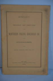
SoldNorthern Pacific Railroad Annual Reports with MapsHeading: (Northern Pacific Railroad) Author: Title: Report of the President and Directors of the Northern Pacific Railroad Co. to the Stockholders at the Annual Meeting, Sept. 27th, 1876 [through 188See Sold Price
SoldNorthern Pacific Railroad Annual Reports with MapsHeading: (Northern Pacific Railroad) Author: Title: Report of the President and Directors of the Northern Pacific Railroad Co. to the Stockholders at the Annual Meeting, Sept. 27th, 1876 [through 188See Sold Price
SoldGeological Plan for Pacific Railroad, 1856Title/Content of Map: 1856 Geological Plan for Pacific RR along the Tejon Ravine / Sierra Nevada -- Geological Section Along the Tejon Ravine ... from the Tulare Valley and The Tejon Depot Camp to TahSee Sold Price
SoldPacific Railroad Reports, 1855-1860Heading: (Pacific Railroad Reports) Author: Title: Reports of Explorations and Surveys, to Ascertain the Most Practicable and Economical Route for A Railroad from the Mississippi River to the PacificSee Sold Price
SoldPacific Railroad Reports - octavo edition w/atlasTitle: Report of the Secretary of War Communicating The Several Pacific Railroad Explorations Author: ** Description: 2 volumes + Atlas containing 14 folding maps and profiles. (8vo) 9x5½, original sSee Sold Price
SoldUnion Pacific Railroad Map of Surveys in 1864, 1865 &Heading: (Union Pacific Railway) Author: Title: Report of the Chief Engineer, with Accompanying Reports of Division Engineers, for 1866 Place Published: Washington, D.C. Publisher:Philp & SolomonsSee Sold Price
Pacific Railroad Reports - octavo edition w/atlasTitle: Report of the Secretary of War Communicating The Several Pacific Railroad Explorations Author: ** Description: 2 volumes + Atlas containing 14 folding maps and profiles. (8vo) 9x5½, original sSee Sold Price
SoldNorthern Pacific Railroad Map, 1867[Antique Northern Pacific Railroad Map], "Map of the Country from Lake Superior to the Pacific Ocean from the Latest Discoveries and Surveys to Accompany the Report of Edwin F. Johnson, Chf. Engr. NorSee Sold Price
SoldExpl & Surveys US Pacific RR Vol. XI atlas 1861Heading: (Pacific Railroad Reports) Author: Title: Reports of Explorations and Surveys, to Ascertain the most Practicable and Economical Route for a Railroad from the Mississippi River to the PacificSee Sold Price
Map Exhibiting the Several Pacific Railroads PreparedReserve Reduced! Title: Map Exhibiting the Several Pacific Railroads Prepared for the Report On The Internal Commerce of The United States Publication Date: 1884 Cartographer: RAND, MCNALLY & CO. PublSee Sold Price
Map Exhibiting the Several Pacific Railroads PreparedTitle: Map Exhibiting the Several Pacific Railroads Prepared for the Report On The Internal Commerce of The United States Publication Date:1884 Cartographer: RAND, MCNALLY & CO. Publisher: RAND, MCNALSee Sold Price
SoldMemorial Northern Pacific Railroad with mapHeading: Author: Johnson, Edwin F., Alexander Ramsay, et al. Title: In the Senate of the United States... Mr. Ramsey submitted the following Memorial, &c. Northern Pacific Railroad. Memorial of the bSee Sold Price
Sold4 Northern Pacific Railroad annual reports, 1884, 85, 87, 92Heading: (Northern Pacific Railroad) Author: Title: Report of the Board of Directors to the Stockholders at Their Annual Meeting, 1884, 1887 and 1892 Place Published: New York Publisher:George W. SacSee Sold Price
SoldRare report on Northern Pacific R.R. 1870 2 mapsTitle: Northern Pacific Railroad. Partial Report to the Board of Directors, of a Portion of a Reconnoissance Made in the Summer of 1869, between Lake Superior and the Pacific Ocean... Accompanied withSee Sold Price
SoldMemorial Northern Pacific Railroad with mapHeading: Author: Johnson, Edwin F., Alexander Ramsay, et al. Title: In the Senate of the United States... Mr. Ramsey submitted the following Memorial, &c. Northern Pacific Railroad. Memorial of the bSee Sold Price
SoldVintage Map of the Railroads of Connecticut, 1901Map of the Railroads of Connecticut to Accompany the Report of the Railroad Commissioners, lithograph in colors, published by the Dodd lithographic Co. (Hartford, CT), sight: 25"h x 35.5"w, overall (fSee Sold Price
Atlantic and Pacific RY Annual Report-April 30, 1868JM Hobby Supply and Railroad Artifact Auctions4.4(127)See Sold PriceFeb 24, 2024
Chicago and Eastern Illinois RR Annual Reports-1878 to 1887JM Hobby Supply and Railroad Artifact Auctions4.4(127)See Sold PriceFeb 24, 2024
Chicago Burlington and Quincy RR 8th Annual Report-June 24, 1864JM Hobby Supply and Railroad Artifact Auctions4.4(127)See Sold PriceFeb 24, 2024
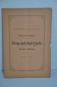
Chicago Rock Island and Pacific RR 11th Annual Report-April 1, 1891JM Hobby Supply and Railroad Artifact Auctions4.4(127)See Sold PriceFeb 24, 2024
Lake Superior and Mississippi River RR 1869 Seven Percent Bonds Book/Report-1869JM Hobby Supply and Railroad Artifact Auctions4.4(127)See Sold PriceFeb 24, 2024
Northern Pacific RR 13th Annual Report-September 26, 1877JM Hobby Supply and Railroad Artifact Auctions4.4(127)See Sold PriceFeb 24, 2024
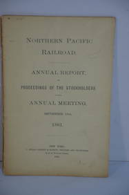
Northern Pacific RR 17th Annual Report-Version 1-September 15, 1881JM Hobby Supply and Railroad Artifact Auctions4.4(127)See Sold PriceFeb 24, 2024
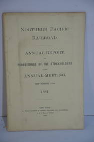
Northern Pacific RR 17th Annual Report-Version 2-September 15, 1881JM Hobby Supply and Railroad Artifact Auctions4.4(127)See Sold PriceFeb 24, 2024
Northern Pacific RR Washington and Northern Idaho Map Folder-1941JM Hobby Supply and Railroad Artifact Auctions4.4(127)See Sold PriceFeb 24, 2024
Union Pacific RR Map of the United States-1926JM Hobby Supply and Railroad Artifact Auctions4.4(127)See Sold PriceFeb 24, 2024
Rock Island RR Iowa and Minnesota Lakes Country Brochure-1926JM Hobby Supply and Railroad Artifact Auctions4.4(127)See Sold PriceFeb 24, 2024
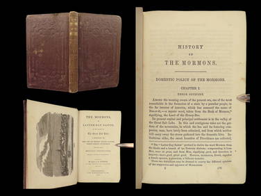
1856 History of Mormons LDS Salt Lake Utah Joseph Smith Polygamy Indian MassacreSchilb Antiquarian Rare Books4.8(428)See Sold PriceMar 31, 2024
Pair of Early Railroad Maps - 1862 Pittsburgh, Ft. Wayne & Chicago Railway and 1873 PennsylvaniaRail & Road Auctions4.6(165)See Sold PriceMar 07, 2024
William Simpson's Sketches at the Seat of War - Two Volumes with 81 Hand-colored LithographsTrillium Antique Prints & Rare Books4.5(32)See Sold PriceFeb 24, 2024
Vaillant - Hawaii: Stranding in the Sandwich Islands (Echouage aux Iles Sandwich). 43Trillium Antique Prints & Rare Books4.5(32)See Sold PriceFeb 24, 2024
Vaillant - Kealakekua Bay, Hawaii (Village de Kearakekoua, Iles Sandwich). 44Trillium Antique Prints & Rare Books4.5(32)See Sold PriceFeb 24, 2024
Vaillant - Honolulu, Hawaii (Vue de Honolulu, Iles Sandwich). 45Trillium Antique Prints & Rare Books4.5(32)See Sold PriceFeb 24, 2024
Vaillant - Hawaiian Dance (Scene de Danse aux Iles Sandwich). 42Trillium Antique Prints & Rare Books4.5(32)See Sold PriceFeb 24, 2024
Blackie (Pub) 1882 Folio Map. West USA - Pacific StatesAlbion Auctions4.6(341)See Sold PriceMar 01, 2024
Perry, Matthew C. 1856 Large Map. Shah Bay, Lew Chew I. JapanAlbion Auctions4.6(341)See Sold PriceMar 01, 2024


![[Western Views]. 14 Tinted Lithographs. Excised f (1 of 0)](https://p1.liveauctioneers.com/dist/images/placeholder.jpg?height=282&quality=70)