SoldChina/Asia: 3 maps: 1774-1799[Asia]. 4 double-page engraved maps in early outline hand-coloring. Very good condition overall. ++ Antonio Zatta. La Tartaria Chinese. Engraved by G. Pitteri. Venice: 1784. 12 1/8 x 15 3/4 in. CartouSee Sold Price
Sold3 maps: China/Asia, [c1640] - [1785].[Asia/Russia]. 3 engraved maps, uncolored, two in very good condition. ++ China Veteribus Sinarum Regio Nunc Incolis Tame Dicta. c.1640. 10 1/2 x 13 1/4 in. Mild worming top of center fold, light foxiSee Sold Price
SoldJohn Cary (British, 1754-1835) Framed Map AssortmentJohn Cary (British, 1754-1835) Framed Map Assortment c.1875, (3) maps including a 1799 'New Map of Germany,' 1804 'New Map of Europe' and 1805 'New Map of Africa' Height: 18.50 inches, Width: 21.75 inSee Sold Price
Sold3 maps of China/Asia: De Fer, 1705 + Bayly, 1782.[China/Asia]. 3 engraved maps, hand-colored in outline. Very good condition. ++ Nicolas de Fer. La Partie Orientale De L'Asie Ou Se Trouvent Le Grand Empire Des Tartares Chinois Et Celuy Du Iapon. EngSee Sold Price
Sold3 maps of China & Asia [ca. 1747-85]. Handcol. OL[China/Asia]. 3 engraved maps, each with some outline coloring. Very good condition. ++ Thomas Bowen. A New & Accurate Map Of Asia, Drawn from the most approved Modern Maps & Charts. c.1747. 12 1/8 xSee Sold Price
SoldSPANISH SILVER COIN CHARM BRACELET. - 3 oz., 8 dwtSPANISH SILVER COIN CHARM BRACELET. Five coins dating 1768, 1774, 1799, 1807, 1808. On a silver link chain. - 3 oz., 8 dwt.; 7 1/2 in. long.See Sold Price
3 MAPS, FALKLAND ISLANDS & SOUTH AMERICAGroup of three maps of South America with the Falkland Islands comprising Emanuel Bowen (English 1694-1767), "New and Accurate Map of Chili, Terra Magellanica, Terra del Fuego &c.", circa 1774; blackSee Sold Price
SoldDunn Map of North AmericaNorth America, As Divided amongst the European Powers…Samuel Dunn (fl. 1774). Engraved Map. London: Sayer & Bennett, 1774. 19 3/4 x 12 3/4 inches visible, 23 1/2 x 16 3/4 inches framedSee Sold Price
SoldVancouver Map of HawaiiVancouver, George (1757-1798). Carte des Iles Sandwich... Engraved map. Paris, 1799. From Vancouver's Voyage de Decouvertes a l'Ocean Pacifique du Nord. 25 1/2" x 35 3/4" sheet, 32 1/2" x 42 1/2" framSee Sold Price
BRYANT, Jacob (1715-1804). A New System, or, anBRYANT, Jacob (1715-1804). A New System, or, an Analysis of Ancient Mythology. London: For T. Payne and others, 1774-1776. 3 volumes, 4to (285 x 221 mm). 31 engraved plates, 3 engraved maps (2 foldingSee Sold Price
SoldAfrica - travel. PARK (Mungo) Travels into the InteriorAfrica - travel. PARK (Mungo) Travels into the Interior Districts of Africa, 3rd edition, 4to, 1799, with portrait, 5 plates and 3 folding maps, 2 leaves of music, lacking half title and gathering A iSee Sold Price
SoldMap of Israel (Canaan), 1799Original copperplate engraving by T. Conder, 1799. Map shows the 12 tribes of Canaan, the journey of Abraham. Dimensions: 14" x 18 3/4" No Reserve This item ships from Ocean View, DE.See Sold Price
A Voyage Towards the North Pole 1774Title: A Voyage Towards the North Pole Undertaken by His Majesty's Command 1773 Author: Phipps, Constantine John Description: [iii]-viii, 253 pp. 3 engraved folding maps, 11 engraved plates, all but oSee Sold Price
A Voyage Towards the North Pole 1774Title: A Voyage Towards the North Pole Undertaken by His Majesty's Command 1773 Author: Phipps, Constantine John Description: [iii]-viii, 253 pp. 3 engraved folding maps, 11 engraved plates, all but oSee Sold Price
SoldVolney Voyage en Syrie et en Égypte 1799Volney (Constantin Francois, Comte de) Voyage en Syrie et en Égypte,2 vol., third edition, imprimatur f., half-titles, 3 folding engraved maps and 5 folding plates, folding table, occasional dSee Sold Price
J.CARY, MAP OF RUSSIAN EMPIRE 1799, 17" X 40"J. CARY, MAP OF RUSSIAN EMPIRE 1799, 17" X 40":17 3/4" x 40". Russian Empire divided into its governments. Two sheets hinged at center Framed. J. Cary engraver, London.See Sold Price
SoldGiovanni Battista Piranesi (Italian, 1720-1778)Giovanni Battista Piranesi (Italian, 1720-1778), "Pianta di Roma e del Campo Marzio", c. 1774, Rome, engraved map on three joined sheets, folded, 53 in. x 30 3/8 in., WE 1008, watermark Robison 36See Sold Price
SoldThomas Kitchin (1718-1774), "A New Map of the UnitedThomas Kitchin (1718-1774), "A New Map of the United States of the United States of America," c. 1782, presented in a carved giltwood frame, H. - 14 1/2 in., W. - 17 3/8 in.See Sold Price
SoldA New Map Of The Russian Empire, 1799.[Russia]. J. Cary. A New Map Of the Russian Empire. Divided into its Governments. Double-page engraving. Lon: John Cary, 1799. 18 x 39 3/4 in. Contemporary hand-coloring, with mountain ridges and swamSee Sold Price
SoldLong (Edward) The History of Jamaica 1774Long (Edward) The History of Jamaica,3 vol., 16 engraved plates and maps, 3pp. advertisements, lightly browned throughout, occasional foxing, a few stains, contemporary contemporary calf, sympSee Sold Price
SoldTooke View of the Russian Empire 1799Tooke (William) View of the Russian Empire during the Reign of Catharine the Second and to the Close of the Present Century,3 vol., first edition, folding engraved map, occasional spotting, orSee Sold Price
SoldGlobe bar 45cm 3 legged pedestal stand redGlobe bar 45cm 3 legged pedestal stand red -- Featuring an old nautical map on its surface the globe can be lifted to reveal the hidden drink cabinet and the highly decorated interior. This cabinet isSee Sold Price
Sold1ST EDITION / 1ÈRE EDITION, ISAAC WELD, D. 1799A First Edition of Isaac Weld's (B. 1774-1856), "Travels through the states of North America and the provinces of Upper and Lower Canada, 1795, 1796, and 1797", featuring a folding map with coloured oSee Sold Price
Sold[Massachusetts]. 2 Maps.[Massachusetts]. 2 Maps. Uncolored. ++ A Plan Of The Town Of Boston. Engraved by J. Lodge. From **London Magazine,** Apr. 1774. 9 3/16 x 6 15/16. Very good, edges slight worn, 2 small marginal tears,See Sold Price
DUNLEVIE c1856 Map Counties Of Gaspe & Bonaventure Quebec Canada SCARCE! #1Luis Porretta Fine Arts4.3(10)See Sold PriceMar 02, 2024
United States Map with American Flag 3-D Wall Mount PaintingWeatherham Estate Treasures3.9(157)See Sold PriceFeb 29, 2024
1938 American Armies and Battlefields by the American Battle Monuments CommissionNorth American Artifact Auctions4.6(182)See Sold PriceApr 20, 2024
Chatelain - 3 Maps of the British Isles (England, Ireland, Scotland)Trillium Antique Prints & Rare Books4.5(30)See Sold PriceFeb 24, 2024
Donovan's The Natural History of British Shells - 5 Volumes in 3 Books with 180 EngravingsTrillium Antique Prints & Rare Books4.5(30)See Sold PriceFeb 24, 2024
1675 ELZEVIER JULIUS CAESAR antique ILLUSTRATED w/ MAPS ROMAN HISTORYJasper524.5(9.8k)See Sold PriceFeb 27, 2024
1738 BIBLE in DUTCH ILLUSTRATED w/ MAPS antique MASSIVE FOLIO BIBLIAJasper524.5(9.8k)See Sold PriceFeb 27, 2024
Emory's Notes of a Military Reconnoissance larger issuePBA Galleries4.7(381)See Sold PriceMar 07, 2024
Bougainville's 1766 circumnavigation. France-Africa-Réunion. GENTS MAG 1774 mapJasper524.5(9.8k)See Sold PriceFeb 28, 2024
Bougainville's 1766 circumnavigation. France-Africa-Réunion. GENTS MAG 1774 mapJasper524.5(9.8k)See Sold PriceFeb 28, 2024
1774: AN ANTIQUE ILLUSTRATED TWO-VOLUME HISTORY OF PERUVIAN DISCOVERY AND CONQUEST WITH MAPNY Elizabeth 4.3(84)See Sold PriceMar 03, 2024
Set of 3 Maps - Netherlands - Belgien - Switzerland - J. BarlowProverde Auctions4.3(3)See Sold PriceFeb 28, 2024
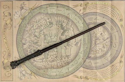
Universal Studios Harry Potter Wand BRapid Estate Liquidators and Auction Gallery4.5(1.1k)See Sold PriceFeb 28, 2024
LARREY, DOMINIQUE JEAN. 1766-1842. Clinique Chirurgicale, Exercée Particulièrement dan...Bonhams4.1(305)See Sold PriceJun 18, 2024


![3 maps: China/Asia, [c1640] - [1785]. (1 of 3)](https://p1.liveauctioneers.com/179/15522/5073998_1_x.jpg?height=282&quality=70&version=1206672512)


![3 maps of China & Asia [ca. 1747-85]. Handcol. OL (1 of 3)](https://p1.liveauctioneers.com/179/15522/5074078_1_x.jpg?height=282&quality=70&version=1206672512)


![[Massachusetts]. 2 Maps. (1 of 1)](https://p1.liveauctioneers.com/179/1435/617507_1_x.jpg?height=282&quality=70)