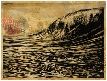
Shepard Fairey (b. 1970), "Dark Wave," 2010, Screenprint, collage, and hand-painted (HPM) on paper,John Moran Auctioneers, Inc.4.7(453)See Sold PriceFeb 27, 2024
Lot Of 3 Early Large Three-Ring Binders Full Of Thousands Of StampsRbfinearts4.4(571)See Sold PriceFeb 24, 2024
A CHINESE PAINTING ALBUM OF LONG ELIZAS SIGNED ZHANG DAQIANBerkeley Auction Gallery4.4(16)See Sold PriceMar 03, 2024
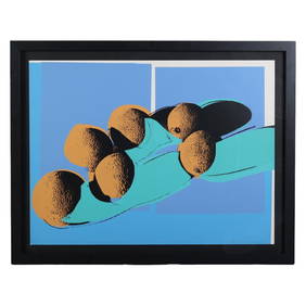
Andy Warhol (1928-1987) Space Fruit Cantaloupes IHill Auction Gallery 4.7(1k)See Sold PriceFeb 28, 2024
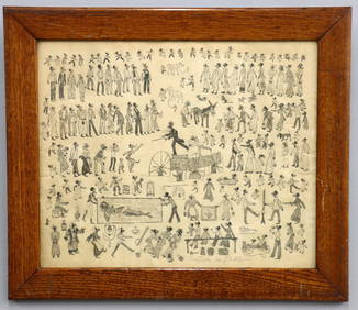
Pennsylvania Folk Art Painting of WashingtonSchmidt's Antiques Inc. Since 19114.8(431)See Sold PriceMar 02, 2024
KATHE KOLLWITZ (GERMANY/RUSSIA, 1867-1945)Thomaston Place Auction Galleries4.4(386)See Sold PriceFeb 25, 2024
JOAN MIRO (SPAIN/FRANCE, 1893-1983)Thomaston Place Auction Galleries4.4(386)See Sold PriceFeb 25, 2024
Alice Baber (1928-1982), "Buried Treasure of the Jaguar," 1978, Watercolor on thick wove paper,John Moran Auctioneers, Inc.4.7(453)See Sold PriceFeb 27, 2024
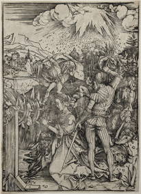
Albrecht Durer. The Martyrdom of St. Catherine (c.1496/7) Hollstein 236. Meder 236, e/g. Woodcut.Tremont Auctions4.6(293)See Sold PriceFeb 25, 2024
Attrib. M. McGeath Darktown Auction DrawingSchmidt's Antiques Inc. Since 19114.8(431)See Sold PriceMar 02, 2024
SoldMoll: The Island of St Christophers, 1729Map: The main island of St Kitts and Nevis in the Leeward "Islands of the Lesser Antilles Publisher: Herman Moll, London Publishing Date: 1730 Size: 8 x 10.75 inches Large compass rose. Original outliSee Sold Price
SoldWest Indies.- - A small mixed group of maps,comprising A New and Accurate Map of the Island of Antigua or Antego, by Emanuel Bowen; Map of the Island of Tobago, by Bryan Edwards; The Island of St Christophers alias St. Kits, by Herman Moll; PiaSee Sold Price
West Indies.- - A small mixed group of maps,comprising A New and Accurate Map of the Island of Antigua or Antego, by Emanuel Bowen; Map of the Island of Tobago, by Bryan Edwards; The Island of St Christophers alias St. Kits, by Herman Moll; PiaSee Sold Price
SoldThomson: Antique Map of St Kits, St Lucia, Nevis, 1816Map: West India Islands. St. Christophers. St. Lucia. Nevis Cartographer: John Thomson Place & Date: Edinburgh / 1816/1817 Size: 23 1/4" x 20" Condition: light overprinting; some browning and stainingSee Sold Price
SoldThomson: Antique Map of West India Islands, 1817A map of the West India Islands including St. Christophers, Nevis and St. Lucia by Scottish cartographer John Thomson for his 1817 "New General Atlas." The map is printed on thick paper and was engravSee Sold Price
1782 Cary Map of St. Kitts and Nevis -- An Accurate MapTitle: 1782 Cary Map of St. Kitts and Nevis -- An Accurate Map of the Islands of St. Christophers and Nevis in the West Indies Cartographer: J Cary Year / Place: 1782, London Map Dimension (in.): 12.1See Sold Price
SoldSt. Christophers, or St. Kitts by Jefferys 1775Title: St. Christophers, or St. Kitts, Surveyed by Anthony Ravell Esqr. Surveyor General of the Islands of St. Christophers, Nevis & Montserrat. Author: Jefferys, Thomas Description: Copper-engraved mSee Sold Price
SoldRochefort (Charles de) The History of the Caribby-Rochefort (Charles de) The History of the Caribby-Islands,viz. Barbados, St.Christophers, St.Vincents, Martinico, Dominico..., translated by John Davies, first English edition, 6 engraved plaSee Sold Price
[Rochefort] History of the Caribby-Islands[Rochefort (Charles de)] The History of the Caribby-Islands, viz. Barbados, St.Christophers, St.Vincents, Martinico, Dominico...,translated by John Davies, first English edition, 9 engraved plSee Sold Price
SoldHerman Moll. The Island of Bermudos. [1729.][Bermuda]. The Island of Bermudos, Divided into its Tribes, with the Castles, Forts &c. Lower half of image is an inset of the northern coast of Providence Island (showing Salt Rey, Hog Island, Long ISee Sold Price
Sold5 maps: West India Islands, Insulae Danicae...[Caribbean/Denmark/Central Europe] 5 Maps. Double-page. ++ West India Islands. 3 maps on 1 sheet: St. Christophers, St. Lucia, Nevis. “Engraved by Kirkwood & Son Edinburgh.” in margin. [C. 1810.]See Sold Price
Thomson: Map of St Christophers, Nevis & St Lucia, 1817Title/Content of Map: 'St Christophers. Nevis. St Lucia' A map of the British West Indian islands of St Kitts and Nevis, and St Lucia This map is folding hence the centrefold line may show on the imagSee Sold Price
Thomson: Antique Map St. Christophers, Nevis & St LuciaTitle/Content of Map: 'St Christophers. Nevis. St Lucia' A map of the British West Indian islands of St Kitts and Nevis, and St Lucia. Caribbean Date Printed: 1817 Image Size: Approx 53.5 x 65.5cm, 21See Sold Price
St Christophers, Nevis & St Lucia. St Kitts. WestTITLE/CONTENT OF MAP: 'St Christophers. Nevis. St Lucia' A map of the British West Indian islands of St Kitts and Nevis, and St Lucia DATE PRINTED: 1817 IMAGE SIZE: Approx 53.5 x 65.5cm, 21.25 x 25.75See Sold Price
St Christophers, Nevis & St Lucia. St Kitts. WestTITLE/CONTENT OF MAP: 'St Christophers. Nevis. St Lucia' A map of the British West Indian islands of St Kitts and Nevis, and St Lucia DATE PRINTED: 1817 IMAGE SIZE: Approx 53.5 x 65.5cm, 21.25 x 25.75See Sold Price
St Christophers, Nevis & St Lucia. St Kitts. West Indies. THOMSON 1830 old mapTITLE/CONTENT OF MAP: 'St Christophers // Nevis // St Lucia' A map of the British West Indian islands of St Kitts and Nevis, and St Lucia DATE PRINTED: 1830 IMAGE SIZE: Approx 52.5 x 64.0cm, 20.75 x 2See Sold Price
St Christophers, Nevis & St Lucia. St Kitts. West Indies. THOMSON 1817 old mapTITLE/CONTENT OF MAP: 'St Christophers. Nevis. St Lucia' A map of the British West Indian islands of St Kitts and Nevis, and St Lucia DATE PRINTED: Published in 1817 IMAGE SIZE: Approx 53.5 x 63.0cm,See Sold Price
St Christophers, Nevis & St Lucia. St Kitts. WestTITLE/CONTENT OF MAP: 'St Christophers. Nevis. St Lucia' A map of the British West Indian islands of St Kitts and Nevis, and St Lucia DATE: 1817 IMAGE SIZE: Approx 53.5 x 65.5cm, 21.25 x 25.75 inchesSee Sold Price
St Christophers, Nevis & St Lucia. St Kitts. West Indies. THOMSON 1830 old mapTITLE/CONTENT OF MAP: 'St Christophers // Nevis // St Lucia' A map of the British West Indian islands of St Kitts and Nevis, and St Lucia DATE PRINTED: 1830 IMAGE SIZE: Approx 52.5 x 64.0cm, 20.75 x 2See Sold Price
St Christophers, Nevis & St Lucia. St Kitts. West Indies. THOMSON 1817 old mapTITLE/CONTENT OF MAP: 'St Christophers. Nevis. St Lucia' A map of the British West Indian islands of St Kitts and Nevis, and St Lucia DATE PRINTED: Published in 1817 IMAGE SIZE: Approx 53.5 x 63.0cm,See Sold Price
SoldWest Indies.- [Rochfort (Charles de)] The History ofWest Indies.- [Rochfort (Charles de)] The History of Barbados, St. Christophers, Mevis, St. Vincents, Antego, Martinico, Monserrat, and the rest of the Caribby- Islands, translated by J. Davies, firstSee Sold Price
SoldThe History of Barbados...and the rest of theHeading: Author: Davies, J., trans. Title: The History of Barbados, St. Christophers, Mevis, St. Vincents, Antego, Martinico, Monserrat, and the rest of the Carriby-Islands Place Published: London PuSee Sold Price
SoldMap of Antigua 1729Heading: (Caribbean) Author: Moll, Herman Title: The Island of Antego Place Published: London Publisher: Date Published: 1729 Description: Copper-engraved map, hand-coloredSee Sold Price
Map of Antigua 1729Heading: (Caribbean) Author: Moll, Herman Title: The Island of Antego Place Published: London Publisher: Date Published: 1729 Description: Copper-engraved map, hand-coloredSee Sold Price
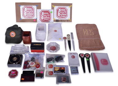
Over Forty Kansas City Southern Railway Promotional Items - Belt Buckle, Money Clips, Ornaments,Rail & Road Auctions4.6(165)See Sold PriceMar 08, 2024
2 JANE NEVILLE LOWCOUNTRY LIGHTHOUSE PHOTOS IN WINDOW FRAMECharleston Estate Services Ltd.4.5(58)See Sold PriceMar 03, 2024
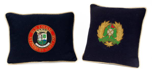
Vintage Golf Themed Pillows, Old Course St. Andrews Scotland, Golf Club, Embroidered Gold BullionHoch LTD.4.5(73)See Sold PriceFeb 25, 2024
Napoleonic Wars.- [Lullin de Chateauvieux (J.F.)] Manuscrit venu de St. Hélène, d'une manièreForum Auctions4.3(52)See Sold PriceFeb 29, 2024
1764 Bellin Map of Lesser Antilles Northern Portion -- Petites Antilles ou Isles du Vent 3e. Partie.Jasper524.5(9.8k)See Sold PriceFeb 27, 2024
1750 Bowen Map of Bermuda and St. Kitts -- A New & Accurate Map of Bermudas or Sommer's Islands...Jasper524.5(9.8k)See Sold PriceFeb 27, 2024
Geographical Statistical and Historical Map of the Windward IslandsJasper524.5(9.8k)See Sold PriceFeb 27, 2024
WEST AFRICA. Guinea. Nigeria Ghana Benin Togo Sierra Leone. MALLET 1683 mapJasper524.5(9.8k)See Sold PriceFeb 28, 2024
Johnson's Africa. Colonies & tribes. Liberia Nile Delta Cape Colony 1866 mapJasper524.5(9.8k)See Sold PriceFeb 28, 2024
Great Lighthouses Of The World St Simons IslandRapid Estate Liquidators and Auction Gallery4.5(1.1k)See Sold PriceFeb 24, 2024
John Cooke 1800s Engraving View of Plymouth Fort & St Nicholas Island FRAMEDKCM Galleries4.7(164)See Sold PriceFeb 25, 2024
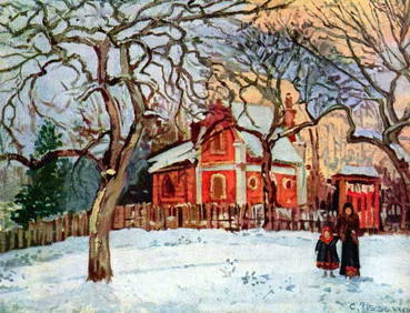
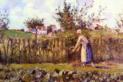
Camille Pissarro - Chestnut Trees in LouveciennesSeized Assets Auctioneers4.3(601)See Sold PriceFeb 25, 2024
The Christian Economy Translated from Greek 1839Rapid Estate Liquidators and Auction Gallery4.5(1.1k)See Sold PriceFeb 28, 2024
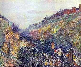
Camille Pissarro - Pontoise, the Cte des Boeufs at the HermitageFederal Assets Auctioneers4.4(411)See Sold PriceFeb 26, 2024
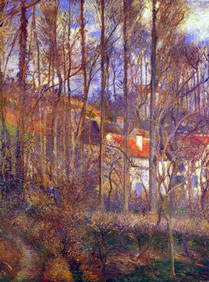
Camille Pissarro - Tuesday on the Boulevard Montmartre at SunsetFederal Assets Auctioneers4.4(411)See Sold PriceFeb 27, 2024
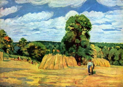
Camille Pissarro - Stagecoach after EnnerySeized Assets Auctioneers4.3(601)See Sold PriceFeb 27, 2024
Four Vintage Silver Bracelets Including One w/St. Christopher's MedallionApple Tree Auction Center4.6(1k)See Sold PriceFeb 28, 2024


![Herman Moll. The Island of Bermudos. [1729.] (1 of 5)](https://p1.liveauctioneers.com/179/47316/21802667_1_x.jpg?height=282&quality=70&version=1383851649)


![West Indies.- [Rochfort (Charles de)] The History of (1 of 1)](https://p1.liveauctioneers.com/5458/143728/72680838_1_x.jpg?height=282&quality=70&version=1559923046)


![Napoleonic Wars.- [Lullin de Chateauvieux (J.F.)] Manuscrit venu de St. Hélène, d'une manière (1 of 1)](https://p1.liveauctioneers.com/5458/319736/171654615_1_x.jpg?height=282&quality=70&version=1708010439)