MATTHEWS c1856 Map Of Upper Canada Ontario Indian Land Agency Divisions Scarce!Luis Porretta Fine Arts4.3(10)See Sold PriceMar 02, 2024
DEVINE c1856 Dr Salters Map Of Lake Huron Ontario Indian Lands etc. No. 7 ScarceLuis Porretta Fine Arts4.3(10)See Sold PriceMar 02, 2024
DUNLEVIE c1856 Map Counties Of Gaspe & Bonaventure Quebec Canada SCARCE! #1Luis Porretta Fine Arts4.3(10)See Sold PriceMar 02, 2024
DUNLEVIE c1856 Map Counties Of Gaspe & Bonaventure Quebec Canada SCARCE! #2Luis Porretta Fine Arts4.3(10)See Sold PriceMar 02, 2024
Map UNITED COUNTIES LEEDS & GRENVILLE by Walling 1861 Rare Canada Map 5ft x 5ftLuis Porretta Fine Arts4.3(10)See Sold PriceMar 02, 2024
Ambroise TARDIEU c1822 Map Venice Napoleon Italian Campaign 17" x 11"Luis Porretta Fine Arts4.3(10)See Sold PriceMar 02, 2024
Map of California, 1911Map: California Maker: Southern Pacific, Matthews-Northrup Works Date: 1911 Size: Elephant Folio, 20.75 inches high x 20.60 inches wide "compiled from authentic and authentic sources by the Southern PSee Sold Price
SoldWall map showing California minerals 1911Title: Map of California showing the approximate location of the principal mineral deposits. Compiled by the State Mining Bureau, Ferry Building, San Francisco, Cal. Fletcher Hamilton, State MineralogSee Sold Price
SoldColor map of California based on 1910 censusHeading: (California) Author: Title: Hammond's Complete Map of California Place Published: New York Publisher:C.S. Hammond & Co. Date Published: 1911 Description: Color foldingSee Sold Price
SoldUSGS California Topography Maps (Lot of 3) (117748)1) 1908-09 Sacramento County Brighton Quadrangle USGS George Otis Smith, Director. From June 1911 Edition. 2) 1895 Palo Alto Quadrangle From May 1899 Edition. 3) 1895 San Jose Quadrangle From March 18See Sold Price
SoldUSA 1911 Lot of 12 State Maps incl Texas & CaliforniaIncl Utah, New Jersey, Nebraska, Washington, Arkansas, Oregon, Texas, California and Nevada, Maine, Maryland and Delaware, Massachusetts, and South Eastern Pennsylvania. Lithograph Maps Published 1911See Sold Price
SoldNolan. Siskiyou County, 1911Huge Official Map of Siskiyou County 115. [MAP]. NOLAN, E. W. & Harvey J. Sarter. Official Map of Siskiyou County California Compiled from Government and Local Surveys By E. W. Nolan and Harvey J.See Sold Price
SoldColor map of San Francisco 1911Heading: (California - San Francisco) Author: Title: Map of San Francisco and Vicinity Place Published: [n.p.] Publisher:Rand McNally & Co. Date Published: 1911 Description:See Sold Price
SoldLarge folding map of Los Angeles, 1911Heading: (California - Los Angeles) Author: Title: Map of Los Angeles including the Territory Annexed and the Harbor Place Published: Los Angeles Publisher:Security Savings Bank Date Published:See Sold Price
SoldSayer & Bennett N. America MapRobert Sayer, English, 1725-1794, and John Bennett, English, fl. 1770-1784. Engraved map with hand colored outline is fully titled "Chart containing the Coasts of California, New Albion, and Russian DSee Sold Price
SoldRare guide to San Diego with map 1911Heading: (California - San Diego) Author: Title: San Diego Pocket Guide: A compendium of general information of the city of San Diego, with latest map, carefully compiled from latest sources Place PuSee Sold Price
SoldEarly US MapAlexix-Hubert Jaillot, French, 1673-1739. A 1694 Edition North American map, hand colored engraving entitled "Amerique, Septentrionale". Depicts California as an island. Central fold with some discoloSee Sold Price
SoldRand-McNally Denver to Pacific Coast Map 1911 ThisThis is an original colored Map of Denver to the Pacific Coast including: Colorado, Montana, Idaho, Washington, Oregon,California, Utah, Nevada, Arizona, Wyoming, New Mexico, and a small sliver ofTexaSee Sold Price
SoldRare map of Duch Flat CA and its minesHeading: (California - Dutch Flat) Author: Uren, Edward C. Title: Map of the Dutch Flat Blue Lead Placer County California Place Published: No place Publisher: Date Published: 1911 DescSee Sold Price
SoldSacramento River Survey. 1911, 31 maps.Heading: (California - Sacramento River)) Author: United States Army Corps of Engineers Title: Examination and Survey of Sacramento River: from Sacramento to Red Bluff; and Survey from Feather River tSee Sold Price
SoldJ. Moxon Totius Orbis TerrarumJoseph Moxon, English, 1627-1691. Hand colored engraved map of the world, in the time of Noah, after the Great Flood; note California along the right margin is depicted as an island. Title cartouche aSee Sold Price
Sold1703 Scherer - World Map [California as an Island]Title: World Map [without title] "Map maker: Heinrich Scherer, Atlas Marianus" "Place and Year: Munich, 1703" "Dimensions: 23.6 x 35.5 cm (9.3 x 14 in)" "Technique: Copperplate engraving" "Coloring: USee Sold Price
SoldDiderot/Vaugondy: Antique Map California & West AmericaTitle/Content of Map: Carte De La Californie Et Des Pays Nord Ouest separes de L'Asie par le Detroit d'Anian… Cartographer: Diderot/de Vaugondy Place & Date: Paris / 1772 Size: 14 3/8" x 11 7/8" ConSee Sold Price
Sold1749 MAP CALIFORNIA AS AN ISLAND, JACQUES CHIQUETFramed map, c. 1749, "L’AMERIQUE SEPTENTRIONALE qui fait partie des Indes Occidentales. Dressée selon les dernieres Relations des Voiageurs et Suivant les nouvelles Observations de Mur. de lSee Sold Price
Sold4Pcs ANTIQUE AMERICAN MAPS County Map California4Pcs ANTIQUE AMERICAN MAPS County Map California Mitchel 1872 Color United States and Territories Canada Texas Indian Territory Mitchell 1876 Cram Carte du Continent de L′Amerique Nord E. CollinSee Sold Price
Soil Map. California Sacramento SheetSoil Map. California Sacramento Sheet. U.S. DEPT. OF AGRICULTURE. BUREAU OF SOILS, LAPHAM, MACY H./A. S. ROOT/W. W. MACKIE, 1904, Elephant Folio - 35.25 H x 27.50 W Inches, Types of soil, other statisSee Sold Price
SoldAlexander Dzigurski (California, 1911 - 1995)Alexander Dzigurski (California, 1911 - 1995) Painting of a lush California landscape. Signed lower right. Oil on canvas board. Sight Size: 8.5 x 11.5 in. His seascapes and landscapes are most realistSee Sold Price
SoldU S Coast Survey 1896 Map. California Nevada Boundary"Boundary Survey between California and Nevada. Sheet 1" Lithograph Map Published 1896, Washington for "U.S. Coast and Geodetic Survey" Folds as issued. Rare. Paper Size: 20 x 19.5 inch (50 x 49cm) GoSee Sold Price
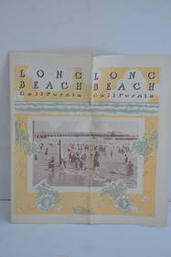
Los Angeles and Salt Lake RR Long Beach California 1911 BrochureJM Hobby Supply and Railroad Artifact Auctions4.4(126)See Sold PriceFeb 24, 2024
EARLY 18TH C. DUTCH CHART OF PACIFIC OCEAN BY FREDERIK DE WIT (1629-1706) WITH CALIFORNIA AS ANThomaston Place Auction Galleries4.4(389)See Sold PriceFeb 24, 2024
An "Official Disneyland Road Map" Richfield Brochure.Van Eaton Galleries4.6(99)See Sold PriceMar 02, 2024
Francis McNally - Antique Map of California & MinnesotaProverde Auctions4.3(3)See Sold PriceFeb 28, 2024


![1703 Scherer - World Map [California as an Island] (1 of 2)](https://p1.liveauctioneers.com/5584/112867/57947644_1_x.jpg?height=282&quality=70&version=1511920104)