Sold2 antique maps, Northeast, & Arctic, includes "Carte2 antique maps, Northeast, & Arctic, includes "Carte Generale des Découvertes de l'Amiral de Fonte et autres Navigateurs Espagnols, Anglois et Russes pour la recherche du Passage a la Mer du Sud.See Sold Price
Sold2 antique maps, New Jersey, revolutionary war map, "A2 antique maps, New Jersey, revolutionary war map, "A plan of the Northern part of New Jersey, showing the positions of the American & British Armies After crossing the North River (Hudson River) in 1See Sold Price
Sold2 Framed antique maps2 Framed antique maps, probably from an old atlas, British America & The United States, map drawn & engraved by J. Rapkin, illustrations by H. Warren & illustrations by R. Wallis, Maps are 10" x 13",See Sold Price
Sold2 Antique Engraved Maps. "A New Description ofCarolina" hand colored and engraved map by Francis Lamb (fl. 1667 - 1701) and John Speed (1552 - 1629), plate - 14.5" high x 20.25" wide, tear / old repair upper left, center crease, toned paper, framSee Sold Price
Sold2 Antique European MapsIncludes British & Gremch Settlements in North America, 1755. Atlantic Ocean in Europe and America.See Sold Price
SoldChart of the World on Mercators ProjectionCirca 1796 Lot of 2 Antique World Maps; Titles: "Chart of the World on Mercators Projection" (Doolittle, sculp.) Approximate size: 11" x 8-3/8". "Map of the World from the best Authorities" (DoolittleSee Sold Price
SoldMortier: Antique Map of Ancient Israel, 1705Title/Content of Map: Ancient Israel King Solomon's Kingdom Date Printed: 1705-06 Cartographer: Pierre Mortier Material/Medium: Paper Size: 23 2/3" x 19 2/3" Antique Map. Copperplate engraved with oriSee Sold Price
Sold2 Antique Hand Colored Maps East & West Indies2 Antique Hand Colored Maps of The East & West Indies. Including map of Batavia and Jamaica Map measures 17 inches high x 21 inches wide. Frame measures 19 inches high x 23 inches wide.See Sold Price
Part of the United States of North America, 1798Map: Part of the United States of North America Cartographer: J. Stockdale Publishing: London, 1798 Size: 18.4 x 16.2 inches This antique map of the recently formed United States is filled informationSee Sold Price
Sold2 Antique Engraved Hand Colored Maps ***The Americas and Scandinavia. As is. *** Updated measurements. Americas - 19 1/2 X 23 image size (23 X 26 frame size)Scandinavia - 19 X 22 (24 X 27)See Sold Price
SoldNatolia quae olim Asia Minor, 16401640 Natolia quae olim Asia Minor. By: Willem Janszoon BlaeuDate: 1640 (circa) Amsterdam. Dimensions: 15 x 19.75 inches (38.1 x 50.2 cm) This is an authentic antique map of Asia Minor that includes CySee Sold Price
SoldMercator: Antique Map of Crete, 1619Title/Content of Map: Candia cum Insulis aliquot circa Graeciam. Cartographer: Gerard Mercator Place & Date: Amsterdam / 1619 Size: 19" x 13 1/2" Condition: wash color; overall age toning A splSee Sold Price
Seutter: Antique Map of Western Hemisphere, 1740Title/Content of Map: Western Hemisphere with California as an Island by Seutter Date Printed: c1740 Cartographer: Matthaus Seutter Material/Medium: Paper Size: 24" x 19 1/2" Original hand colored CopSee Sold Price
SoldBellin: Antique Map of Louisiana/Mississippi Basin 1750Map: Karte von Luisiana, dem Laufe des Mississippi und den Benachbarten Laendern Cartographer: Bellin Place & Date: Leipzig / 1750 (?) Size: 21 1/2" x 15 1/2" Condition: b&w; overall age toning, a fewSee Sold Price
SoldSanson / Mariette: Antique Map of the Caribbean, 1656Map: Les Isles Antilles &c Cartographer: Sanson / Mariette Place & Date: Paris / 1656 Size: 21 1/2" x 15 1/2" Condition: outline color; light overall age toning, heavier in the margins; minor spottingSee Sold Price
SoldSeutter: Antique Map of the World, 1740Title/Content of Map: World by Seutter Date Printed: c1740 Cartographer: Matthaus Seutter Material/Medium: Paper Size: 24" x 19 1/2" Original hand colored Copperplate engraved. Published in Augsburg iSee Sold Price
SoldSanson: Antique Map of New World as Atlantis, 1690Map: Atlantis Insula Cartographer: G. Sanson / Covens & Mortier Place & Date: Amsterdam / 1690 Size: 21 1/2" x 16" Condition: outline color; overall age toning; minor fraying at edges of margins. TheSee Sold Price
SoldForlani: Antique Map, Town View of Venice, 1569Title: Venetia, Splendid 1569 Lafreri-school town view of Venice Map maker: Paolo Forlani, De’ disegni delle più illustri città et fortezze del mondo Place and Year: Venice, 1569 Dimensions: 19.2See Sold Price
Elwe: Antique Map of North America, 1792Title/Content of Map: North America by Elwe Date Printed: 1792 Cartographer: Jan Barnard Elwe Material/Medium: Paper Size: 20" x 24 1/2" Hand colored copperplate engraved Map still shows Florida as anSee Sold Price
SoldWeigel: Antique Map of Italy, 1720Title/Content of Map: Italy by Weigel Date Printed: c1720 Cartographer: C. Weigel Material/Medium: Paper Size: 14" x 17 1/2" Hand colored copperplate engraved. Published in Nuremberg. Please note thatSee Sold Price
SoldJansson: Antique Map of Scotland, 1646Map: 1646 Jansson Map of Scotland -- Provincae Lauden seu Lothien et Linlitouo Cartographer: J. Jansson / Valk & Schenk Year / Place: 1646 c Map Dimensions: 14.2 x 21 in. Condition: Excellent, near fiSee Sold Price
SoldChatelain: Antique Map of Mexico & Florida, 1719Map: Carte contenant le Royaume du Mexique et la Floride Cartographer: Chatelain Place & Date: Amsterdam / 1719 Size: 20 1/2" x 16" Condition: b&w; margins frayed; overall age toning; stain on upper pSee Sold Price
SoldHomann Heirs: Antique Map of North & South America 1746Title/Content of Map: Americae mappa generalis Date Printed: 1746 Cartographer: Homann Heirs Material/Medium: Paper Size: 23 1/2" x 21" Hand colored copperplate engraved. Published in Nuremberg. Map hSee Sold Price
Hooker: Antique Map of Lower & Midtown Manhattan, 1831Map: 1831 Hooker Lower and Midtown Manhattan Map -- Map of the City of New York Cartographer: W Hooker Year / Place: 1871 reissue, New York City Map Dimensions: 15.4 x 12.2 in. Condition: Very Good. CSee Sold Price
17TH C. ANTIQUE MAP SIEGE OF LA ROCHELLE, FRANCE, FRAMEDThomaston Place Auction Galleries4.4(389)See Sold PriceFeb 24, 2024
18TH C. ANTIQUE MAP: FRENCH & INDIAN WAR, FRAMEDThomaston Place Auction Galleries4.4(389)See Sold PriceFeb 24, 2024
Two (2) Antique 18th C. Copper Engraved Framed Maps - America & EuropeMagnusson Art Group4.5(50)See Sold PriceMar 14, 2024
Battle of the Nile: Disposition of the English & French Fleets, at the Commencement of the Action,Trillium Antique Prints & Rare Books4.5(30)See Sold PriceFeb 24, 2024
Putnam - First Map of the State of Ohio by Rufus PutnamTrillium Antique Prints & Rare Books4.5(30)See Sold PriceFeb 24, 2024
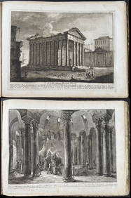
Morghen's Antichi Monumenti Esistenti - Volume with 44 EtchingsTrillium Antique Prints & Rare Books4.5(30)See Sold PriceFeb 24, 2024
Hamilton - Engraving of a Painting from a Grecian Vase. 2Trillium Antique Prints & Rare Books4.5(30)See Sold PriceFeb 24, 2024
First Copy of Gautier's Le Roman de la Momie - 13 Original Watercolors by George Barbier (2 VolumesTrillium Antique Prints & Rare Books4.5(30)See Sold PriceFeb 24, 2024
Wilson - Wood Thrush, Red-breasted Thrush or Robin, & Nuthatches. 2Trillium Antique Prints & Rare Books4.5(30)See Sold PriceFeb 24, 2024
1800 MUNGO PARK TRAVELS to AFRICA 2 VOLS w/ MAP antique in ENGLISHJasper524.5(9.8k)See Sold PriceFeb 27, 2024
1816 MAP NORTHERN PART OF RUSSIA or MUSCOVY in EUROPE copper engraving ANTIQUEJasper524.5(9.8k)See Sold PriceFeb 27, 2024
World War 2 Europe Battle of the Atlantic 1939-43 Axis Expansion limits 1959 mapJasper524.5(9.8k)See Sold PriceFeb 28, 2024
ANTIQUE ROMAN ARMORIAL VELLUM BINDING, 1744, ILLUSTRATED WITH AN ANTIQUE MAP BY FLORUSNY Elizabeth 4.3(85)See Sold PriceMar 03, 2024
Hubert Kornelisz (1689 - 1733) - Set of 2 Allegorical Copperplate Engravings, NetherlandsProverde Auctions4.3(3)See Sold PriceFeb 28, 2024
Henriette Sjöberg (1842 - 1915) - Set of 2 Fruit Prints - Apple and PearProverde Auctions4.3(3)See Sold PriceFeb 28, 2024
Henriette Sjöberg (1842 - 1915) - Set of 2 Fruit Prints - ApplesProverde Auctions4.3(3)See Sold PriceFeb 28, 2024
Henriette Sjöberg (1842 - 1915) - Set of 2 Fruit Prints - Apple and CherryProverde Auctions4.3(3)See Sold PriceFeb 28, 2024
Henry Seebohm (1832 - 1895) - Set of 2 British Bird Egg Prints - Pink Footed Goose - Brent Goose -Proverde Auctions4.3(3)See Sold PriceFeb 28, 2024
Paul Louis Oudart - Set of 2 Antique Prints - Herpetology, Reptile - Bernard Germain Etienne De LaProverde Auctions4.3(3)See Sold PriceFeb 28, 2024
Antique Map of The Kingdom of Spain, 1701 PrintAntiques Online Auctions4.6(410)See Sold PriceMar 14, 2024
Antique Map of Poland, 1700 by Guillaume De Lisle, ParisAntiques Online Auctions4.6(410)See Sold PriceMar 14, 2024
Antique Map of France, 1703 by Gillaume Del Isle PrintAntiques Online Auctions4.6(410)See Sold PriceMar 14, 2024