Atlases.- Seller (John) The Coasting Pilot..., 13Atlases.- Seller (John) The Coasting Pilot Describing the Sea Coasts, Chanells, Soundings, Sands, Shoals, Rocks, and Dangers, The Bayes, Roads, Harbors Rivers & Ports with the Buoyes Beacons, and SeaSee Sold Price
Seller's Coasting PilotThe Coasting Pilot: describing the sea-coasts, channels, soundings, sands, shoals, rocks & dangers. upon the coasts of England, Flanders and Holland, with directions to bring a ship into any harbour oSee Sold Price
SoldEnglish Pilot 1752 John Seller Coastal ChartsSeller, Attributed to John, The English Pilot, Describing The Sea-Coasts, Capes, Head-Lands, Soundings, Sands, Shoals, Rocks and Dangers, the Bays, Roads, Harbours, Rivers and Ports in the Whole NorthSee Sold Price
SoldAtlases.- Seller (John) Atlas Minimus or a Book ofAtlases.- Seller (John) Atlas Minimus or a Book of Geography, engraved title, frontispiece, double-page world map (with neatly repaired tear) and 49 single-page maps only with facing tables (lacking BSee Sold Price
Maritime Atlas.- - Coasting Pilot (The),15 double-page engraved maps, 2 with extending fold-outs, engraved map of St. Malo in text on penultimate leaf, numerous woodcut coastal profiles in text, title and front free endpaper detached, someSee Sold Price
SoldCoasting Pilot (The)Maritime Atlas.- Coasting Pilot (The). Describing the Sea-Coasts, Capes, Headlands, Soundings, Sands, Shoals, Rocks and Dangers. The Bays, Roads, Harbours, Rivers and Ports of England, Scotland, HolSee Sold Price
Sold[SHIP-USED ATLAS] GREAT BRITAIN'S COASTING PILOTIn Two Parts, Being a New and Exact Survey of the Sea-Coast of England and Scotland..., by Captain Greenvile Collins, London: Printed for W. and J. Mount and T. Page, on Tower-Hill, 1758, inscribed 'TSee Sold Price
Sold[Seller (John)] - The English Pilot. Part I DescribingBays, Roads, Harbours, Rivers and Ports… of England, Scotland, Ireland, Holland, Flanders, Spain, Portugal, to the Straights Mouth, with the Coasts of Barbary, and off to the Canary, Madera, CapSee Sold Price
MAPS, Ancient World, Seller/OrteliusCartographic Miscellany; Ancient World. Seller/Ortelius, [Lot of 2] A Mapp of the Five Zones [and] [De Circulis Minoribus], 1601-1700 (circa). A. A Mapp of the Five Zones, by John Seller, from Atlas TSee Sold Price
SoldSELLER, JOHN (FL. 1658-98): 'ATLAS COELESTIS CONTAININGSELLER, JOHN (FL. 1658-98): 'ATLAS COELESTIS CONTAINING THE SYSTEMS AND THEORYES [SIC] OF THE PLANETS AND CONSTELLATIONS OF THE STARS..' [London: no publisher, circa 1690]. 8vo (138 x 90mm). EngravedSee Sold Price
Betts Eastern Hemisphere“Eastern Hemisphere.” From The London Modern Atlas. London: John Betts, ca. 1840. 16 x 13 3/8. Lithograph. Original hand color. Small ink spots in lower Africa and light stains just above and beloSee Sold Price
SoldCoastal Pilot.- The Coasting Pilot: Describing the SeaCoastal Pilot.- The Coasting Pilot: Describing the Sea Coasts, Channels, Soundings... Beacons, and Sea-marks, Upon the Coasts of England, Holland, Flanders & France, With Directions to Bring a Shipp iSee Sold Price
SoldSeller (John) A Pocket Book Containing severall ChoiceSeller (John) A Pocket Book Containing severall Choice Collections in Arithmetick, Astronomy, Geometry, Surveying, Dialling, Navigation, Astrology, Geography, Measuring, Gageing, engraved title, 67 siSee Sold Price
SoldSeller (John) - A Group of English County Mapsincluding Staffordshire, Pembrokeshire, Breckonshire and others , 8 engraved maps, 4 hand-coloured, most with text below, c.170 x 270mm , 1787 (8)See Sold Price
1677 SELLER JOHN (1630 - 1697) INCISIONE in bianco e1677 SELLER JOHN (1630 - 1697) INCISIONE in bianco e nero "Chart of the sea coast of Italy, Sicily and part of barbary" (cm 40,5 x 51,5) tratta dal libro The english pilot, the second book. Anno 1677See Sold Price
Sold-. Seller (John) - A Chart of the Westermost Partfrom the Straits of Gibraltar to the Adriatic, probably from the Atlas Maritimus, decorative title cartouche supported by sea deities, upper left, Names of Islands, Capes, Havens &c on scroll cartouchSee Sold Price
SoldAttica. The New General Atlas. John Thomson.Maker: Thomson, John. Origin: Edinburgh, Thomson, 1817. Medium: Original engraving hand-colored at publication. Sheet size: 21 x 13 1/4 in. No Reserve: This lot starts at $1 and has no reserve as a coSee Sold Price
Serres (John Thomas).- Bougard (Rene) - The Little SeaThe Little Sea Torch: or, True Guide for Coasting Pilots, translated and revised by J.T.Serres, first English edition , 134 hand-coloured aquatint coastal views after Serres on 20 plates and 24 hand-cSee Sold Price
SoldSeller Map of New England, 1675SELLER, John (1632–1697). A Chart of the Sea coasts of NEW ENGLAND, NEW JARSEY, VIRGINIA, MARYLAND and CAROLINA from C. Cod to C. Hatteras... Engraved map with original hand color. London, c. 1See Sold Price
SoldA Chart of the Western OceanJohn Seller, John Coleson, William Fisher, James Atkinson, & John Thornton. Engraved map with original hand-color in outline. London, 1674. 17 1/2 x 22 inches. Very rare first edition of Seller’s seSee Sold Price
SoldSeller, J. Chart of the coast of U.S. to NewfoundlandSeller, John A Chart of the coast of America Newfoundland to Cape Cod by John Seller Hyrographer to the King C. 1674 Copperplate engraving; outline coloured Printed area: 55 x 42 cm; 21.6 x 16.5 in ChSee Sold Price
SoldCaptain Collins Sea Chart of The River Thames andCaptain Greenville Collins (1643-1694), "The River of the THAMES from London to the Buoy of the Nore," London: British Coasting Pilot, 1693. This hand colored engraving sea chart map features the RiveSee Sold Price
SoldSeller Map of Atlantic, 1674SELLER, John (1632–1697), John Coleson, William Fisher, James Atkinson, & John Thornton. A Chart of the Western Ocean. Engraved map in the original hand color in outline. London, 1674. 17 1/2"See Sold Price
REV. J LINDSEY A New and Correct Chart of the HarbourREV. J LINDSEY A New and Correct Chart of the Harbour of Cork Engraving, 46 x 54.5cm From 'Great British Coasting Pilot' by Greenville Collins, first published in 1693. The last atlas was published inSee Sold Price
17TH C. ENGLISH LINEAR MAP BY OGILBY, FRAMEDThomaston Place Auction Galleries4.4(386)See Sold PriceFeb 24, 2024
(Early 19th c) IRON-BOUND DOME TOP STRONG BOXJohn McInnis Auctioneers,LLC4.6(502)See Sold PriceFeb 24, 2024
1815 NEWBURYPORT PERMISSION to COME to TOWNJohn McInnis Auctioneers,LLC4.6(502)See Sold PriceFeb 24, 2024
1890s PHILADELPHIA PHILLIES BASEBALL TEAM PHOTOJohn McInnis Auctioneers,LLC4.6(502)See Sold PriceFeb 25, 2024
TWO (19th c) SCANDINAVIAN PINE PANTRY BOXESJohn McInnis Auctioneers,LLC4.6(502)See Sold PriceFeb 25, 2024
PUBLIC BUYS the "EL" COMMEMORATIVE PRESENTATIONJohn McInnis Auctioneers,LLC4.6(502)See Sold PriceFeb 25, 2024
CHINESE PEOPLE'S REPUBLIC ERA PUNCH BOWLJohn McInnis Auctioneers,LLC4.6(502)See Sold PriceFeb 25, 2024
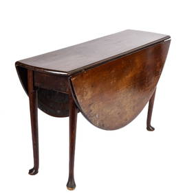
(18th c) QUEEN ANNE MAHOGANY DROP LEAF TABLEJohn McInnis Auctioneers,LLC4.6(502)See Sold PriceFeb 25, 2024
(Early 19th c) CARVED & PAINTED FOLK ART SPOONJohn McInnis Auctioneers,LLC4.6(502)See Sold PriceFeb 25, 2024
PHOTOGRAPHIC REPRODUCTION of J.F.K. PORTRAITJohn McInnis Auctioneers,LLC4.6(502)See Sold PriceFeb 25, 2024
Tobia Scarpa (b. 1935), A battuto glass vase for Venini, 1997; Venice, ItalyJohn Moran Auctioneers, Inc.4.7(453)See Sold PriceFeb 27, 2024
Fulvio Bianconi (1915-1996), A "Ritagli" iridescent glass vase for Venini, 1992; Venice, ItalyJohn Moran Auctioneers, Inc.4.7(453)See Sold PriceFeb 27, 2024
Peter Basch (1921-2004), Brigitte Bardot, Gelatin silver print on paper, Image: 13" H x 10" W;John Moran Auctioneers, Inc.4.7(453)See Sold PriceFeb 27, 2024
Battle of the Nile: Disposition of the English & French Fleets, at the Commencement of the Action,Trillium Antique Prints & Rare Books4.5(30)See Sold PriceFeb 24, 2024


![[SHIP-USED ATLAS] GREAT BRITAIN'S COASTING PILOT (1 of 14)](https://p1.liveauctioneers.com/522/145506/73550360_1_x.jpg?height=282&quality=70&version=1562377940)
![[Seller (John)] - The English Pilot. Part I Describing (1 of 1)](https://p1.liveauctioneers.com/410/71675/36846980_1_x.jpg?height=282&quality=70&version=1430835880)